February 8, 2023

Sols 3737-3738: Preparing To Drill Dinira

Written by Scott VanBommel, Planetary Scientist at Washington University
This image of the Curiosity rover's shadow over the Mars surface was taken by Front Hazard Avoidance Camera (Front Hazcam) onboard NASA's Mars rover Curiosity on Sol 3735.

This image was taken by Front Hazard Avoidance Camera (Front Hazcam) onboard NASA's Mars rover Curiosity on Sol 3735. Credits: NASA/JPL-Caltech. Download image ›

In Monday's two-sol plan we completed a short drive to another drill location as we continued our attempt to acquire a sample of the Marker Band for potential analysis by SAM and CheMin. With the post-drive images from Monday's plan received, the team focused early discussions on where in the workspace would be a suitable drill area, if any. Of the two flattish rock faces we were interested in and considering, only one proved to be viable. With that, our decision of where to drill in this workspace was made, and we commenced planning "drill sol 1," focusing our suite of instruments on the drill target "Dinira." In the included image, Dinira is approximately in the center of the raindrop-shaped slab, the edge of which is slightly covered by the shadow of Curiosity's left-front wheel's actuator.

In preparation for drilling Dinira, Mastcam images of our planned drill target were acquired after ChemCam conducted analyses with its laser. We then acquired MAHLI images before and after brushing Dinira, as well as after conducting a preload test to assess the stability of the rock. APXS analyses on Dinira, one at the center of the brushed spot and one slightly offset, rounded out our drill target activities on the first sol. The second sol science block was populated with additional ChemCam and Mastcam activities, including a Mastcam image on Dinira to complement the earlier pre-DRT images. Curiosity also acquired Navcam suprahorizon and dust devil movies before snapping twilight images and a picture of Phobos. The rest of the second sol focused on handing over to the weekend plan with as much power as possible, setting the rover up well for what will undoubtedly be a busy and exciting three sols.

February 6, 2023

Sols 3735-3736: Searching for a Drill Site Near Encanto

Written by Sharon Wilson Purdy, Planetary Geologist at Smithsonian National Air and Space Museum
This image was taken by Right Navigation Camera onboard NASA's Mars rover Curiosity on Sol 3733.

This image was taken by Right Navigation Camera onboard NASA's Mars rover Curiosity on Sol 3733. Credits: NASA/JPL-Caltech. Download image ›

Curiosity successfully followed her tracks and is back near the Encanto drill site! With a beautiful workspace in view, the science and operations team had a busy day of planning on the “Marker band” surface. We assessed potential drill targets, selected targets for contact science, and planned imaging.

When evaluating the rocks in the area for the best possible drill site, the team focused on identifying large, flat, thick blocks that didn’t fracture or move when the rover drove over them. Several candidate drill sites were discussed and a favorite was chosen, with several blocks identified as back-ups. The plan includes Mastcam stereo images of our favorite potential drill target along with three alternate nearby drill targets. Upon the completion of the contact science described below, Curiosity will drive ~10 meters to the potential drill site and unstow the arm. Post drive clast surveys and workspace survey mosaics will be acquired.

Directly in front of the rover, two bedrock targets will be studied. MAHLI and APXS will analyze a bedrock target named “Pico Espejo,” and ChemCam, MAHLI, and Mastcam will characterize the geochemistry and texture of the nearby “Uatatas” target. After finding the meteorite named Cacao on sol 3725, we will take ChemCam passive and a Mastcam image of another possible iron meteorite named “Cana Dulce.” Mastcam will take stereo images a sand dune along the Marker band horizon in the distance as well as stereo images of the repeated layers at the base the Amapa Butte. The afternoon will contain observations to characterize dust in the atmosphere and twilight imaging.

After a full day of science activities, the science block on sol 3736 will be untargeted. Navcam will be used to look for dust devils and Mastcam will characterize potentially iridescent ice clouds at twilight. We are all looking forward to our upcoming mid-week planning session and the start of another drill campaign!

February 5, 2023

Sols 3732-3734: Enchanting Encanto Calls

Written by Ashley Stroupe, Mission Operations Engineer at NASA's Jet Propulsion Laboratory
This image was taken by Left Navigation Camera onboard NASA's Mars rover Curiosity on Sol 3730.

This image was taken by Left Navigation Camera onboard NASA's Mars rover Curiosity on Sol 3730. Credits: NASA/JPL-Caltech. Download image ›

Today we made a three-sol plan for the weekend including contact science, lot of imaging, and a long drive back toward the previously attempted marker band drill target, Encanto. After additional exploration of the marker band, the team decided it was worth turning around and trying to drill again in the same general location as Encanto. I took on a new role as Engineering Uplink Lead (EUL), managing the engineering activities in the plan, such as data management and heating. We had a lot of stuff in the plan today, which made meeting our power guidelines difficult. The Tactical Uplink Lead (TUL), Science Planner, Science Operations Coordinator (SOC), and myself worked together to optimize things to make sure we could keep all our activities.

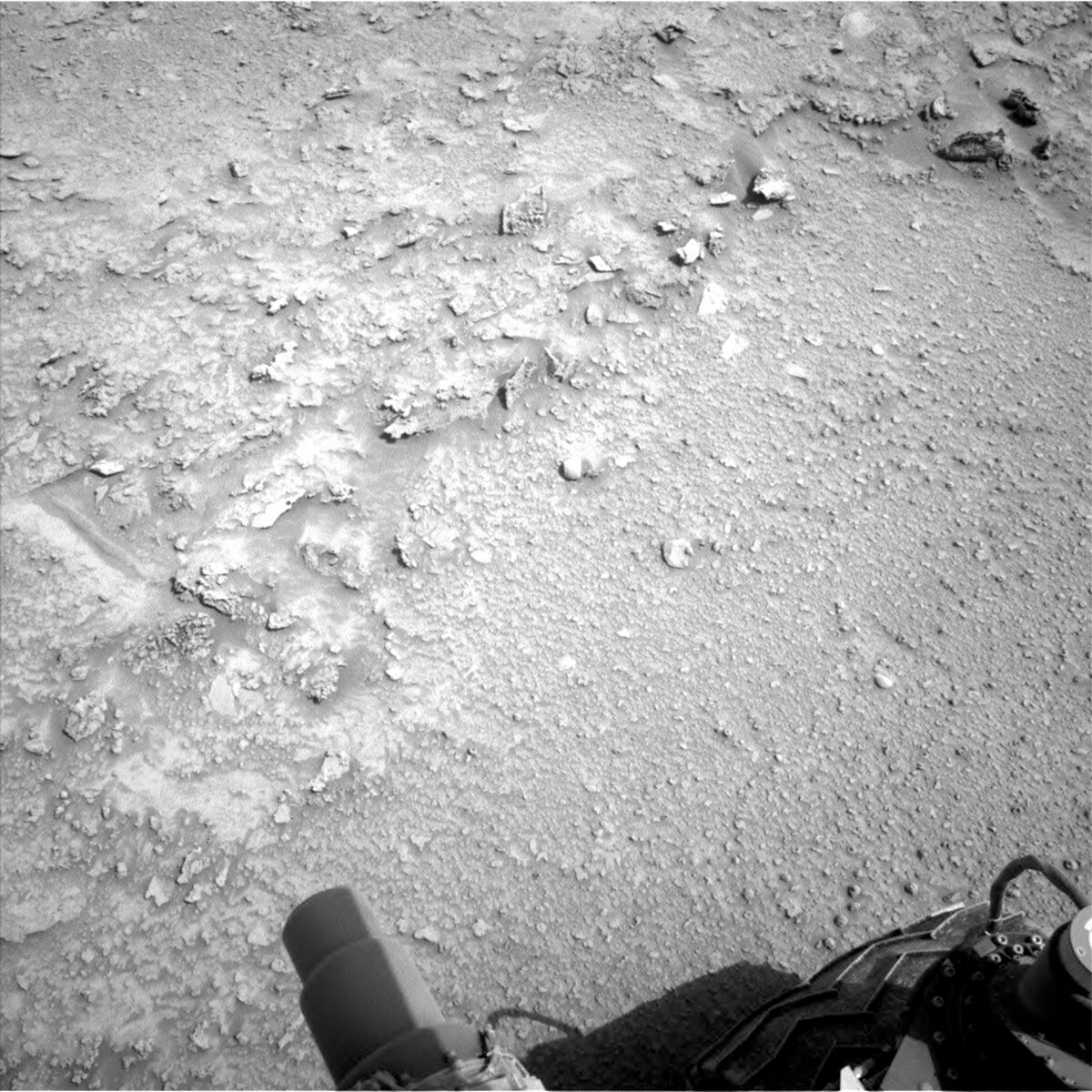
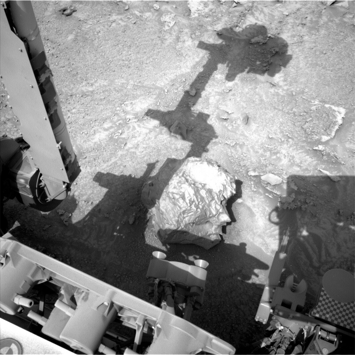
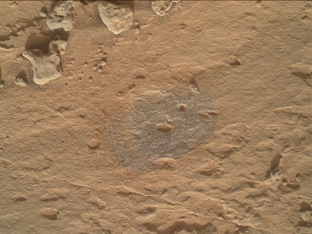
Curiosity has a bit of a lazy morning, sleeping in a bit before waking up to do imaging and contact science. The workspace today is covered with pebbles and small cobbles lying on the surface. We begin with some Mastcam multispectral imaging of two small foreign rock targets: “Paraiso,” which is a dark gray stone, and “Petro,” another possible meteorite. We also take a large stereo mosaic of the future route to continue to ascend Mt. Sharp. ChemCam then takes a LIBS observation of the target “Yavico,” which is one of the larger cobbles in the area. Finally Mastcam takes a documentation image of the Yavico ChemCam target. After another nap, Curiosity wakes up and starts to exercise the arm. First, there is some housekeeping to do by taking some ChemCam RMI images of the drill bit to help track bit wear. Then, the Rover Planners planned MALHI imaging on two cobble targets, Paraiso and “Pasamoni.” The challenge with cobbles is that they are small which requires extra evaluation time to ensure the placements are safe and likely to be successful. Short APXS evening integrations are done on both targets, which are fortunately just big enough to place the APXS on without having to hover. Before going to sleep for the night, Curiosity stows the arm to prepare for the next day’s drive.

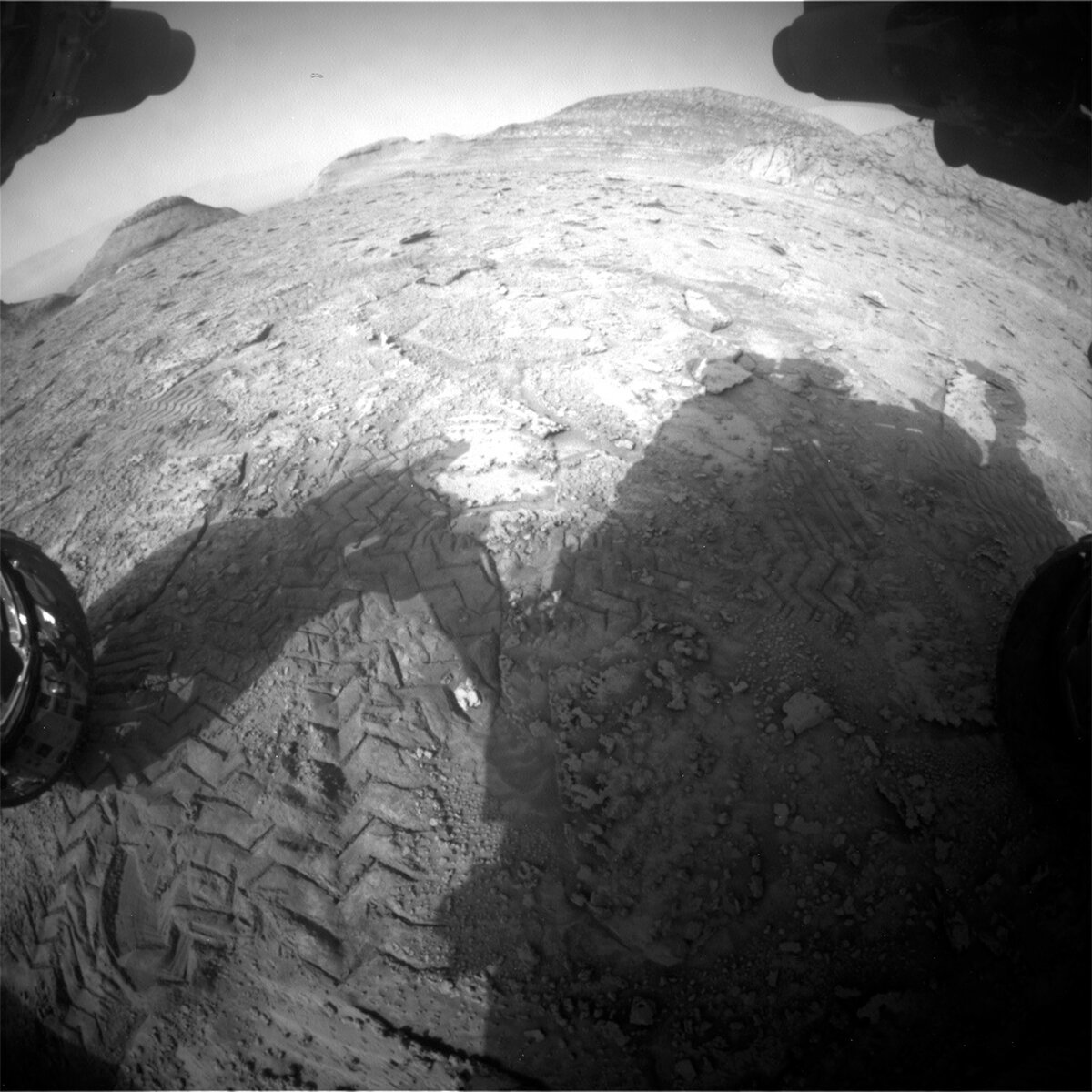
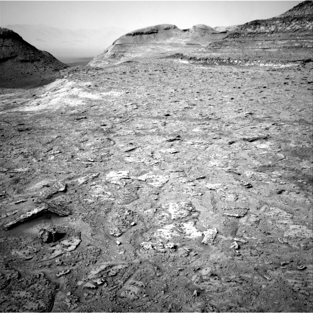
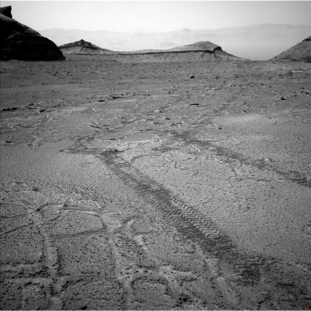
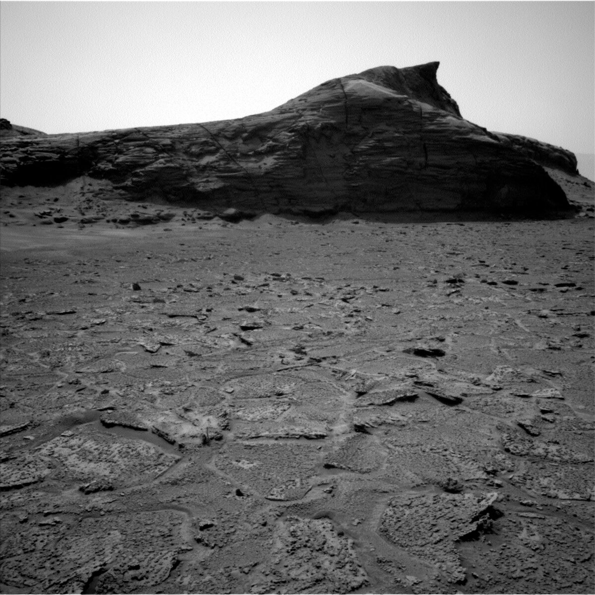
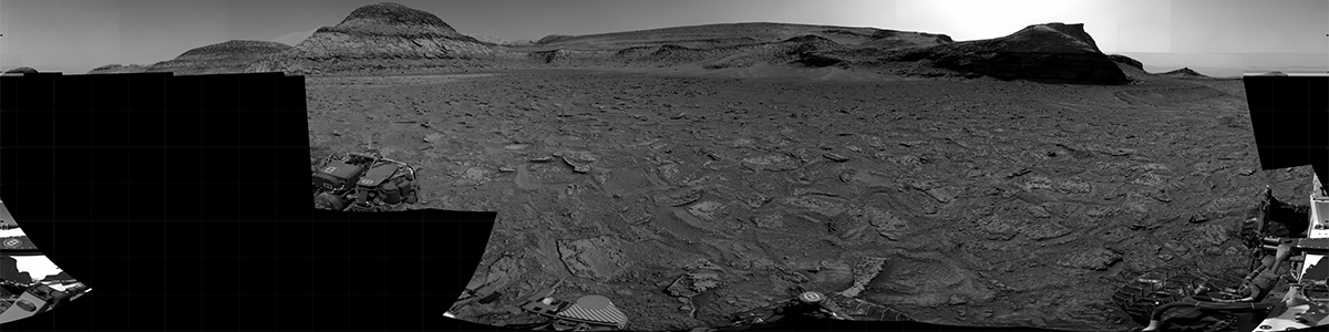
Curiosity also gets to sleep in a bit on the second sol before waking up to take more imaging. Mastcam takes three large mosaics. First is a stereo mosaic of the troughs in the polygonal patterns in the ground nearby, which are visible in the image. Next is another stereo image of “Tawakoni,” looking at the rover tracks as they cross from terrain with troughs to terrain without troughs to look for any differences in how the terrain was disturbed. ChemCam then takes a LIBS observation and Mastcam documents “Xaraco,” which is another small foreign rock nearby. With the imaging done, Curiosity is ready to get on the road. The Rover Planners had a challenge today, driving nearly 100m back in the direction of Encanto. Normally, driving that far would require using autonomous navigation to avoid hazards that are too far away to see. But today, the Rover Planners could make use of all the imaging we took on the way here to plan a safe drive and set us up to find another potential drill target. The image shows some of the nearby tracks that we’ll be approximately following back to the Encanto area. As seen in the image, the terrain is fairly flat so we don’t expect much slip taking Curiosity off the planned route.

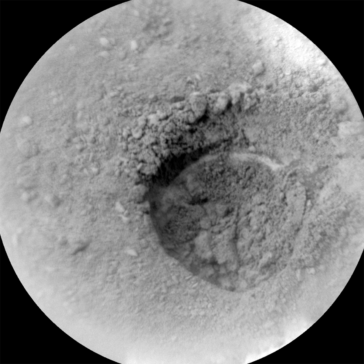
After the drive, we do another engineering activity which looks at the sun in order to cancel out any error that has accumulated in Curiosity’ onboard estimate of roll and pitch. This is essential to do in order for the rover to understand the terrain and whether a path is safe, as well as to know where to find Earth and the orbiters in the sky for communication. We follow the drive up with a standard set of imaging for driving and contact science, as well as some extended upper tier imaging and a Mastcam solar tau (imaging to monitor dust in the atmosphere). Near sunset, we also take some additional imaging with Navcam and Mastcam to look for clouds and a MARDI image to see the terrain under the rover. The image shows how hazy the horizon is, due to dust in the atmosphere.

On the last sol of the plan, Curiosity gets an earlier start on more imaging. AEGIS is used to autonomously find some interesting outcrop to image. Navcam does a suite of atmospheric imaging, including looking for dust devils and a suprahorizon movie to monitor dust in the atmosphere. Mastcam also takes a look at the rover deck to monitor dust accumulation there. After a long rest, Curiosity wakes up early the next morning, before handing over to the next plan, to take some additional Navcam atmospheric images and another Mastcam solar tau.

February 1, 2023

Sols 3730-3731: Smoother and Brighter? – Until You Get Up Close!

Written by Lucy Thompson, Planetary Geologist at University of New Brunswick
This image showing Curiosity's nameplate and the Mars surface was taken by Left Navigation Camera onboard the Curiosity rover on Sol 3728.

This image was taken by Left Navigation Camera onboard NASA's Mars rover Curiosity on Sol 3728. Credits: NASA/JPL-Caltech. Download image ›

The drive in our last plan took us to an area that appeared somewhat smoother and brighter from orbit (as well as from drive direction imaging) on the so-called “Marker band” that we have been investigating. The Marker band was identified as of interest prior to Curiosity landing within Gale crater owing to its distinct texture and appearance from orbit within the layers of rock that make up Mount Sharp. What does this interesting feature represent? Might it be a layer of volcanic ash? How does its chemistry, mineralogy, texture and colour differ from the surrounding Mount Sharp rock layers? These are all questions we are trying to address as we continue to traverse the Marker band, which is why we drove to our current workspace. However, when we looked at the images this morning, it was clear that our parking spot was far from smooth, at least on the cm-scale, and the brightness can probably be attributed to the ubiquitous dust and soil present (see the image associated with this blog). Our workspace was sprinkled with small (1-3 cm size), resistant pebbles that may or may not be attached to underlying rock, which is obscured by the dust and soil that has collected between the pebbles. Our plan was to get “contact” science of the rock in this workspace, but because of the size and nature of the pebbles, it was not safe to place the APXS in contact with what the rover engineers referred to as, “APXS-killers!” The pebbles were the perfect size and spacing that they could have poked up into the APXS instrument, so we chose instead to hover over the pebbles (the target, “Alasca”) with APXS to determine their composition. We will also take close-up MAHLI images of “Alasca,” as well as of an interesting trough-like feature (“Alegria”). As the APXS strategic planner today, I chose the target and liaised with the rover engineers to make sure that our instrument will be safely deployed. To further characterize this workspace, ChemCam will fire the laser at the resistant pebble “Viudita” to determine composition, and we will acquire an accompanying Mastcam documentation image.

Further afield, we planned imaging of the terrain around and ahead of us with both Mastcam and ChemCam RMI. These images include continued characterization of the grey float rocks that are scattered on the surface; documenting the stratigraphy in the direction that we plan to drive in; looking for more examples of the rhythmic layering that we saw exposed within the Marker band when we first investigated it; and imaging apparent changes in the surface texture of the Marker band.

After executing all our targeted science, we plan to drive away, ~12 m to the SSW, to put some of the grey float rocks in our workspace for the weekend. Once the drive has completed, there is lots of untargeted science still to be done. A MARDI image will document the terrain below us, and an untargeted ChemCam AEGIS activity will give us a glimpse of the composition of our new workspace. The rest of the untargeted science will predominantly comprise observations (Mastcam and Navcam) to monitor the atmosphere and sky, including Mastcam imaging of Phobos, Mastcam twilight imaging and a Navcam twilight movie. Standard REMS, DAN and RAD activities round out this plan.

January 30, 2023

Sols 3278-3279: Making the Most of Limited Data

Written by Ken Herkenhoff, Planetary Geologist at USGS Astrogeology Science Center
This image of Martian rocky terrain with part of the Curiosity rover in the right lower corner was taken by Left Navigation Camera onboard NASA's Mars rover Curiosity on Sol 3727.

This image was taken by Left Navigation Camera onboard NASA's Mars rover Curiosity on Sol 3727. Credits: NASA/JPL-Caltech. Download image ›

The Sol 3727 drive went well, positioning the rover at the transition in the Marker Band that was the goal of the drive. As expected, we did not receive enough image data to allow DRT brushing to be planned, but we were able to plan APXS and MAHLI observations of a rough bedrock target named "Primavera." The lack of complete, full-resolution Navcam coverage made it more challenging than usual to select and accurately point at targets of interest. I focused on planning long-distance RMI observations, and despite the limited data we were able to plan an RMI mosaic of a distant block with interesting textures exposed. We also planned a LIBS raster on a nearby nodular rock named "Shulinab." Mastcam will take an image of Shulinab for context and acquire stereo mosaics of a dark linear feature, the planned drive direction, and some stones that don't appear to be derived from the local bedrock. The Left Mastcam will also acquire a 7x6 mosaic of textures near the rover. After all these activities have completed, the rover will drive about 26 meters to a brighter patch of ground, unstow its arm and take images of the arm workspace in preparation for contact science planning on Wednesday. Mastcam will once again measure the amount of dust in the air above the rover by imaging the Sun, then will search for ice clouds and take an image of Mars' larger moon Phobos after sunset.

On Sol 3729 Navcam will search of dust devils and ChemCam will autonomously search for and shoot its laser at an outcrop target. That evening, Navcam will search for clouds during twilight. As usual, REMS and DAN activities are spread throughout the plan.

January 27, 2023

Sols 3725-3727: To Be a Meteorite or Not To Be a Meteorite – That Is the Question!

Written by Ashley Stroupe, Mission Operations Engineer at NASA's Jet Propulsion Laboratory
This image showing part of the Curiosity rover and the shadow of its arm above a rock was taken by Left Navigation Camera onboard the Curiosity rover on Sol 3724.

This image was taken by Left Navigation Camera onboard NASA's Mars rover Curiosity on Sol 3724. Credits: NASA/JPL-Caltech. Download image ›

Today we came in to see another really beautiful workspace. The image shows the rock on which we are doing contact science, “Cacao,” and the shadow of the unstowed arm in the afternoon light. The rock we are parked in front of is one of several very dark-colored blocks in this area which seem to have come from elsewhere, and we are calling “foreign stones.” Our investigations will help determine if this is a block from elsewhere on Mars that just has been weathered in an interesting way or if it is a meteorite. I served as the Tactical Uplink Lead (TUL) today and helped manage to get all the complicated activities into today’s plan.

On the first sol of our weekend plan, we are doing a lot of imaging. We begin with some stereo Mastcams of Cacao and “Gavidia,” which is another dark rock nearby. We also take Mastcam of a potential future drive target. Also we take a CCAM LIBS observation of “Maroa,” a lighter gray rock also in the workspace, as well as an RMI of the Inverted channel that we have been periodically observing. We wrap up the first sol’s targeted science with a Navcam dust devil movie. Later in the afternoon, we do a cloud survey with Mastcam and Navcam, as we are back in cloud season on Mars.

Later in the afternoon, we begin contact science on two targets, one named “Curare” and the other “Cururu,” both of which are on the top of the Cacao rock. This is a very tricky set of observations because Cacao is close in front of us and very tall, so we need to be extra careful to avoid hitting it with the arm. In addition to taking MAHLI close-up images of the rock, we also are imaging the drill bit after our attempt to drill at Encanto in the marker band and evening APXS integrations on both targets before stowing the arm and going to sleep for the night.

On the second sol of the plan we do more targeted science, including Mastcam and CCAM LIBS of the target “Curuxuim,” which is another target on the Cacao rock as well as ChemCam RMI of a distant target and a Mastcam survey of some of the other foreign stones in the area. We also do another later-afternoon cloud survey.

On the third sol of the plan, we have two targeted science blocks. One in the morning is dedicated to ChemCam LIBS on the target “Cinarucu,” another small gray rock in the workspace and some atmospheric observations (a Mastcam solar tau and a Navcam large dust devil survey). The afternoon block is dedicated to a multispectral mosaic of Cacao and a mosaic of the “Chenapau” butte as well as imaging the color calibration target. In the later afternoon, we then have a short drive to another nearby transition in the Marker Band. The hope is to be able to perform both contact science and imaging on it. Science is calling it a “triple junction” because from orbit it looks like a step up where three different units are in close proximity and it looks like something interesting is going on there. This drive is fairly simple as the terrain, for the most part, is flat and hazard-free. However, the very start of the drive required a little extra care as we are driving over the large Cacao rock; it is about 30cm tall so we need to be careful but we still have plenty of clearance to drive over it. After we drive, if everything is still safe, we will unstow the arm to get a better view of our new workspace.

The next morning, before we hand over to the next plan, we have an early set of environmental observations, including Navcam zenith movie, suprahorizon movie, and a north-facing line-of-site image and a Mastcam solar tau.

January 25, 2023

Sols 3723-3724: Aiming for the Triple Junction

Written by Susanne Schwenzer, Planetary Geologist at The Open University
This image was taken by Left Navigation Camera onboard NASA's Mars rover Curiosity on Sol 3721.

This image was taken by Left Navigation Camera onboard NASA's Mars rover Curiosity on Sol 3721. Credits: NASA/JPL-Caltech. Download image ›

Your blogger is a little tired right now… I am just back from a field trip to the salt flats in Botswana, guided by colleagues from BIUST University, walking, viewing and sampling in 38 °C heat. It was great to walk around and see with my own eyes geology relevant to Mars here on Earth. This enhances my – and more generally our - understanding of the physical and chemical processes that underly observations on Mars. I have been doing some analogue research in the Ntwetwe Pan, but while looking at the vast, muddy plains could not keep myself from thinking back to Mars. Is that how the area around the clay bearing unit we travelled through earlier in the mission would have looked like when the water was just starting to dry off? I can see similarities and differences, and both can inform our work on Mars and our interpretation of the data we receive. But, back to Mars!

Today’s planning started with a discussion where to drive next. We had spotted features in the distance, including a triple junction of rock layers, and are now aiming for those, and for a large, dark rock just before that. Carefully surveying each image for features that look different allows us to spot the unknown, the new, and the change, and then put all our instruments to work to understand what we see. Piece by piece, the picture of the geology of Gale crater grows and with it our understanding of Mars as a planet. The triple junction is especially important, as it is expected to allow us to see how the different rock layers are related to each other.

But before we drive, Curiosity will be busy at its current parking location with two APXS targets, which will also be documented by MAHLI: “El Descanso” and “Peters Mine.” MAHLI in addition performs a dogs-eye view to document sedimentary features on a target named “Semang Peak.” All of those will add to the understanding of the chemistry and formation conditions of the differently textured rocks. Mastcam will document the various features around the rover and at a distance. There will be a mosaic to further look at the marker band feature. Yes, that’s the rock that so far was too hard to drill, most recently as target Encanto. Mastcam will also document an area around target “Cacao” and “Telhiero,” as well as take single frame images of the ChemCam LIBS targets “Mapiripana” and “Potaro.” ChemCam also performs long distance RMI imaging on target “Amapa.”

Atmospheric observations include a dust devil survey and horizon movie. DAN is taking a passive measurement, allowing us to get a full set of data once more, including atmospheric measurements and water in the subsurface under the rover. Then the rover will drive off to Cacao, the large rock spotted at a distance, and upon arrival take a MARDI image and a set of Navcam and Mastcam images that will allow understanding the new parking location for the planning in two days’ time.

January 23, 2023

Sol 3721: Wrapping up at the Encanto Drill Site

Written by Sharon Wilson, Planetary Geologist at the Smithsonian National Air and Space Museum
This image of a hole in the soil was taken by Chemistry & Camera (ChemCam) onboard NASA's Mars rover Curiosity on Sol 3720.

This image was taken by Chemistry & Camera (ChemCam) onboard NASA's Mars rover Curiosity on Sol 3720. Credits: NASA/JPL-Caltech/LANL. Download image ›

Despite giving it the “old college try,” Curiosity’s attempt to drill into the Marker Band at the “Encanto” site did not reach sampling depth. Because other rocks around the rover look similar to “Encanto” and are likely also too hard to drill, the Science Team decided to convert the plan to a “Touch and Go.”

Although the Science Team is disappointed to leave this Marker Band location without a sample, Curiosity will use MAHLI, APXS, and ChemCam LIBS to analyze the chemistry and texture of the shallow “Encanto” drill hole and tailings, targeting the intriguing light-toned material exposed in the wall of the drill hole. We may see another location in the Marker Band worth sampling in the near future, but even if we don’t, there will certainly be many more exciting drilling opportunities to look forward to as Curiosity continues her climb up Mt. Sharp!

In addition to a ~25 meter drive to the south on Sol 3721, Mastcam will take an image of the “Cacao” target to document the terrain in the direction that the rover is driving as well as a multispectral image of “Cana Dulce,” a dark-toned rock that is perched on the surface of the Marker Band. Curiosity will round out the sol by observing the sky and looking for dust devils.

January 20, 2023

Sols 3718-3720: Go For Drilling at Encanto

Written by Lauren Edgar, Planetary Geologist at USGS Astrogeology Science Center
ASA's Mars rover Curiosity acquired this image of a rock face using its Mars Hand Lens Imager (MAHLI) on January 19, 2023, Sol 3716 of the mission.

NASA's Mars rover Curiosity acquired this image using its Mars Hand Lens Imager (MAHLI), located on the turret at the end of the rover's robotic arm, on January 19, 2023, Sol 3716 of the Mars Science Laboratory Mission. Credits: NASA/JPL-Caltech/MSSS. Download image ›

In the previous plan, Curiosity conducted a preliminary assessment of the potential drill target “Encanto” (as seen in the above MAHLI image) and today we received the data. The drill preload test and contact science data look good, so we are GO for our third attempt to get a sample of this marker band.

Today’s 3-sol plan includes the full drill on the first sol, followed by portion characterization on the second sol, and some remote sensing activities. The team planned ChemCam LIBS on two bedrock targets named “Macucuau” and “Marahuaca” to look for variations in chemistry, as well as a long distance RMI mosaic to evaluate some nodular beds in the nearby cliffs. ChemCam will also acquire RMI images of the drill hole to help with targeting in the next plan, and passive spectra on the drill tailings. The plan also includes Mastcam imaging of the “Encanto” block to look for changes before and after drilling, plus Mastcam multispectral observations of the drill tailings and a target named “Cacao” to investigate some dark gray float rocks. Curiosity will also be busy looking at the sky, with a number of activities to look for potential noctilucent clouds at twilight, monitor dust in the atmosphere, and search for dust devils.

Hopefully the third time is the charm, and we look forward to seeing results from drilling at “Encanto!”

January 18, 2023

Sols 3716-3717: Our Encanto!

Written by Elena Amador-French, Science Operations Coordinator at NASA's Jet Propulsion Laboratory
NASA's Mars rover Curiosity took 28 images in Gale Crater using its mast-mounted Right Navigation Camera (Navcam) to create this mosaic.

NASA's Mars rover Curiosity took 28 images in Gale Crater using its mast-mounted Right Navigation Camera (Navcam) to create this mosaic. Credits: NASA/JPL-Caltech. Download image ›

Yesterday’s plan executed successfully including a short bump that placed us in front of an interesting block that may just contain our next drilled target!

Before the science team commits to drilling the target “Encanto,” we will first investigate the chemistry and composition of the target using APXS, ChemCam, and Mastcam (using their multispectral capability), to ensure that it is scientifically in-line with the rest of the Marker Band. Additionally, we will perform a preload test which will provide a sense of the stability of the block.

El Encanto is a town and municipality in the Amazonas region of Colombia. Additionally one translation of the Spanish word “encanto” is “charm” – we indeed hope this drill target is charmed after we faced challenges with our last two drill attempts on the Marker Band.

In addition to today’s initial drill campaign activities, we will take a 360 degree Mastcam mosaic and perform our regular cadence of environmental monitoring activities.

Looking forward to seeing what this “Encanto” holds for us on Friday!