October 20, 2023

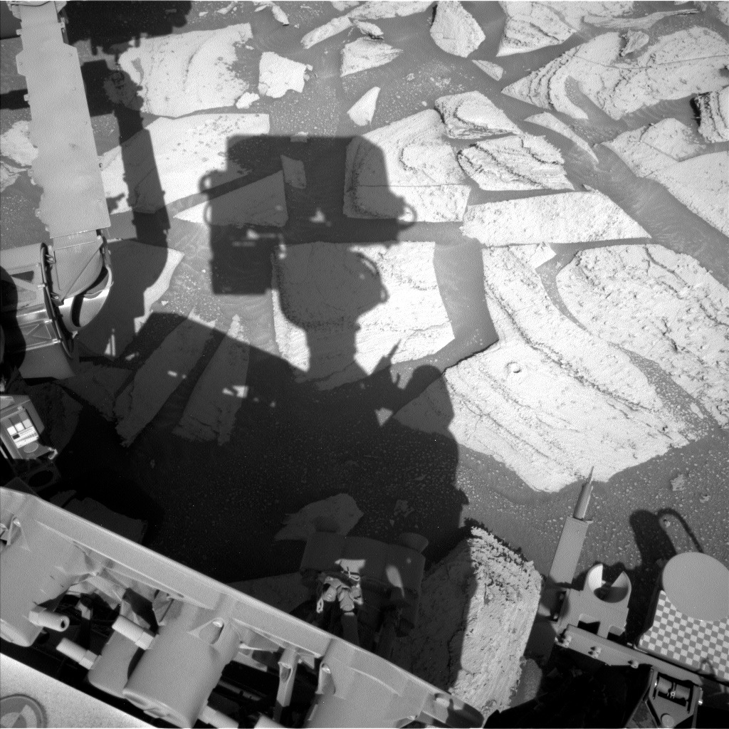
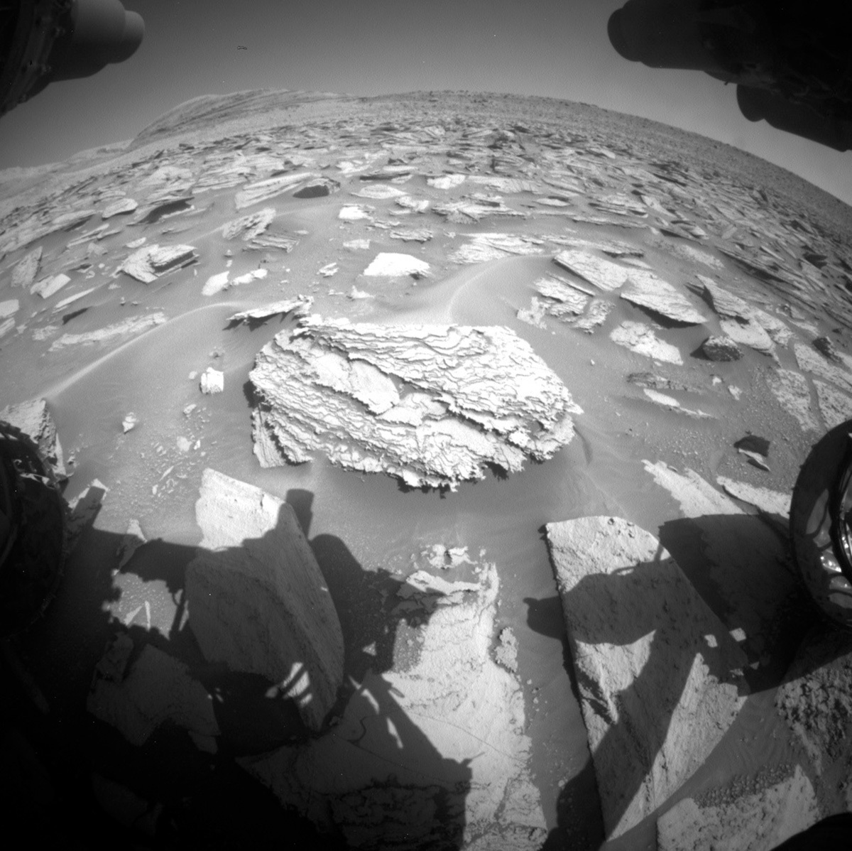
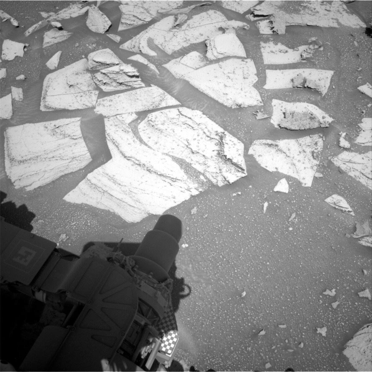
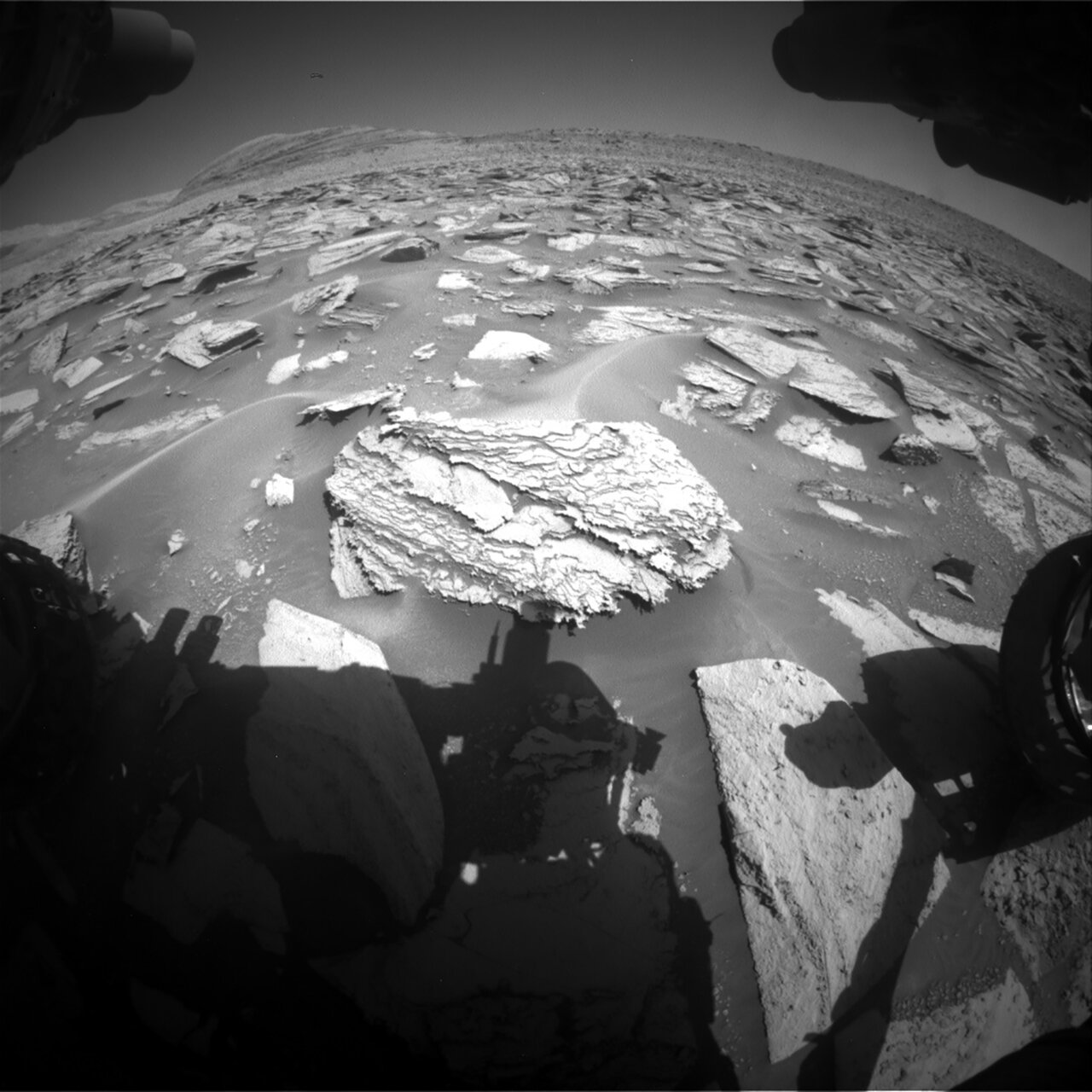
Sols 3984-3986: Sampling Sequoia

Written by Lucy Thompson, Planetary Geologist at University of New Brunswick
Mastcam image of the Sequoia drill hole acquired on Sol 3981.

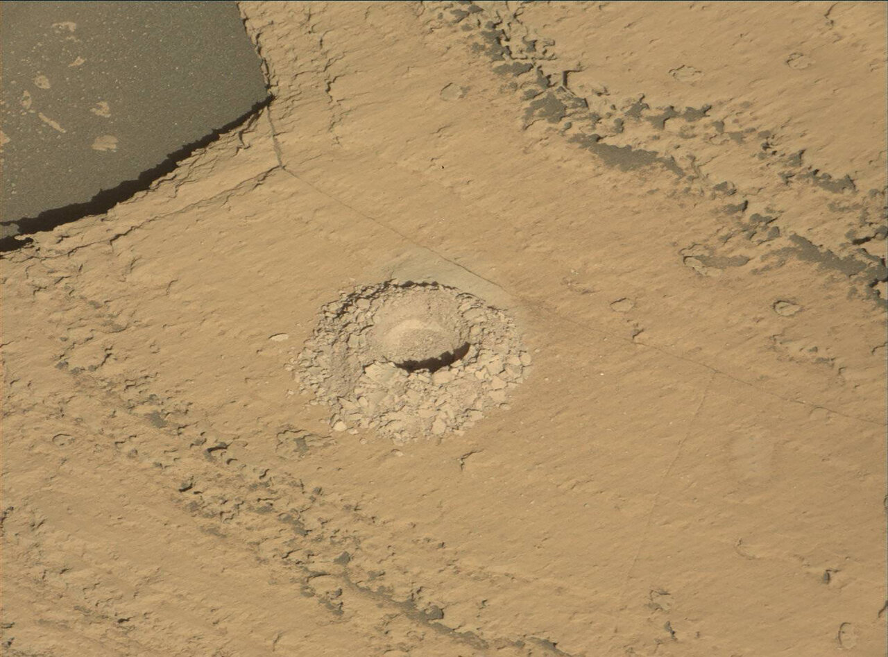
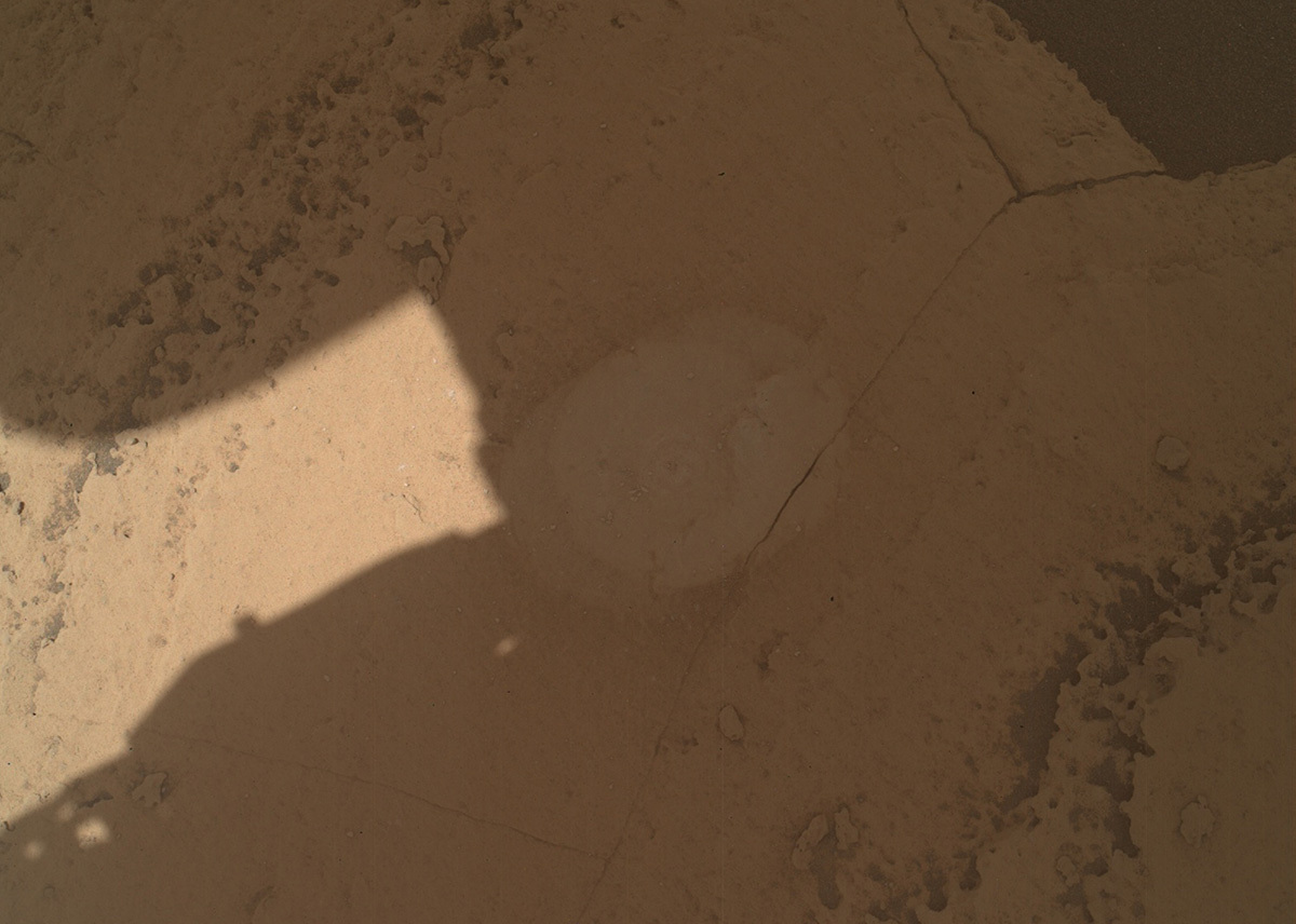
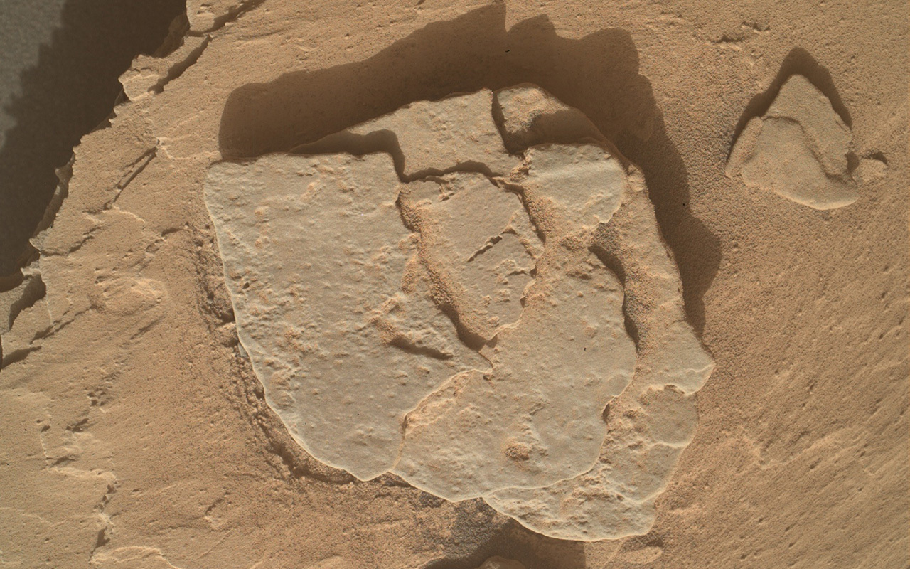
Mastcam image of the Sequoia drill hole acquired on Sol 3981. Credits: NASA/JPL-Caltech/MSSS. Download image ›

Earth planning date: Friday, October 20, 2023

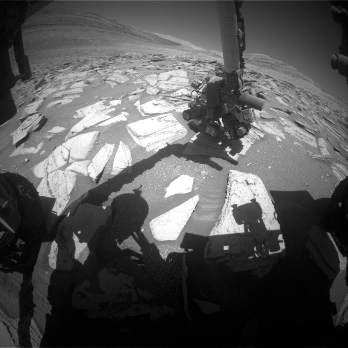
The highest priority in this weekend’s 3-sol plan is the SAM preconditioning activity. This is in anticipation of a SAM evolved gas analysis (EGA) of the Sequoia drill sample next week. We will review the downlink from our first night of CheMin analysis over the weekend to make a final decision of whether we want to proceed with the EGA on Monday. We are all excited to see what the mineralogy of our 39th drill hole on Mars will be. We are ~60 m higher in elevation than our previous Ubajara drill location. Will the mineralogy of our newest drill sample be the same, or might there be changes as we climb up through the layers of sulfate-bearing rocks exposed on Mount Sharp? Changes in mineralogy could indicate changing conditions during the initial deposition of the sediment that comprises the rock, or perhaps later alteration processes. To support the upcoming, power-hungry, SAM EGA we had to be careful to preserve power in this weekend plan. However, this still permitted us to pack in lots of science observations of both the rocks and terrain around us, as well as atmospheric investigations.

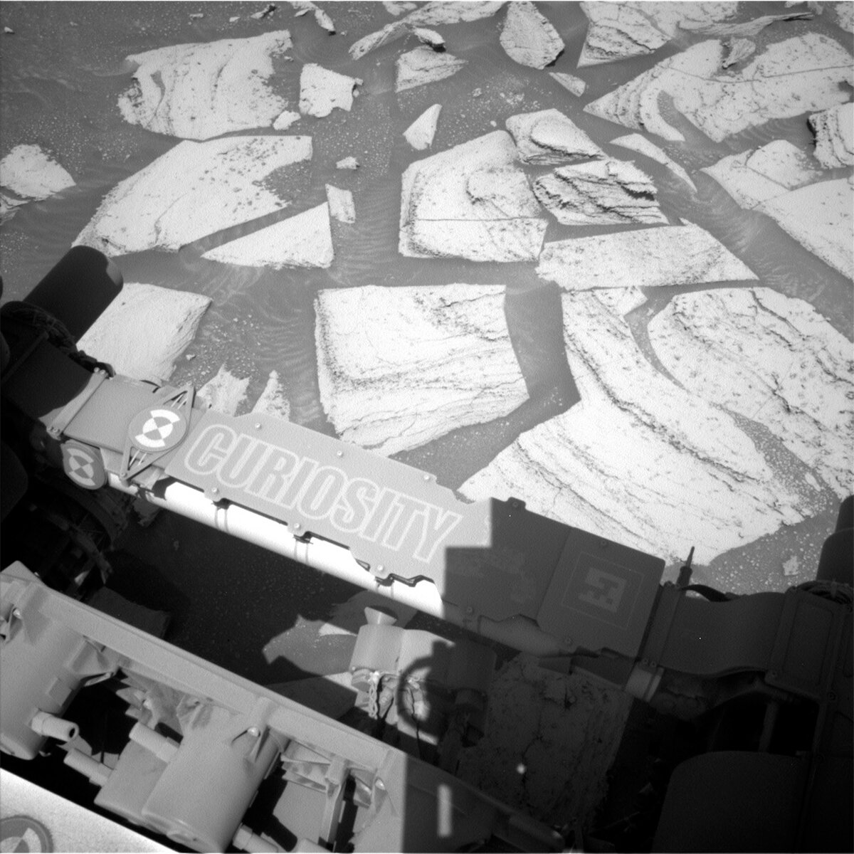
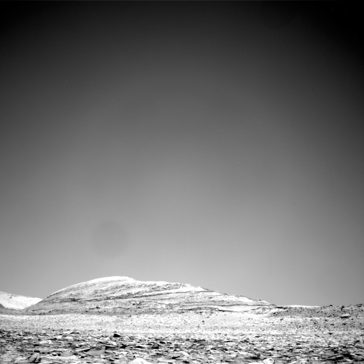
ChemCam will analyze the “Fridays Folly,” “Guitar Lake” and “Wolverton” bedrock targets to investigate compositional variation across the layering present in the same block as the Sequoia drill hole. The layers could represent some of the material sampled during drilling, thus the chemistry of the different layers can aid in the interpretation of the CheMin and SAM results. We will also image these targets with Mastcam for colour documentation. As well as firing its laser, ChemCam will also utilize its remote imaging capabilities to acquire RMI mosaics of the base of the nearby Kukenan butte, and the crater rim. To complement the RMI of the crater rim, a Mastcam mosaic will be pointed in the same direction. We are also imaging some nearby rocks with interesting curvilinear features (“Brainard Lake”) as well as the drill hole and drill fines with Mastcam. The drill hole observation can help to determine whether wind is moving the fines around, and with targeting of the fines for contact science, once we have finished supplying sample to our internal CheMin and SAM instruments. As an APXS team member, I am particularly eager to use the robotic arm to place APXS on the drill fines and compare their chemistry with what we measured at the surface. To capture the full context of our 39th drill hole on Mars, a Navcam 360 mosaic of Sequoia and the surrounding terrain will also be acquired. The terrain beneath the rover will be imaged with MARDI to look for changes as Curiosity is parked in this location during the drill campaign (e.g., movement of windblown sand).

A plethora of environmental observations are also scattered throughout the plan on different sols and at different times to monitor changes in atmospheric conditions. These include a Navcam cloud altitude observation, a zenith movie, two suprahorizon movies, a line of sight scan and single line of sight image. We will also acquire two Mascam tau observations in this plan. Standard REMS, DAN and RAD activities round out this 3-sol, weekend plan.

The MSL science team are all eagerly anticipating our first peek at the mineralogy of Sequoia, which we should receive later today!

October 19, 2023

Sols 3982-3983: Welcome to the Drillhole Family, 'Sequoia'!

Written by Emma Harris, Graduate Student at Natural History Museum
This image was taken by Left Navigation Camera onboard NASA's Mars rover Curiosity on Sol 3981.

This image was taken by Left Navigation Camera onboard NASA's Mars rover Curiosity on Sol 3981. Credits: NASA/JPL-Caltech. Download image ›

Earth planning date: Wednesday, October 18, 2023

The target 'Sequoia' has been successfully drilled! The image today is one of my favourites – the shadow of the rover mast, and the perfectly drilled target in the background... it doesn’t get much better than that! Curiosity stays in place for a little while longer for CheMin analysis of the drilled material, and no drive meant we had more power than expected. And wow, the science team stepped up - we managed to get 1 hour of observations on the first sol, and 1.5 hours on the second sol!

Today in planning, I undertook the role of 'Keeper Of the Plan' for the geology and mineralogy science theme group, and the role is abbreviated to GKOP. It was my job to make sure the geology-focused science requests from instrument teams made it successfully into the plan to be sent to the rover. For the first sol of this midweek plan, we start off with a Navcam dust devil survey. Then, ChemCam takes over for two LIBS observations of the drillhole and the tailings to determine the chemical composition here. Mastcam comes in at the end of the first block of activities to document the ChemCam activities on Sequoia and to again attempt to identify any change by wind activity. On the afternoon of the first sol, and morning of the second sol, we also planned photometry observations. Using Navcam and Mastcam images taken at different times of the day, we can measure the reflectivity of the surface and can use this in working out the physical properties of the surface.

A couple of hours after the early morning photometry, the second sol contains 1.5 hours of science observations. First, a Mastcam tau observation is used to measure atmospheric opacity. We then turn to ChemCam for a LIBS target on the same block as the drillhole, named 'Angel Wings.' This observation is paired once again with a Mastcam documentation image. We then turn to a nearby butte named 'Kukenan' for a ChemCam Long Distance RMI, as well as a beautiful, big Mastcam mosaic of the entire butte face! One of the great things about drill campaigns is that we stay put for a while, and are able to get large observations of the beautiful surroundings.

October 16, 2023

Sols 3977-3979: Taking a Rain Check

Written by Alex Innanen, Atmospheric Scientist at York University
NASA's Mars rover Curiosity acquired this image using its Mars Hand Lens Imager (MAHLI), located on the turret at the end of the rover's robotic arm, on October 12, 2023, Sol 3975 of the Mars Science Laboratory Mission.

NASA's Mars rover Curiosity acquired this image using its Mars Hand Lens Imager (MAHLI), located on the turret at the end of the rover's robotic arm, on October 12, 2023, Sol 3975 of the Mars Science Laboratory Mission. Credits: NASA/JPL-Caltech/MSSS. Download image ›

Earth planning date: Friday, October 13, 2023

It's been an exciting week in space – Conor already mentioned the news from OSIRIS-REX on Wednesday and just before I logged on for my shift this morning the Psyche spacecraft launched. But the week isn't over and weekends on Mars have lots of room for excitement.

Wednesday's pre-drilling tests on target 'Sequoia' (shown in the image above) mostly went smoothly, but the preload test failed. That meant we needed to make a slight adjustment, moving the drill target a couple centimetres. Even such a slight change meant we had to redo drill sol 1 – no drilling for us this weekend. Instead we'll be trying again on Monday on a slightly new target, 'Sequoia 2.'

This reminded me a bit of the Psyche launch. It was originally planned for the 12th, but weather conditions meant the launch was delayed. It's not weather delaying us, but we're still taking a rain check on drilling. We're no strangers to things getting shuffled around and moved back – Curiosity just had to readjust its position to reach our current drill target. I even started writing this blog all ready to talk about drilling this weekend! Of the many things I've learned from Curiosity over the years, it's how to react to changes. Ultimately, taking the weekend to redo drill sol 1 will mean that we're in an even better position to drill next week.

The weekend isn't entirely given over to evaluating our new drill target though. That will be done on the second sol, which is more or less a repeat of Wednesday's drill target characterisation with APXS and MAHLI (but no DRT). The other two sols have plenty to occupy our rover as well. Navcam and Mastcam are starting photometry experiments, which look at how light scatters off the surface at different times of sol. Four of these experiments are planned for the weekend, with more to come in the following sols. The first sol also sees ChemCam and Mastcam examining a nearby block, 'Grey Pass,' as well as a Mastcam solar tau.

The third sol sees a nice long science block, with a 360 degree dust devil survey and a suprahorizon cloud movie as well as ChemCam LIBS on another block 'Bubbs Creek' and a long distance mosaic on Kukenan. A bit later in the afternoon we're also getting a cloud altitude observation, which lets us use cloud shadows to estimate cloud altitudes. We’re quickly approaching the end of the cloudy season on Mars, so it's always great when we can get some cloud watching in. We wake up early on our final morning for our weekly morning ENV block, where we do some more cloud watching (zenith and suprahorizon movies and a phase function sky survey) as well as some dust characterisation with another Mastcam tau and a 4x1 Navcam line of sight observation.

October 16, 2023

Sols 3980-3981: Cliffhangers Go by the Name of 'Stand By' in Mission Operations

Written by Susanne Schwenzer, Planetary Geologist at The Open University
This image was taken by Front Hazard Avoidance Camera (Front Hazcam) onboard NASA's Mars rover Curiosity on Sol 3978. Credits: NASA/JPL-Caltech. Download image ›

This image was taken by Front Hazard Avoidance Camera (Front Hazcam) onboard NASA's Mars rover Curiosity on Sol 3978. Credits: NASA/JPL-Caltech. Download image ›

Earth planning date: Monday, October 16, 2023.

We are just at the first steps of the next drilling campaign, as regular readers of this blog will certainly have spotted already. The last plan had the preload test, that little dent we make into the rocks to gauge how both the rock and the rover’s arm will react to the pressures and stresses of the drilling. It’s a good forecast, but rocks are natural materials, and sometimes they just decide to break. Remember that Groken drill hole? I don’t blame you, if not, because the blog about it is just three days short of three years old! You can find it here if you want to go down memory lane! Fred Calef decided to use the image of the broken off rock piece (which also got additional attention with the analytical instruments) for his title image!

I have picked the ‘arm on the rock’ image above, because I simply love to see instruments on the rocks. But what became of our preload test? Well, it’s a little more complex as engineers weren’t quite sure we’d passed all tests for quite a while into planning. That’s not to say that there was any specific problem, just that the numbers were complex enough to analyse that the time between when our engineers got them and the start of planning wasn’t quite enough. So, we were told to ‘stand by’ … that was at 4 pm in the UK, which is where this blogger is located. While the engineers looked at the downlink, the scientists made the most of that ‘stand by’ situation, assumed success and we started the planning process for the science observations we’d like in the plan.

The plan has the actual drill of the Sequoia drill site and the cadence of observations to characterise the drill hole and the fines, starting with Mastcam and ChemCam imaging. ChemCam also targets ‘Sharktooth’ with a LIBS measurement, a target that was chosen to be in the same layer as the drill to compare chemistry. Finally, Mastcam looks – again – at the change detection location to see if we can make out any wind action.

The science activities in the plan are short today as the drilling is very power intense and of course the main focus in the plan. About an hour into planning, when we had completed our work, the mission scientist came back to give us an update and told us to … you guess it: ‘stand by’. He could give us a green light for submission of our desired science activities as the analysis showed that chances were getting higher and higher that all the numbers would be looking good at the end of the analysis. So, we submitted our plan, although it was not yet totally clear if we could actually drill. That said, our optimism had been upgraded to a 95 % confidence level that we could actually drill. What else? Well, to continue to ‘stand by’ of course! We went into the next meeting to go over the entire plan, still on ‘stand by’ for the final verdict on the ‘go’ for drilling. At that point, it was 7 pm over here. Some assessments are just a little more complex than others… and ‘Better be safe than sorry’ as we say here in the UK. So, even after that meeting had finished, we were still on ‘stand by’ for the final go/no go decision on the drill.

Now, go or no go? Did we send the drill command? Well, at 19.47 pm UK the final verdict was delivered and the decision was made that we are go for drilling! So, with the numbers all analysed, we got the go for drilling and our plan was sent to Curiosity. We are all awaiting to see the new kid of the drill hole family soon! If you want to see what the first 36 of them look like… here you go!

October 12, 2023

Sols 3975-3976: Preparing To Drill

Written by Conor Hayes, Graduate Student at York University
A Left Navcam image from sol 3974 showing off the nameplate on the rover’s arm and our next drill target “Sequoia” just right of centre.

A Left Navcam image from sol 3974 showing off the nameplate on the rover’s arm and our next drill target “Sequoia” just right of centre. Credits: NASA/JPL-Caltech. Download image ›

Earth planning date: Wednesday, October 11, 2023

Planning today started 90 minutes later than usual thanks to the data downlink containing the information we needed to assemble the plan not arriving on Earth until just before 9:30 PDT. The late start meant that I was able to watch the reveal of the initial results from the OSIRIS-REx mission, which delivered a sample of the asteroid Bennu to Earth several weeks ago.

On Mars, Curiosity is prepping to take a sample of its own, albeit one that won't be returned to Earth (that honour belongs to Curiosity's twin Perseverance over in Jezero Crater). After we weren't able to start our next drilling campaign on Monday, we received word today that our bump to a better position was successful, allowing us to begin our preparations to drill as early as this weekend.

Drilling and the activities that accompany it can be quite power-intensive, which means that we have less flexibility in planning other observations. This was definitely the case today, as we had just over an hour and a half of available science time instead of the two hours that we usually have on two sol plans. Both ENV and GEO had to prioritize their observation requests, downscoping or deferring activities as necessary to fit everything into the available time.

Because today's plan is "drill sol 1," we begin by unstowing the rover's arm to do some pre-drilling investigation of our drill target "Sequoia." This includes use of APXS as well as MAHLI imaging before and after clearing away the dust on Sequoia with DRT. We will then perform what's known as a "preload test" where we will place the drill down on Sequoia (without activating the drill) to see how the rock responds to that force. The results of the preload test will be documented by MAHLI. Later in the sol, we will use LIBS to investigate the target "Saddlehorn," take some Mastcam images of the future site of the Sequoia drill hole, and image the SAM inlet covers with Mastcam and Navcam. The first sol of this plan finishes off with some evening APXS integrations.

When the rover wakes up on the second sol, we'll begin with some more ChemCam activities, including a LIBS observation of "Kern River," some passive (no LIBS) observations with RMI imaging of Sequoia, and RMI imaging of the upper Gediz Vallis ridge. Mastcam will then document the aftermath of the two LIBS activities in this plan. We will finish off with a 4x1 Navcam mosaic of the north crater rim to measure the amount of dust in the atmosphere between the rover and the edge of Gale Crater.

Routine observations from REMS, RAD, and DAN round out this plan as we look forward to drilling another hole in the Martian surface in the coming sols.

October 9, 2023

Sols 3968-3969: Dreaming of a Drill Campaign

Written by Natalie Moore, Mission Operations Specialist at Malin Space Science Systems
Front Hazcam image of our beautifully-layered workspace for planning sols 3968-3969.

Front Hazcam image of our beautifully-layered workspace for planning sols 3968-3969. Credits: NASA/JPL-Caltech. Download image ›

Earth planning date: Wednesday, October 4, 2023

Winter is almost half over in Gale, but this rover doesn’t hibernate! The last time we stopped for more than a few sols was at the Ubajara drill site back in early May, almost 1 kilometer and 150 sols ago. Now, five months later, we’re approaching our next drill site in this area of alternating banded layers dispersed across lithified sand. The scientist jury is still out on which block is their favorite, but the operations team is already preparing to begin a two-to-three week drill campaign in the near future. With solar conjunction fast approaching, it’ll be interesting to see how much of a drill campaign we can fit between now and November 11th.

For this two-sol, unrestricted plan, we’re waking up with a remote science block containing two Navcam activities to measure the atmospheric opacity and search for dust devils (we’ve seen some large ones recently!). Mastcam will follow up with a mono, Mastcam Right-only mosaic of the upper Gediz Vallis ridge we’ve been driving parallel to since our crater cluster campaign. ChemCam will finish off the block with a 5x1 LIBS raster on a nodular bedrock target named “Black Giant," with Mastcam Right documenting the effort afterwards.

On sol 3953 (September 20th, 2023) the Mastcam-34mm (Mastcam Left) filter wheel stalled between filters L0 (clear) and L1 (green) while running a multispectral atmospheric opacity (tau) imaging sequence. Since then, the Mastcam team has been sending a series of diagnostic commands with varying motor drive parameters, in an effort to characterize the problem and get the filter wheel back to the L0 position where it is most often used. To date, some progress has been made, and the team is hopeful that the L0 position will be reached soon. Analysis will then continue to determine if the filter wheel can be safely returned to normal service. Remember, this rover has been outside Earth’s protection since late 2011! This isn’t the first time our engineering team fixed something remotely and it won’t be the last.

After another Mastcam Left diagnostic activity completes, our first arm backbone will kick off and includes two contact science targets: “Helen Lake” (a less dusty dark-toned layer) and “Marion Peak” (a slightly dustier dark-toned layer). Here’s an example of a dark-toned layer fragment (where Blackcap Mountain was!) sitting atop the light-toned layer from sol 3962. MAHLI will take a full-suite of images on Helen Lake from 25cm, 5cm, and 2cm away and another mini-suite of images on Marion Peak from 25cm and 5cm away. After the imaging, our arm turret will spin to the APXS frame for their evening integrations on the two targets. The first orbiter to pass over our rover will be the Trace Gas Orbiter, which should send our remote and arm data back to Earth by ~3:30am Pacific tomorrow (Thursday) morning.

We mostly nap the night away, and on the second sol we'll wake up with another remote sensing block starting again with a Navcam dust devil movie. Mastcam will follow up this time with some near-field mosaics of sand troughs between blocks (I like this example from sol 3966), and ChemCam will shoot their second LIBS target named “Bridgeport” on a smoother piece of bedrock. With all our arm activities done, we’ll be ready to drive and potentially end up near our next drill site. Our post-drive data will start coming down to Earth at ~5am Pacific on Friday, and from that we’ll begin our weekend planning while our rover rests her wheels for the night.

October 9, 2023

Sols 3973-3974: Bumping to a Better Position

Written by Abigail Knight, Graduate Student at Washington University
This image was taken by Right Navigation Camera onboard NASA's Mars rover Curiosity on Sol 3972.

This image was taken by Right Navigation Camera onboard NASA's Mars rover Curiosity on Sol 3972. Credits: NASA/JPL-Caltech. Download image ›

Earth planning date: Monday, October 9, 2023

After the drive this weekend, Curiosity has arrived at another light-toned band that we hope to evaluate for drilling before solar conjunction begins next month. We have some light-toned, slightly nodular rocks in our workspace serving as potential drill target candidates. The goal today at the start of planning was to do contact science with APXS and MAHLI and assess targets for drilling and subsequently investigation with CheMin and SAM. We unfortunately determined that the positioning of the rover’s front left wheel precluded drilling, so we will be bumping to a better position to set us up for success if we decide to proceed with our drill campaign later this week.

There is no use of the arm in this plan, so there are no MAHLI or APXS observations. The first sol of our plan has a morning science block with a Navcam line-of-sight observation to assess dust in the atmosphere, Mastcam extension of our current workspace, and ChemCam LIBS observation of light-toned bedrock target “Three Sirens” with Mastcam documentation. The afternoon science block includes a Navcam cloud shadow movie, Navcam cloud zenith movie, and Mastcam solar tau.

The second sol of the plan has another morning science block, including a Navcam suprahorizon movie to characterize the atmosphere, Navcam dust devil movie, ChemCam LIBS observation of dark and flaky bedrock target “Yokuts,” ChemCam long-distance mosaic to continue the documentation of Peace Vallis, and Mastcam documentation of “Yokuts.” We then have our mobility backbone, where we hope to reposition Curiosity to enable an option to drill later in the week, followed by post-drive imaging. Later, we have another science block including a Navcam dust devil survey, Navcam cloud zenith movie, and Navcam suprahorizon movie. Finally, we have a MARDI observation to round out this two-sol plan.

October 9, 2023

Sols 3970-3972: Driving Along the Rocky Road

Written by Abigail Fraeman, Planetary Geologist at NASA's Jet Propulsion Laboratory
This image was taken by Front Hazard Avoidance Camera onboard NASA's Mars rover Curiosity on Sol 3969. It shows the shadow of the rover with the wheel making a slight appearance.

This image was taken by Front Hazard Avoidance Camera onboard NASA's Mars rover Curiosity on Sol 3969. Credits: NASA/JPL-Caltech. Download image ›

Earth planning date: Friday, October 6, 2023

Unfortunately the drive we’d hoped to complete on sol 3969 didn’t execute due to a well understood issue, so we’re going to try again today. The drive will take us just a few meters to the south to reach a rock the team is considering as a possible drill target. In the meantime, we’re taking advantage of the fact that we have additional data of this location’s workspace from the sol 2968-2969 plan to build on the contact science observations we collected previously in the week. Using the high resolution MAHLI images from Wednesday, our intrepid rover planners were able to figure out how to safely brush the “Helen Lake” target, which we’ll be doing in today’s plan. We’ll collect APXS and additional MAHLI images of Helen Lake after that event, plus MAHLI images of “Heart Lake” and MAHLI and APXS of “Feather Peak.”

Curiosity will be doing more than contact science too! We’ll continue to document the area around us with Mastcam, collecting a 21x3 M100 mosaic to complement previous coverage of the areas. We’ll also take some Mastcam documentation images of three ChemCam LIBS targets named “Black Kaweah,” Heart Lake, and “Sonora,” and some long distance ChemCam RMI mosaics of the Gale Crater rim and Kukenan butte. Additional environmental science monitoring activities, including observations to image dust in the sky and search for dust devils, will round out the weekend plan.

October 3, 2023

Sols 3966-3697: Light Rocks on Deck, Gray Rocks in the Hole

Written by Sharon Wilson Purdy, Planetary Geologist at Smithsonian National Air and Space Museum
This image was taken by Right Navigation Camera onboard NASA's Mars rover Curiosity on Sol 3965.

This image was taken by Right Navigation Camera onboard NASA's Mars rover Curiosity on Sol 3965. Credits: NASA/JPL-Caltech. Download image ›

Earth planning date: Wednesday, October 2, 2023

HiRISE images of Gale crater show that Curiosity is driving through a section of layered rocks on Mt. Sharp, and the layers consist of alternating bands of light and gray/dark rocks. What causes the color variation of these rocks that makes this terrain look banded from orbit? It may relate to differences in the composition or chemistry of the rocks; alteration that occurred after they formed; how the rocks within each band are eroding; or varying amounts of sand cover. As she drives uphill, Curiosity uses her suite of instruments to study the chemistry and texture of the bedrock to determine the nature and origin of this banding.

The plan for sols 3966 and 3967 included further analysis of light rocks, a drive, and post-drive imaging. Curiosity will use the dust removal tool (DRT), MAHLI, and ChemCam to characterize the bedrock at "Burnt Mountain," and the adjacent "Bearpaw Meadow" target will be analyzed with DRT, APXS, and MAHLI. ChemCam LIBS will assess the chemistry of "The Watchtower" target, a smooth layer on the larger "Coyote Flat" bedrock, in addition to a resistant layer at the "Sky Meadows" target. ChemCam also planned two long-distance RMI images: one will capture the Peace Vallis fan-shaped deposit on the distant crater rim and the other will take a closer look at the boulders and bedrock within the upper Gediz Vallis ridge.

Mastcam also has a full slate of activities in this 2-sol plan. Not only will Mastcam document the two ChemCam LIBS targets, Mastcam will also image the disturbed terrain and residual layers on a nearby bedrock target called "Slim Lake," and a fragmented rock to assess mechanical weathering. Looking uphill, a Mastcam mosaic will document the bedrock in front of us to characterize the gray/darker rocks that make up the next interval band. After Curiosity completes her short drive on sol 3967, Mastcam will document the workspace and the future drive direction, and during the drive we planned a "clast survey" to assess the accumulations of pebble-sized rocks covering the ground.

Finally, ENV included a large dust devil survey and a Mastcam "tau" observation that images the Sun to measure the amount of dust in the air. I am looking forward to seeing our workspace on Wednesday as the rover continues her climb along the Mt. Sharp ascent route!

September 29, 2023

Sols 3964-3965: "Double DRT for a Soliday"

Written by Natalie Moore, Mission Operations Specialist at Malin Space Science Systems
MAHLI image of “Blackcap Mountain” from about 27cm away on Sol 3962

MAHLI image of "Blackcap Mountain" from ~27cm away on Sol 3962. Credits: NASA/JPL-Caltech/MSSS. Download image ›

Earth planning date: Friday, September 29, 2023

Welcome to another weekend in Gale crater, Mars! As Abigail Knight described in Wednesday’s blog, we elected not to drive last plan while we waited for the workspace imaging from Navcam and Mastcam to arrive on Earth. All went as expected and we received the necessary imaging to assess the terrain well enough for using our DRT on the beautiful light-toned slab of rock in front of us. With that image open, I just want to point out our remote and contact science targets we analyzed from Wednesday: The sol 3962 ChemCam LIBS target, Pants Pass, was in the mid-right region of the slab with the sedimentary layers. Here you can see the LIBS spots on the Pants Pass layers from the ChemCam RMI. The contact science targets, Blackcap Mountain and Burnt Mountain, are the dark-toned raised layers on the lower-middle and upper-middle of the slab respectively (you can’t miss em!).

It’s critical to characterize the bedrock between the light-toned blocks and the dark-toned blocks up ahead, so for today’s plan we decided on two (!) DRT targets to double up the contact science while we’re in a stable position to unstow the arm. The first DRT target, “Cloudripper,” is located on a super flat spot to the left of Blackcap Mountain. The Second DRT target, “White Pass,” is located on another flat spot below Burnt Mountain and above Pants Pass. MAHLI will go down to ~3cm distance from each of those targets for a full suite of images, which means we can get ~0.017 mm/pixel resolution - the grain size of siltstone!

For remote science, ChemCam is shooting their LIBS on Wednesday’s Burnt Mountain contact science target and a nearby block named “Sky Pilot” (vertically-layered block in the lower-center of this Navcam image). We're staying at this location for further bedrock analysis on Monday’s plan, so Mastcam will document the LIBS targets from today but defer any mosaics until Monday.

In other news, we have a soliday this weekend (I think I explained this term pretty well in one of my blogs last year) so next week we’ll be able to plan in “unrestricted” sols, which are days where the Earth and Mars time zones align. During unrestricted planning periods, we get information about how the activities we planned on one Earth day actually executed on Mars in time for the start of planning the next Earth day. This will be our first unrestricted planning cycle without sufficient budget for Tuesday ops, so we’ll still need to plan two sols at a time on Monday. However, we can save the drive for sol two and keep our APXS evening integrations on the first sol. Hope you have a great soliday weekend!