March 22, 2023

Sols 3778-3779: Waves and a Rock

Written by Scott VanBommel, Planetary Scientist at Washington University
This image shows part of the Curiosity rover's instruments and shadow above the Mars surface, ahead of a rock formation.

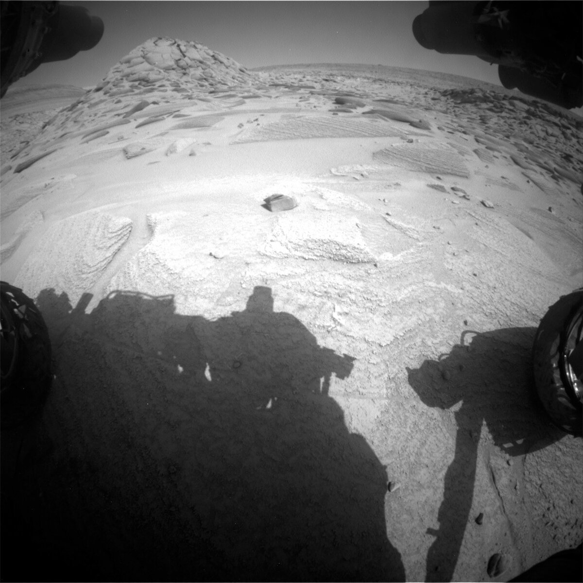
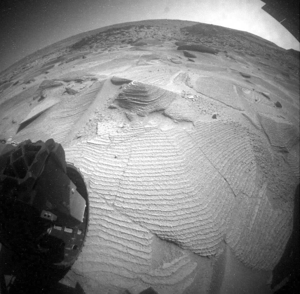
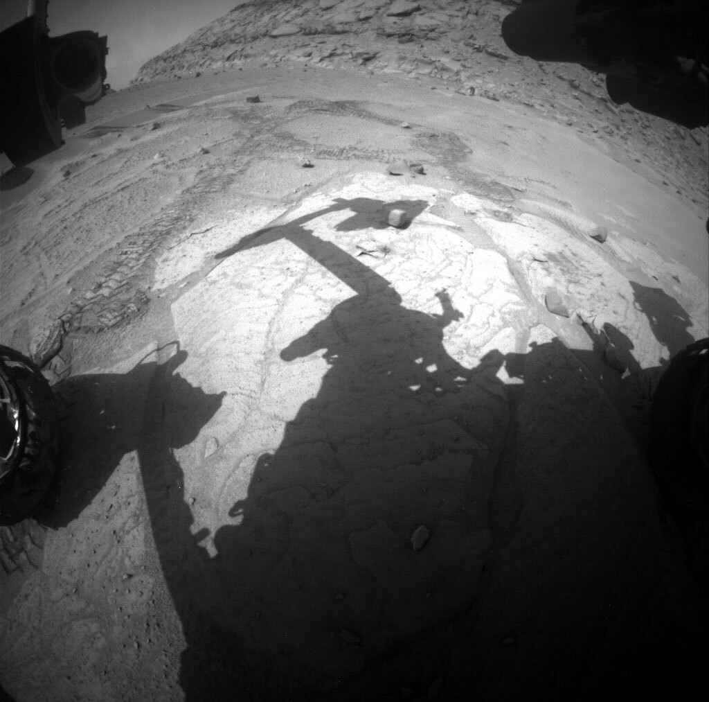
This image was taken by Right Navigation Camera onboard NASA's Mars rover Curiosity on Sol 3776. Credits: NASA/JPL-Caltech. Download image ›

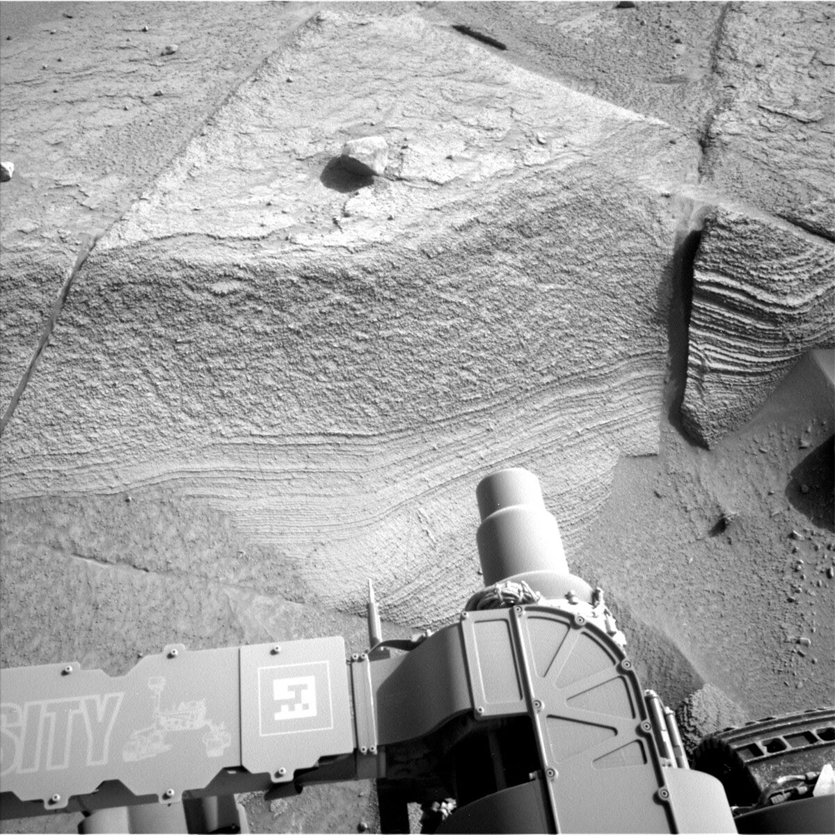
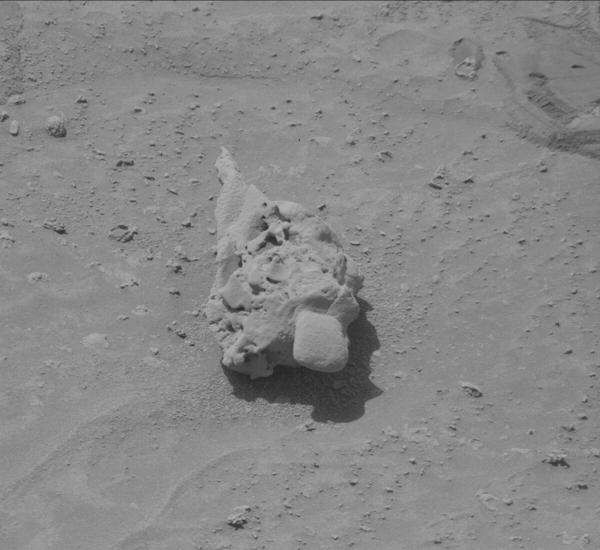
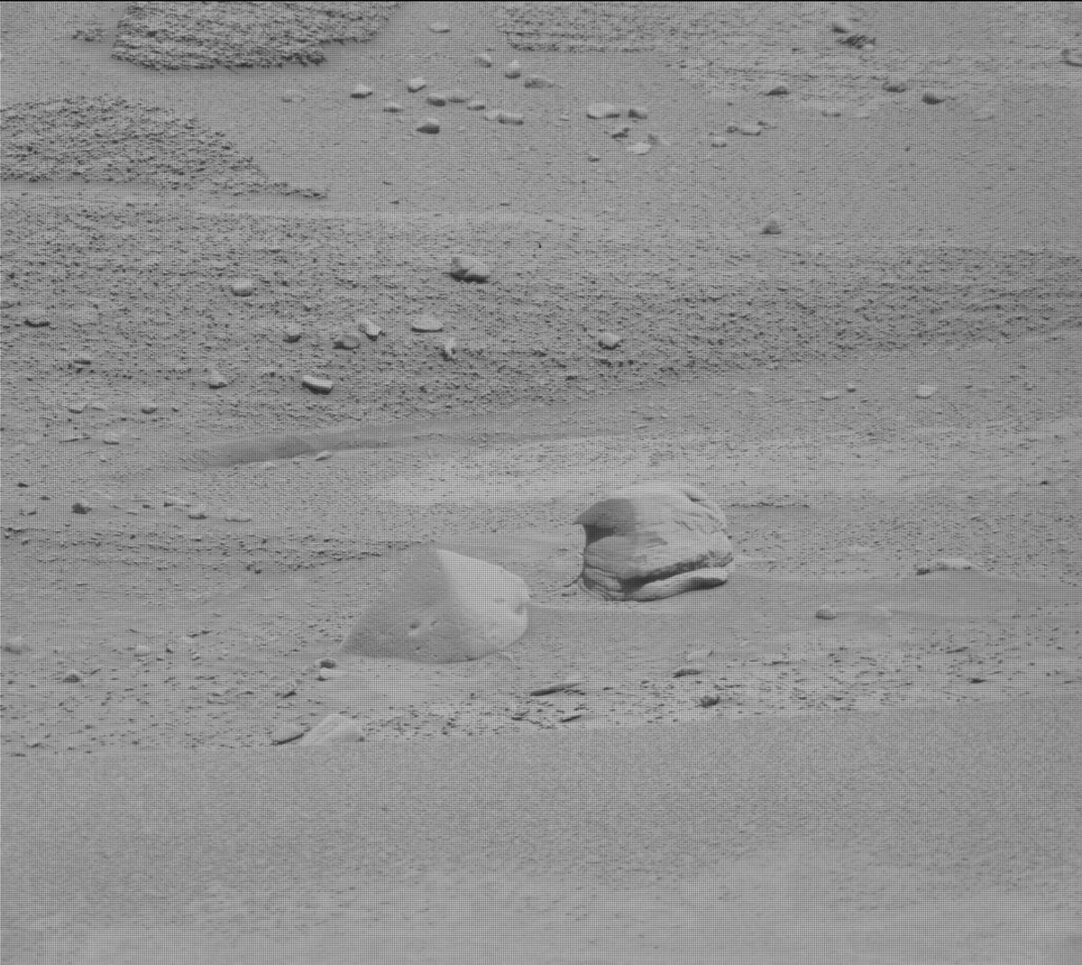
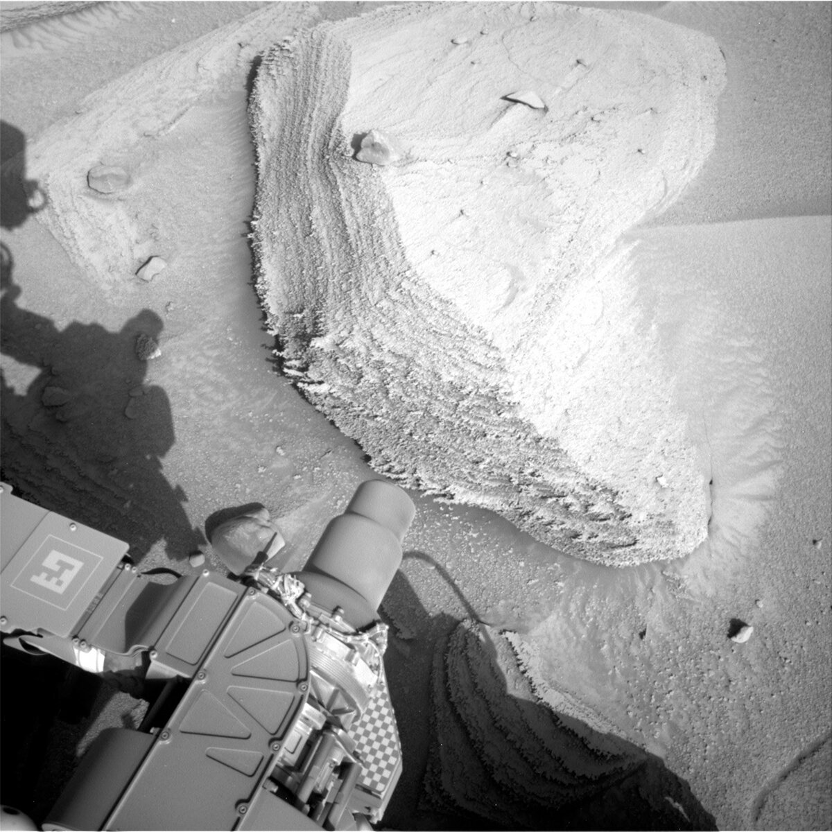
Monday's planned drive positioned Curiosity with a new workspace to investigate. We have left the Marker Band, with Natalie's blog nicely summarizing our campaign there. As a physicist and spectroscopist by training, I find myself looking more at the analytical data, in particular X-ray fluorescence data, acquired on rocks, than the rocks themselves. But there was something about the primary rock target in today's workspace that kept my eyes glued. Not so much its shape, but its texture. We've seen this before, sure, but there was a certain textural je ne sais quoi of this rock for me. Not only the layers, but the ruffled edges. I couldn't put my finger on what in everyday life it reminded me of, so, I did the only logical thing one can do in such a situation: ask my 5- and (nearly) 3-year-old nieces in Canada what the rock in tosol's blog image reminded them of. They said waves and a rock, respectively.

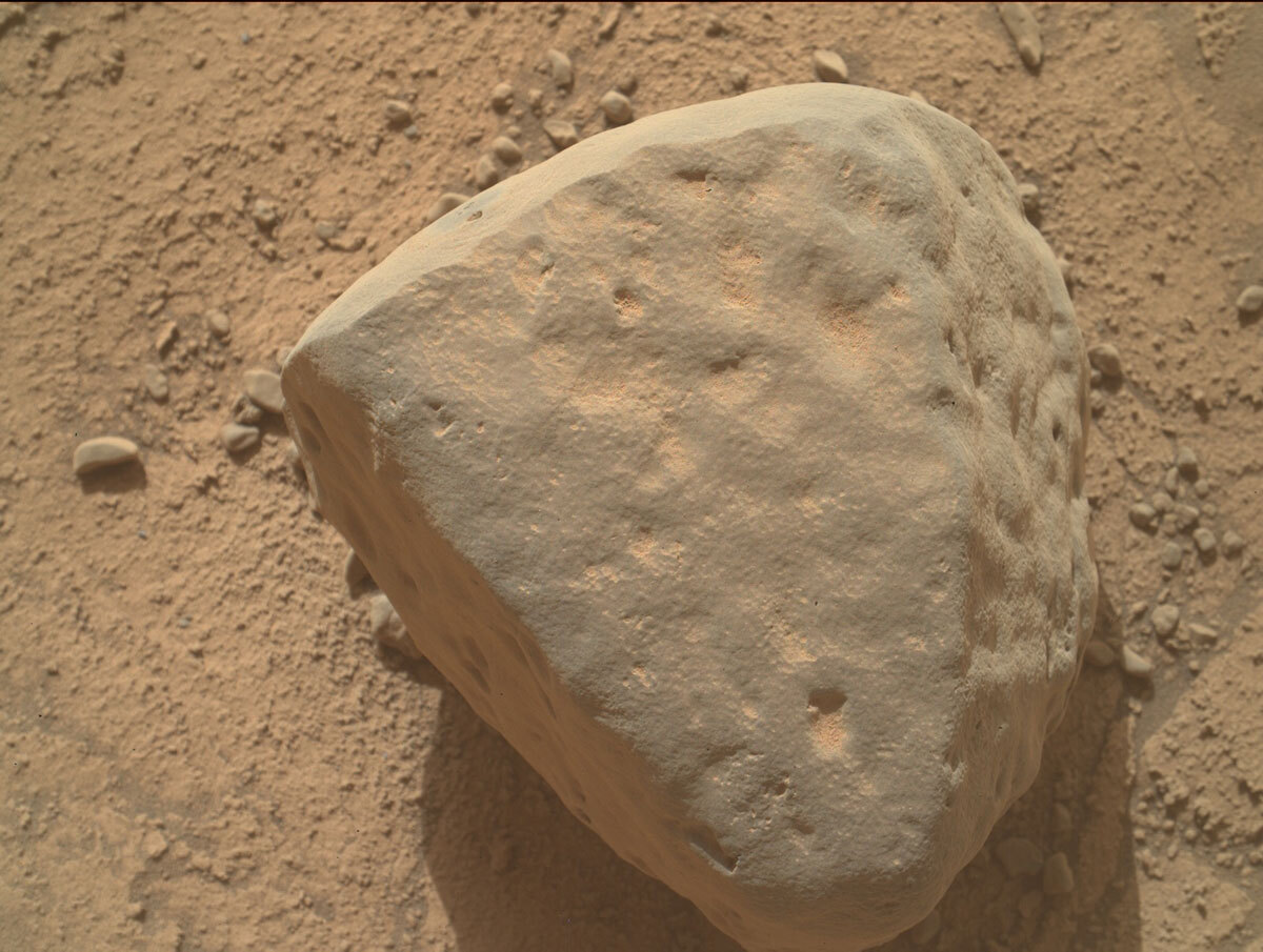
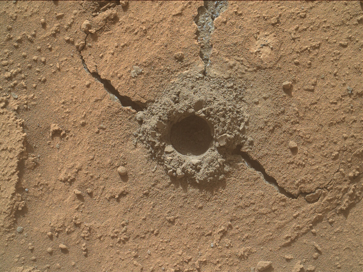
Today's two-sol plan focused on brushing and acquiring APXS compositional analyses of this rock, specifically one spot named "Marabitana." Curiosity then acquired images of the brush with Mastcam before acquiring further images of Marabitana as well as "Owenteik," "Itapaiuna," "Uaila," "Mocidade," "Xeriuini," and "Anaua," with ChemCam acquiring laser analyses of Anaua as well. In the early afternoon when the lighting was just right, Curiosity acquired several MAHLI images of Marabitana, including one planned only 1 cm above the surface. The arm was then stowed, and Curiosity commenced a planned drive of roughly 15 m in parallel with DAN performing active bombardment of Mars with its neutrons. At the end of the drive, MARDI snapped an image beneath the rover as Curiosity concluded its sol 3778 activities. The second sol of the plan contained passive analyses by DAN, automated laser targeting analyses by ChemCam, and environmental science using ChemCam, Navcam, Mastcam, and, of course, REMS.

We shall see what Friday's workspace has in store. I'd wager more "waves and rocks," but I'll defer classification to the same experts.

March 20, 2023

Sols 3776-3777: Spring Past the Marker Band

Written by Natalie Moore, Mission Operations Specialist at Malin Space Science Systems
This image shows the shadow of the Curiosity rover above the Mars surface with rocks and a hill in the distance, including float block target "Rio Urubu."

Front Hazcam image of our sol 3776 workspace including float block target “Rio Urubu” and our drive direction in the distance. Credits: NASA/JPL-Caltech. Download image ›

Our Tapo Caparo drill campaign is officially concluded and our wheels are turning again! Specifically, we’re back on the strategically-created route up Aeolis Mons (aka Mount Sharp), “paving” the path as we go. As a personal habit, when we leave a distinct area I like to look back at the road behind and all we’ve accomplished along the way. So, a quick sentimental summary... we drove our wheels up on the Marker Band for the first time back in November (sol 3645) ~4.5 months ago. Through a particularly cold and wet southern-California winter, the team planned: 29 drives, 5 drill attempts, 4 Mastcam 360 degree mosaics, and 61 plans sent to the rover. Today marks the beginning of Spring in Earth’s northern hemisphere and the end of our Marker Band traverse saga. A fortuitous synchronicity for sure.

Today we found ourselves in front of a single, grey float rock in the workspace we then named after a river in the Amazonas in Brazil: “Rio Urubu.” Without an obvious DRT-able spot on the underlying bedrock, the science team focused their main efforts on characterizing the float rock since it looked fairly dust-free. In order of science events - we’ll start with an APXS short integration on Rio Urubu, ChemCam following up with a 5-spot LIBS raster, Mastcam taking a single-frame multispectral, and finally MAHLI performing a full-suite of images at different distances (25 cm - 5 cm stereo - 2 cm close approach). For a ~15 cm float block on Mars, Rio Urubu is going to get a lot of attention from us Earthlings “aliens"! In addition to our Rio Urubu analysis, we’re also planning ~60 stereo Mastcam images of the surrounding terrain and a ~20 meter drive further south. A classic, “split touch and go” plan for Curiosity (where we “split” the arm activities around the remote science activities before driving in the afternoon).

While we didn’t have a flat enough bedrock surface for DRT today, we did get two DRT targets last Friday and the MAHLI images were available on Earth this morning. Check out our close approach images, which ended up being 0.6 cm from “San Rafael” and 1.2 cm from “San Francisco de Yuruani” after we cleared the dust with our DRT. That’s a frame height of ~2 cm - better than holding a magnifying glass and looking at it in person!

March 17, 2023

Sols 3773-3775: Geologists Love a Good Contact!

Written by Sharon Wilson Purdy, Planetary Geologist at Smithsonian National Air and Space Museum
This image shows part of the Curiosity rover standing before rock on the Martian surface on sol 3771.

This image was taken by Left Navigation Camera onboard NASA's Mars rover Curiosity on Sol 3771. Credits: NASA/JPL-Caltech. Download image ›

With a jam packed three-sol plan on her plate, Curiosity won’t have time to kick back and relax this weekend! The rover is heading south across the Marker Band and is currently sitting in front of a lovely view that includes a contact between two types of bedrock. The lower section of bedrock consists of very thin, horizontal layers, as though you were looking at the edge of a thick stack of construction paper. Above, the bedrock appears rougher and bumpier and is not finely layered. Over the weekend, Curiosity will analyze both of these bedrock sections, below and above the contact, because this abrupt change in appearance may help us understand how the environment evolved over time.

The weekend plan will utilize several instruments to characterize the bedrock, including DRT, APXS, MAHLI, and multispectral activities of the “San Rafael” target in the lower section, and the “San Francisco de Yuruani” target in the upper section. A MAHLI mosaic of target “Santa Elena de Uairen” will stretch vertically across the two types of bedrock. ChemCam LIBS will analyze the “Pico del Toro” target in the lower section and the “San Francisco de Yuruani” target in the upper section. Mastcam will document the contact in the workspace as well, in addition to taking a stereo image of target “Iurua” to get a closer view of an interesting rock sitting on the surface nearby.

Once Curiosity wraps up this long list of science activities, the rover will complete a short drive toward a nearby bedrock outcrop, stopping to take a look at a “foreign” stone (a rock that looks different than the surrounding bedrock). Monitoring of environmental conditions will continue over the weekend with a survey for dust devils and observing the dust in the atmosphere.

It was wonderful to see so many science team members at the Lunar and Planetary Science Conference this week in Houston. We have so much to celebrate after ten years of exploration with the Mars Science Laboratory Rover Curiosity and so much to look forward to on the road ahead!

March 15, 2023

Sols 3771-3772: Toodle-oo Tapo Caparo

Written by Catherine O'Connell-Cooper, Planetary Geologist at University of New Brunswick
MAHLI context image of Tucupita, sol 3769, taken from an approximately 25 cm standoff.

MAHLI context image of Tucupita, sol 3769, taken from an approximately 25 cm standoff. Credits: NASA/JPL-Caltech/MSSS. Download image ›

Today, we finally leave Tapo Caparo and begin something new. But... actually, we are not going very far. Whilst sitting at Tapo Caparo, we spent some time looking around at the neighbourhood using Mastcam and ChemCam imaging. Not too far away, we spotted a workspace that includes two types of bedrock - a finely laminated bedrock (which is what we just drilled) and some bedrock with abundant nodules but apparently no laminations. This might mark a transition from one unit to another, so today we planned a drive over to that area in order to get this workspace into our weekend plan.

Today's plan is therefore a Touch and Go plan, doing the very last contact science on our wish list and then moving on. APXS will analyse a float rock ("Tucupita") which was previously analyzed by ChemCam, who will use LIBS to look at another float ("Uaimiti") for comparison. As the MAHLI team acquired images of Tucupita (shown above) in Monday's plan to facilitate APXS placement today, they are able to fit it in a MAHLI-only target, looking at another float stone ("Tamanaco") which is slightly closer to the rover.

As we have been here for several sols, we have already imaged the buttes around us with Mastcam and the ChemCam long distance imager (RMI), but once we leave, obviously the view will change. So, before we leave, we will get one final set of images from this viewpoint of the "Chenapau" butte (Mastcam) and a large channel feature further afield (RMI). As ever, the ENV theme group continues their monitoring of environmental conditions in Gale. Navcam will complete a dust devil (wind vortice) survey, and Mastcam will look at dust in the atmosphere (tau measurement).

It will be good to be back on the road, even if we are just heading further along the Marker Band. The Marker Band (including this drill site) has been the site of lots of exciting science, some of which was presented this week at a special session at the Lunar and Planetary Science Conference ("LPSC") in Texas, marking our ten years of active roving in Gale. However, there is so much amazing data and images to work on from the Marker Band, we will be talking about for many years to come!

March 13, 2023

Sols 3769-3770: Crossing Off Our Liens at Tapo Caparo

Written by Elena Amador-French, Science Operations Coordinator at NASA's Jet Propulsion Laboratory
This image of a drill hole in the Mars dirt was taken by Curiosity on sol 3767.

NASA's Mars rover Curiosity acquired this image using its Mars Hand Lens Imager on March 12, 2023, Sol 3767. Credits: NASA/JPL-Caltech/MSSS. Download image ›

Today’s 2-sol plan wraps up our remaining drill campaign and workspace liens at Tapo Caparo.

Our weekend plan ran successfully though we had a known issue which caused several of our remote sensing activities planned for the weekend to not execute.

Today’s plan was therefore jam packed with recovering any remaining remote sensing observations of our area and some contact science.

For our arm work – the MAHLI instrument will look at two targets: “Tucupita” and “Mariapiri.” We’ll use our APXS instrument to investigate the composition of “Mariapiri” and an offset position of our drill tailings. Tucupita is an interesting potential float rock in our workspace. A float rock is an out of place rock that does not appear to be part of the greater bedrock. On Earth (and Mars) these can appear after eroding from a different stratigraphic unit, for example. Comparing the difference in composition and texture of Tucupita compared to the bedrock in the workspace can provide clues into how the region has eroded over millions of years. The Mariapiri target is a small fracture that formed after we drilled Tapo Caparo. This fracture provides a small window into what the subsurface looks like texturally in the area.

The remainder of today’s plan will pick up our normal environmental monitoring activities.

March 10, 2023

Sols 3766-3768: Taking Turns With Tapo Caparo

Written by Lucy Thompson, Planetary Geologist at University of New Brunswick
Rear Hazcam image showing an example of the finely laminated bedrock, typical of this area.

Rear Hazcam image showing an example of the finely laminated bedrock, typical of this area. Credits: NASA/JPL-Caltech. Download image ›

Curiosity has spent the last week or so balancing power constraints to enable remote science and environmental observations, along with the analyses of the “Tapo Caparo” Marker band drilled sample with the rover’s internal CheMin and SAM instruments to determine mineralogy and composition. While drill sample is held within the drill bit assembly, we are unable to use the other arm instruments (MAHLI and APXS), but once we have delivered enough sample to CheMin and SAM, we dump any remaining sample, and are then able to use APXS and MAHLI. So, in this plan, it is the turn of MAHLI and APXS to investigate the powdered sample surrounding the Tapo Caparo drill hole. MAHLI will document the close-up textures and any colour variation, and APXS will determine the composition. The APXS chemistry of the drill fines will be compared to the analyses obtained of the brushed bedrock prior to drilling to look for heterogeneities and used to refine interpretations of the CheMin and SAM data. As the APXS payload downlink and uplink lead during planning today, I helped to select the best location to place APXS on the drill fines and ensured that the timing and sequences were correct. The APXS team are excited to receive the data from this measurement, as the Marker band has proven to have interesting chemistry and mineralogy! Before we dump the remaining Tapo Caparo drill fines, we will deliver four more samples to SAM so they can perform an EGA-GCMS analysis to look for organic molecules.

Aside from the continued characterization of the Tapo Caparo drill, we also managed to find enough power and time to plan a number of remote science observations. These included expanding previously acquired Mastcam mosaics of the area around the Tapo Caparo drill site, and of an area ahead of the rover, “Chenapau” valley. Mastcam will also document the three ChemCam LIBS targets, “Manoa Pium,” “Sima Humboldt” and “Catatumba.” Manoa Pium is a bedrock target, Catatumba is a spherical nodule or pebble, and Sima Humboldt is a float block. The wheel scuff and associated freshly fractured bedrock targets “Paricarana,” “Pirapitinga,” and “Taracua” will also be imaged with Mastcam. ChemCam will also utilize their RMI capabilities to image the beautiful laminations in the nearby “Itaquera” bedrock target.

Not to be left out, the environmental science team also planned a full set of activities to continue monitoring the atmosphere. These include Mastcam basic tau (surveys dust in the atmosphere), crater rim extension and sky survey observations, as well as a Navcam large dust devil survey, zenith and suprahorizon movies. This very busy plan is rounded out with standard REMS, DAN and RAD activities.

Phew! It amazes me how much we are still able to accomplish with our ageing rover!

March 8, 2023

Sols 3764-3765: Don't Dream and Drive…

Written by Susanne Schwenzer, Planetary Geologist at The Open University
This image shows a Mars rock on the Martian surface and was taken by Curiosity on Sol 3762.

This image was taken by MAST_RIGHT onboard NASA's Mars rover Curiosity on Sol 3762. Credits: NASA/JPL-Caltech/MSSS. Download image ›

What a contrast! When I look to my right, snow is accumulating on my window (yes, I am under the roof, if you are wondering) and in front of me are pictures of a beautiful red landscape! I am sure you have seen this beautiful mosaic, and we are still very close to that area. Such a stunning view! And now my brain wonders if there ever was snow falling, dancing, quietly, covering it all in white, a dusting first, then, even more until it’s a white dream world? Wouldn’t it have been great to stand there, on Mars, at that time? Well, that wouldn’t just require a crewed spaceflight to Mars, it would also require time travel by … like … 4 billion years, back to a time when here on Earth there were just microbes. Well, before I write a science fiction piece here, I better get back to planning!

That planning was a little more eventful than what I would have liked, though, and required my full attention. I was Geo Science Team lead today. At the start of planning we were waiting for confirmation on a data transfer that got stuck somewhere in traffic on its way to Mars. Whenever we have to start planning without the full information on things such as rover state or returned data, we have to keep several options open, because we of course want to maximize the science that Curiosity does on Mars that next sol! That means, book-keeping a lot of ‘If … then …’-options open. But after over ten years, the team has some experience with that, and our keeper of the plan kept the overview of more than just one plan today. For me, though, the trick is to have lots of little sticky notes, and at one point my computer screen was half covered in them. But the information eventually arrived in part, and the science team received the go for planning our two-sol plan. However, we were still waiting on some pieces of information, which came in after we had put together our ChemCam and Mastcam activities. While we were working in one virtual room, engineers and the mission leadership were assessing the rover data as they came in. Finally, and unfortunately for us in the science planning room, the decision was made to be absolutely sure that the rover would be kept safe and happy, and therefore, as a precaution, all the science activities with ChemCam and Mastcam did not get included in the plan.

That does not mean the rover, which in itself is happy and healthy, will be completely idle! CheMin will get more mineralogy data for us. DAN will do its activities to investigate the water and chlorine in the underground below the rover, and REMS will do its weather measurements such as wind and temperature. Of course, data management activities feature in the plan as well. With that, a hectic, and in the end a little disappointing planning day ends, and we hand over to the next team. Well, they have a ready-made plan now! … and I can look at my window, which is now covered in snow so thickly that I cannot even see the streetlights anymore. Well, I step out of the house and feel the snow under my feet, and my mind wanders back to dreaming about Martian snow crunching under spacesuit boots… Well, would we have needed one, back when Mars had more precipitation and Gale was filled with a lake? Yes, you guessed it, I am back to time-and-space-travel dreams while I watch the snow fall and cover my garden in beautiful, peaceful white.

March 7, 2023

Sol 3763: Martian Déjà Vu

Written by Alex Innanen, Atmospheric Scientist at York University
This image was taken by Mast Camera (Mastcam) onboard NASA's Mars rover Curiosity on Sol 3760.

This image was taken by Mast Camera (Mastcam) onboard NASA's Mars rover Curiosity on Sol 3760. Credits: NASA/JPL-Caltech/MSSS. Download image ›

We had another later start to planning today, and again are planning only a single sol. In a lot of ways, the plan is similar to yestersol’s. Having completed the column clean, we’re ready to drop the sample off to SAM for GCMS tomorrow. So, like yestersol, the plan includes a short science block, the SAM activity, and then a lot of napping. Because SAM is so power hungry, we have to be careful about how much power other activities are taking. Both GEO and ENV had to prioritize observations and have an idea of what could be dropped or exchanged.

In our short science block, Mastcam is extending imaging of the targets ‘Tefe’ and ‘Sima Humboldt.’ ChemCam has a LIBS observation on a nearby pyramid shaped float block, ‘Mont Nadai,’ which you can see in the image above. The science block is rounded out with a dust devil survey from ENV.

After the science block, Curiosity will take a little nap to get ready to deliver the drill sample to SAM. This is accompanied by Mastcam imaging of the SAM inlet both before and after dropping off the sample. The dropoff wraps up with the sample hopefully safe and sound and ready for GCMS tomorrow, and, just like yestersol, Curiosity will go to sleep until it’s time to wake up for tomorrow’s plan.

March 6, 2023

Sol 3762: SAM Wants More Sample

Written by Natalie Moore, Mission Operations Specialist at Malin Space Science Systems
This image of the SAM inlets on the Curiosity rover was taken on sol 3759.

Sol 3759 Mastcam Left image of SAM inlet 2 (open) and SAM inlet 1 (closed) after dropping off initial sample to SAM inlet 2. Credits: NASA/JPL-Caltech/MSSS. Download image ›

This morning’s plan started a bit uncertain as we waited for the SAM team to decide whether to proceed with further analysis of the Tapo Caparo drill sample. Just in case they decided against it, last Friday’s team put together two options for our plan today — the second option requiring Rover Planner, MAHLI, and APXS activities to help wrap up this drill campaign.

We started planning today at 10am PST due to the timing of our orbital passes above Gale crater, which can sometimes mean a pretty long day for the tactical planning team! However, on today’s "late-slide" plan, the SAM team decided quickly they were “go” for further sample analysis, which meant no arm activities could be planned (since we’re still carrying sample from drilling) and everyone on the Rover Planner/MAHLI/APXS teams were released for the day. As someone on today's MAHLI uplink team, I was content having a slow Monday to start this last busy week at the Tapo Caparo drill site. The instrument teams carrying our mission today include Mastcam, ChemCam, and most importantly: SAM!

We are now at the stage of our drill sol path where we have to be careful about how much battery power we’re using, so today’s plan includes a lot of nap time. We have just a single, ~1 hour remote science block with two Mastcam stereo multispectral targets, a Mastcam stereo mosaic to extend coverage near the drill hole, and a ChemCam LIBS target with corresponding Mastcam documentation image of the laser shots. It’s rare that there are no Navcam activities, but they too were released from planning after priorities were discussed for the limited remote science time we can afford today.

After remote science concludes ~13:30 local Gale time, Curiosity will be mostly asleep until around midnight when the plan’s main (and hungriest for power) activity from SAM kicks off. SAM's gas chromatograph "column clean” activity will increase the intended column’s internal temperature until contaminants are removed to prepare for further sample drop off and full GCMS later this week. I like to think of this as “washing our hands before eating,” but for about 4.5 hours. After SAM finishes cleaning their column, our rover will sleep some more until the next plan starts at 09:49 after sunrise.

What does a “Mission Operations Specialist" like myself do on slower days like this? Besides writing these few words, I’m spending the rest of my day staring at images we’ve taken here from Mastcam/MAHLI/MARDI (in that order, usually — check out this cloud we imaged on sol 3724!), organizing my shift notes for next time, and chipping away at a python-based interface that will hopefully help the Mastcam team visualize our data more easily. Happy Monday, everyone!

March 3, 2023

Sols 3759-3761: More Analyses of the Tapo Caparo Drill Sample

Written by Lauren Edgar, Planetary Geologist at USGS Astrogeology Science Center
This image was taken by Front Hazard Avoidance Camera (Front Hazcam) onboard NASA's Mars rover Curiosity on Sol 3755.

This image was taken by Front Hazard Avoidance Camera (Front Hazcam) onboard NASA's Mars rover Curiosity on Sol 3755. Credits: NASA/JPL-Caltech. Download image ›

Curiosity is in the middle of a drill campaign at Tapo Caparo to characterize the rhythmically laminated unit of the Marker Band. Earlier this week CheMin got a first taste of this sample, and now it is SAM’s turn. The focus of the 3-sol weekend plan is to drop off some sample to SAM, and then perform an Evolved Gas Analysis (EGA) – which involves heating up the sample to very high temperatures and measuring the composition of gases that come out. It’s a power-hungry plan, but we were also able to get some more data for CheMin from the analyses in the previous plan, as well as some remote sensing.

In addition to the SAM and CheMin activities, Curiosity will be busy acquiring ChemCam observations of 3 different bedrock targets to see if there’s any variation in the different layers in the workspace. The plan also includes an RMI to help target a tiny spherical pebble with ChemCam LIBS in a future plan. Mastcam will take a few mosaics to document the local stratigraphy and start thinking about our ascent route after we wrap up this campaign. We’ll also document the ChemCam targets and keep an eye on the drill tailings and rover deck to monitor the movement of fines. The plan also includes a number of Mastcam and Navcam observations to monitor atmospheric opacity and search for clouds and dust devils. I’ve been on shift as LTP this week, so it’s been fun to think about how to fit all of the cool science into these plans and what we need to accomplish before leaving. I love the Front Hazcam image (above) which shows the shadow of the rover’s arm towering over the workspace – Curiosity we’ve asked you to do a lot this weekend, but you’ve got this!