February 21, 2022

Sols 3391-3394: Rocky Road (But Not the Tasty Kind) For the Holiday

Written by Ashley Stroupe, Mission Operations Engineer at NASA's Jet Propulsion Laboratory
This image was taken by Right Navigation Camera onboard NASA's Mars rover Curiosity on Sol 3390.

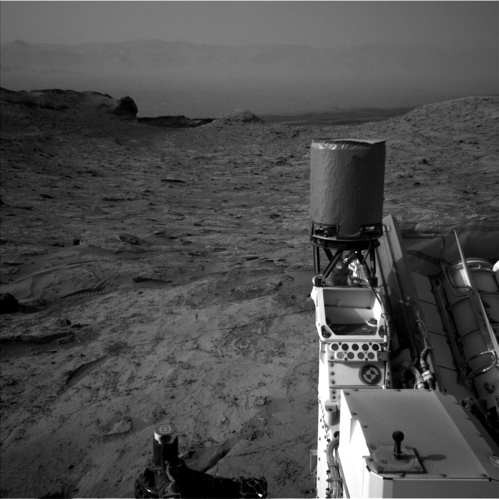
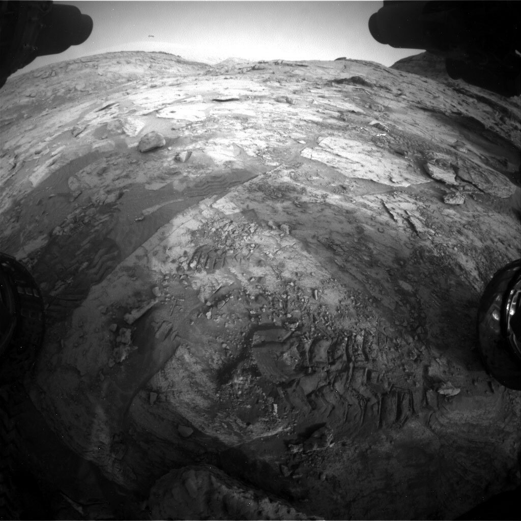
This image was taken by Right Navigation Camera onboard NASA's Mars rover Curiosity on Sol 3390. Credits: NASA/JPL-Caltech. Download image ›

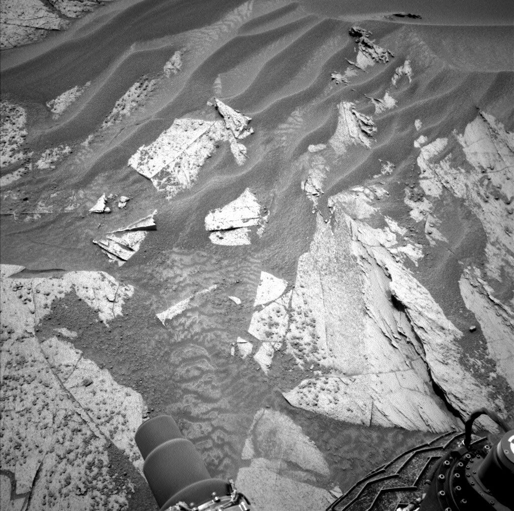
MSL planning was met with beautiful images of our path ahead, like this one. We ended up planning to look at many of these rocks with our science instruments before driving on. This is a busy plan, covering four sols due to the holiday on Monday. In order to keep things manageable, especially given that our uplink is early tonight, we are doing all of our activities on the last 3 sols of the plan and leaving the first sol fairly empty.

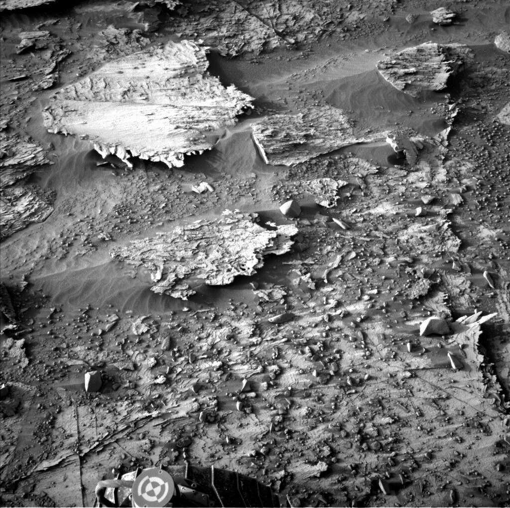
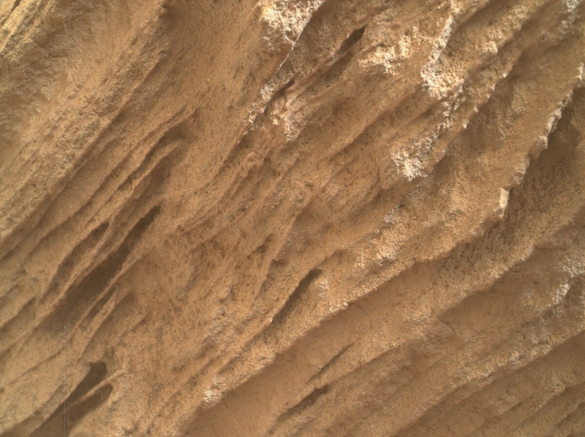
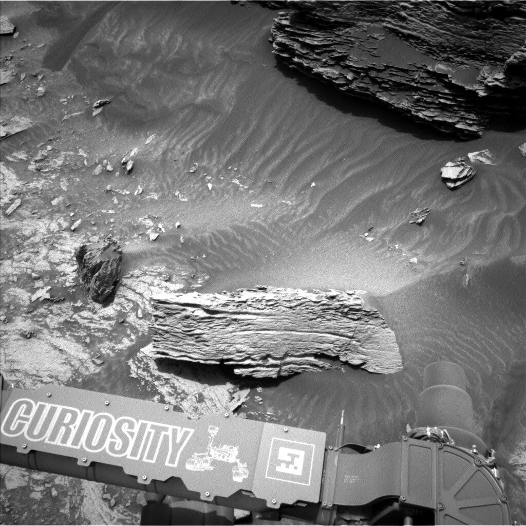
On the second and third sols of the plan we are doing an extensive set of targeted science observations. ChemCam LIBS is sampling several rocks, including “Pickletillem Marsh” (a bedrock target near our next parking location), “Voxter Voe” (a rough, broken block with a dark coating), and “Nithsdale” a float rock. ChemCam is also taking an RMI mosaic of a nearby sedimentary feature called “Onich Dry Gorge.” Mastcam is targeting all of the ChemCam LIBS targets in order to help understand their compositions. But in addition, we are painting the area with Mastcam mosaics to document the Siccar Point group unconformity (a contact between underlying bright outcrop and the Stimson formation). We are taking a large mosaic of Onich Dry Gorge and a smaller mosaic of “Sango Bay” (which also includes an unusual float block). We also have a mosaic of the “Cio Mor Cliffs” area, which is another sedimentary butte structure. This large suite of observations should help us to better understand the unconformity and the context around it; unconformities are really interesting because they can represent significant gaps in time that could be associated with changes in the environment. There is also a multispectral image of “Tomnaverie,” which is in the workspace and also has a dark coating, and “Qui Ness” which is a field of loose rocks to the northeast.

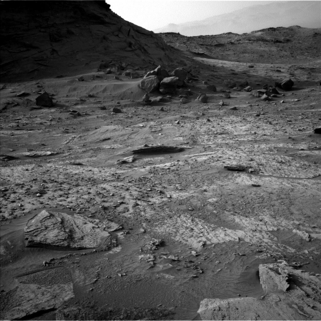
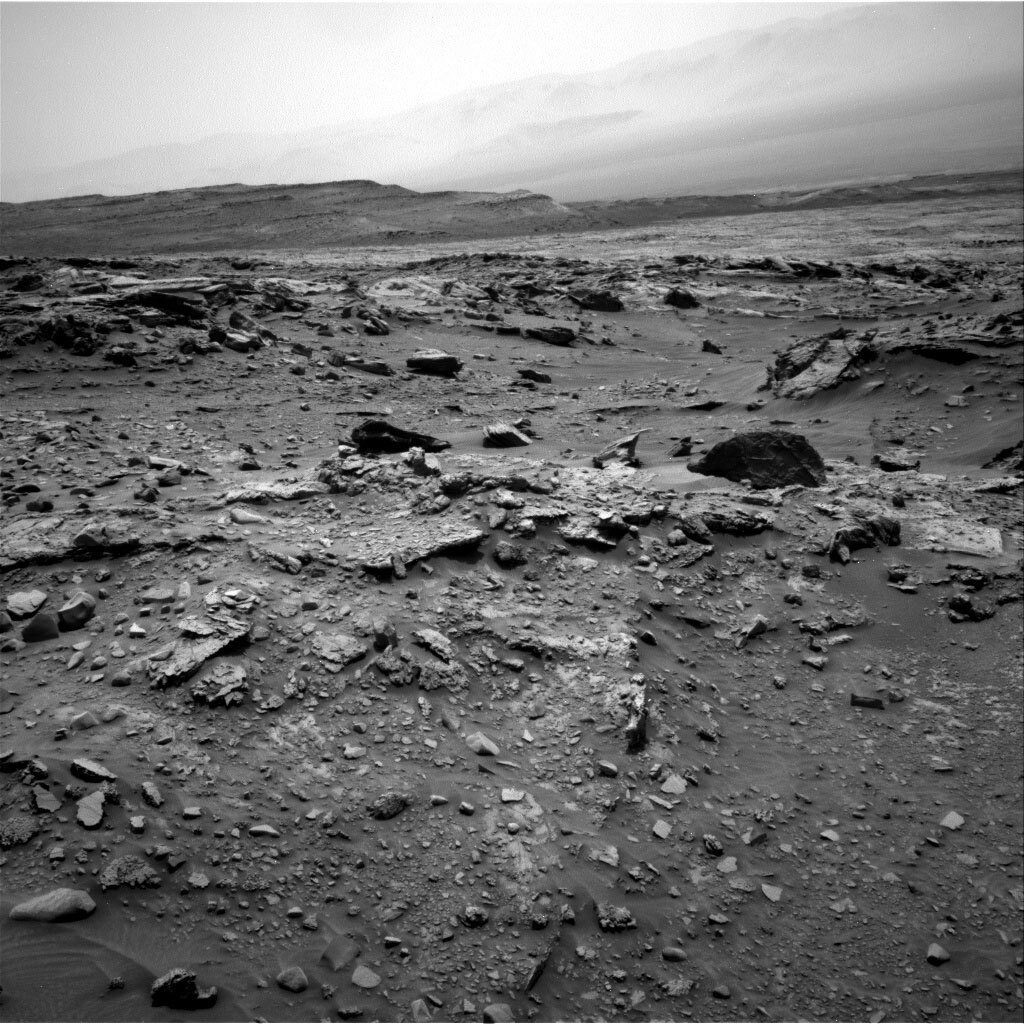
In addition to all the ground targets, we have a lot of atmospheric observations, as there is a lot of dust in the air (as visible in the image). From our current location, we take a dust devil survey and a dust devil movie with Navcam. We also have some engineering maintenance activities sprinkled in the plan in order to help keep an eye on the health of our systems.

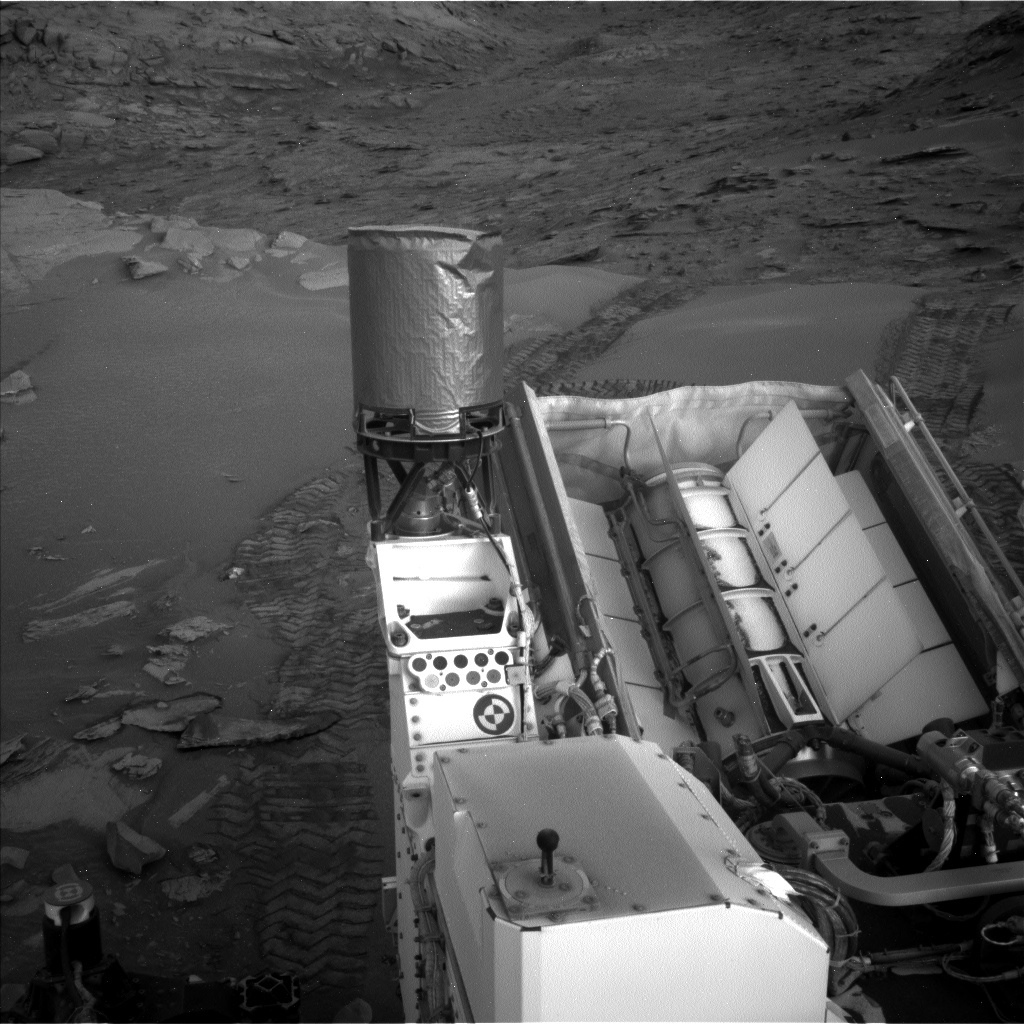
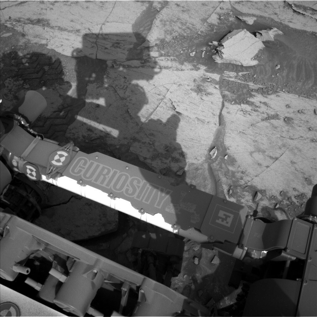
We Rover Planners were also kept busy planning both arm and drive activities. On the second sol, we did some contact science on “Foss Mine” (another dark-coated bedrock target in the workspace) and Nithsdale targets. We tried to find a rock large and smooth enough that we could brush it, but unfortunately, all the rocks we could reach were too small, too rough, and covered with pebbles. Once we decided to just use APXS and MAHLI, the rest of the arm planning was more straightforward. We did MAHLI and short APXS observations on both, and got a close 1cm approach and QRM images (Quantitative Relief Modeling, which uses 5 images instead of just a stereo pair to get a more accurate model of the surface).

Planning the drive, which is on the third sol, was definitely a challenge. Our stereo coverage of the terrain is very spotty due to all the rocks, which block us from seeing what’s behind them, and there is a lot of sand and many big rocks in the path ahead. Ultimately, working with the science team, we decided to park only a few meters away on a small rise (to the right of the large dark block in the center of the image). This will give us a good vantage point to look into the valley ahead and try to scope out our future route. We also needed to pick our parking position with care – we want to get some bedrock in our workspace for Tuesday, we need to avoid leaving any wheels on these loose rocks that would leave us unstable (and unsafe to use the arm), and facing a direction where the rover’s turret does not block our view into the valley. We chose to drive about 10m total, in order to get the rover oriented at a good heading and parked in a good spot. We expect a similarly beautiful view from our post-drive imaging.

The last sol of the plan, has an extensive suite of atmospheric observations. Very early in the morning, we are taking a ChemCam sky observation, Navcam zenith movie, suprahorizon movie, and a line-of-site looking northward, and Mastcam crater rim extinction and solar tau.

February 15, 2022

Sols 3388-3390: Pediment Passage

Written by Scott Guzewich, Atmospheric Scientist at NASA's Goddard Space Flight Center
This image was taken by Left Navigation Camera onboard NASA's Mars rover Curiosity on Sol 3387.

This image was taken by Left Navigation Camera onboard NASA's Mars rover Curiosity on Sol 3387. Credits: NASA/JPL-Caltech. Download image ›

Curiosity is advancing westward through a largely boulder-strewn channel that is leading us toward the Greenheugh Pediment. The Pediment is where our rover will spend the next many months, as we turn back uphill to the south and continue our ascent up Mt. Sharp. Despite it being quite craggy in our current location, we did have to drive over a large sand patch to get to our current parking location!

Today’s objective was to study one of the last remaining bedrock patches available to us before we ascend onto the Pediment in the days ahead. We quickly identified “Loch Coruisk” as our preferred bedrock slab for contact science with MAHLI and APXS. ChemCam will then zap it with LIBS in addition to two other bedrock pieces nearby. Both ChemCam and Mastcam will also be imaging the edge of the Pediment to our southwest and northwest so we can study the geologic contact that the edge represents. That imaging includes a Mastcam 360° mosaic, which will surely be spectacular! As we’re quickly approaching the dust storm season on Mars, we also added several dust devil movies with Navcam and observations to monitor the dust amounts in the atmosphere above us and within Gale Crater itself.

February 14, 2022

Sol 3387: Valentine's Day on Mars, Love and Science

Written by Sean Czarnecki, Planetary Geologist at Arizona State University
This image was taken by Left Navigation Camera onboard NASA's Mars rover Curiosity on Sol 3386.

This image was taken by Left Navigation Camera onboard NASA's Mars rover Curiosity on Sol 3386. Credits: NASA/JPL-Caltech. Download image ›

Our Curious robotic explorer is spending another Valentine's Day in faraway Gale crater, Mars. For the first time since 2019, Curiosity has a NASA-built MRV (Martian Rover Valentine)! Although Perseverance and Curiosity won't be able to visit each other, they will certainly be sending love over the red horizons.

On this Valentine's Day, Curiosity is planning a full workload with ChemCam LIBS and APXS of 'Loch Garten' followed by MAHLI images of this target before and after dust removal. In addition, ChemCam and Mastcam will image 'Stivva Head' and Mastcam will image 'Blackcraig.'

Navcam will be looking for dust devils and taking other images, while DAN, RAD, and REMS will be taking standard measurements.

February 11, 2022

Sols 3385-3386: Up We Go!

Written by Vivian Sun, Planetary Geologist at NASA's Jet Propulsion Laboratory
This image was taken by Left Navigation Camera onboard NASA's Mars rover Curiosity on Sol 3383.

This image was taken by Left Navigation Camera onboard NASA's Mars rover Curiosity on Sol 3383. Credits: NASA/JPL-Caltech. Download image ›

In this weekend two-sol plan (Sunday is a soliday!), we continue making progress towards the “Greenheugh Pediment” and will hopefully be almost on top of the pediment after the weekend drive. As we climb onto the pediment via its steep slopes, Curiosity will drive as far as we have available navigation mesh, so this drive will be similar to the last plan’s drive in terms of distance.

But before we continue driving towards the pediment, we planned plenty of contact science and remote sensing at our current location. We will be obtaining APXS and MAHLI measurements of “Kintradwell,” a smooth bedrock surface, that will provide us with more data about changes in bedrock composition as we approach the contact with the pediment capping unit. ChemCam observations of “Apardion” and “Copp Crag,” two nodular targets, will give compositional data on these diagenetic textures, similar to what we’ve observed in our past workspaces (see above image). We’ll also be thoroughly documenting the fantastic landscape around us, with more Mastcam and ChemCam imaging of “Maringma Butte,” focusing in particular on a protruding lens of rocks, and Mastcam imaging of “Blackcraig Butte.” Although we have imaged these buttes before from previous locations, these additional images are useful not only because they will be higher resolution (since we are closer now), but also because imaging the same feature from different angles is how we build up our three-dimensional understanding of the layering and sedimentology in these buttes.

February 9, 2022

Sols 3383-3384: Picking Our Way to the Pediment

Written by Catherine O'Connell-Cooper, Planetary Geologist at University of New Brunswick
Left navigation camera image of the base of Blackcraig butte.

Left navigation camera image of the base of Blackcraig butte. Credits: NASA/JPL-Caltech. Download image ›

We are continuing our traverse towards the "Greenheugh pediment." We passed along this area on our detour to The Prow, and our sedimentologists have a long list of imaging wishes, features which caught their eyes on the initial pass through and which we now get the chance to really examine in detail as we skirt along the base of the pediment. From today's vantage point, Mastcam and ChemCam are imaging the buttes and hills around us, Mastcam focusing on the "Blackcraig" and "Maringma" buttes, and ChemCam taking long distance imagery of the pediment.

We are also adding to our geochemical analyses along here too. APXS and MAHLI will analyze the bedrock target "Tantallon Castle" and ChemCam will analyze the target "Corpach Wreck."

Our past couple of drives have been in the order of 50-60 metres as we retraced our steps over known terrain, but as we get closer to the pediment and the steep climb up, our drives will slow down. Today's all star, all female, rover planner team planned a 24 metre drive - shorter than recent drives, but which will take over an hour as we slowly pick our way forward!

February 7, 2022

Sols 3381-3382: Whence We Came

Written by Michelle Minitti, Planetary Geologist at Framework
This image was taken by Left Navigation Camera onboard NASA's Mars rover Curiosity on Sol 3379.

This image was taken by Left Navigation Camera onboard NASA's Mars rover Curiosity on Sol 3379. Credits: NASA/JPL-Caltech. Download image ›

After our adventures further uphill, Curiosity is backing down hill to get to the start of the path she will take up to the "Greenheugh Pediment." We are still surrounded by amazing stratigraphy and have the benefit of having been through here before. We can fill in missing pieces of terrain, and follow up interesting observations. Mastcam and ChemCam imaging fills both needs today. Mastcam will acquire stereo mosaics across the base of "Maringma" butte, and across another butte east of our current location. Both mosaics are aimed at imaging sedimentary structures in these vertical exposures. In complementary fashion, ChemCam will cover the eastern butte layering with a 10x1 RMI mosaic. Mastcam will also image a stretch of tilted bedrock layers, dubbed "Plomo," that stretch uphill away from the rover.

Closer to the rover, ChemCam, MAHLI and APXS were also busy at this stop. Typically on a "touch and go" sol, we look at a given target with APXS and MAHLI, and then shoot another target with ChemCam to, in effect, spread the wealth of data we acquire across a workspace. Today, in part because we have ChemCam, APXS, and MAHLI data from this area from our first pass, we had the opportunity to focus all three instruments on one target, "El Dorado." We hope between APXS, MAHLI, and ChemCam, one instrument strikes gold at this prominent bedrock layer.

After our drive down hill, DAN will acquire both active and passive measurements, MARDI will acquire an image of the terrain under the left front wheel, ChemCam will autonomously shoot a target in the rover vicinity, and Mastcam will acquire a sky survey. REMS and RAD will continually monitor the environment as we start to move out of winter in Gale.

February 4, 2022

Sols 3378-3380: Leaving the Prow in Our Rearview Mirror

Written by Abigail Fraeman, Planetary Geologist at NASA's Jet Propulsion Laboratory
This image was taken by Left Navigation Camera onboard NASA's Mars rover Curiosity on Sol 3376.

This image was taken by Left Navigation Camera onboard NASA's Mars rover Curiosity on Sol 3376. Credits: NASA/JPL-Caltech. Download image ›

We’ll be checking off the last item on our “Prow vicinity investigation” to-do list today with MAHLI and APXS observations on two bedrock targets named “Aji” and “Erico,” as well as ChemCam observations on a tilted block named “Cucurital” and bedrock target named “Rockstone.” We’re also collecting a lot of images at this location, with five planned Mastcam mosaics consisting of 494 individual frames between them, a 5x1 ChemCam RMI mosaic, and Mastcam context images of the Cucurital and Rockstone ChemCam targets. Not enough imaging for you? We’ll snap even more Mastcam photos after our drive, with a 180 degree mosaic (that’s an additional 55 Mastcam frames for those keeping score at home) on top of our standard suite of post-drive images. The weekend plan rounds out with some observations to monitor the environment around the rover, including a ChemCam passive sky observation on the third sol of the plan that will measure the composition of gases in the atmosphere.

Now that we’ve wrapped up our activities in this area, the drive we planned today is sending us several meters north, back the way we came. We are aiming for a passageway that will allow us to ascend back onto the Greenheugh pediment. Once we climb up, we’ll leave the Mt. Sharp group rocks behind for a while and get to explore the very different period of Mars’ history that is preserved in the Greenheugh pediment and superposed Gediz Vallis ridge.

February 2, 2022

Sols 3376-3377: Second Servings at the Prow

Written by Susanne Schwenzer, Planetary Geologist at The Open University
NASA's Mars rover Curiosity acquired this image using its Mars Hand Lens Imager (MAHLI), located on the turret at the end of the rover's robotic arm, on February 2, 2022, Sol 3374 of the Mars Science Laboratory Mission, at 00:54:34 UTC.

NASA's Mars rover Curiosity acquired this image using its Mars Hand Lens Imager (MAHLI), located on the turret at the end of the rover's robotic arm, on February 2, 2022, Sol 3374 of the Mars Science Laboratory Mission, at 00:54:34 UTC. Credits: NASA/JPL-Caltech/MSSS. Download image ›

The above image is a MAHLI image of a small part of the Toron block in front of the rover. Take a moment to marvel at all the details. We arrived here two sols ago and didn’t drive away just yet to get some second servings. If you look closely at the image above, all the details will be telling you why we are very happy that we are able to get second servings of the Toron block. In other words, we have another sol to add investigations of details on this block and in the area. In detail, ChemCam is looking at the target ‘Apocaila’ to document the most common rock in the area, and the one which our rover is currently parked on. This so-called bedrock is also the target of Mastcam this sol, with a large mosaic starboard of our rover. ChemCam is also turning its attention back to the Toron block for the second servings investigating the target ‘Paure,’ which is on a different part of the Toron block from what was imaged yesterday, so we can get one more set of MAHLI images of all those awesome details.

Looking slightly further afield, ChemCam will get an RMI mosaic on the target ‘Paure’ to document even more of all those fascinating sedimentary structures. Even further afield the landscape looks equally exciting, and therefore ChemCam has a long distance RMI in the plan to get images from an area in the distance to get a closer look at some intriguing structures that look like thicker bedding or maybe something else. That’s for the new images to reveal as the ones we have do not quite have the resolution to make that decision. But that’s what long distance RMIs are for! Make sure you check the raw images page on this website in the coming days.

The rover is going to drive, and after that the standard set of navigation camera images will help the next planning and of course they are also the first ones to reveal science details of the new parking position. ChemCam will add an AEGIS observation – and throughout the plan there are observations of the atmospheric conditions, too. It’s a busy two sols for Curiosity!

February 1, 2022

Sols 3374-3375: MAHLI Lets the Dog Out at the Prow!

Written by Catherine O'Connell-Cooper, Planetary Geologist at University of New Brunswick
Left Navigation camera showing the “Toron” float block, and “The Prow” in the background.

Left Navigation camera showing the “Toron” float block, and “The Prow” in the background. Credits: NASA/JPL-Caltech. Download image ›

In our weekend drive we aimed to get up close to the “Toron” block, which is a “float rock” or out of place chunk of bedrock in the workspace. Unlike many float rocks, Toron’s original location (tantalizingly out of reach on “The Prow,”) can be pinpointed with confidence, which allows us to analyze the upper reaches of The Prow from a safe position.

The rover planners placed the rover in the optimal position to plan some amazing contact science. APXS analysis of the block (target “Sumuru”, in the upper centre of Toron) will help determine geochemistry of The Prow. One of the key items on our wish list here was to determine grain size, and MAHLI will take close-up images of Sumuru, hopefully allowing us to see grains. Unfortunately, Toron is too close for ChemCam to shoot with the LIBS laser (no holes in the rover, please!!). Luckily the tricky terrain up to The Prow poses no difficulty to LIBS, which can comfortably analyse targets from several metres away. ChemCam will therefore use LIBS to analyze at “Karaurin” and RMI to image “Lago de Gladys,” both located where we believe Toron to have originated.

The real star of the show however is the MAHLI “Dog’s Eye” or mosaic image along the top of the Toron block. Dogs Eye mosaics are a lot of work for the MAHLI and rover planner teams, so they get reserved for targets with high scientific merit, like this one. The mosaic will follow the sedimentary structures along the length of the block, and capture what appears to be a transition just above the Sumuru target. This set of 11 images will give us a wealth of knowledge, and hopefully help answer questions about the origin of The Prow.

We are staying at this location until Wednesday, when we will plan our next drive out and along the edge of The Prow.

January 28, 2022

Sols 3371-3373: Some Lucky Breaks at the Prow!

Written by Catherine O'Connell-Cooper, Planetary Geologist at University of New Brunswick
Front Haz camera image, showing churned up sand and broken rock fragments in the workspace.

Front Haz camera image, showing churned up sand and broken rock fragments in the workspace. This image was taken by Front Hazard Avoidance Camera (Front Hazcam) onboard NASA's Mars rover Curiosity on Sol 3369.Credits: NASA/JPL-Caltech. Download image ›

We continue to characterize “The Prow,” which stands proud above nearby flat lying dust coated bedrock. Our sedimentologists are very keen to get grain size measurements, as this can give very valuable insights into conditions at the time the sediments were laid down. A change in grain size can show that we have changing conditions over time, so getting MAHLI on rocks here is the highest priority so that we can get a solid measurement of grain size.

Unfortunately, the underlying bedrock is very dusty making grain size identification difficult and, as Susanne told us in the last blog, getting Curiosity up close to The Prow is proving very difficult. However, we have had a couple of lucky breaks … literally! The GEO team has identified a float block “Toron,” which broke off The Prow but whose original location up on The Prow can be identified. In today’s plan we will drive to this block, which was analyzed by ChemCam earlier in the week, and will hopefully be in a position to analyze grain size for The Prow.

We were able to find a brushable target “Suapi” in our current workspace, so we can clear dust and analyze with MAHLI and APXS. Additionally, the rover wheels broke apart some bedrock as we drove to our current workspace, so we are getting a six image MAHLI mosaic on the freshly exposed “The Test” bedrock target. ChemCam are analyzing the targets “Sororopan” and “Parime” in the underlying bedrock, “Yuruani” up on The Prow and “Paikwa” on the Toron block we will be aiming for in our weekend drive.

We complement the geological analysis with a full suite of atmospheric measurements, monitoring dust content in the atmosphere and looking for dust devils on the horizon.