September 5, 2023

Sol 3940: Lemonade From Lemons!

Written by Lucy Thompson, Planetary Geologist at University of New Brunswick
Hazcam image of APXS in contact with the “Artemisio” nodular bedrock over the 2023 Labor Day weekend taken by the Curiosity rover.

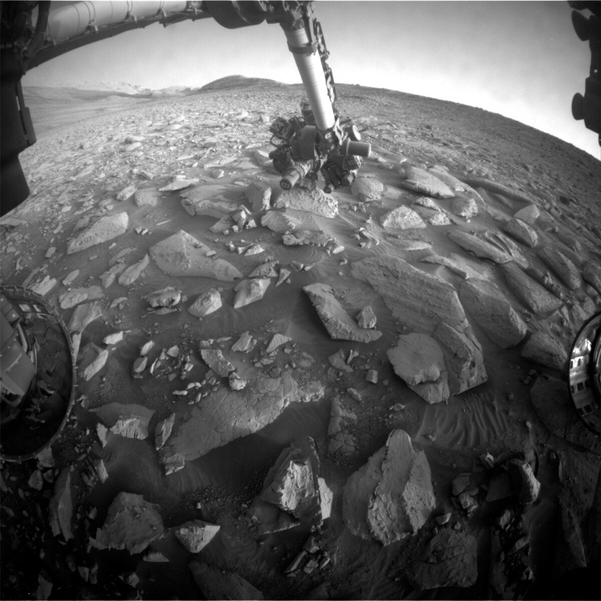
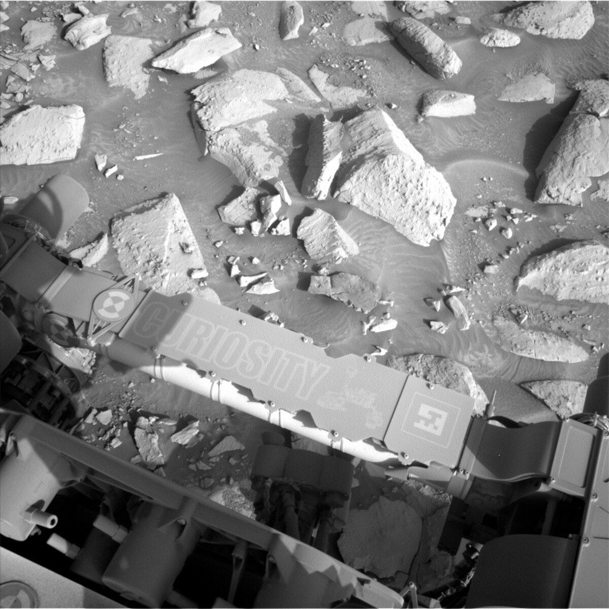
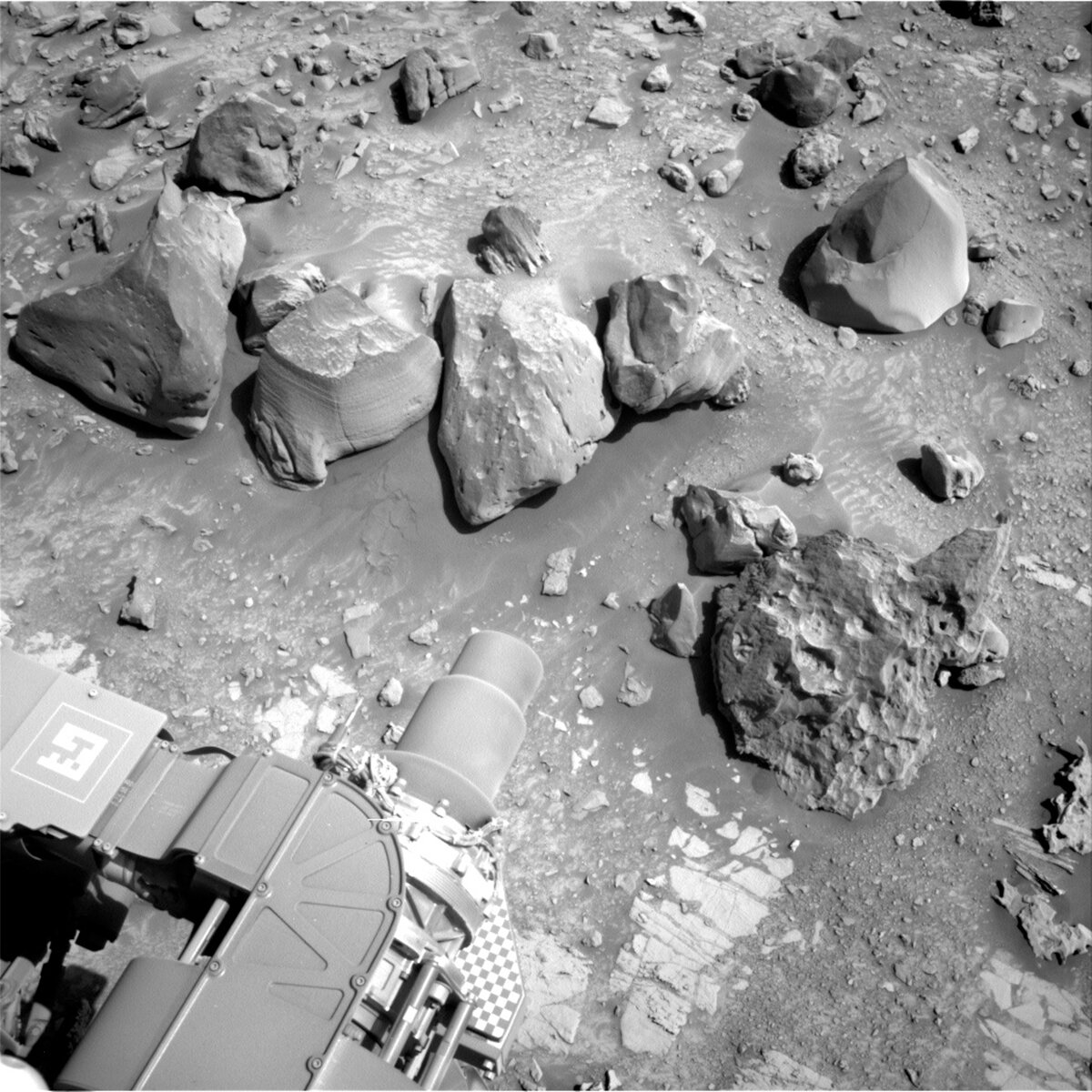
Hazcam image of APXS in contact with the “Artemisio” nodular bedrock over the weekend. Credits: NASA/JPL-Caltech. Download image ›

Earth planning date: Tuesday, September 5, 2023

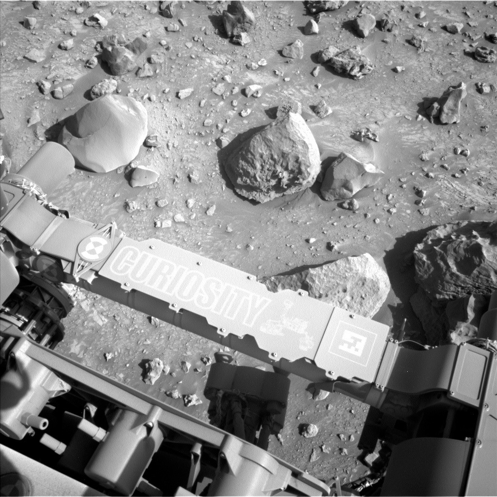
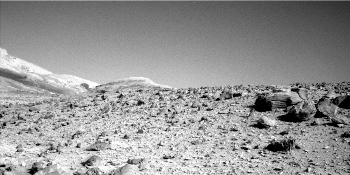
The team knew coming into planning today that there would be a discussion about which activities should take the highest priority. There is an unusually early decisional downlink pass that also has only a low data volume. This meant that we would need to discuss how to fit in arm contact science, targeted science and a drive before that pass. However, we did not really have to make the difficult choice after all. While the weekend drive executed perfectly through this tricky terrain of sand and large blocks, Curiosity ended up with one wheel perched on a rock. The rover engineers determined that if the rover slipped off the rock, the drop would be ~13 cm. This is too large a drop risk to safely unstow the arm and do contact science (our first lemon). Our second lemon that we had to contend with was that the imaging acquired in our drive direction only allows a short, ~20 m drive. However, the science team is always at the ready to make lemonade from lemons and jumped at the chance to increase the number of targeted science observations.

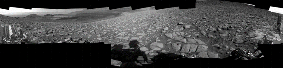
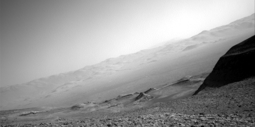
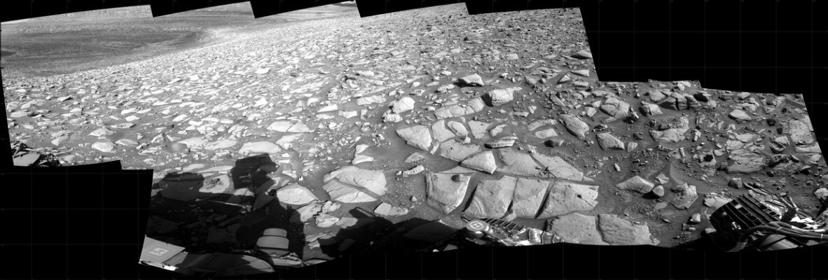
We continue to acquire imaging of the Gediz Vallis ridge in order to help us understand how this relatively late feature within Gale crater formed. The abundant large blocks contained within the ridge deposits indicate a relatively high energy environment, e.g., a landslide, a flooding event or maybe glacial activity. How do the included blocks relate to other rocks already encountered within Gale crater, and to the exposed stratigraphy higher up Mount Sharp? Are there separate packages or layers of sediment within the ridge that might represent different depositional events and processes? Are there noticeable changes in the ridge as we drive from north to south? What is the nature of the contact with the sufate-bearing unit? A large Mastcam mosaic will be acquired in this plan to help us continue to address these questions. To continue looking at the layering and structure within the Kukenan butte, and to aid in determining how the stratigraphy fits with what we are driving over, ChemCam will take a long distance RMI mosaic of the butte.

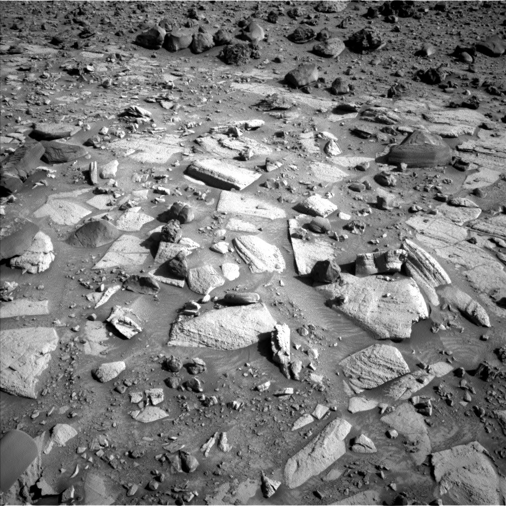
Of course, we are also interested in documenting what is in the immediate vicinity of the rover. ChemCam will fire its laser at an elongate resistant feature (“Olympia”) within an exposed bedrock block to determine whether there is interesting chemistry associated with it. We analyzed some resistant, nodular-looking bedrock in the weekend plan with APXS (“Artemisio”). How will the two features compare compositionally and texturally? We will acquire a Mastcam documentation image of the Olympia feature and a mosaic of the immediately surrounding area. Mastcam will also image some nearby resistant fins, “Palaeochori.” Even with the two large imaging mosaics, the environmental team were also able to squeeze just a little more juice from those lemons to add in a Navcam dust devil movie before we drive away. After the drive MARDI will image the new terrain beneath the rover. Standard REMS, DAN and RAD activities round out this plan.

September 5, 2023

Sols 3936-3939: Double the Fun

Written by Michelle Minitti, Planetary Geologist at Framework
This image showing Curiosity's nameplate above the Mars surface was taken by the Left Navigation Camera onboard NASA's Mars Curiosity rover on Sol 3934.

This image was taken by the Left Navigation Camera onboard NASA's Mars Curiosity rover on Sol 3934. Credits: NASA/JPL-Caltech. Download image ›

Earth planning date: Friday, September 1, 2023

Most long weekend plans are packed with lots of fun science, and this weekend’s plan - to get us through the US Labor Day holiday - was no exception. But the way this one was packed had an unusual pattern to it - many of our activities came in pairs! The rarest pair was two separate uses of the DRT - it has been more than 200 sols since we last had such luck. The soon-to-be-much-cleaner block is the brightly-illuminated one near the center of the workspace. One DRT will cover the fractured texture near the bottom of the block (on the target “Areopoli”), and the second will cover the lumpy texture near the top of the block (on the target “Artemisio”). This duo is covered by paired MAHLI and APXS analyses, and one of the pairs of Mastcam multispectral observations. The second Mastcam multispectral observation is on a part of the “Zagori” dune field that hugs the base of the rise we are driving along. Mastcam's other activity pairs include two large mosaics that together capture kilometers of terrain east of us, two atmospheric dust observations, and two activities that monitor the state of the rover. ChemCam long distance RMI mosaics came in twos - one aimed nearly 40 kilometers away at the Gale crater rim, and the other aimed to continue our documentation of the amazing layers of the “Kukenan" butte. The second and third sols of the plan have a pair of ChemCam LIBS rasters. One target “Kissamos,” crosses some of the beautiful layers present in the workspace, and the second, “Amphipolis,” focuses on a gray block that wandered down from the Gediz Vallis Ridge. The first sol of the plan also has a pair of ChemCam activities, but they are more fraternal twins rather than identical ones. ChemCam will target Areopoli for a LIBS raster (even more information from this target!), and then will turn its gaze to sky for passive sky observation. Navcam gets pairs of sky-gazing activities across the plan, with two cloud movies and two dust devil monitoring activities.

There are, of course, many one-hit wonders in the plan (like a MARDI twilight image), and other activities too good to do just twice (REMS, RAD, and DAN). But as we roll into the weekend, let’s celebrate the dynamic duos of the plan!

September 1, 2023

Sols 3934-3935: Copy and Paste

Written by Amelie Roberts, Graduate Student at Imperial College London
Navcam 360 mosaic featuring our current location, including our workspace, drive direction, and distal buttes and crater rim.

Navcam 360 mosaic featuring our current location, including our workspace, drive direction, and distal buttes and crater rim. Credits: NASA/JPL-Caltech. Download image ›

Earth planning date: Wednesday, August 30, 2023

Earth to Mars? Due to a communications issue, Curiosity didn’t receive its instructions on time on Monday, leading to Curiosity taking an extended weekend break - just like its British colleagues!

Today, we’re back on track with planning with a lot of discussions about the degree to which we should copy and paste the original plan intended for sols 3932 to 3933. There were debates about whether we should engage in some additional contact science, investigate some purple rocks, or conduct a DRT of some nearby enigmatic polygonal fractures. Ultimately, we settled on a complete copy and paste of the original plan (which you can read about here) as we were determined not to miss out on the planned imaging of part of the crater rim before it was obscured by hills or lose our orthogonal view of upper Gediz Vallis ridge. The GEO team were delighted with this decision, as this meant we could submit the plan ahead of schedule!

To recap the plan for sols 3934 to 3935, Mastcam will be busy with two large, stereo mosaics of upper Gediz Vallis ridge and the nearby well-layered bedrock, which features the enigmatic polygonal fractures. Additionally, Mastcam will also find the time to capture a multispectral observation of a dark float rock “Psofida,” thought to be a remnant from Gediz Vallis ridge. Meanwhile, ChemCam will not only investigate bedrock target “Amygdalea” (also documented by Mastcam), but also look much further afield towards the Peace Vallis fan and Gale crater rim (through a long distance RMI). To conclude our targeted science observations, APXS and MAHLI will investigate the composition and texture of another nearby bedrock block called “Paion”.

Following this, Curiosity will embark on its next drive along the layered sulfates, continuing the investigation on the cause of the alternating dark and light-toned banding. Finally, we will complete our untargeted observations featuring a Navcam dust devil survey and cloud altitude observations, a look at the dust in the atmosphere through a basic tau observation, and our customary post-drive terrain imaging.

With our plan submitted, let’s hope for clear skies and effective communication to Mars!

August 29, 2023

Sols 3930-3931: Wrapping up at the Ridge

Written by Emma Harris, Graduate Student at Natural History Museum, London
This image was taken by Left Navigation Camera onboard NASA's Mars rover Curiosity on Sol 3928.

This image was taken by Left Navigation Camera onboard NASA's Mars rover Curiosity on Sol 3928. Credits: NASA/JPL-Caltech. Download image ›

Earth planning date: Friday, August 25, 2023

In the next 2 sols we are wrapping up our mini campaign at the upper Gediz Vallis Ridge (uGVR) that has been documented in previous blogs over the last week or so. Before we leave however, we want to collect as much data as we can! Next, Curiosity will be driving back to the nominal Mount Sharp Ascent Route (MSAR). We diverted from the MSAR back in June in order to navigate some tricky terrain, and then again briefly here at the uGVR.

A jam-packed final 2 sols at the uGVR sees us documenting five float rocks in our workspace that we ‘bumped’ to with a ~7 m drive previously. Over the next 2 sols, the rocks “Styx,” “Knossos,” and “Stravia” will be documented by Mastcam multispectral analysis. ChemCam LIBS observations will be undertaken on Styx and on another float rock named “Elafonisos.” Elafonisos also receives complimentary Mastcam documentation. The terrain around here has been tricky to navigate, making it precarious to unstow Curiosity’s arm if we are perched on unstable rocks, but tosol was successful! The arm will be unstowed for APXS and MAHLI documentation of Knossos and the fifth and final float rock documented in this plan named “Meteora.”

Aside from the immediate workspace, we also had time in the plan to look further afield. A Mastcam mosaic of the MSAR and future drive direction will be taken, as well as two Mastcam mosaics of blocks and float rocks higher up within the uGVR. The ChemCam instrument takes the lead for two Long Distance RMIs (LD RMIs) of a block named “Argos” in the uGVR, and a second LD RMI of the yardang unit higher up on Mount Sharp. Finally, the plan is rounded off with a Navcam dust devil survey and some morning atmospheric observations. Whilst I’m sure there are many folks that wish we could hang out at the uGVR for a while longer, Mount Sharp won’t climb itself, and it’s time to get back to the MSAR. Thanks Gediz Vallis Ridge!

August 28, 2023

Sols 3928-3930: Bumping Along the Gediz Vallis Ridge

Written by Conor Hayes, Graduate Student at York University
A Curiosity rover Navcam “line-of-sight” image of the northern rim of Gale Crater.

A Navcam “line-of-sight” image of the northern rim of Gale Crater, showing off the impressive slope that we’re parked at on the Gediz Vallis Ridge. Credits: NASA/JPL-Caltech. Download image ›

Earth planning date: Wednesday, August 23, 2023

As was mentioned on Monday, we decided to forgo our usual drive to fit more science in while we are still at our upper Gediz Vallis ridge (uGVr) waypoint. Last Friday's blog talked a little bit about how Mars seems to have been doing everything in its power to stop us from reaching the Gediz Vallis ridge, so now that we're finally here and won't be coming back once we leave, we want to be absolutely certain that we've collected all the data we want to have before we drive away.

This fact was an early motivator in planning today. Before we could sit down to determine our contact science targets, we had to decide where we wanted to drive today. We aren't quite ready to leave the uGVr just yet, so we quickly ruled out the option of backing down off the ridge and returning to our nominal ascent route. That left the decision between a small "bump" to poke at some nearby rocks that are just outside of the range that can be reached from our current location and a longer drive along the side of the ridge. Ultimately, we decided to go for the bump as the longer drive could risk slipping on the sandy terrain that has occasionally caused us problems over the last few months.

Because we didn't drive, we were still positioned in a safe position to get (almost) all of our desired contact science done. Unfortunately, upon closer inspection, the target that had been pre-selected on Monday for DRT was deemed to be DRT-incompatible. However, we were still able to get APXS and MAHLI observations of "Epidaurus" and MAHLI imaging of "Limni Stymfalia." Both of these targets will also be scrutinized by Mastcam and ChemCam LIBS. In addition, ChemCam RMI will continue its imaging of Peace Vallis on the north rim of Gale Crater and Mastcam will document a bedrock target that was selected by ChemCam AEGIS over the weekend.

After our short drive, ENV will get to work with a combined Zenith Movie and Cloud Shadow Movie observation to measure the altitude of clouds above Gale, a south-facing Suprahorizon Movie, and a 360 degree dust devil survey. GEO will use Mastcam to image the area immediately in front of us at our new location to assist with planning on Friday, and the rover will use AEGIS to autonomously select targets for ChemCam LIBS. As always, REMS, RAD, and DAN make this a complete plan with their usual suite of routine observations spread throughout.

August 28, 2023

Sols 3932-3933: Touch and Go, Go, Go!

Written by Lucy Thompson, Planetary Geologist at University of New Brunswick
A Curiosity rover's navcam mosaic of the current workspace and drive direction with the area of light and dark bands.

Navcam mosaic of the current workspace and drive direction with the area of light and dark bands (probable next drill area) that we are driving towards visible within the top left corner. Credits: NASA/JPL-Caltech. Download image ›

Earth planning date: Monday, August 28, 2023

Curiosity successfully navigated the numerous resistant, dark boulders (once included in the Gediz Vallis ridge deposit and the focus of our recent investigations), 20 degree slopes and broken up bedrock to cover a distance of ~65 m back towards our planned ascent route up Mount Sharp in the weekend plan. This is one of our longer recent drives, and we are planning another one tosol as we anticipate our next drilling campaign in an interesting area of alternating light and dark layers identified both from orbit and in Mastcam and Navcam imagery. Because the rover engineers have a good sightline from our current location we are hoping to “go, go, go” and drive ~55 m towards the drill area in this plan.

Before we go, go, go though, the geologists dialled in for planning today made sure to maximize the pre-drive time available to acquire chemical and textural/structural data on the rocks and strata exposed immediately surrounding the rover and further afield. We will first unstow Curiosity’s arm to investigate the composition and texture of a well-layered bedrock block, “Paion” with APXS and MAHLI. We will also utilize ChemCam to look at the composition of another bedrock target, “Amygdalea,” which will also be documented by Mastcam. Images will also be acquired by Mastcam to observe a possible contact between the Gediz Vallis ridge deposit and the underlying bedrock, to extend the high resolution colour imagery of the area around the rover, to observe the “Psofida” dark float (probably a remnant of the Gediz Vallis deposit), and look at dust in the atmosphere with a basic tau observation. A long distance RMI mosaic of the Gale crater rim and Peace Vallis fan will also be captured with ChemCam, before the atmosphere becomes too dusty to see that far.

Once we have gone, and the drive hopefully executes successfully, a number of untargeted observations are planned. CCAM will autonomously select a target to analyze for composition with LIBS, Navcam will take a large dust devil survey and MARDI will image the new terrain beneath the rover. Standard REMS, DAN and RAD activities round out this plan.

After 11 years, Curiosity just keeps go-, go-, going!

August 23, 2023

Sols 3926-3927: Martian Tapas With a View

Written by Natalie Moore, Mission Operations Specialist at Malin Space Science Systems
Image shows right Navcam image of MSL's sol 3924 Mars workspace including boulder targets Mytikas, Helmos, and Epidaurus.

Right Navcam image of our workspace including boulder targets Mytikas, Helmos, and Epidaurus. Credits: NASA/JPL-Caltech. Download image ›

Earth planning date: Monday, August 21, 2023

While Southern California was hunkering down during a rare hurricane-ish weather event, our contrasting dry and cold rover was working through the weekend plan we sent up last Friday. And unlike last Friday, all activities (including the ever-elusive Gediz Vallis ridge ~2 meter climb!) executed successfully and put us right in front of an array of ridge rocks for us to “snack” on for a few sols. We’re about 50 meters from the top of the ridge, and this location may be the last stop on our upper Gediz Vallis ridge (uGVr) detour. There’s currently no future plan to get this close to uGVr geology again, so making sure we get the data we need here trumps driving away. Therefore, we’re skipping our usual drive-per-plan and staying here until at least Wednesday so we can fit in two contact science targets this plan and a bonus target pre-drive in Wednesday’s plan. And since we took a Mastcam 360 panorama at Friday’s location, there’s lots of good imagery to digest while our rover picks away at the topographical tapas on our plate (can you tell it’s lunchtime and I’m going on vacation to Barcelona next week?)

The first sol of this plan starts with a block of Remote Sensing Mast (RSM) instrument activities. Navcam will point the RSM at the horizon searching for dust devils and atmospheric changes, then Mastcam takes over and points the RSM at our workspace to take ~65 stereo images of the boulders before any contact science happens. ChemCam will point the RSM at a pointy and pitted boulder named “Epidaurus” (the boulder in the lower-half of this Mastcam image), and Mastcam will keep the RSM right where it is to document ChemCam’s LIBS effort. Then it’ll be time for the main course: our arm activities. The arm will unstow for the first time since sol 3921 and use our DRT to get the stratified boulder named “Mytikas” (the boulder in the right-lower-half of this Mastcam image) as shiny as possible for APXS and MAHLI. Then MAHLI will take over the turret and take a full suite of images - that’s four positions from 25cm, 5cm, and 1cm away - of the Mytikas DRT spot before performing a fancy mosaic down the vertical face of Mytikas to document its stratigraphy from 5cm away. Finally, MAHLI will do another full suite of a third boulder named “Helmos” (the boulder in the lower-right side of this Mastcam image) before APXS gets really close to “sniff” the Helmos and Mytikas targets for the remainder of the evening.

The second sol of this plan is less hungry, including just two RSM blocks in the midday and evening before wrapping it up and waiting for the instructions we’ll decide on during Wednesday’s planning. Those RSM blocks contain a Mastcam multispectral stereo image of the Mytikas DRT spot, a larger dust devil survey from Navcam, and a second ChemCam LIBS on a boulder further away named “Patmos.”

Before I head off to lunch, I’d like to share a part of planning that’s been the tradition here at Malin Space Science Systems. Normally on my blogging days I command both the MAHLI and MARDI cameras, but MARDI is usually only commanded after we drive. Since there’s no drive (and no MARDI image) this plan, it’s tradition to write a haiku instead of our usual report. Here’s the contents of our MARDI report today:

"No MARDI in the plan.

Three rocks in our view
So before we say adieu
We must touch them all."

August 21, 2023

Sols 3923-3925: Approaching the Ridgetop – "Bermuda Triangle" Ahead!

Written by Deborah Padgett, OPGS Task Lead at NASA's Jet Propulsion Laboratory
This image of the Martian surface was taken by Left Navigation Camera onboard NASA's Mars rover Curiosity on Sol 3921.

This image was taken by Left Navigation Camera onboard NASA's Mars rover Curiosity on Sol 3921. Credits: NASA/JPL-Caltech. Download image ›

Earth planning date: Friday, August 18, 2023

The Gediz Vallis Ridge has been a long-term, and, at times, seemingly impossible goal of the Curiosity Rover mission. Our path to it has repeatedly been diverted from our first difficult climb onto the Greenhugh Pediment way back in 2020, our dead-end foray onto and across the pediment through a steep side ravine of the Gediz Vallis, ultimately blocked by the potentially wheel-eating “Gatorback” ridges in 2022, and finally to our recent slip-and-slide circuitous climb out of the Marker Band Valley onto the Gedis Vallis ridge itself. The team today called GV Ridge the “Bermuda Triangle” of Mt. Sharp. We are now just a few meters away from being able to reach the arm out and get contact science on some of the ridge material, and anticipation is growing.

The drive on Sol 3921 ended a few meters short of our destination cluster of boulders due to some sideways sliding en-route. The uncertain footing also left our wheels unsafe to support a deployment of Curiosity’s arm, so all of our weekend science activities will be via targeted remote sensing rather than use of the arm’s instruments for more detailed study. Mastcam is taking this opportunity to perform a 360 degree panorama, which should be spectacular! Mastcam will also have large mosaics targeted at the transition between the dark “float” rock ridge material and the underlying sulfate-bearing bedrock, as well as multispectral imaging of the nearby “Skiathos” and “Skopelos” boulders. ChemCam will zap those same rocks with its laser to study a possible surface coating and compositional variations between rock layers. ChemCam will also use the telescopic mode of its RMI camera to zoom in on a light colored bedrock wall adjacent to a basin of dark sand and to continue its characterization of the amazing layering on Kukenan Butte. Meanwhile, Navcam will take some dust devil movies and a measurement of dust in the air across Gale Crater, as well as imaging of clouds and their shadows on the beautiful peaks around us.

Another short 2 m drive, which the team calls a “bump,” will finally place Curiosity within arm’s reach of the boulder collection on Sol 3924. Following our usual set of post-drive observations, Curiosity will perform AEGIS and MARDI imaging on Sol 3925 to further document the geology of our new location. We end the plan in the early morning of Sol 3926 with a set of atmospheric observations, including a dust measurement and a Navcam 360 phase function sky survey.

With Monday’s plan, Curiosity will hopefully be able to finally perform contact science on a diverse cluster of GV Ridge boulders, presuming that our drive is successful and doesn’t leave our wheels perched on any of the abundant rocks on this steep slope. Another remaining challenge is a very tiny decisional downlink on Monday, giving us very little data to decide on our next steps. In addition, on Monday, JPL is in the bullseye of the very first tropical storm watch to ever be posted in Southern California by the National Hurricane Center. Fingers crossed that the “GV Ridge Triangle” will not claim another MSL plan before Curiosity reaches the top!

August 17, 2023

Sols 3921-3922: Cruising to the Contact

Written by Abigail Knight, Graduate Student at Washington University
This image was taken by Left Navigation Camera onboard NASA's Mars rover Curiosity on Sol 3919

This image was taken by Left Navigation Camera onboard NASA's Mars rover Curiosity on Sol 3919. Credits: NASA/JPL-Caltech. Download image ›

Earth planning date: Wednesday, August 16, 2023

Curiosity had a successful drive on Monday and is now positioned at the transition between lighter and darker-toned materials with a myriad of exciting geologic targets to investigate in the coming sols, including dark-toned float rocks, bedrock near the contact between the sulfate unit and upper Gediz Vallis Ridge, and a cluster of texturally-diverse boulders a few meters off to the left. Actually, there were so many intriguing targets available in our workspace today that we decided to split our contact science time and squeeze two APXS targets into the plan! Sol 3921 kicks off with some short touch-and-go APXS integrations on two separate targets. Our first target (“Kamenianoi”) is a dark-toned float rock that has presumably tumbled down from upper Gediz Vallis Ridge, and our second target (“Eleftheroupoli”) is dusty bedrock near the contact. Both of these targets will be imaged by MAHLI as well.

We also have many targets being investigated via remote sensing on Sol 3921. The targeted science block in the morning includes a Navcam line-of-sight observation, Mastcam imaging of targets “Kamenianoi”, “Aegina” (laminated bedrock), “Eleftheroupoli”, “Ano Potamia” (a dark-toned block), and “Kalavryton” (a clast), as well as a Mastcam calibration target observation. ChemCam will perform LIBS on target “Aegina” and acquire a 10x1 long-distance RMI mosaic of a fractured area. Later on Sol 3921, we have a short drive to a long-awaited cluster of diverse boulders to our left that we plan to investigate over the upcoming three-sol weekend plan. We then have our standard post-drive imaging to assess our new workspace for contact science and document clasts and soil along the rover’s traverse.

On Sol 3922, we have a Mastcam basic tau to measure the optical depth of the atmosphere and an observation of the line-of-sight extinction of the crater rim to assess dust in the atmosphere. We have also planned post-drive ChemCam AEGIS, a Navcam dust devil movie, and a Mastcam sky survey. As Curiosity continues onward to Gediz Vallis Ridge in the coming sols, there should continue to be no shortage of fantastic targets to study along the way!

August 15, 2023

Sols 3919-3920: A 'Blissful' Martian Rock Paradise, Straight Ahead!

Written by Catherine O'Connell-Cooper, Planetary Geologist at University of New Brunswick
This Left Navcam image shows a tonal difference between lighter coloured rocks at the base of the image and darker rocks in the upper half of the image.

This image shows a tonal difference between lighter coloured rocks at the base of the image and darker rocks in the upper half of the image taken by the Left Navigation Camera onboard NASA’s Mars rover Curiosity on Sol 3917. Credits: NASA/JPL-Caltech. Download image ›

Earth planning day: Monday, August 14, 2023

The Gediz Vallis Ridge represents a hugely interesting and enigmatic feature, one that we have been talking about since landing (and probably well before that), but one that seemed so very very far away. We have been discussing science goals and campaigns for when we reach it at our bi-annual long term planning meetings …. and every chance in between. But it has always felt so far away - until now! Over the past 11 years, Curiosity has traveled 30+ km (see the interactive map here), and the ridge is close.

Since leaving the “Jau” crater cluster, we have been driving to an area at the base of the ridge which appears to mark a contact between the underlying “sulfate unit” bedrock and the overlying ridge. You can see it in the accompanying image, with lighter coloured rocks in the lower half of the image (the sulfate unit) and the darker rocks in the upper half (the Gediz Vallis ridge). We are hoping to get close enough to do contact science on some of the darker boulders and rocks scattered across the ridge unit, which we surmise are from the ridge itself. This stop will also provide excellent viewsheds for imaging further up the ridge. We are so close, we can almost taste it. In fact, one of our geologists decided they could almost smell the ridge from today’s workspace – it smells like geological “bliss” in case you are wondering!

Sadly, due to some unstable wheel placement, it was decided to keep the arm stowed in today's plan, rather than risk taking it out. But that’s okay – we are within a couple of drives of hitting that Gediz Vallis Jackpot, we can wait a couple of more sols! In the meantime, we crammed the plan with ChemCam activities, lots of imaging and ENV activities.

Mastcam will take further images of the current workspace and the “nearfield” (just beyond the reachable workspace), looking at the bedrock and the dark float stones scattered across it. The 5x1 “Metsovo” mosaic focuses on layering within the bedrock. Mastcam will look at two of the float rocks in more detail, taking a multispectral image of “Psychro Cave” and documentation images of “Syros,” which will be today’s ChemCam LIBS target. In addition, ChemCam planned an RMI (long distance image) on “Foinikas,” a larger boulder on the ridge, with a really interesting texture, and an AEGIS image of the post-drive workspace. Of course, we are also imaging the Gediz Vallis ridge. A 14x1 mosaic will look at the diversity of the rock types strewn on the ridge unit.

ENV planned several activities too. Mastcam will take a pair of tau images, to help constrain the levels of dust in the atmosphere. There are several Navcam movies planned (a cloud shadow movie, zenith movie, two suprahorizon movies) and a large dust devil survey.

Our drive will take us about 24 metres, getting us closer and closer to those Gediz Vallis ridge rocks …. I can almost smell that geological bliss myself now!