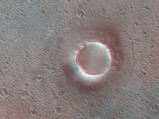
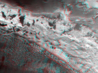
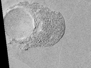
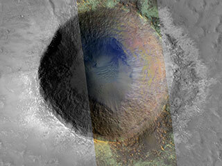
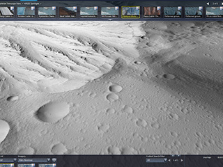
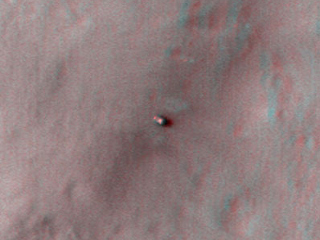
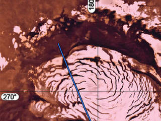
NASA
NASA Science
Mars Exploration Program
Skip Navigation
menu
Videos
Storm Chaser on Mars
March 20, 2012
Mars Reconnaissance Orbiter Catches a Twister in Action.
[53, 178]
Related
A Lockheed Martin-built Atlas 5 rocket, like the one pictured, will launch the Mars Reconnaissance Orbiter in August 2005 from Cape Canaveral Air Station, Florida.
Atlas 5 Rocket
This graphic depicts the Mars Climate Sounder instrument on NASA's Mars Reconnaissance Orbiter measuring the temperature of a cross section of the Martian atmosphere as the orbiter passes above the...
Scanning Martian Atmospheric Temperatures
Nili Patera is a region on Mars in which dunes and ripples are moving rapidly. HiRISE continues to monitor this area every couple of months to see changes over seasonal and annual time scales.
Dunes and Ripples in Nili Patera
Impact cratering and erosion combine to reveal the composition of the Martian underground by exposing materials from the subsurface.
Clay Minerals in Craters and Escarpments on Mars
This map traces where NASA's Mars rover Curiosity drove between landing at a site subsequently named "Bradbury Landing," and the position reached during the mission's 123rd Martian day, or sol, (De...
Curiosity Traverse Map, Sol 123
This image covers part of the floor of a large ancient impact crater, near the western rim.
Layers of Water-Deposited Sediment (3-D)
This image shows part of Ladon Vallis that is located within Ladon basin.
Light-Toned Layered Rock Outcrop in Ladon Valles (3-D)
The Mars Color Imager test view looks northward and includes the large Argyre Basin in Mars' southern hemisphere.
View of Argyre Basin from Test of Mars Color Image
This area at the base of Mount Sharp on Mars includes a pale outcrop, called "Pahrump Hills," that NASA's Curiosity Mars rover investigated from September 2014 to March 2015, and the "Artist's Driv...
Curiosity Heading Away from 'Pahrump Hills'
Artist's concept of Mars Reconnaissance Orbiter approaching Mars.
This movie clip shows a global map of Mars with atmospheric changes from Feb. 18, 2017, through March 6, 2017, a period when two regional-scale dust storms appeared. It combines hundreds of images ...
Back-to-Back Martian Dust Storms
This image acquired on April 8, 2018 by NASA's Mars Reconnaissance Orbiter, shows the gullied western slopes of an unnamed crater (about 10 kilometers wide) in Acidalia Planitia.
Crater Gullies and Fractures in Acidalia Planitia
This observation from NASA's Mars Reconnaissance Orbiter shows a sand dune field in the Nili Fossae region of Mars. The dark lines swirling over the surface of the dunes are the tracks of dust devi...
Dust Devils on Mars
Three images of the same location taken at different times on Mars show seasonal activity causing sand avalanches and ripple changes on a Martian dune.
Seasonal Changes in Northern Mars Dune Field
Mysterious features on slopes hint there could be water flows on Mars.
Possible Water Flows on Mars
The high resolution imaging science experiment (HiRISE) is one of six science instruments for NASA's Mars Reconnaissance Orbiter.
Telescopic Camera for Mars Reconnaissance Orbiter, Front End
The High-Resolution Imaging Science Experiment (Hi-RISE) camera aboard NASA's Mars Reconnaissance Orbiter captured this avalanche plunging down a 1,640-foot-tall (500-meter-tall) cliff on May 29, 2...
HiRISE Catches an Avalanche on Mars
These two images show Shallow Radar (SHARAD) instrument data from two tracks in a part of Mars' Utopia Planitia region where the orbiting, ground-penetrating radar on NASA's Mars Reconnaissance Orb...
Radargrams Indicating Ice-Rich Subsurface Deposit
Impact cratering and erosion combine to reveal the composition of the Martian underground by exposing materials from the subsurface.
Clay Minerals in Craters and Escarpments on Mars (Figure 3)
A configuration interpreted as the United Kingdom's Beagle 2 Lander, with solar panels at least partially deployed, is indicated in this composite of two images from the High Resolution Imaging Sci...
Beagle 2 Lander on Mars, With Panels Deployed
Eridania Region Outcrops
Sand dunes are among the most widespread wind-formed (aeolian) features present on Mars.
Dune Composition (3-D)
The South Polar residual cap (the part that lasts through the summer) is composed of carbon dioxide ice.
Honey, I Shrunk the Mesas
'Marsshine' on Shadowed Part of Phobos
Phobos from 5,800 Kilometers
The red line on this map shows where NASA's Mars Rover Opportunity has driven from the place where it landed in January 2004 -- inside Eagle Crater, at the upper left end of the track -- to where i...
Opportunity's Path on Mars Through Sol 2436
You Might Also Like
The agency is asking the NASA community to work together to develop a revised plan that leverages innovation and proven technology.
NASA Sets Path to Return Mars Samples, Seeks Innovative Designs
NASA has proven powered, controlled flight is possible on other worlds, just as the Wright brothers proved it was possible on Earth.
After Three Years on Mars, NASA's Ingenuity Helicopter Mission Ends
The agency established the board in May 2023 to evaluate the technical, cost, and schedule plans prior to confirmation of the mission’s design.
NASA Releases Independent Review's Mars Sample Return Report
A pair of quakes in 2021 sent seismic waves deep into the Red Planet’s core, giving scientists the best data yet on its size and composition.
NASA InSight Study Provides Clearest Look Ever at Martian Core
Ten sample tubes, capturing an amazing variety of Martian geology, have been deposited on Mars’ surface so they could be studied on Earth in the future.
NASA's Perseverance Rover Completes Mars Sample Depot
Filled with rock, the sample tube will be one of 10 forming a depot of tubes that could be considered for a journey to Earth by the Mars Sample Return campaign.
NASA's Perseverance Rover Deposits First Sample on Mars Surface