NASA
NASA Science
Mars Exploration Program
Skip Navigation
menu
Images
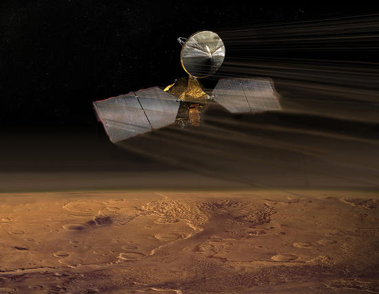
Artist concept of Mars Reconnaissance Orbiter
July 14, 2009
Credits
NASA/JPL-Caltech
ENLARGE
[51, 178]
Related
Wind is one of the most active forces shaping Mars’ surface in today’s climate. Wind-carved features such as these, called “yardangs,” are common on the Red Planet.
Wind at Work
Explanation on how CRISM hyperspectral images are used to understand the history and formation of Valles Marineris, one of the largest canyons in the solar system, and how the data is used to unrav...
CRISM: Exploring the Geology of Mars
This map shows the route driven by NASA's Mars rover Curiosity through the 43rd Martian day, or sol, of the rover's mission on Mars (Sept. 19, 2012).
Curiosity Traverse Map Through Sol 43
This mosaic, taken with the High Resolution Imaging Science Experiment (HiRISE) camera on NASA's Mars Reconnaissance Orbiter, shows the planned route (in yellow) of NASA's Curiosity rover from "Pah...
Curiosity Rover Planned Route
Sand dunes often accumulate in the floors of craters. In this region of Lyot Crater, NASA's Mars Reconnaissance Orbiter (MRO) shows a field of classic barchan dunes on Jan. 24, 2018.
Once in a Blue Dune
This map shows the route driven by NASA's Mars rover Curiosity through the 29th Martian day, or sol, of the rover's mission on Mars (Sept. 4, 2012).
Curiosity Traverse Map Through Sol 29
Back-and-forth blinking of this two-image animation shows movement of a sand dune on Mars. The images are part of a study published by Nature on May 9, 2012, reporting movement of Martian sand dune...
Advancing Dune in Nili Patera, Mars
This image acquired on December 26, 2018 by NASAs Mars Reconnaissance Orbiter, shows the hills that resulted from uplifted rocks due to an impact that formed the 230-kilometer diameter Galle Crater.
Gullies in Galle
This image reveals exposed layers in Noctis Labyrinthus which may contain signatures of iron bearing sulfates and phyllosilcate (clay) minerals.
Eastern Floor of Aram Chaos
This image, taken with the High Resolution Imaging Science Experiment (HiRISE) camera, shows distinct bands of alternating tone and brightness within the "Murray Formation" on Mars.
Bands on the 'Murray Formation'
This map traces where NASA's Mars rover Curiosity drove between landing at a site subsequently named "Bradbury Landing," and the position reached during the mission's 130th Martian day, or sol, (De...
Curiosity Traverse Map, Sol 130
The Russell Crater dune field is covered seasonally by carbon dioxide frost. This image shows the dune field after the frost has sublimated, or evaporated directly from solid to gas. There are just...
Defrosted Dunes
Tracks from the first drives of NASA's Curiosity rover are visible in this image captured by the High-Resolution Imaging Science Experiment (HiRISE) camera on NASA's Mars Reconnaissance Orbiter.
A Rover's Journey Begins
The High-Resolution Imaging Science Experiment (Hi-RISE) camera aboard NASA's Mars Reconnaissance Orbiter captured this avalanche plunging down a 1,640-foot-tall (500-meter-tall) cliff on May 29, 2...
HiRISE Catches an Avalanche on Mars
The yellow-white cloud in the bottom-center of this image is a Mars "dust tower" — a concentrated cloud of dust that can be lofted dozens of miles above the surface. The blue-white plumes are water...
A Mars Dust Tower Stands Out
This map shows the route driven by NASA's Curiosity Mars rover from the location where it landed in August 2012 to its location in September 2016 at "Murray Buttes," and the path planned for reachi...
Curiosity Destinations for Second Extended Mission
Dark, narrow streaks on Martian slopes such as these at Horowitz Crater are inferred to have been formed by seasonal flow of water on contemporary Mars. Detection of hydrated salts at the streaks s...
Recurring "Lineae" on Slopes at Horowitz Crater
NASA's Curiosity rover and its parachute were spotted by NASA's Mars Reconnaissance Orbiter as Curiosity descended to the surface on Aug. 5 PDT (Aug. 6 EDT).
Curiosity Spotted on Parachute by Orbiter
Martian gullies as seen in the top image from HiRISE on NASA's Mars Reconnaissance Orbiter resemble gullies on Earth that are carved by liquid water. However, when they are observed with the additi...
Adding Composition Data About Mars Gullies
The smaller, narrow ridges oriented vertically are yardangs, which are created by wind erosion; the wind strips away the surrounding terrain, and the ridges remain because they contain more hardene...
Meanders and Tributaries in Ridge Form in the Zephyria Region (3-D)
This image (top) taken by the Shallow Radar instrument on NASA's Mars Reconnaissance Orbiter reveals the layers of ice, sand and dust that make up the north polar ice cap on Mars
What Lies Below a Martian Ice Cap
Among the many discoveries by NASA's Mars Reconnaissance Orbiter since the mission was launched on Aug. 12, 2005, are seasonal flows on some steep slopes, possibly shallow seeps of salty water. Thi...
For Anniversary of Orbiter's Launch: Seasonal Flows in Mars' Valles Marineris
The largest crater in this mosaic of images taken by the Context Camera on NASA's Mars Reconnaissance Orbiter is Endeavour Crater, which is 22 kilometers (14 miles) in diameter.
Endeavour Crater in Context
This set of images from NASA’s Mars Reconnaissance Orbiter shows a fierce dust storm is kicking up on Mars, with rovers on the surface indicated as icons.
2018 Giant Dust Storm on Mars
In this Mars Reconnaissance Orbiter view of the Curiosity rover mission's waypoint called "the Kimberley," the red dot indicates the location of a sandstone target, "Windjana," selected for close-u...
Location of Mars Sandstone Target 'Windjana'
You Might Also Like
The agency is asking the NASA community to work together to develop a revised plan that leverages innovation and proven technology.
NASA Sets Path to Return Mars Samples, Seeks Innovative Designs
NASA has proven powered, controlled flight is possible on other worlds, just as the Wright brothers proved it was possible on Earth.
After Three Years on Mars, NASA's Ingenuity Helicopter Mission Ends
The agency established the board in May 2023 to evaluate the technical, cost, and schedule plans prior to confirmation of the mission’s design.
NASA Releases Independent Review's Mars Sample Return Report
A pair of quakes in 2021 sent seismic waves deep into the Red Planet’s core, giving scientists the best data yet on its size and composition.
NASA InSight Study Provides Clearest Look Ever at Martian Core
Ten sample tubes, capturing an amazing variety of Martian geology, have been deposited on Mars’ surface so they could be studied on Earth in the future.
NASA's Perseverance Rover Completes Mars Sample Depot
Filled with rock, the sample tube will be one of 10 forming a depot of tubes that could be considered for a journey to Earth by the Mars Sample Return campaign.
NASA's Perseverance Rover Deposits First Sample on Mars Surface