NASA
NASA Science
Mars Exploration Program
Skip Navigation
menu
Images
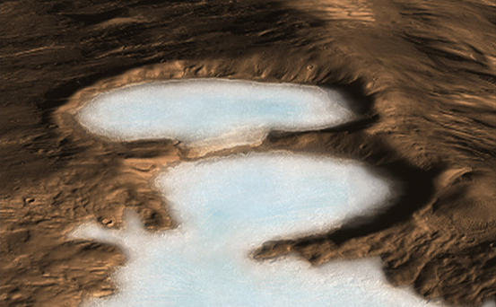
Artist concept of Glaciers on Mars
November 20, 2008
Credits
NASA/JPL-Caltech
ENLARGE
[51, 178, 188]
Related
Overview map showing the location of the study area within Aeolis Dorsa (star).
Overview Map of Aeolis Dorsa
This image maps the traverse of NASA's Mars rover Curiosity from "Bradbury Landing" to "Yellowknife Bay," with an inset documenting a change in the ground's thermal properties with arrival at a dif...
Curiosity's Traverse into Different Terrain (Sol 121)
The yellow-white cloud in the bottom-center of this image is a Mars "dust tower" — a concentrated cloud of dust that can be lofted dozens of miles above the surface. The blue-white plumes are water...
A Mars Dust Tower Stands Out
This image, acquired on January 2, 2014, by NASA's Mars Reconnaissance Orbiter, shows dune fields located among canyon wall slopes.
Hanging Sand Dunes within Coprates Chasma
Drainage Near Crater in Terra Sabaea.
Drainage Near Crater in Terra Sabaea
This view shows a full-resolution portion of the first image of Mars taken by the High Resolution Imaging Science Experiment camera (HiRISE) on NASA's Mars Reconnaissance Orbiter.
First Mars Image from Newly Arrived Camera
This image shows a graben (a trough formed when the ground drops between two parallel faults) and a lava flow in the Tharsis volcanic province of Mars. North is up.
Graben Cutting Lava Flow in Tharsis
The colorful rocks exposed in the central peak visible in this image probably reflect variations in mineral content that were caused by water activity early in Mars' history. The CRISM hyperspectra...
Colorful Central Peak in an Unnamed Crater (3-D)
The total distance driven by NASA's Mars rover Curiosity passed the one-mile mark a few days before the first anniversary of the rover's landing on Mars.
Full Curiosity Traverse Passes One-Mile Mark
This map shows the route driven by NASA's Curiosity Mars rover from the "Bradbury Landing" location where it landed in August 2012 (the start of the line in upper right) to a major waypoint called ...
Curiosity Mars Rover's Route from Landing to 'The Kimberley' Waypoint
The black speck circled in the lower left corner of this image is a cluster of recently formed craters spotted on Mars using a new machine-learning algorithm. This image was taken by the Context Ca...
Machine Learning Spots a Cluster of Mars Craters: Context Camera's View
The High-Resolution Imaging Science Experiment aboard NASA's Mars Reconnaissance Orbiter provides this view of Olympus Mons, the tallest known volcano in the solar system.
NASA and Microsoft Provide Mars 3-D Close Encounter
This large outflow channel shows many characteristic signs that massive amounts of water have flowed through this area, including the teardrop and streamlined islands.
Hebrus Valles (3-D)
Download a PDF of the Mars Reconnaissance Orbiter Arival Press Kit.
Mars Reconnaissance Orbiter Arrival Press Kit
This March 20, 2014, image from the MARCI camera on NASA's Mars Reconnaissance Orbiter has a dark spot (at center of inscribed rectangle) noticed while the image was being examined for a weather re...
Impact Scar Detected in Mars Weathercam Image
NASA's Mars Reconnaissance Orbiter has been observing Mars since 2006, enabling it to document many types of changes, such as the way winds alter the appearance of this recent impact site. The orbi...
Mars Reconnaissance Orbiter Observes Changes
The High Resolution Imaging Science Experiment (HiRISE) camera on NASA's Mars Reconnaissance Orbiter took two images of the larger of Mars' two moons, Phobos, within 10 minutes of each other on Mar...
Mars' Moon Phobos
This image shows the landing site of NASA's Curiosity rover and destinations scientists want to investigate.
Martian Treasure Map
NASA's Curiosity rover and its parachute were spotted by NASA's Mars Reconnaissance Orbiter as Curiosity descended to the surface on Aug. 5 PDT (Aug. 6 EDT).
Curiosity Spotted on Parachute by Orbiter
This area at the base of Mount Sharp on Mars includes a pale outcrop, called "Pahrump Hills," that NASA's Curiosity Mars rover investigated from September 2014 to March 2015, and the "Artist's Driv...
Curiosity Heading Away from 'Pahrump Hills'
These images from the NASA Mars Reconnaissance Orbiter show several impact scars on Mars made by pieces of the NASA Mars Science Laboratory spacecraft that the spacecraft shed just before entering ...
Impact Scars from MSL Cruise Stage and Two Balance Weights
Crater Floor Deposits in Promethei Terra
Crater Floor Deposits in Promethei Terra
A regional dust storm visible in the southern hemisphere of Mars in this nearly global mosaic of observations made by the Mars Color Imager on NASA's Mars Reconnaissance Orbiter on Nov. 25, 2012.
Regional Dust Storm Weakening, Nov. 25, 2012
This is a diagram that shows the launch phases for the Mars Reconnaissance Orbiter.
Mars Reconnaissance Orbiter's Launch Timeline
The Mars Reconnaissance Orbiter’s Context Camera, which captured the 110,000 images that make up the interactive global mosaic, is especially useful for spotting impact craters like those seen here.
Global CTX Mosaic of Mars: Impact Craters
You Might Also Like
The agency is asking the NASA community to work together to develop a revised plan that leverages innovation and proven technology.
NASA Sets Path to Return Mars Samples, Seeks Innovative Designs
NASA has proven powered, controlled flight is possible on other worlds, just as the Wright brothers proved it was possible on Earth.
After Three Years on Mars, NASA's Ingenuity Helicopter Mission Ends
The agency established the board in May 2023 to evaluate the technical, cost, and schedule plans prior to confirmation of the mission’s design.
NASA Releases Independent Review's Mars Sample Return Report
A pair of quakes in 2021 sent seismic waves deep into the Red Planet’s core, giving scientists the best data yet on its size and composition.
NASA InSight Study Provides Clearest Look Ever at Martian Core
Ten sample tubes, capturing an amazing variety of Martian geology, have been deposited on Mars’ surface so they could be studied on Earth in the future.
NASA's Perseverance Rover Completes Mars Sample Depot
Filled with rock, the sample tube will be one of 10 forming a depot of tubes that could be considered for a journey to Earth by the Mars Sample Return campaign.
NASA's Perseverance Rover Deposits First Sample on Mars Surface