April 19, 2023

Sols 3805-3806: Two Steps Forward, One Step Back

Written by Lucy Thompson, Planetary Geologist at University of New Brunswick
This image shows the scuffed bedrock and sand in the workspace including the “Pepejoe” target and was taken by Curiosity's Navcam on Sol 3803.

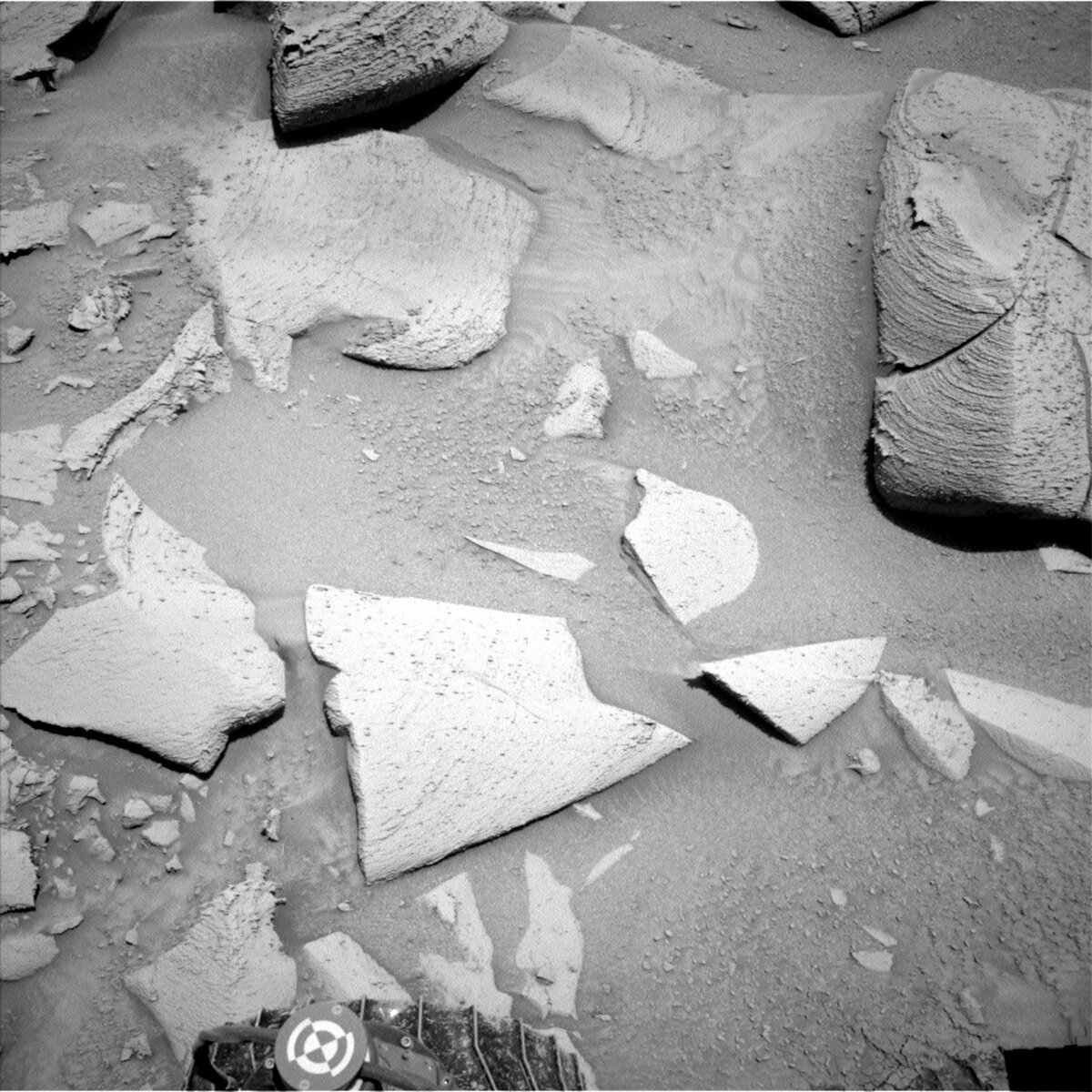
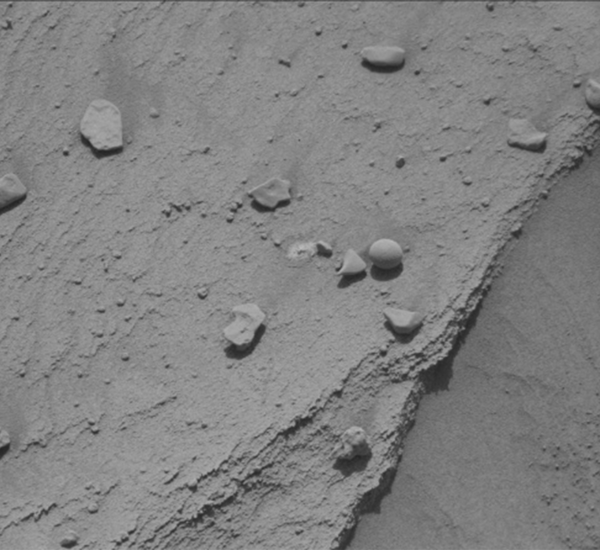
Navcam image showing the scuffed bedrock and sand in the workspace including the “Pepejoe” target. Credits: NASA/JPL-Caltech. Download image ›

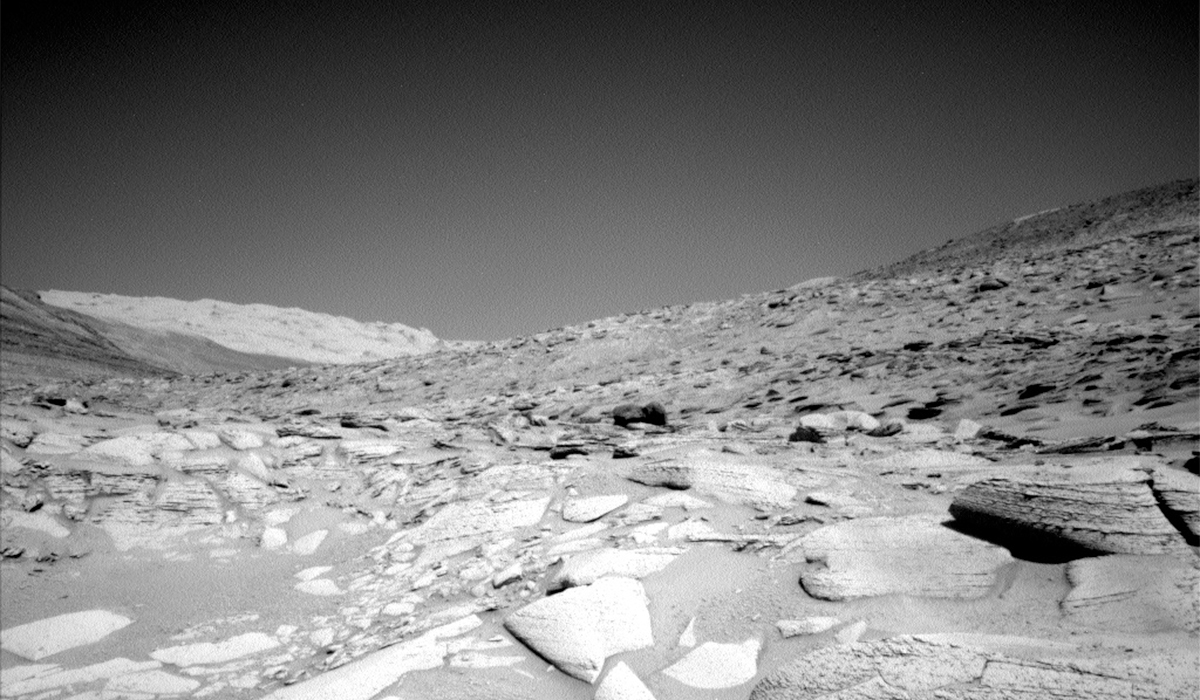
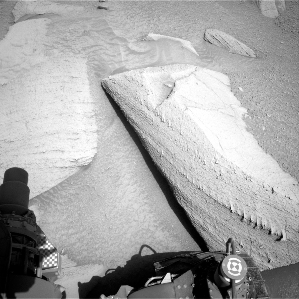
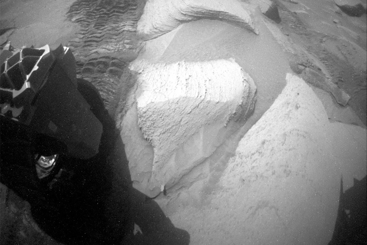
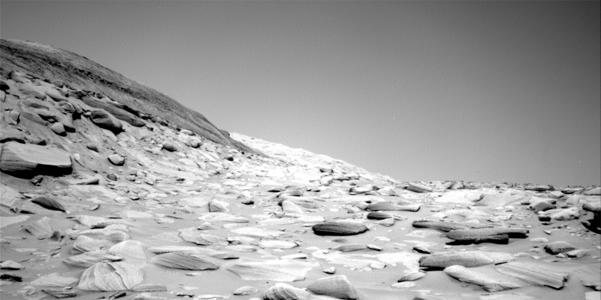
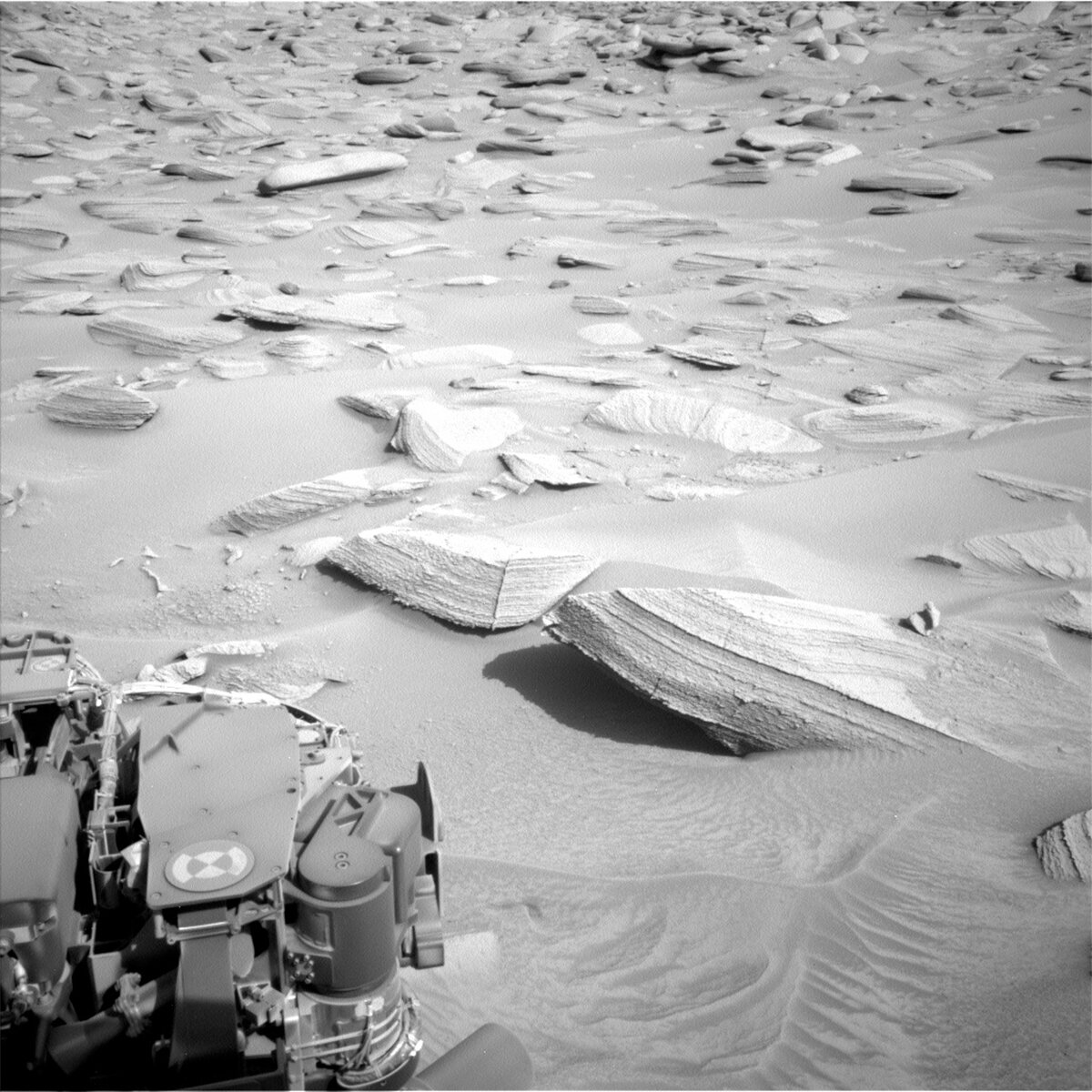
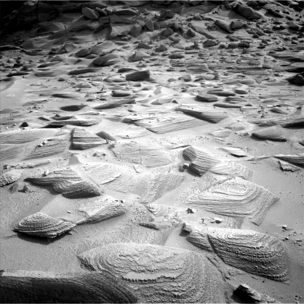
To quote our project scientist, Ashwin, it was clear when we assessed our downlink that Curiosity had almost literally taken “two steps forward and one steps back” during the drive in our previous plan. It has been tricky for our intrepid Mars explorer as we have tried to pick our way through this small canyon as we exit marker band valley. There are abundant large blocks that we are trying to avoid and sand patches that are potential slip hazards for the rover. Unluckily, as Curiosity attempted to back up from the previous parking spot before driving forward, we encountered some of these blocks and sand such that the planned drive did not execute any further. An unforeseen bonus of driving backwards is that we had freshly scuffed sand and rock in our workspace. As a geologist, any time I am in the field here on Earth looking at rocks, one of the first things I do is to use my hammer to expose fresh surfaces, which often reveal different colours and textures than on a weathered surface. At Gale crater, the only time we get to investigate a freshly exposed rock surface is when we scuff or break a rock from driving over it, and then it is often behind us, so we are lucky to have the fresh surfaces in our workspace today.

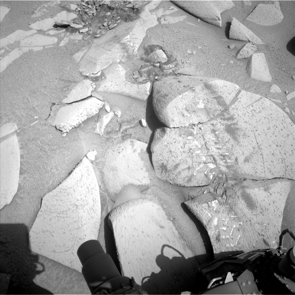
Unfortunately, because of the tricky terrain, Curiosity was not on stable enough ground to safely unstow the arm. As the APXS payload uplink lead today, I was disappointed that we could not get an APXS compositional measurement and close up MAHLI images of the fresh rock, which would require arm movement. Instead, we will utilize ChemCam and Mastcam to investigate the chemistry and textures of the fresh rock and sand in the workspace. “Paramaca” and “Pepejoe” are examples of the freshly exposed/scuffed bedrock, and we will also capture the wheel tracks in the sand with Mastcam. Looking further afield, we are also acquiring Mastcam and ChemCam RMI imaging of a possible channel feature (“Owentiek”) and a large boulder within the Gediz Vallis channel (“Ratunde”) respectively.

Curiosity will hopefully then weave her way through the sand and blocks, taking many steps forward to our next workspace. After the drive has completed MARDI will image the new terrain beneath the rover, and ChemCam will acquire an AEGIS compositional measurement from a bedrock target in the new workspace.

Not to be left out, the environmental science team have also planned a full set of activities to continue monitoring the atmosphere. These include a Mastcam basic tau observation, as well as a Navcam 360 sky survey, line of sight image, large dust devil survey and suprahorizon movie. Standard REMS, DAN and RAD activities round out this plan.

April 18, 2023

Sols 3803-3804: Making Tracks up Marker Band Valley

Written by Sharon Wilson Purdy, Planetary Geologist at Smithsonian National Air and Space Museum
This image of smooth Martian rock formations was taken by Left Navigation Camera onboard NASA's Mars rover Curiosity on Sol 3802.

This image was taken by Left Navigation Camera onboard NASA's Mars rover Curiosity on Sol 3802. Credits: NASA/JPL-Caltech. Download image ›

Curiosity is carefully and patiently driving up a local canyon, named Marker Band valley, across a variably tilting surface that is scattered with horizontally banded bedrock and patches of sand. Can you imagine how fun and challenging it would be to scramble up the pass over this bumpy, uneven, and sandy terrain? As the rover continues her ascent up Marker Band valley, the rocks continue to vary subtly. Several targets in this two-sol plan aim to characterize the texture and chemistry of the rocks to document changes that may help unravel the environment in which they formed.

The plan on sol 3803 includes a ChemCam LIBS analysis (plus Mastcam documentation) of a thinly layered bedrock at “Cambrouze” to capture compositional changes between the layers. ChemCam will also take a long-distance image of a rock ledge with interesting structures that may mark a contact between local rock units. Mastcam stereo mosaics are planned at “La Venta” to investigate a rock with a vertical gray colored stripe that may be a sandstone-filled vein or fracture, and “Pequia,” a rock with an interesting texture and subtle horizontal banding. A Mastcam multispectral image will characterize “Ile Portal,” a dark gray rock that looks very out of place resting on the light-toned surface – perhaps it came from further upslope on Mt. Sharp?

After this set of remote observations, the rover will complete a relatively short drive toward a small dark-toned rock that is visible ahead. A few untargeted science activities are in the plan on sol 3804 including a ChemCam AEGIS activity that will give us information about our new workspace as well as Mastcam deck monitoring.

I’m excited to see the view from the next plateau in Marker Band valley! Drive safely, Curiosity!

April 17, 2023

Sols 3800-3802: Clouds Above, Contact Science Below

Written by Alex Innanen, Atmospheric Scientist at York University
This image shows a rocky Martian terrain of multiple hills, and was taken by Curiosity on Sol 3799.

This image was taken by Left Navigation Camera onboard NASA's Mars rover Curiosity on Sol 3799. Credits: NASA/JPL-Caltech. Download image ›

Here in Toronto, the weather feels like summer. But in Gale Crater it’s coming towards the end of Autumn. At this time of year, we enter Aphelion Cloud Belt season, when we see regular formation of water-ice clouds. While not as striking as the twilight clouds earlier in the year, these clouds form every Mars year at around the same time and last for many months, making this the perfect opportunity to learn about martian clouds. To accomplish that, the ENV team supplements our year-round cloud observations, the zenith and suprahorizon movies (which point directly overhead, and near the horizon), and two seasonal observations, the Phase Function Sky Survey and the Cloud Altitude Observation. These can tell us about how the clouds themselves and the water-ice crystals within them behave, and all four of these observations are in this weekend’s plan.

It's not just about the clouds though this weekend. We’re still climbing through the canyon, so the plan starts out with contact science followed by another short drive, and then some remote science.

More specifically, we start with a Mastcam mosaic of the inverted channel and a ChemCam LIBS observation of ‘Kourou,’ a nearby dark float rock. After this, MAHLI is getting up close with ‘Terre Firme’, and then we’ll brush the dust off of ‘Lorenco’ and get APXS and MAHLI contact science on it. After a nap, we’ll wake up for some night time imaging of the CheMin inlet with MAHLI.

The next sol, Mastcam will have a field day imaging ‘Lorenco,’ ‘Kourou,’ ‘Owenteik,’ ‘Teotonio,’ ‘Rizere de Mana’ and a nearby vein network. Then ChemCam will take a LIBS observation of ‘Rizere de Mana’ and a mosaic of the buttes ‘Alto Alegre.’ We’ll then make our brief drive uphill.

The next sol of the plan has a small untargeted science block, where ENV will look for dust devils and characterise the amount of dust between us and the distant crater rim and ChemCam AEGIS will autonomously select a target. After that, we’ll go back to sleep but that’s not it for the weekend – we wake up early the next morning for our weekly morning ENV activities to finish up the plan.

April 13, 2023

Sols 3798-3799: Digging in to the Details

Written by Lauren Edgar, Planetary Geologist at USGS Astrogeology Science Center
This image of the Martian rock Cupixi and a rock with a "shark's teeth" formation nearby, with the Curiosity rover visible at the edge of the image, was taken by the Curiosity rover on Sol 3797.

This image was taken by Right Navigation Camera onboard NASA's Mars rover Curiosity on Sol 3797. Credits: NASA/JPL-Caltech. Download image ›

After a short bump in yesterday’s plan to get to a better workspace, Curiosity is poised to get a detailed look at the next stratigraphic unit in this small canyon. Since leaving the Amapari Marker Band, we’ve been acquiring a lot of great contact science targets to look for changes in the chemistry. This requires sweeping away the dust with the Dust Removal Tool, and then using APXS, MAHLI, ChemCam, and Mastcam multispectral to get a detailed look at the grain size and composition of different units as we climb through the valley.

Today’s two-sol plan kicks off with several Mastcam mosaics to investigate the local stratigraphy, as well as the resistant nodules in these rocks. Some of these ventifacted nodules (shaped by the wind) are sticking out in positive relief with morphologies that have jokingly been compared to fins or “shark’s teeth” (seen in the lower right corner of the above Navcam image). We would love to take a bite out of these rocks to see what they’re made of! But we’ll have to rely on our instruments for that. So we’ll clear away a fresh patch of bedrock with the DRT at a target named “Cupixi” (the block on the left in the above image), followed by MAHLI imaging, and then use APXS and ChemCam to look at the composition. Mastcam will also acquire a multispectral observation at “Cupixi.” In addition to the observations at Cupixi, ChemCam will investigate a target named “Pico do Trocoa” to look at these nodules in more detail, and MAHLI will acquire a dog’s eye mosaic to assess the grain size and stratification in a layer forming the “sharks’s teeth.” The plan also includes several environmental monitoring observations to assess dust in the atmosphere and to search for clouds and dust devils. On the second sol Curiosity will complete a drive to climb higher in this canyon and figure out what other fascinating units lie above.

April 12, 2023

Sol 3797: Slip and Pivot

Written by Michelle Minitti, Planetary Geologist at Framework
This image showing large rock formations and part of the Curiosity rover on Mars was taken by the Curiosity rover's Rear Hazcam on Sol 3796.

This image was taken by Rear Hazard Avoidance Camera (Rear Hazcam) onboard NASA's Mars rover Curiosity on Sol 3796. Credits: NASA/JPL-Caltech. Download image ›

As you can see in the above image, the terrain our rover drivers is navigating is challenging - slippery sand surrounding big, wheel-unfriendly rocks. These contrasting regimes contributed to us not-quite-arriving at our planned workspace with all six wheels confidently on known terrain. Thus, we had to pivot from a combined contact and remote science day, to one with remote science and a drive. But the interesting textures in the workspace and the surrounding terrain motivated the science team to not want to stray too far from this area. So the rover drivers planned a short bump toward another intriguing rock that gives us a bit more confidence that we can arrive at it to enable arm work in the next plan.

With no arm work in the plan, our GEO and ENV planning groups ably filled up our pre-drive science time with ChemCam, Navcam, and Mastcam observations. Navcam will start things off with a dust devil survey. Mastcam planned a series of stereo images and mosaics at targets that all shared regularly-spaced, resistant features paralleling the layering of this area; despite being geographically dispersed, their similarities earned them the same name, “Teotonio.” Layering patterns on another target, “La Macarena” (pause to sing it to yourself…), earned another Mastcam mosaic, as did one of the blocks in the area (“La Vueltosa”) exhibiting a scalloped fracture pattern that we have not seen for quite awhile. This pattern is also present on the block we are bumping toward, “Regina.” The Mastcam images we planned on Regina should be returned to Earth in time to help us plan our analysis of it tomorrow. ChemCam targeted yet another scalloped fracture block, “Chiles,” with its lone LIBS analysis in the plan. Farther afield, Mastcam will capture the west side of “Owenteik” butte, and ChemCam will collect an RMI mosaic of a hypothesized inverted channel structure on Gediz Vallis Ridge.

In parallel with all the pre-drive science and the drive, DAN passive will run for four hours, adding an active measurement post-drive, as well. Post-drive, Navcam will acquire a cloud altitude observation, and MARDI will give us a view of the ground beneath our left front wheel. RAD and REMS will keep their regular watch on the weather and radiation conditions in Gale.

April 10, 2023

Sol 3796: Software Upgrade Complete!

Written by Scott VanBommel, Planetary Scientist at Washington University
This image of Martian pebbles was taken by Curiosity's Mast Camera on Sol 3786.

This image was taken by Mast Camera (Mastcam) onboard NASA's Mars rover Curiosity on Sol 3786. Credits: NASA/JPL-Caltech/MSSS. Download image ›

As Ken noted in his recent blog, our beloved rover spent much of the last week completing a software upgrade while the science team met virtually to synthesize and discuss results. That upgrade has been completed successfully, and Curiosity was back to work characterizing a local canyon in an effort to study the composition and sedimentology of the geologic units above "Tapo Caparo." While continually on the lookout for its next drill location, Curiosity will maintain a regular cadence of chemical and textural analyses of rocks along its canyon-transecting traverse.

Chemical analysis and imaging efforts were central to tosol's plan which focused on APXS and MAHLI on a brushed rock face, "Tarilandia," before the rover executed a planned drive of ~30 m. As APXS prefers colder temperatures and MAHLI benefits from midday illumination, a one-hour science block between these two arm activities rounded out the geologic science planned before the drive. The science block included a Mastcam crater rim extinction image and an extension of the "Tutu Kampu" mosaic. Mastcam also documented the targets "Loulouie" and Tarilandia. Lastly, ChemCam imaged and conducted laser analyses on the target "Bem Querer," the strikingly round stone captured in this blog's image, before a Mastcam image was acquired of the same target.

Towards the end of the drive Curiosity will acquire imaging that will support targeting in tomorrow's one-sol plan. The data will be relayed to Earth via the MAVEN spacecraft and should arrive around 09:00 PDT tomorrow. Tomorrow's shift will start later than usual as we wait for these data to arrive and take advantage of a favourable (for those of us located in North America) "Gale crater night shift."

March 31, 2023

Sols 3786-3788: Ready for Software Upgrade

Written by Kenneth Herkenhoff, Planetary Geologist at USGS Astrogeology Science Center
This image of rocky Mars terrain was taken by Right Navigation Camera onboard NASA's Mars rover Curiosity on Sol 3784.

This image was taken by Right Navigation Camera onboard NASA's Mars rover Curiosity on Sol 3784. Credits: NASA/JPL-Caltech. Download image ›

An issue at a Deep Space Network station prevented the Sol 3785 plan from being sent to Mars, so none of those planned activities occurred. But the rover is in a good location and orientation for the software upgrade that is planned for next week, so no driving is included in the Sol 3786-3788 weekend plan. Similarly, no arm motion is allowed in the weekend plan, to ensure that MSL is ready for the upgrade. That means that there is plenty of time and power for remote sensing activities this weekend, so this 3-sol plan is packed with over 5 hours of remote observations! In addition, REMS and RAD will monitor the environmental conditions and DAN will measure the amount of hydrogen in the near subsurface.

The Sol 3786 plan starts with a bunch of Mastcam observations, to look for wind-driven changes in wheel-disturbed soil at "Magneetrots" and acquire stereo mosaics of the terrain ahead, a possible vein network at "Los Azulitas," scoured bedrock at "Tutu Kampu," textures at the boundary between two geologic units, and layering at "Theobroma." Then ChemCam will use its laser to sample the chemical composition of bedrock target "Mana" and acquire an RMI mosaic of strata exposed to the southeast of the rover. The Right Mastcam will document the Sol 3784 ChemCam AEGIS laser spots and look for wind-induced changes at "Romeral" and "Solimoes." Navcam will then search for dust devils and clouds above the horizon before APXS measures atmospheric chemistry.

During the morning of Sol 3787, ChemCam will measure the elemental chemistry of bedrock target "Ponta" and of the atmosphere above the rover, and Navcam will search for dust devils. Early that afternoon, the Right Mastcam will again look for changes in the Magneetrots soil and image the ChemCam LIBS spots on Mana and Ponta, then Navcam will check the dustiness of the atmosphere towards the north and search for clouds above the horizon. Later in the afternoon, Mastcam will survey the sky near the sun and measure the amount of dust in the atmosphere. Navcam will then survey the entire sky and search for clouds.

Early on Sol 3788, Navcam will search for clouds again and Mastcam will measure the dust in the atmosphere. Later that morning, ChemCam will measure the chemistry of a laminated float block named "Emma" and the Right Mastcam will document the resulting laser spots. Early in the afternoon, Navcam will again search for clouds and dust devils, and both Mastcam and Navcam will look toward the north to monitor the dustiness of the atmosphere. Finally, several engineering activities are planned in the evening to prepare for the software update.

Early next week, while the software update is proceeding, the science team will have a "virtual" meeting to discuss recent results and interpretations. If all goes well, normal science operations will resume around next weekend.

March 29, 2023

Sol 3785: Tiptoeing Through the Tricky Terrain

Written by Lucy Thompson, Planetary Geologist at University of New Brunswick
The seam-corrected mosaic provides a 360-degree cylindrical projection panorama of the Martian surface centered at 207 degrees azimuth (measured clockwise from north).

NASA's Mars rover Curiosity took 31 images in Gale Crater using its mast-mounted Right Navigation Camera (Navcam) to create this mosaic. Credits: NASA/JPL-Caltech. Download image ›

Signs of spring are all around as most of us come on shift from various locations within the northern hemisphere today. We still have thick snow on the ground here in eastern Canada, but the sounds of melting snow and bird song are all around. Meanwhile on Mars, we may not be tiptoeing through the tulips, but we are certainly, very carefully, tiptoeing our way through the many loose blocks and sand that line the pass we are currently driving through. A further consideration is that we are rapidly nearing a flight software update, planned for next week. We therefore need to ensure that the rover is in a good location for communication with the orbiters that relay all the information to and from Curiosity.

The rover engineers did an excellent job with the previous drive, placing Curiosity in a position to be able to brush and analyze a representative bedrock block. The brushed, finely laminated and nodular “Tarilandia” target will be analyzed by APXS, MAHLI and Mastcam to document composition and texture and ChemCam and Mastcam will investigate the chemistry and texture of another bedrock block (“Inini”) within the workspace. We will acquire a number of Mastcam and RMI images of potential contacts between different units, as well as to document textures and structures within exposed bedrock.

Not to be left out, the environmental science team also planned a full set of activities to continue monitoring the atmosphere. These include a Mastcam basic tau observation, as well as a Navcam line of sight image, and dust devil and suprahorizon movies.

After we have completed all that science, Curiosity will hopefully tiptoe and zig-zag through the blocks and sand to put us in a good position for our software update and to resume science observations when we return to planning next week. Standard REMS, DAN and RAD activities round out the plan.

This is our last full plan before we wind down science activities on Friday to prepare to install a new version of the rover’s flight software next week. The engineering team has been preparing for a few years to develop the software, upload it, and now switch over to it on Mars. We will let the engineers do their jobs on Monday through Thursday of next week and if all goes well, we’ll be back up and running after that!

March 27, 2023

Sols 3783-3784: A Picture Perfect Day – Or To Be More Exact, a Day Perfect for Taking Pictures!

Written by Catherine O'Connell-Cooper, Planetary Geologist at University of New Brunswick
This image shows part of the Curiosity rover in the bottom left and rock formations on the Mars surface up ahead.

Left Navigation camera, sol 3781 – showing the typical terrain at our current location. Credits: NASA/JPL-Caltech. Download image ›

Due to some delayed downlink of images, we didn’t receive all the information we needed in time to do contact science today. Although the data did eventually arrive, it was too late to allow us to get the arm out for contact science. Each planning day has a very strict timeline, in order to make our scheduled uplink time, which is MSL’s allotted time for using the Deep Space Network to get our plan up to the rover. Planning contact science targets takes most of the first two hours of work on any given day, so the three hour delay before the data was processed would likely have resulted in us missing our uplink slot – a rare occurrence for the super efficient MSL team, and one we aim to avoid at all costs!

So instead, we decided to make it an imaging day, and lean heavily on the Mastcam and ChemCam teams, characterizing the area around the rover and beyond. Mastcam will take several small mosaics (e.g., 2 rows of 2 images, or 2 rows of 4 images) and ChemCam will use its Remote Micro Imager (RMI). On the far right of the workspace, Mastcam will image “Tacuiquene,” a block with nodules and laminations, which seems to be a float from along our future drive path, so we will get a taste of what is to come. There are a lot of vein features in this area, so both ChemCam and Mastcam will be looking at these. Close to the rover, ChemCam is using LIBS to analyze some of these raised veins at “Jauaperi” which will also be imaged by Mastcam. Just above this, Mastcam will image the strata or layers in the target “Cauame.” Further afield, Mastcam will image a large vein feature at “Los Azulitas” and reimage the veiny target “Cano Macareo” from a slightly different, closer perspective than the previous mosaic.

A small grey float “Cerra Duida” will get the most attention today – ChemCam will image this with the RMI (which gets very detailed images from a distance), take a “passive” measurement (i.e., not using the LIBS laser), and Mastcam will take a multispectral image of the target. We have analyzed quite a few of these grey floats in recent weeks, and the team is interested in learning more about them.

Our drive today will be a relatively short one (20 metres or so). The driving in this area is slow going. Rather than regular flat bedrock, we are facing rocks sticking out from sand patches with float stones loose on the surface (see the accompanying image). Some of the bedrock slabs here also move when driven on, such as today’s Mastcam target “Nosan Mountain” – providing quite the obstacle course for the rover planners to pick through.

March 24, 2023

Sols 3780-3782: Perfect 10

Written by Michelle Minitti, Planetary Geologist at Framework
This image of rock formations on the Martian surface in grayscale was taken by Curiosity on sol 3778.

This image was taken by Left Navigation Camera onboard NASA's Mars rover Curiosity on Sol 3778. Credits: NASA/JPL-Caltech. Download image ›

Curiosity is ten and a half years into operating in Gale cater, a concept that before and even a few years after landing seemed to be an impossible dream. When we landed, my daughter - then 6 - asked me how long the rover would last. I remember telling her “By the time you get to high school, we’ll be just about out of power to do much.” I am pleased to report to you today how wrong I was, as she is months away from graduating from high school and Curiosity's weekend plan uses all ten of our science instruments and all of our engineering cameras. It is as awe inspiring as the views from this high up on Mount Sharp.

MAHLI and APXS will image and analyze two targets. “Capanapro” is an example of the layered bedrock that typifies this region above the Marker Band, and “Amanauo” is one of the loose, gray rocks that we find littered on and among the bedrock slabs. MAHLI will image the MAHLI and APXS calibration targets, a ~twice a year monitoring of instrument performance relative to standard imaging targets. SAM will also conduct an instrument health check, while CheMin plans to discard the “Tapo Caparo” sample after successful analyses. These latter activities ensure we are to ready for whatever our next drill target is!

ChemCam will analyze two different targets, “Adankasima” and “Nova Esperanca,” which investigate specific bedrock layers around the rover - almost like reading individual pages of a book. ChemCam also plans to look far afield of our workspace, north toward the Gale crater rim, for two long distance RMI mosaics. The dust load in the atmosphere, which we know because of systematic Mastcam and Navcam imaging (some of which is included in this plan), is fairly low which makes clear long distance views possible. Mastcam plans to acquire hundreds of images in an attempt to capture all of the sites of interest to the planning team today. Stereo mosaics of the “Owenteik” butte, the stair-stepped bedrock where the Adankasima target is located, and small blocks like “Los Pijiguaos” reveal the structures and geologic relationships of the rocks exposed in the valley we are traversing. A multispectral analysis on the “Chenapau” butte hopes to unravel if there is a mineralogical cause behind the color differences that we observe on the butte. And a mosaic back toward the Marker Band will just be pretty.

RAD and REMS will run at their respective systematic cadences through the whole weekend, and DAN will run for hours in passive mode punctuated by period active pings of the subsurface to keep tabs on the H content of the bedrock.

Once we pick our way through the rocky terrain to the next workspace, we will acquire the Navcam and Hazcam images necessary to plan our next activities and drive, and MARDI will snap an image of the terrain beneath the rover.