March 1, 2023

Sols 3757-3758: Reacting To External Forces

Written by Elena Amador-French, Science Operations Coordinator at NASA's Jet Propulsion Laboratory
This image was taken by Right Navigation Camera onboard NASA's Mars rover Curiosity on Sol 3755.

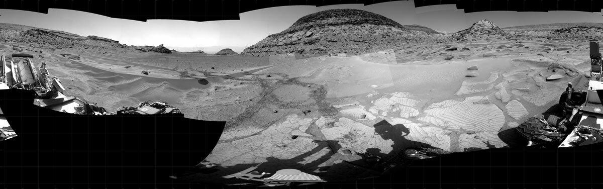
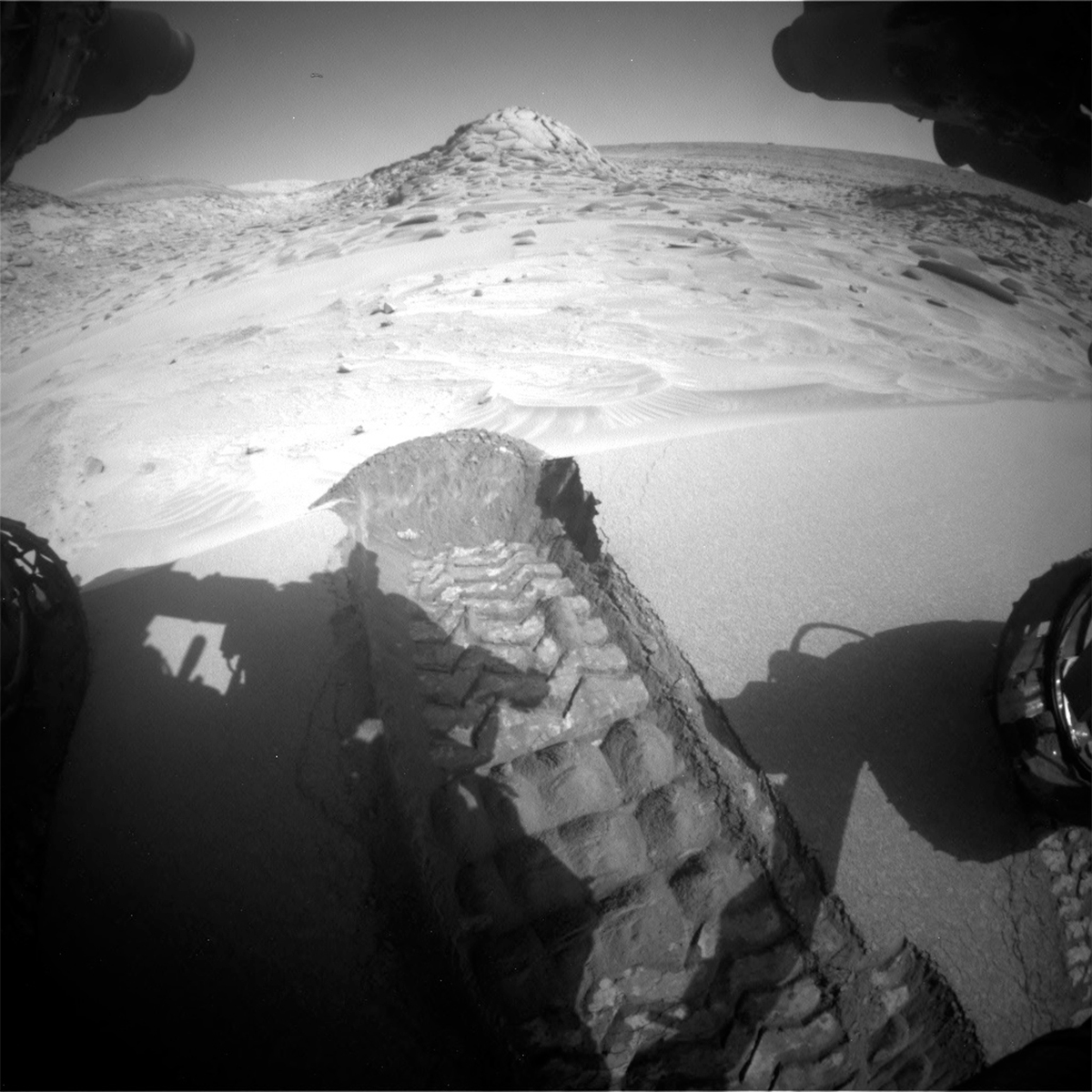
This image was taken by Right Navigation Camera onboard NASA's Mars rover Curiosity on Sol 3755. Credits: NASA/JPL-Caltech. Download image ›

One of my favorite parts of mission operations is working with colleagues to react quickly to new information, both from the rover and from our ground systems on Earth. Yesterday’s 1 sol plan was developed in near record time (really, we were finished in 4 hours and 6 minutes whereas on average it takes us anywhere from 6-7 hours!), this was in part due to the low complexity activities we had in the plan. However, due to an issue at the Deep Space Network (DSN) station we were meant to use, we were not able to uplink that plan to Mars. And that same station would continue to be “down” for today’s 2 sol plan. This means we did miss one sol’s worth of activities on Mars and were at risk this morning of losing another 2 sols worth of activities.

While not ideal, this presents a, dare I say it, fun puzzle for us to solve. As science operations coordinator, my first task was to query what critical activities did not execute in the 3756 plan and what critical activities are needed before Friday to keep us chugging along in the Tapo Caparo drill campaign. With those observations in hand, I worked with a group of engineers at JPL to consider what options we had available to us today. This meant working closely with our communications planning engineers that understand the availability of other DSN stations and orbiters that can be used as relays, our engineering uplink leads that understand what time critical data arrive on Earth and Mars, and our tactical uplink lead engineers that know how to quickly rebuild our skeleton plans to ensure a smooth operation.

In conclusion, our communications planning engineers were able to negotiate with other missions and the DSN to uplink today’s plan through a different station. So today’s planning then resumed fairly normally with a 2 sol plan that both recovered activities that did not execute on 3756 and new activities that will ensure a timely continuation of our drill campaign. It took many people to make this happen this morning, and it’s the best part of operations!

All activities planned in 3756 were brought back into today’s plan (see yesterday’s blog for a description). In coordination with the APXS atmospheric observation, today we also used ChemCam’s passive mode to observe the composition of the sky to compare with APXS – these two observations will provide a complementary view.

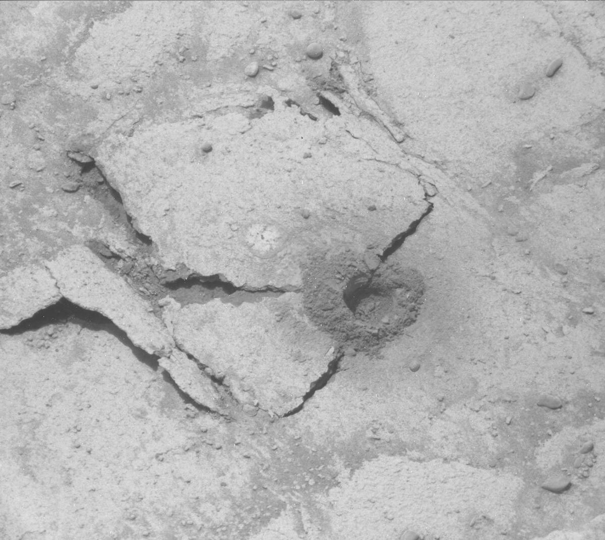
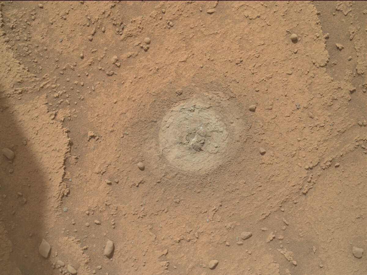
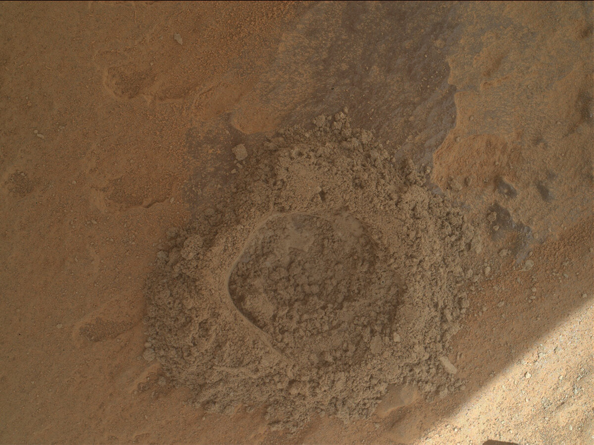
As noted in yesterday’s blog, this morning we received our mineralogical results from the CheMin XRD instrument – our first taste of the composition of Tapo Caparo. The results were very interesting to the team, and they requested a second analysis (of the same sample) in today’s plan. This additional integration builds up the peaks that make up an XRD observation to allow a more precise declaration of the mineralogy.

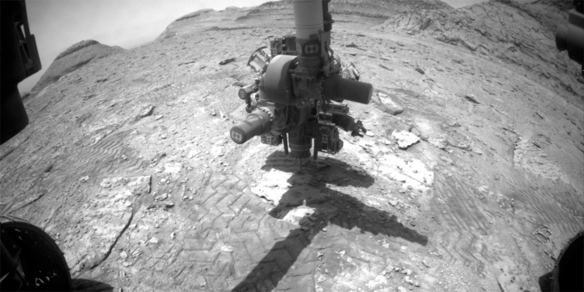
In preparation for delivering drilled sample to our second internal laboratory, SAM, we also performed a preconditioning activity that prepares a sample cup to be used for future experiments, notionally scheduled for this weekend.

What a fun day to do rover operations!

February 28, 2023

Sol 3756: Sit Back and Wait for the Data To Roll In

Written by Elena Amador-French, Science Operations Coordinator at NASA's Jet Propulsion Laboratory
NASA's Mars rover Curiosity took 37 images in Gale Crater using its mast-mounted Right Navigation Camera (Navcam) to create this mosaic.

NASA's Mars rover Curiosity took 37 images in Gale Crater using its mast-mounted Right Navigation Camera (Navcam) to create this mosaic. Credits: NASA/JPL-Caltech. Download image ›

Today we planned a single sol plan.

We are in the middle of the Tapo Caparo drill campaign. In yesterday’s plan we delivered 2 portions of sample to our CheMin instrument for mineralogy. That analysis will run overnight on Mars which corresponds to the middle of the day Tuesday, on Earth. That meant we did not have any new information to react to this morning for planning.

We still have plenty of science activities to plan but none that involved the Rover Planners, so they were released early to work strategic activities like, for example, what we expect our next eventual drive to look like after this campaign ends. Working activities strategically makes for a more refined plan once we do come in for day-of planning, allowing more time to be spent reacting to new information.

Our geology and environmental theme groups filled this single sol plan with many goodies. We will take a ChemCam LIBS observation of the rock exposed from a fracture that formed during the drilling process, “Moura.” This gives a nice perspective on some fresh rock, unobscured by the collection of dust. We’ll also use ChemCam’s remote micro imager (RMI) capability to take some high-resolution imaging of fine laminations on a nearby block named “Itaquera.”

During a drill campaign, we can remain at the same location for several weeks sometimes. This gives instruments like Mastcam the opportunity to take small chunks of a larger mosaic piece by piece over the course of our stay. This saves power on the rover and the complexity of sequencing for our instrument operators. In today’s plan, Mastcam will take a 7x7 stereo mosaic as an extension off the target “Tefe.”

Our environmental theme group requested a Navcam large dust devil survey and a nighttime APXS atmospheric observation. We take APXS atmospheric measurements once a month. Just like on Earth – atmospheric measurements like these are most powerful when placed into the context of a year (or years) worth of observations, this can tell us how compositional changes vary with respect to seasons, for example.

It has been a short and sweet planning day, looking forward to seeing CheMin’s mineralogy results for Tapo Caparo tomorrow morning!

February 27, 2023

Sol 3755: Got Rock Sample?

Written by Kenneth Herkenhoff, Planetary Geologist at USGS Astrogeology Science Center
This image was taken by Mast Camera (Mastcam) onboard NASA's Mars rover Curiosity on Sol 3753.

This image was taken by Mast Camera (Mastcam) onboard NASA's Mars rover Curiosity on Sol 3753. Credits: NASA/JPL-Caltech/MSSS. Download image ›

The tactical operations team was very happy this morning because it appears that a sample of the Tapo Caparo bedrock was successfully acquired! Although the target rock slab fractured during drilling, all indications are that enough sample was collected to allow analysis by the CheMin and SAM instruments. So the primary goal of the Sol 3755 is to drop some of the drill sample into CheMin for analysis. But first, several remote science observations are planned. Mastcam will acquire a 2-frame stereo mosaic of the steep, sandy "Rio Unini" surface at the base of Chenapau to look for possible changes since it was imaged on Sol 3748. Mastcam multispectral observations of foreign stones (rocks that appear to have been moved to their present locations from somewhere else) "Tucupita" and "Tamanaco" are also planned, along with a 6x3 stereo mosaic of sedimentary structures in "Chenapau Valley." Then Navcam will search for dust devils and ChemCam will shoot its laser at the wall of the drill hole and measure the spectral reflectance of the Tapo Caparo drill tailings. The Right Mastcam will document the ChemCam laser spots and take a 6x8 stereo mosaic to extend the coverage of the nearby "Tefe" sedimentary laminations before the arm is used to feed a couple sample portions to CheMin. After taking a nap, the rover will wake up to acquire MARDI and Navcam images during evening twilight, then take another nap before the overnight CheMin analysis begins. Of course, we are all interested to hear what CheMin discovers about the minerals in Tapo Caparo!

February 24, 2023

Sols 3752-3754: Perseverance From the Curiosity Team

Written by Natalie Moore, Mission Operations Specialist at Malin Space Science Systems
NASA's Mars rover Curiosity acquired this image using its Mars Hand Lens Imager (MAHLI), located on the turret at the end of the rover's robotic arm, on February 23, 2023, Sol 3750 of the Mars Science Laboratory Mission.

Sol 3750, MAHLI image of Tapo Caparo post-preload test. Credits: NASA/JPL-Caltech/MSSS. Download image ›

Yesterday, on our weekly day off from planning, the team awaited Drill Sol 1 triage data to confirm if Tapo Caparo seemed more drillable (as Dr Catherine O'Connell-Cooper described so well on Wednesday’s blog) — or otherwise too hard like our last Marker Band drill attempts at Amapari, Encanto, and Dinira. The MAHLI image taken after the preload test arrived early and showed something we haven’t seen for a while: DRT scratches and a divot from the preload test! This was a good sign that this upper unit of the Marker Band might not be as hard as our last few drill targets in the lower, rippled unit (which did not get deep enough to collect sample). By midday the geochemistry data from APXS and ChemCam came down and both teams went to work analyzing Tapo Caparo’s chemistry to determine if it was distinct enough to warrant gathering sample. After some productive discussion this Friday morning, the team decided wholeheartedly to proceed with Drill Sol 2 and finally (hopefully) get to sampling depth before leaving the Marker Band area for good.

Our modeling tools work extra hard on Drill Sol 2 plans so there’s an incentive to keep things moving early in the day. But since we’ve planned Drill Sol 2 four other times in the past ~three months, our team knew exactly what to do to make planning go as smooth as possible. As our Rover Planner Lead, Ashley Stroupe, described in the Sol 3676 blog (our first Amapari drill attempt), drilling takes a lot of rover energy and pre-drill planning is kept to a minimum. So, we’re using sol 3752 for our full drill including lots of documentation imaging during and after. The only non-drill activities on that sol will be some DAN subsurface measurements and a Navcam twilight cloud survey since we’re still in Mars twilight cloud season (check out this NASA blog from 2016 with pretty plots of Gale Crater seasonal cycles).

Sol 3753 will be filled with remote science: Mastcam taking the lead for data volume with >60 full images taken midsol, ChemCam following close behind with 21 RMI frames, some afternoon Mastcam images showing the atmospheric opacity near the sun, and lastly a MARDI image at 19:00 local Mars time to hopefully get better exposure on what’s under us than what we took on sol 3749. In the middle of all this remote science, an early-afternoon arm block contains test sample drop-off activities to the closed SAM inlet, assuming the drill succeeds and sample is collected. On the last sol, more time is dedicated to remote science with lots more Mastcam images, ChemCam LIBS and RMI, and Navcam’s usual long-distance movies to maybe catch dust devils and other atmospheric occurrences. We had a sholiday (soliday + holiday) last weekend, so Earth and Mars are pretty in-sync right now with timing. That means our drill data should come down ~11am Saturday (tomorrow) morning, whatever the outcome!

For fun, here’s a nice view of APXS during the DRT of Tapo Caparo, before any other contact science was accomplished. I also love these Hazcam images of 1. APXS touching a ripple crest from sol 3749 (planned Tuesday) and 2. Backward facing view of our Tapo Caparo drill location, showing the beautifully laminated blocks we are next to. For color context, here’s a Mastcam Left image of a similar block taken mid-drive to the Tapo Caparo drill location.

February 22, 2023

Sols 3750-3751: Drilling the Marker Band… Again?

Written by Catherine O'Connell-Cooper, Planetary Geologist at University of New Brunswick
This image shows laminated bedrock near the wheels of the Curiosity rover on Mars.

Sol 3749, Right Navigation camera, showing laminated bedrock to the right of our workspace. Credits: NASA/JPL-Caltech. Download image ›

We continue to drive along the Marker Band and found ourselves this morning (as planned) in an area of strongly laminated bedrock. The accompanying image shows the bedrock to the right of our current workspace, with very regular distinctive laminations or layers, about 3 cm or less apart. We are interested generally to see how this compares to the “rippled” Marker Band material that we tried to drill over the past several months, but specifically to determine if this material is a suitable drill target.

After trying multiple times in the “rippled” Marker Band, the team decided it was time to move on. It was difficult, because getting a drilled sample in this area is considered to be of very high scientific importance. The analysis of drilled samples is one of the strengths of Curiosity – it is the Mars Science Laboratory (MSL) after all! Using our highly specialized analytical instruments (SAM and CheMin), we can add so much information to that which we routinely get using our geochemical instruments (APXS and ChemCam). So – we will try again in a different unit of the Marker Band, this time on “Tapo Caparo.” It’s in an area of bedrock similar to that shown above, but with more subdued (and drill friendly!) laminations.

In today’s two sol plan, we are focusing on drill triage on Tapo Caparo. The Rover Planners (RPs) are doing a pre-load test to determine if this block is safe to drill. APXS and ChemCam will investigate the geochemistry and Mastcam will acquire a multispectral image, so that we can fully characterize the geochemistry here and at the same time, see if this target is similar to the surrounding bedrock. MAHLI will also image the target, so that RPs can be sure that there are no obvious features here which would affect the drill, such as a large vein or a fracture. ChemCam will also use LIBS to analyze “Tefe” within a patch of very strongly laminated bedrock, a target that will be documented by Mastcam too. Drilling is a very power intensive activity, so today we are hoarding power, and restricting activities. Mastcam (unusually) has just the one long distance mosaic image, looking up at the “Chenapau” butte.

ENV will continue its routine environmental monitoring, using REMS and DAN, in addition to a Mastcam tau image (measuring dust in the atmosphere). Navcam will also get a pre-dawn cloud survey. We are still in noctilucent cloud season, so consistent periodic imaging is a high priority task for the foreseeable future.

February 21, 2023

Sol 3749: Another Busy Day on Mars

Written by Alex Innanen, Atmospheric Scientist at York University
This image shows Curiosity's wheel scuff, nicknamed "Taracua," on the Mars surface and part of the rover's wheels.

This image was taken by Front Hazard Avoidance Camera onboard NASA's Mars rover Curiosity on Sol 3748. Credits: NASA/JPL-Caltech. Download image ›

After a holiday/soliday weekend, we’re back to work with today’s single sol plan, and there’s a lot to pack into it.

After the drive, Curiosity’s wheel scuffed the rippled sand feature right in front of us, which you can see in the image above. This scuff – nicknamed ‘Taracua’ – is the subject of both ChemCam and Mastcam observations looking at both the surface and interior of the feature. Mastcam is also looking slightly further afield to examine a nearby stone ‘Kwaimatta,’ pebbles, and more distant rhythmic features, including another pass at a target we looked at almost 10 sols ago, ‘Itaquera.’ Even further afield, we have a view of the crater rim again which means we’re able to get a line of sight measurement to look at the amount of dust in Gale Crater. As well as these remote observations, we’re also doing contact science on the ripple with both APXS and MAHLI. With that done, we’re planning to drive to a possible drill location.

Even after all that, the sol isn’t finished yet. After every drive we take a standard set of post-drive imaging, to see where we’ve ended up and help plan further drives. We’re also doing more characterisation of atmospheric dust – this time with a solar tau. The twilight cloud season is still going strong, so we also included Mastcam imaging just after sunset to try and capture more of these glowing clouds.

My role today was ESTLK (ENV Science Theme Lead and Keeper of the Plan), but I was also joined by an ESTLK-in-training. Training new ESTLKs always involves a slightly different way of thinking. Some conventions or rules I take for granted may be confusing to someone without the context of many, many shifts under their belt, and there are oh so many acronyms we like to throw around. In this way it’s a bit like writing these blog posts, trying to think of how I can present things that may seem second nature to me to the rest of the world. Both are a really great way to slow down and appreciate the intricacies of the work.

February 17, 2023

Sols 3746-3748: When Data Show Up Late…

Written by Susanne Schwenzer, Planetary Geologist at The Open University
This image shows dust scraped up on the Mars surface and was taken by Curiosity on Sol 3744.

This image was taken by MAHLI onboard NASA's Mars rover Curiosity on Sol 3744. Credits: NASA/JPL-Caltech/MSSS. Download image ›

Today, I was heading for my computer when my colleagues went off to celebrate the end of the working week. Yes, that’s right, planning started at 5 pm in my part of the world (the UK) today. That was one hour later than anticipated (and I would have missed all my colleagues going ‘Have a good weekend!’) Why that late? Most days, we start an hour earlier, at 8 am in Pasadena California, not 9 am, like today. Today, we only got data that we required for the planning day at 8.45 am Pasadena, after they acquired a slight delay on the way off Mars and had to take the next orbiter to get here. You may have seen reports of not transmitted or delayed data before, and this can happen for any number of reasons, and most of them are just an issue or change somewhere in that long chain of events that have to happen just right for us to get the data on time. If you want to know more, here are all the details! So, the data missed the bus, figuratively speaking, and I had to content with my colleagues telling me all about their weekend plans before I went to my shift. … but of course I had a great answer to what I was up to on a Friday night: doing mission planning, which is always a lot of fun. And nothing tops looking at new images from Mars, hot off the orbiter!

The one image that we all were interested in was the drill hole, and the previous blogger has already captured the resistance that those rocks have put up, including an image with the drill on the ground. I have included above the result of our attempt: an image of what should have been the Dinira drill hole. We drove off that site now and are on our way up Mt Sharp again. Today’s workspace image reminded me of popcorn scattered all over the table – seems appropriate for a Friday night, right?

The site offered us an ideal opportunity to do an APXS raster of four measurements in the same area to assess the chemical differences of the small nodules and the underlying bedrock. MAHLI supports this observation with a series of close-up images. MAHLI also looks at target “Cunucunuma,” which is a single rock that sits near the rover and looks very different from the bedrock: it has lots of vesicles, and clearly is a float rock. ChemCam is investigating “Cunucunuma,” too, and also looking at one of the nodules sitting above the bedrock at target “Flores Verdes” and a bigger version of these nodules in target “Curucuquero.”

Mastcam is very busy in this plan, starting with a 360° panorama mosaic. It also supports the ChemCam LIBS observations taking documentation images of the targets “Cunucunuma” and “Flores Verdes.” The area has a very particular pattern to it, of which images are taken at targets “Serra do Pacu” and “Serra Imeri.” In the distance, there is a mosaic on the hill site earlier named “Chenapeau” and a large mosaic in the far field of the rover. Finally, there are three multispectral observations on the targets “Tres Bocas,” yes, that’s the APXS target, and targets “Rio Maria” and “Wina.” Not enough images? We thought so, too! There also are two ChemCam RMI observations, one as long distance on “Chenapeau” and a two-image raster on target on “Trairaro,” also a float rock.

Add atmospheric observation and DAN active and passive observations and a MARDI image, as well as a Mastcam Phobos image, and you have a very busy plan! Well, the rover has three sols to do that and drive off to the next stop, which gets us close to one of the aeolian features in the scene. Of course, there also is some imaging after the drive, which will hopefully arrive in good time for the planning on Tuesday, after the US Presidents day.

February 15, 2023

Sols 3744-3745: The One That Got Away…

Written by Lauren Edgar, Planetary Geologist at USGS Astrogeology Science Center
This image of Curiosity's arm above the Mars surface was taken by Front Hazard Avoidance Camera onboard the Curiosity rover on Sol 3742.

This image was taken by Front Hazard Avoidance Camera onboard NASA's Mars rover Curiosity on Sol 3742. Credits: NASA/JPL-Caltech. Download image ›

The team was eagerly awaiting our downlink this morning to hear how the drill attempt from Sol 3742 went. The images came down and indeed there was a drill hole… a mini drill hole… and sadly not deep enough to get to a sufficient depth for the drill assembly to start collecting sample. This was our fourth attempt to drill this marker band, and we gave it our best shot from both a geology and engineering perspective. Unfortunately these rocks do not want to cooperate – they’re hard and they weather into resistant and recessive beds which make them very challenging to drill. So the team made the difficult decision to get back on the road, without a drill sample from this location. I can imagine future rover scientists telling tall tales of these marker band rocks and the one that got away: “that was the hardest rock I’ve ever seen! It looked me right in the eye and then jumped out of the net (drill bit assembly)…” All kidding aside, we’ve learned a lot about these rocks from remote sensing, contact science, and drill attempts, and the team is excited to analyze the data and think about what else lies ahead.

Today’s two-sol plan is focused on wrapping up science at the “Dinira” drill site. MAHLI and APXS will analyze the mini drill hole and drill tailings, and ChemCam and Mastcam will also investigate the chemistry and texture at the attempted “Dinira” drill hole. The team also planned a long distance ChemCam RMI mosaic to study some distant stratigraphy – which is a good reminder that there’s still a lot to explore ahead! Then Curiosity will drive ~97 m to the south, to get us back on track to traverse across the marker band. The second sol includes some untargeted observations, including an autonomously selected ChemCam AEGIS target. Curiosity will also acquire a number of environmental observations to monitor dust in the atmosphere and search for noctilucent clouds at twilight.

So we’ll say goodbye to the “Encanto” and “Dinira” drill target vicinity… these targets were not charming and did not deliver wealth as their names may have suggested, but we’ll always remember their elusive and intriguing qualities!

February 13, 2023

Sols 3742-3743: Let's Drill!

Written by Keri Bean, Rover Planner Deputy Team Lead at NASA's Jet Propulsion Laboratory
NASA's Mars rover Curiosity acquired this image using its Mars Hand Lens Imager (MAHLI), located on the turret at the end of the rover's robotic arm, on February 9, 2023, Sol 3737 of the Mars Science Laboratory Mission.

NASA's Mars rover Curiosity acquired this image using its Mars Hand Lens Imager (MAHLI), located on the turret at the end of the rover's robotic arm, on February 9, 2023, Sol 3737 of the Mars Science Laboratory Mission. Credits: NASA/JPL-Caltech/MSSS. Download image ›

Today we are drilling the Dinira target! The scientists and engineers have been closely working together to adjust the drilling strategy to give us the best shot of a successful drill while also managing the wear and tear on our hardware. There is no guarantee it will work as Mars always loves to throw us curveballs, but we’re giving it our best! It is also cloud season on Mars, so in addition to drilling, this plan is full of sky observations to look for clouds like the ones in this image from sol 3739.

We start out sol 3742 with some Navcam atmospheric observations followed by some ChemCam laser observations of Itu, which we used the robotic arm on over the weekend, and some long-distance ChemCam imaging as well. Once that wraps up, we drill! Drilling takes up a lot of the rover’s power, so once we’re done, the rover will take a nap until around sunset. At that point the rover will wake up and take some more atmospheric observations with Navcam and Mastcam. Once that wraps up, the rover will sleep most of the night, only waking up for the regularly scheduled communication windows.

On the morning of sol 3743, the rover will take more atmospheric and environmental observations with Navcam and Mastcam. ChemCam will use its laser on the target Yakarinta from the previous plan and also image our drill target Dinira. Mastcam will also image Dinira along with some long-distance imaging. The rover will spend most of the rest of the sol sleeping to recover power, although the rover will wake up twice, once mid-afternoon and once just after sunset, to take more Navcam and Mastcam atmospheric and environmental observations.

February 10, 2023

Sols 3739-3741: Cloud Gazing While We Get Ready To Drill

Written by Abigail Fraeman, Planetary Geologist at NASA's Jet Propulsion Laboratory
This image of the Martian sky and clouds was taken by Right Navigation Camera onboard NASA's Mars rover Curiosity on Sol 3737. Credits: NASA/JPL-Caltech.

This image was taken by Right Navigation Camera onboard NASA's Mars rover Curiosity on Sol 3737. Credits: NASA/JPL-Caltech. Download image ›

The team is taking a little time to work through the best strategy for drilling here, so today’s plan just focused on collecting additional contact science and remote sensing data from around the future Dinira drill target. Fortunately, there’s no shortage of interesting things to look at from our current position, so the science team had lots of fun deciding on what rocks to observe. We’re going to get composition and fine scale texture on a flat area near Dinira by using the DRT, APXS, and MAHLI on a target we’ve named “Yakarinta.” We’ll also take the opportunity to learn more about the resistant features on the top of this rock, using APXS and MAHLI on a target named “Itu” as well as a ChemCam observation of a target called “Los Caracoles.” A nearby block that was churned up by the rover’s wheels gives us a rare opportunity to see a freshly exposed face of the Marker Band rocks, so we’ll take advantage by collecting a ChemCam and MAHLI observation of this rock on targets named “Macuanatapurucuara” and “Uraricaá” respectively. Finally, ChemCam will observe a nearby block named “El Pato,” and Mastcam will acquire lots of mosaics of the surrounding area.

Curiosity will additionally be looking up several times this weekend as “noctilucent cloud season” has returned to Gale crater! Noctilucent (Latin for “night shining”) clouds light up right around sunset, and we first found them several years ago forming very high in the sky during the early winter months at Gale crater. These clouds are likely made of carbon dioxide ice, and we’ll be monitoring them for the next few weeks. We have already caught some great images this season!