January 17, 2023

Sol 3715: Back at It on the Marker Band After a Holiday-Soliday Weekend

Written by Scott VanBommel, Planetary Scientist at Washington University
This image was taken by Left Navigation Camera onboard NASA's Mars rover Curiosity on Sol 3714.

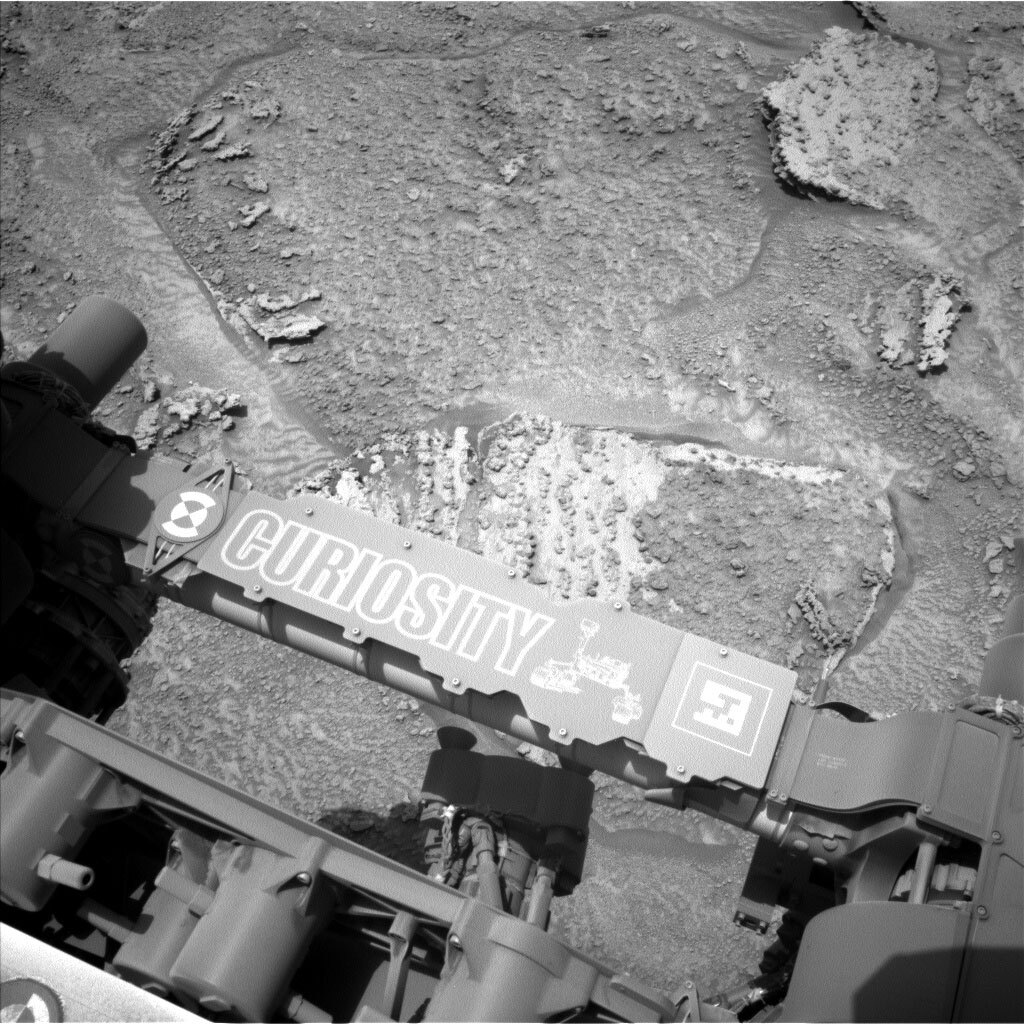
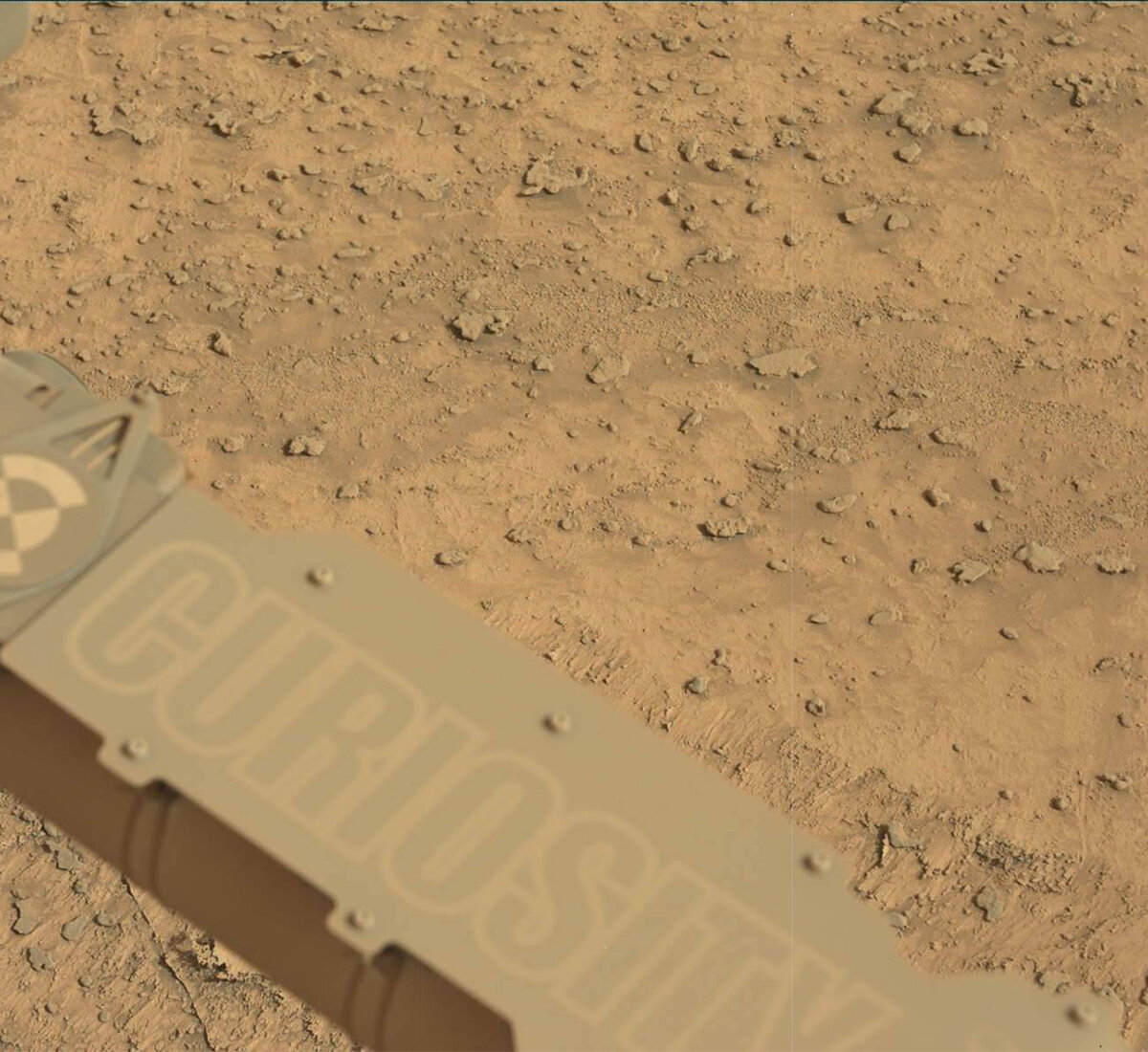
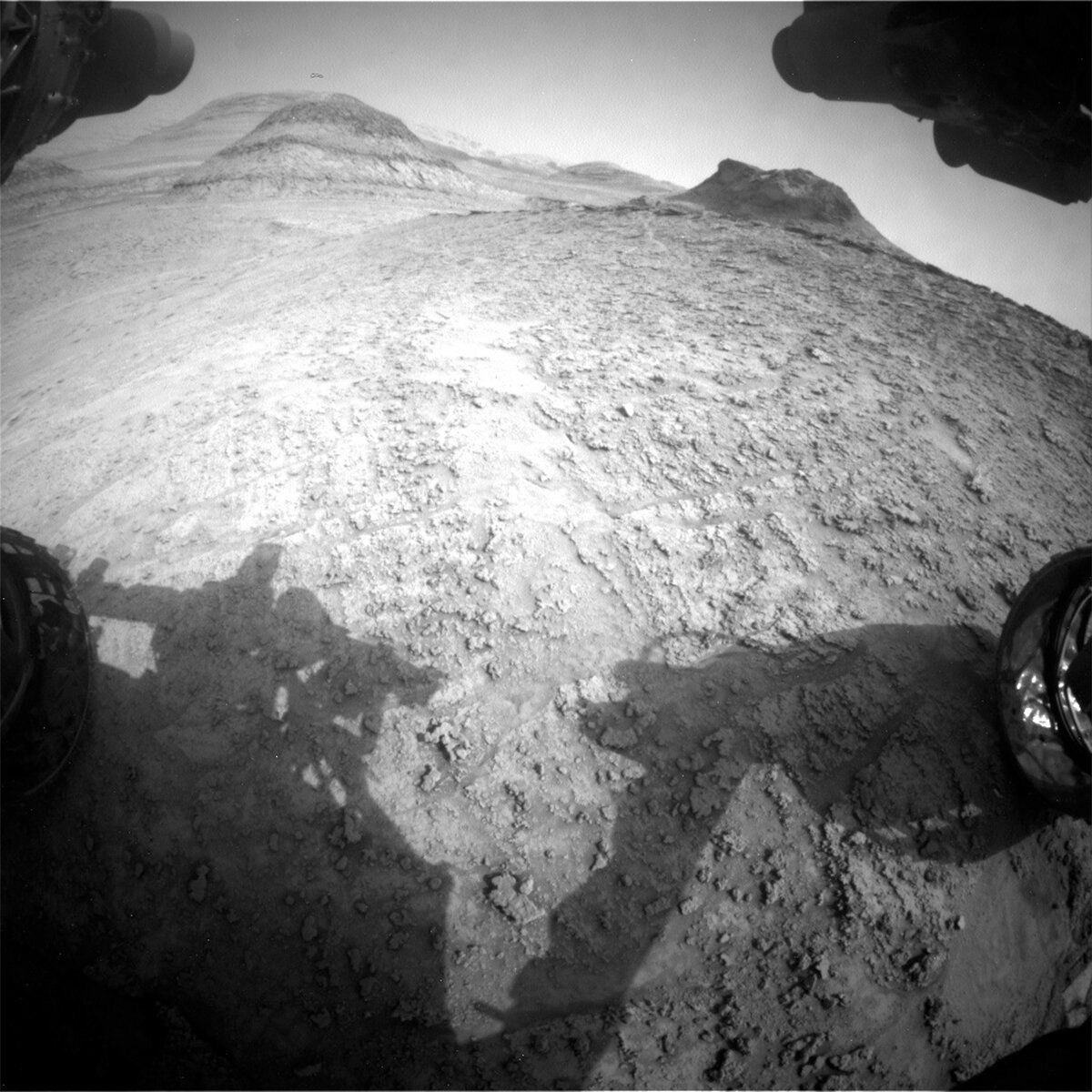
This image was taken by Left Navigation Camera onboard NASA's Mars rover Curiosity on Sol 3714. Credits: NASA/JPL-Caltech. Download image ›

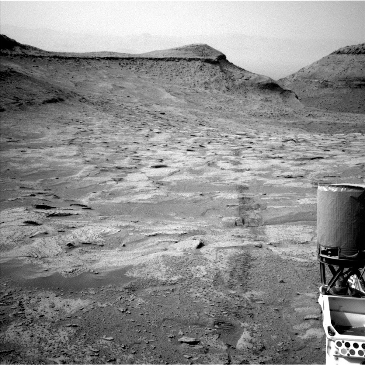
Curiosity's science and engineering team members were back at it today after a holiday long weekend, while Curiosity itself was ready and waiting after its own soliday weekend. With the data from the holiday-soliday plan in hand, Curiosity's team was faced with the decision whether or not to drill our current location, and, if so, where.

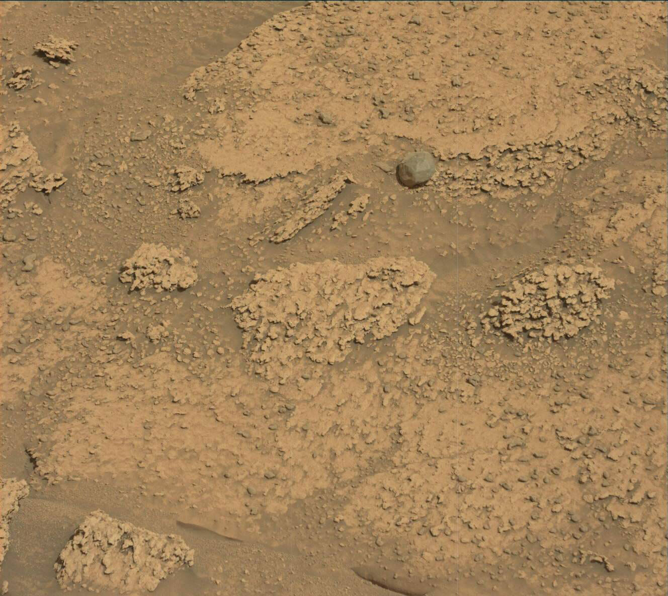
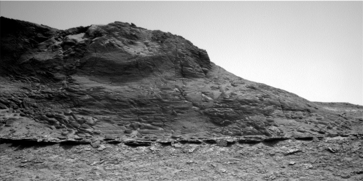
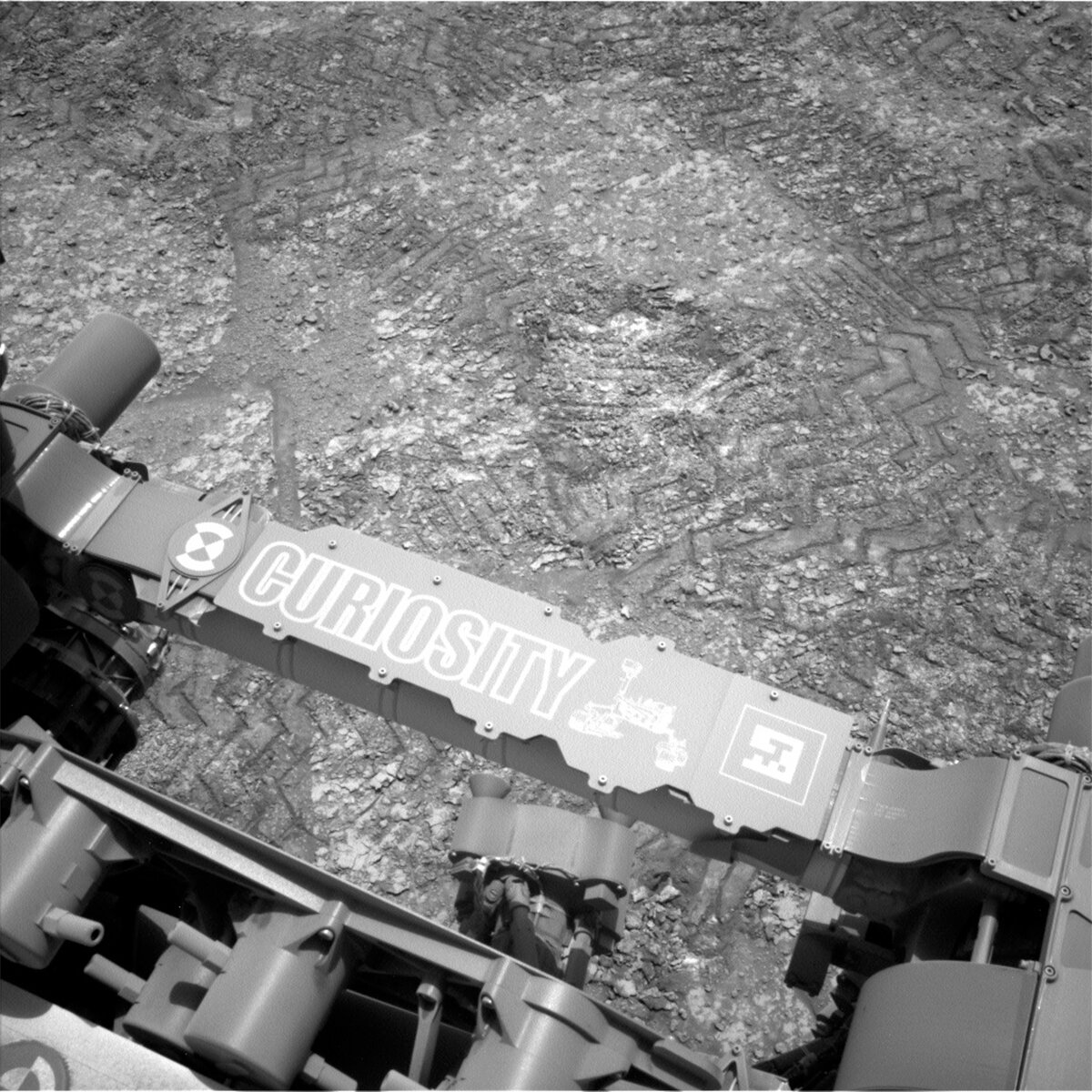
The Marker Band has proven elusive to drill. Curiosity has tried twice prior (e.g., sol 3676 and sol 3682-3683 blogs) and today's workspace, in particular the bright material right above Curiosity's iconic arm in the included image, was hopefully going to prove fruitful on this our third attempt. However, once again, Mars had different ideas as drilling was deemed not possible here due to the nodular and bumpy nature of the workspace. We will instead execute a short drive, or bump, 3 m from our current location to a new location named "Guramoni," where the conditions for drilling look more favourable.

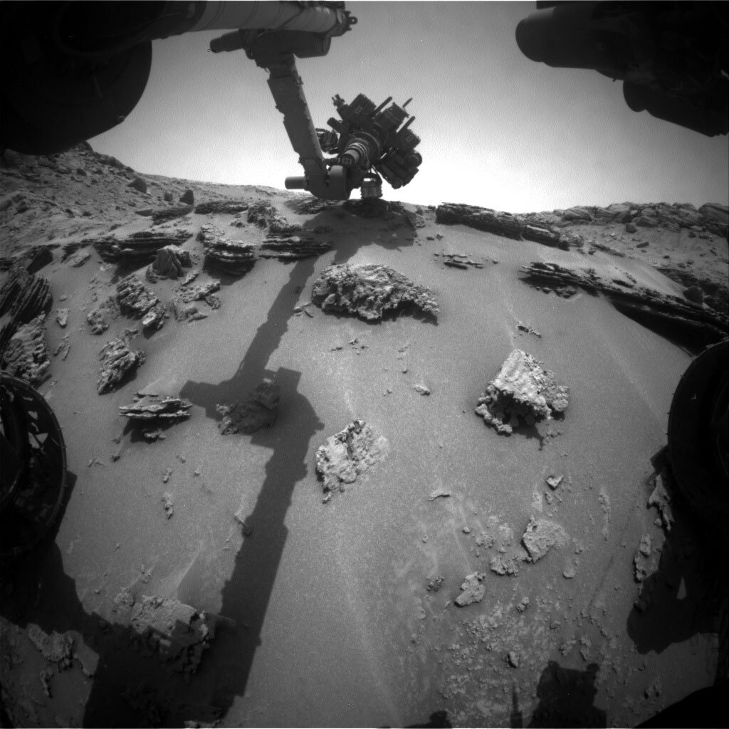
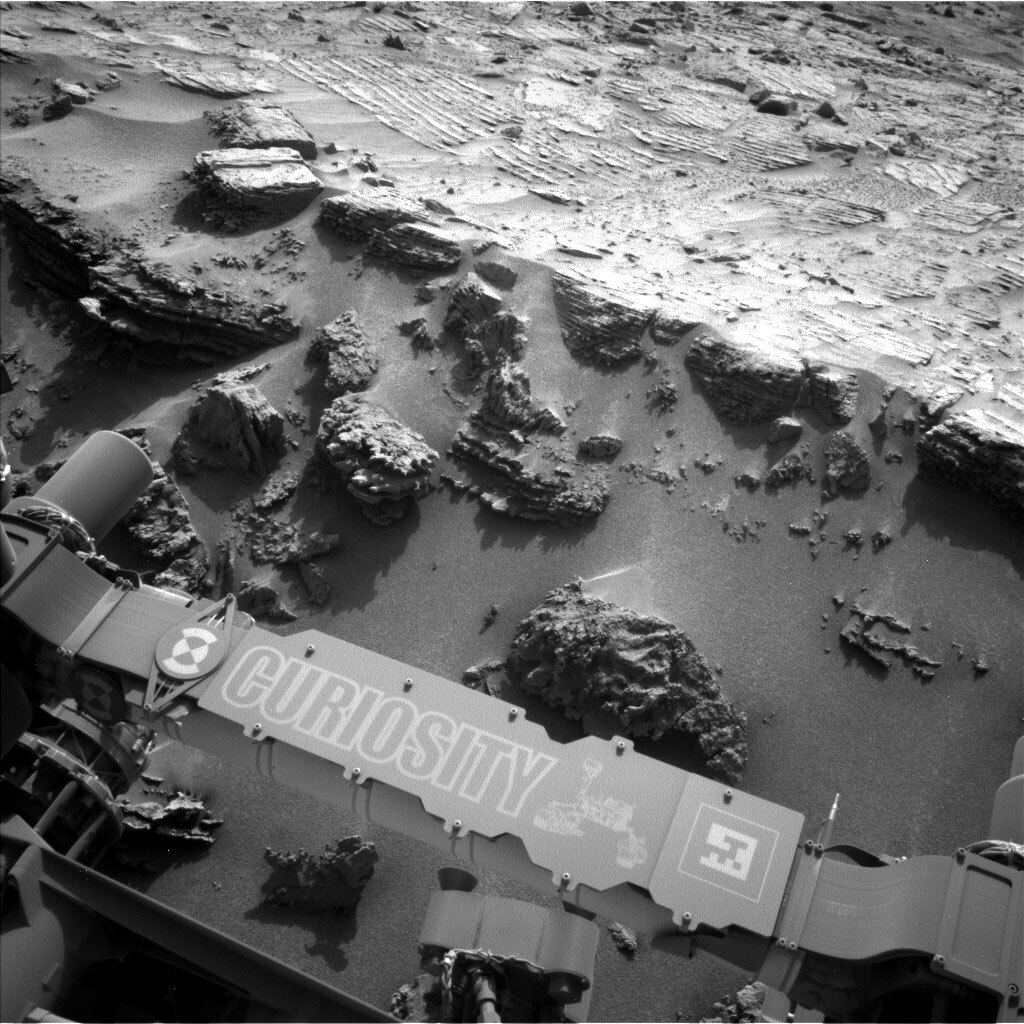
Complementing the drive in today's one-sol plan is a brush of the target "Tarra" followed by a quick touch-and-go APXS analysis as well as MAHLI and Mastcam images. Further imaging and a ChemCam 5x1 LIBS raster on "Faro" round out the activities at our current location ahead of bumping to Guramoni. Finally, Curiosity wraps tosol's planned activities by acquiring the requisite post-drive images, which shall arrive via a MAVEN relay in time for tomorrow's team to assess the new workspace for drilling suitability.

January 16, 2023

Sols 3712-3714: To the Marker Band! (Again)

Written by Abigail Fraeman, Planetary Geologist at NASA's Jet Propulsion Laboratory
This image showing the Curiosity rover's nameplate was taken by Mast Camera (Mastcam) onboard NASA's Mars rover Curiosity on Sol 3708.

This image was taken by Mast Camera (Mastcam) onboard NASA's Mars rover Curiosity on Sol 3708. Credits: NASA/JPL-Caltech/MSSS. Download image ›

We received the data that we had been missing during Wednesday’s planning, so we hit the ground running today, ready to plan for contact science and our drive onto the Marker Band in this new location! Early in planning the Geology and Mineralogy science theme group selected two targets in our workspace that will be brushed and examined with MAHLI and APXS named “Paredao” and “Curupira.” ChemCam will also be able to observe targets in the workspace, hitting one of the contact science targets, Paredao, with its laser, as well as two darker float rocks with interesting textures named “Uaica” and “Paruaina.” Mastcam will image all of the targets, including collecting multispectral images of the two DRTed areas. Mastcam will also collect several large mosaics of the surrounding area, supplementing the awesome imaging we already acquired on this location on Wednesday. The Atmosphere and Environment science theme group also planned observations to continue to assess the environment in the local area.

Our drive will then take us on top of the Marker Band. We are excited to study this unique feature from a new location, and will also be on the lookout for rocks that might make suitable targets for a third drill attempt.

January 11, 2023

Sols 3710-3711: Pausing To Take in the View

Written by Kristen Bennett, Planetary Geologist at USGS Astrogeology Science Center
This image showing part of the Curiosity rover and Martian hills ahead was taken by Left Navigation Camera onboard Curiosity on Sol 3708.

This image was taken by Left Navigation Camera onboard NASA's Mars rover Curiosity on Sol 3708. Credits: NASA/JPL-Caltech. Download image ›

At this point in the mission, the team is very good at responding to tactical surprises. Today, we did not receive the necessary downlink to proceed with the nominal plan. Fortunately, we received enough downlink to know that the last plan finished successfully and the rover is safe. All we need to do is wait for the missing data and keep going! We have enough images to look at the terrain that is in the distance, but not enough to see what is in front of the rover right now. This means we cannot do contact science or drive, but we can take in the view with plenty of long distance images in today’s plan.

Several Mastcam mosaics are included in this two sol plan. First, Mastcam is characterizing some distant terrain at the base of Chenapau that we expect to drive to soon. There is also a Mastcam mosaic that covers Amapa from a different angle. The plan also includes the “Tupaquim” and “Uaiu” mosaics, which both target features that are exposed below the marker band. Tupaquim targets dark-toned bands, and Uaiu targets potentially wavy layers.

The two ChemCam LIBS observations occur a little closer to the rover on targets “Iracoume” and “Moreiru.” These targets are to characterize the closest bedrock that is visible in the images that were downlinked. The plan also includes two long distance RMIs: one on the flank of Chenapau and another on the marker band.

January 10, 2023

Sols 3708-3709: In Search of a New Marker Band Drill Site

Written by Catherine O'Connell-Cooper, Planetary Geologist at University of New Brunswick
Mastcam image of the 3708 workspace.

Mastcam image of the 3708 workspace. Credits: NASA/JPL-Caltech/MSSS. Download image ›

We continue to characterize the Marker Band and the bedrock just below it, with the aim of understanding the origin of the Marker Band. For today’s two-sol plan, in an area below the Marker Band, we planned early morning APXS and MAHLI (Touch & Go) on the brushed target “Jenipapo,” similar to the flattest material in the accompanying Mastcam image. Mastcam will acquire some multi-spectral imaging on the same target, and on the target “Pau Baru,” seen in the upper right of the Mastcam image. This is an unusual grey float rock which may be a remnant of material higher up Mount Sharp or may be a meteorite. We have analyzed a few meteorites over the past ten years, but they are not so abundant that we fail to get excited at the thought of a new one! ChemCam will use LIBS to target some rough textured bedrock at “Cuchivero,” directly below Pau Baru.

Our drives have been taking us alongside the Marker Band. Although the drill attempts at Amapari were not deep enough to be deemed successful drills, the geochemical results from there were intriguing enough to make us look for other similar locations, so that we can try again.

The Marker Band is a long thin horizon, which makes it hard to drill but relatively easy to follow and to pick out in images of the area in front of us. As a result, this plan (like other recent plans) has been chock full of images. Mastcam will take several images of the Marker Band from this location and also at the mid-point of the drive, to help us both understand the stratigraphy of the Band and also to help earmark new potential drill sites for the coming weeks. Mastcam will also document the near environment, looking at bedding structures (“Quitauau”) and fractures just beyond the rover.

Our drive is relatively short (23 metres) but will hopefully place us just below the Marker Band, so that we can assess the chemistry of the bedrock just below it.

January 6, 2023

Sols 3705-3707: Moving Along the Marker Band

Written by Alex Innanen, Atmospheric Scientist at York University
This image was taken by Left Navigation Camera onboard NASA's Mars rover Curiosity on Sol 3703.

This image was taken by Left Navigation Camera onboard NASA's Mars rover Curiosity on Sol 3703. Credits: NASA/JPL-Caltech. Download image ›

Curiosity is continuing to make the most of the new year – both on Earth and on Mars which recently entered Mars Year 37, only a few days before the new year on Earth. After a successful drive along the slope below the Marker Band, we’re ready for a full weekend.

On our first sol, ChemCam has a LIBS observation on the target ‘Waimiri’ followed by two mosaics on the Marker Band and the distant yardang on Mount Sharp. This is accompanied by Mastcam imaging of Waimiri, as well as two other targets, an outcrop ‘Ingarico’ and a butte ‘Amapa,’ and the Marker Band. Mastcam is also doing a tau observation to characterise the amount of dust in the atmosphere. Later in the day, we’re getting up close to two bedrock targets, Waimiri and the nearby ‘Caroebe’ using both APXS and MAHLI.

The second sol starts with a dust devil survey followed by ChemCam LIBS on the nearby bedrock target ‘Uaribooto’ and a mosaic on a distant butte. This is followed by Mastcam of Uaribooto and both Waimiri and Caroebe before we’re ready to move on. We’re continuing to drive further along the Marker Band, but just because we’re driving doesn’t mean that we can’t also enjoy the view. Included in the is further characterisation of the Marker Band with Mastcam.

After we reach our next destination, we round out the weekend with our final sol. AEGIS will find a target for ChemCam to image, and ENV is taking a cloud movie and dust devil movie. Then, later in the sol, Mastcam will get the chance to view an eclipse, when Mars’ larger moon Phobos will transit the face of the sun. The weekend finishes early on the morning of sol 3708 with a morning ENV block consisting of two cloud movies and a tau observation. As we move into winter at Gale Crater, we start to see more clouds, so we like to keep an eye on the sky!

January 3, 2023

Sols 3702-3704: A New Year on Mars and a Brand-New Workspace

Written by Lucy Thompson, Planetary Geologist at University of New Brunswick
This front hazcam image taken by Curiosity shows the thin, resistant Marker band outcrop in top right of the image and the buttes ahead to the south on Mars on sol 3700.

Sol 3700 Front Hazcam image showing our current workspace, the thin, resistant Marker band outcrop in top right of the image and the buttes ahead to the south. Credits: NASA/JPL-Caltech. Download image ›

The team came into our first day of planning for 2023 to learn that all our holiday activities had executed as expected! As Curiosity ages, we are thankful that she continues to do amazing science on Mars, and the holiday plans were no exception. We finished up our investigations at the Marker band (for now anyway), analyzed bright material revealed in a scuff just below the Marker band and drove to the south to continue our climb of Mount Sharp. Our view this morning revealed dusty, in place bedrock with dark fragments scattered over the surface, which do not appear to be in place. These dark fragments may be pieces of the Marker band or they may be associated with the in place bedrock just to the right of the rover. Our activities are focused on documenting the chemistry, texture and context of the rocks in front of the rover, as well as looking further afield at the Marker band as it extends south, and the surrounding and distant buttes.

ChemCam is analyzing two targets (“Uafaranda” and “Aliquelau”) with LIBS to document the chemistry of the bedrock at different distances from the nearby, overlying Marker band. Do we see a change in the composition of the underlying bedrock as we get closer to the Marker band that might indicate alteration associated with the contact? To complement these observations, we are also investigating the “Uafaranda” bedrock target, after brushing to remove the ubiquitous dust cover, with APXS (chemistry) and MAHLI (close-up imaging). APXS and MAHLI will also be used to examine the composition and texture of one of the dark-toned rocks (“Anarem”) that are strewn across the surface. This might help us determine the origin of these rocks. We are also documenting all three of these targets with Mastcam, as well as some nearby regolith-filled troughs (“Aoiau” and “Arraia”).

We will image the Marker band at this location with Mastcam to look for lateral changes in its texture and structure relative to our previous locations, and some nearby buttes (“Alto Alegre”) for context with the surrounding terrain. ChemCam long distance RMI mosaics will also be acquired of sections of two other buttes off in the distance.

On the second sol of this 3-sol, New Year plan we hope to continue our path south by ~50 m. To fully document the terrain below us, and any transitions that may occur as we drive, a MARDI image is planned for after the drive.

The environmental science team were also busy and planned several observations to continue monitoring changes in atmospheric conditions. These include: a Navcam large dust devil survey, a dust devil movie and suprahorizon movie, and a Mastcam basic tau observation. Standard REMS, DAN and RAD activities round out this plan.

December 23, 2022

Sols 3699-3702: A Scuff for the New Year

Written by Abigail Fraeman, Planetary Geologist at NASA's Jet Propulsion Laboratory
This image shows Curiosity's nameplate above the rocky Martian terrain and was taken by Left Navigation Camera on Curiosity on Sol 3690.

This image was taken by Left Navigation Camera onboard NASA's Mars rover Curiosity on Sol 3690. Credits: NASA/JPL-Caltech. Download image ›

Curiosity has executed two out of the ten sols we planned on Wednesday to cover the rover’s activities through the holidays, so the three sols we planned today (sols 3699-3671) won’t actually execute on Mars for several days. The activities we included in the remaining eight sols of Wednesday’s ten-sol plan don’t involve any driving or arm activities, so we picked up today’s planning knowing this (very far future plan) would start with Curiosity looking at the same workspace and ready for science in the new year.

We were thrilled this morning to discover the early holiday present we hoped Curiosity would “unwrap” using a scuff was opened for us, and we had abundant crushed white rocks available in our workspace to observe with our contact science instruments. We selected three targets for MAHLI and APXS observations that included two spots with different amounts of the white material named “Mapuera” and “Mapuera offset” and a dark sand target named “Corume” for comparison. ChemCam is getting in on the action too, measuring the composition of targets named “Urucuri” and “Orinduque” with LIBS, and a passive spectral observation of “Sequereu.” Mastcam rounds out the geology activities, with stereo and multispectral images of the very interesting ground all around the rover at this location. While we’re here, we’ll also collect an active DAN measurement to measure hydrogen (a proxy for water) below the surface. We’ll then drive off, back to our strategic route that climbs Mt. Sharp, and we will collect additional environmental monitoring observations after the drive.

As we roll into a new year here on Earth, it’s nice to reflect on all Curiosity has accomplished over the last 12 months. This time last year we were eagerly about to start our ascent of the Greenheugh Pediment, blissfully unaware of the rough terrain up there that would force us to re-route. Even with this change of plans, we’ve covered so much terrain since then – the spectacular views in “Paraitepuy Pass” and first successful drill into the sulfate unit were highlights of the year for me. I wonder what we’ll be able to say about 2023 at this time next year?

December 21, 2022

Sols 3689-3698: The 10 Days of Christmas (On Mars)

Written by Lucy Thompson, Planetary Geologist at University of New Brunswick
Front Hazcam image taken on Sol 3688 showing the APXS instrument on the rhythmically layered target “Tamandua.”

Front Hazcam image taken on Sol 3688 showing the APXS instrument on the rhythmically layered target “Tamandua.” Credits: NASA/JPL-Caltech. Download image ›

🎵 On the first sol of Christmas, Curiosity will bring to us; one APXS analysis, one ChemCam analysis and a multitude of Mastcam, MAHLI and RMI images! On the second sol of Christmas, Curiosity will bring to us; more ChemCam RMI images, more Mastcam images, more Navcam images and a drive to a new, exciting location. 🎵

To allow for the MSL science team and engineers to take some time off over the holidays, we typically uplink long, multi-sol plans to keep Curiosity occupied while we enjoy the festivities. The rocks currently exposed in front of us have fascinating and beautiful textures, which we are attempting to characterize before we drive away in the second sol of this 10-sol plan. The dark, grey rocks exhibit unusual laminations with uniform spacing and thickness (termed rhythmic), with superimposed rounded and resistant, but hollow protuberances (which we have coined “barnacles,” even though these nodules formed naturally in the rock). What processes were responsible for the formation of the rhythmic layering, and the hollow nodules? How do these rocks compare compositionally and texturally with the immediately underlying rippled bedrock? These are all questions we hope to address with the suite of measurements we made in yestersol’s plan and those we uplink tosol. ChemCam and APXS will measure the composition of the nodules (“Aracara” and “Truaru” respectively), and Mastcam and MAHLI will image those two targets on the first sol. This data can be compared with the compositional data we obtained yestersol on the rhythmically layered rocks (e.g., “Tamandua”). A MAHLI dog’s eye mosaic will also be acquired over a region of the hollowed features (“Wapixana”) to hopefully shed light on their formation process. The dog’s eye mosaic involves a number of images being acquired along the rock face, as close to perpendicular as possible. We will continue to document the rhythmic layering with Mastcam images of a region, “Quixada.”

Before we drive on the second sol of our holiday plan, we will acquire one more ChemCam analysis and Mastcam image of the rhythmically laminated rocks at the target, “Vert-Barauana,” that looks like a relatively freshly exposed face. Before the drive, the ChemCam RMI capability will also be utilized to image the bedrock layer we are currently investigating off to the south.

The drive will take us back to an area that we previously drove over, exposing interesting bright soil and crushed rock. Before we drive, we will capture some of these disturbed bright soils and rocks with Mastcam imaging. The bright soils and rocks will hopefully be in our workspace for the next multi-sol holiday plan. To fully document the terrain below us, and any transitions that may occur as we drive, a MARDI image was also planned.

The environmental science team were also busy and planned several observations to continue monitoring changes in atmospheric conditions over the holidays. These include: a Navcam large dust devil survey and suprahorizon movie; a Mastcam stereo sky column and full tau observation; and an APXS atmospheric measurement. Standard REMS, DAN and RAD activities round out this plan, with the REMS activities occurring in the background throughout the 10 sols.

December 20, 2022

Sol 3688: Arm Day

Written by Keri Bean, Rover Planner Deputy Team Lead at NASA's Jet Propulsion Laboratory
This image was taken by Left Navigation Camera onboard NASA's Mars rover Curiosity on Sol 3687.

This image was taken by Left Navigation Camera onboard NASA's Mars rover Curiosity on Sol 3687. Credits: NASA/JPL-Caltech. Download image ›

We were very glad to come in to today’s planning to see the drive placed us in a perfect position to bring out the robotic arm to do some science!

The rover will spend the first several hours of the sol 3688 plan taking ChemCam and Mastcam. ChemCam will use its laser on the target “Quixada” followed by ChemCam imaging of “Xiriana” and “Xidao.” Then Mastcam takes over with imaging the now-laser zapped Quixada, Xiriana, and the future robotic arm target “Tucuxuma.”

Once that long imaging block is done, we’ll take out the robotic arm to take a cool mosaic of the layered rocks in front of the rover at the target Tucuxuma, along with an APXS integration and some MAHLI imaging of another target “Tamandua.” We are also taking some inspection imaging of APXS. Today was a tricky one for the arm Rover Planners, since all the bumpy and lumpy rocks you can see in the image above made it really hard to find a place to safely put the arm down without risking bumping our turret into the other rocks in the area. I was “RP2” today and I supported the arm Rover Planner in finding targets, evaluating safety of the robotic arm, and also doing the final verification and modeling of the commands.

After the arm activities, the rover will take a short nap before waking up to take a Navcam movie looking for dust devils and sending data back to Earth. The rover then takes another nap, waking up later in the evening for APXS integrations on the Tamandua target. Later that night we’ll clean APXS and move the robotic arm into a safe overnight configuration in the air. After that, the rover will sleep for a few more hours before communicating more data back through our Mars orbiters. The plan also has our standard environmental monitoring activities with REMS, RAD, and DAN scattered throughout. The rover will sleep the rest of the night, preparing for another fun day of science tomorrow!

December 19, 2022

Sol 3687: Looking On Up - Leaving the Amapari Drill Site

Written by Sharon Wilson, Planetary Geologist at the Smithsonian National Air and Space Museum
One Mastcam image that will be stitched together to make a large mosaic of the hills in the distance along the rover’s upcoming traverse.

One Mastcam image that will be stitched together to make a large mosaic of the hills in the distance along the rover’s upcoming traverse. Credits: NASA/JPL-Caltech/MSSS. Download image ›

Slight change of plans! The drive that Curiosity was supposed to complete over the weekend was pulled from her plan, so the rover started the day at the Amapari drill site. We will recover our ChemCam and Mastcam coordinated observation of target “Aricama” to document the bedrock composition of the Marker Band. ChemCam will also acquire passive spectroscopy of the bedrock from the “Puraque” target. The “Sao Luiz” target will be analyzed by Mastcam to image the dark layers at the Marker Band and its relationship to the surrounding rocks. Mastcam will also image the “Jundai” target to see if a part of a rock was broken off when the APXS instrument touched it over the weekend. The rover will collect multispectral Mastcam imaging on a layered hill, or butte, named “Chenapau” to document the tonal variations of the layers, while ChemCam plans to take two long distance RMI images of an inverted channel to provide information about the sediments and structure within the channel. The MAHLI instrument will recover imaging that was lost in the previous sol plan at “Jundia,” the “Amapari” drill cuttings, and the “Urutanim” target that was previously investigated by ChemCam. Curiosity will then drive away from the Amapari drill site and MARDI will collect a systematic set of images to create a “sidewalk” video of the rocks and soils along the way. Rounding out the plan, the environmental theme group will use the Navcam instrument to search for dust devil activity. By the end of the sol, Curiosity will be parked back at the rhythmically layered rocks and interesting nodules below the Marker Band – stay tuned for more amazing images and data!