December 16, 2022

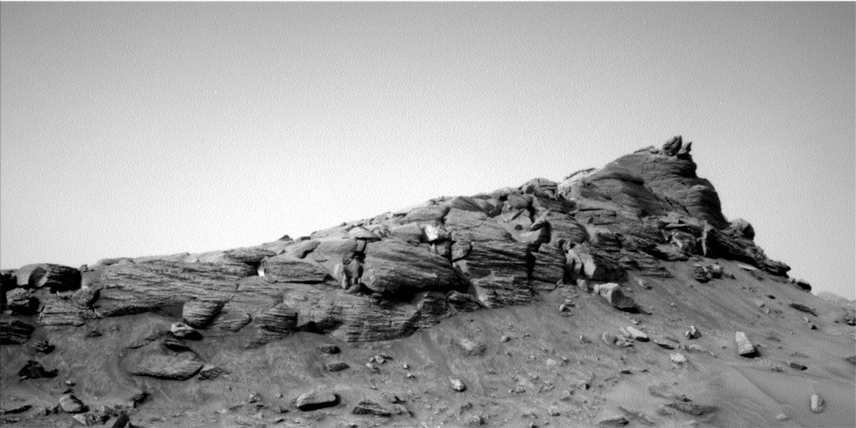
Sols 3684-3686: The Calm After the Rock-Toddler-Tantrums

Written by Susanne Schwenzer, Planetary Geologist at The Open University
This image was taken by Mast Camera (Mastcam) onboard NASA's Mars rover Curiosity on Sol 3682.

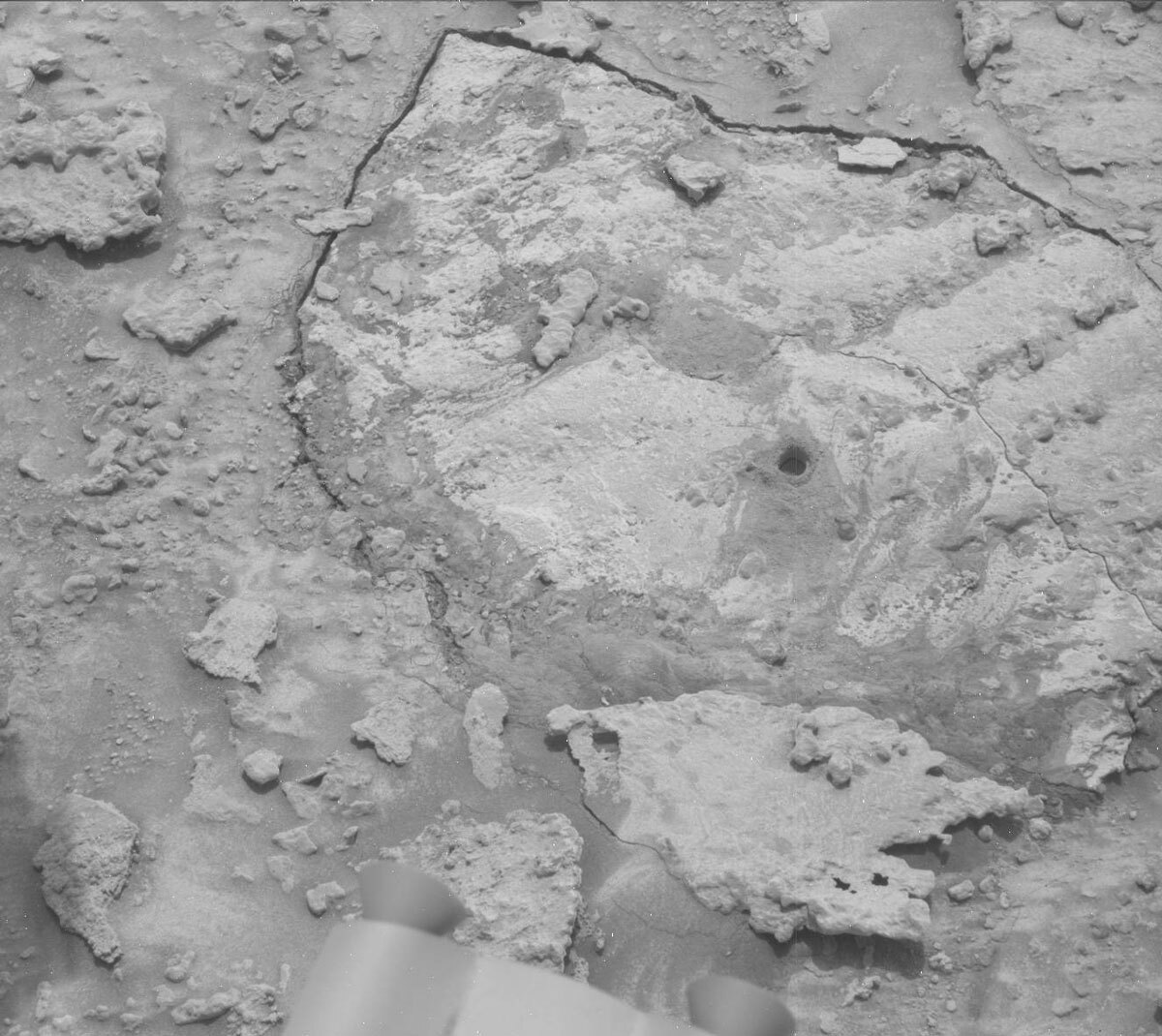
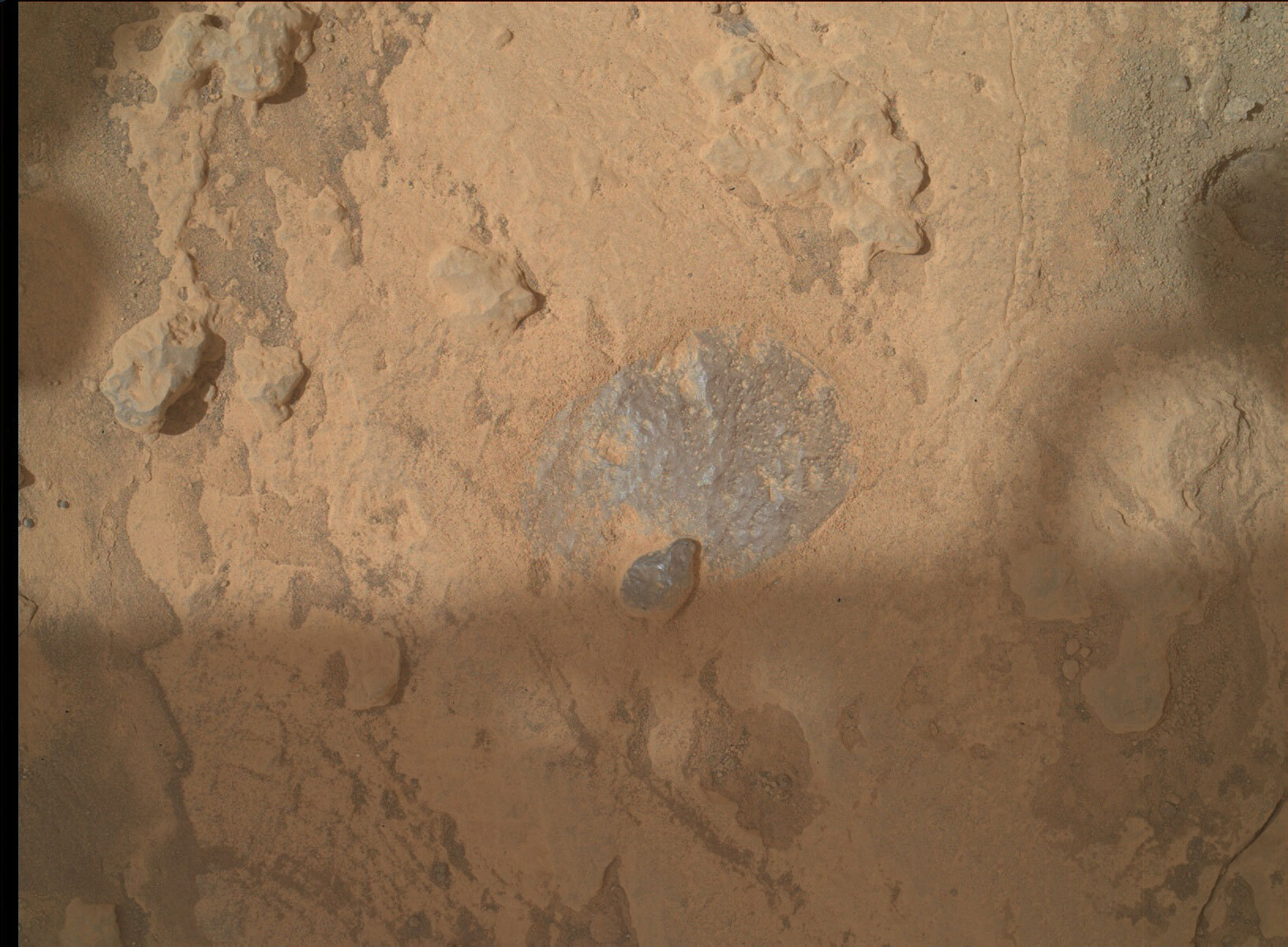
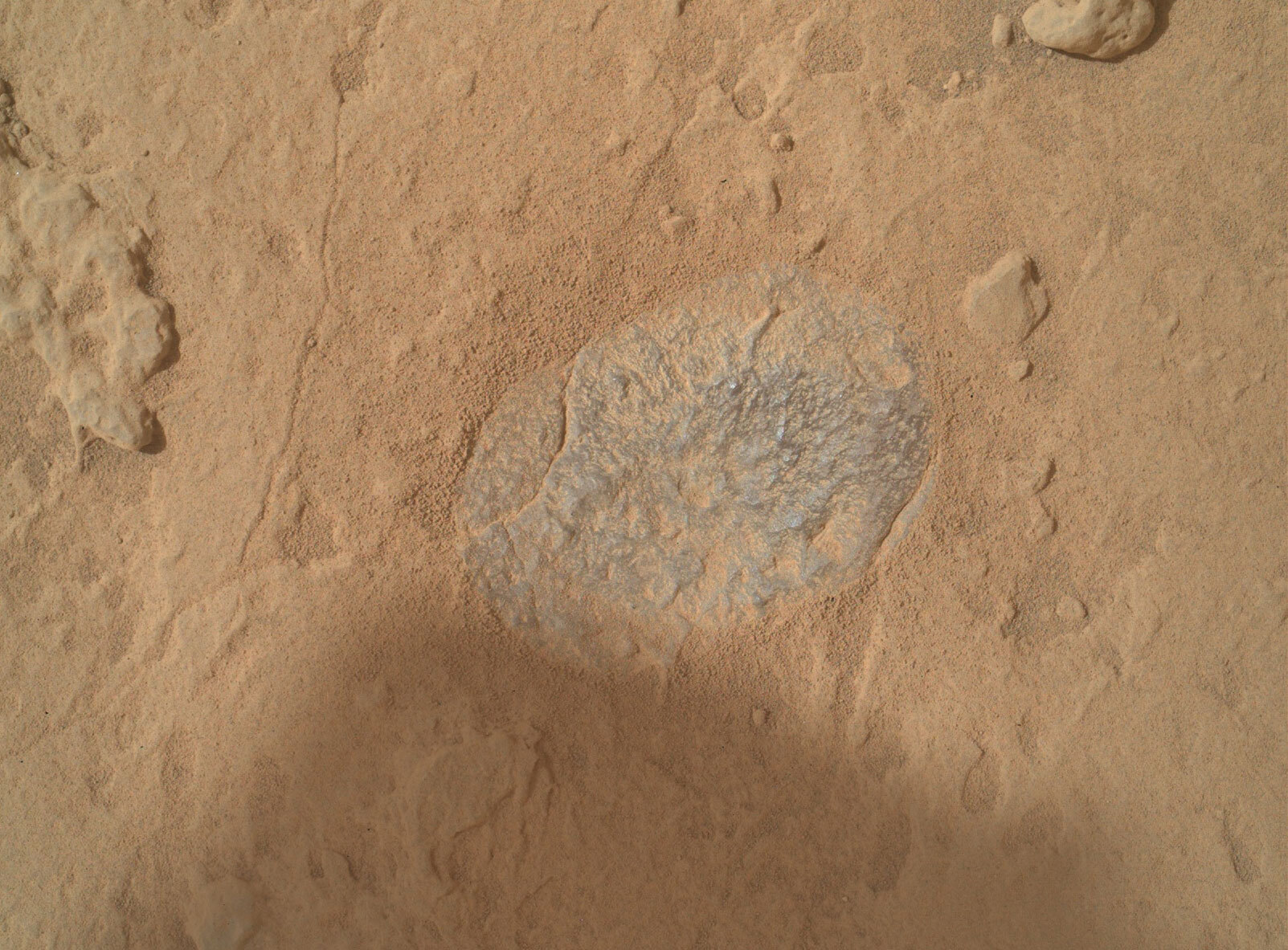
This image shows the “Amapari” drill hole, unfortunately not quite as deep as the team on Earth hoped. The image was taken by Mast Camera (Mastcam) onboard NASA's Mars rover Curiosity on Sol 3682. Credits: NASA/JPL-Caltech/MSSS. Download image ›

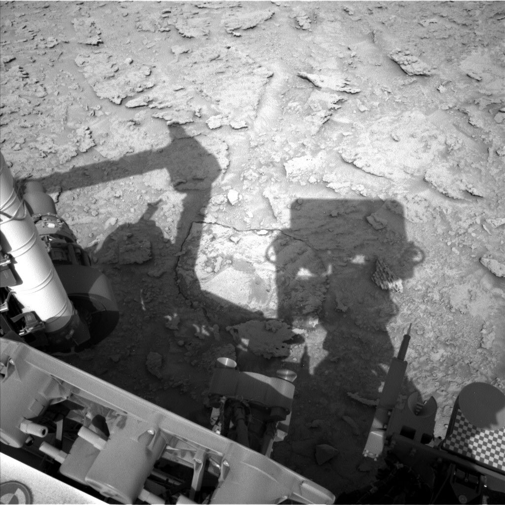
Sometimes, I think Mars rocks are just a bunch of toddlers whom we have told to tidy their play room. And the more we want something, the more resistance we get. The latest episode of ‘This-rock-is-too-hard-to-drill, says the rock,’ reminded me of our drill attempt at Vera Rubin Ridge. In June 2018, we had drilled Duluth and also weathered the dust storm. We then tried to drill a specific type of rock with a hematite mineral signature observed from orbit. Looking back at July 2018, we can re-live that story. First was target ‘Voyageurs’ and my colleague Lauren Edgar entitling her blog ‘Hard as Rock’ after the drill only made a dent into the surface, and only got a little further into the rock at target ‘Ailsa Craig’ (see ‘It’s a Hard Rock Life’ by Ryan Anderson). Well, reading the past few blogs from December 2022 made me remember all that. Deja Vu, but let’s hope we get it this time, as the rocks we want to drill would provide an important piece of information about the changes in the landscape we observe on the images, and also the chemistry that we observe with ChemCam and APXS.

Today, though, was a calm and regular planning day, which had us plan three sols, knowing what we wanted to do from the get go and no surprises to scramble around. That’s welcome at a time where many of us are scrambling in other parts of our lives to get the holiday shopping done, and such… you know what I am talking about here on Earth at that time of the year, right? But that doesn’t mean we won’t keep the rover busy with exciting science.

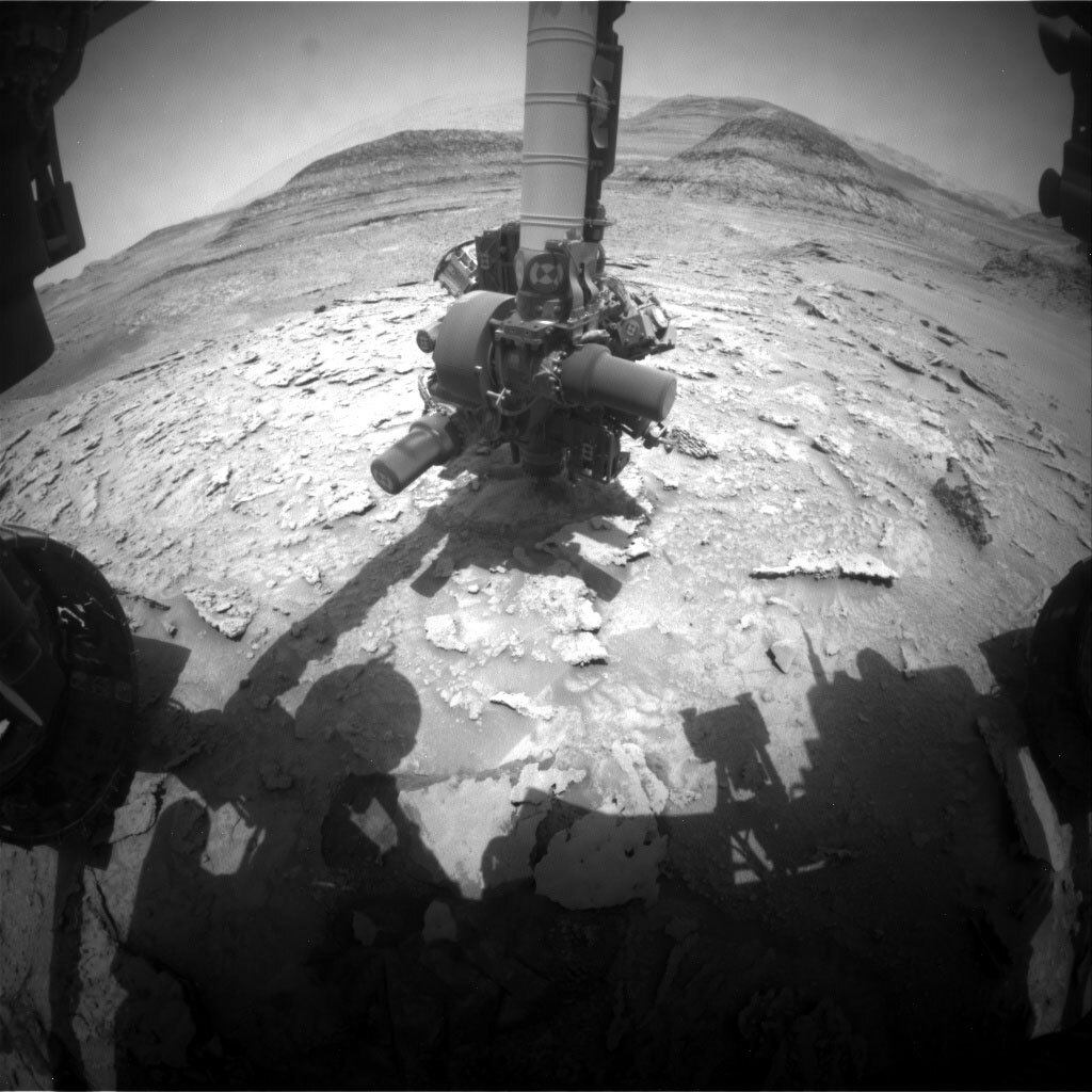
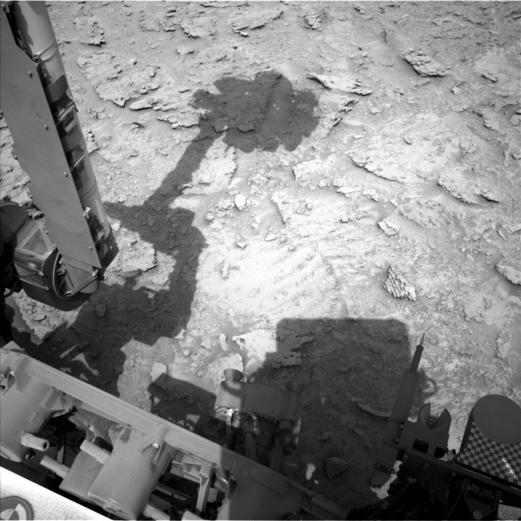
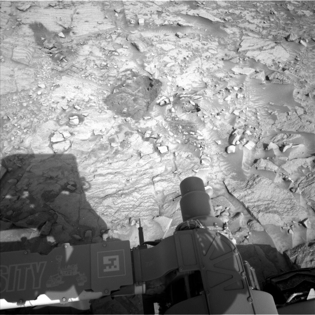
APXS and MAHLI will investigate target “Jundia,” a target that looks nodular, target “Urutanim,” which was already investigated by ChemCam in the previous plan, and finish up our drill activities by looking at the Amapari drill tailings.

Mastcam will continue its feast to image the beautiful and hugely interesting scenery around us. It will look at the workspace and extend the coverage there, but also document all the ChemCam activities in this three sol plan. More into the distance it will look at the target “Sao Jorge” and then complete our activities around this rock-toddler-tantrum drill site with a 360° mosaic.

ChemCam has a busy time, too, with three LIBS targets in the plan. It will look at both Amapari drill holes, and in addition at the nearby target “Aricama.” ChemCam also used its imaging capability to get close looks at two interesting areas, one is the continuation of the rock type we tried to drill, and at a sedimentological feature in the distance that could be what is known as inverted channel – a feature where the surrounding of an ancient, fossilized stream bed are harder than the rock formed from the materials that surrounded that stream bed. Therefore, we still see the streambed, as a positive relief feature, and the former surroundings have weathered away. We will see what the close up images reveal there! Add MARDI imaging, ENV activities and a drive, and we have a very busy sol on Mars!

December 14, 2022

Sols 3682-3683: Perspective

Written by Scott VanBommel, Planetary Scientist at Washington University
This image was taken by Left Navigation Camera onboard NASA's Mars rover Curiosity on Sol 3681. Credits: NASA/JPL-Caltech.

This image was taken by Left Navigation Camera onboard NASA's Mars rover Curiosity on Sol 3681. Credits: NASA/JPL-Caltech. Download image ›

In yesterday’s blog, Natalie Moore wrote of our continued attempts to drill “Amapari” and word from our beloved rover that our drill was still on the ground when data arrived from Mars. Today we received confirmation that the arm had retracted from the surface, exposing the hole that prompted an earlier than expected termination of our latest drill attempt. These latest data confirmed we did not reach the desired depth and there was insufficient sample in the drill stem for analysis by CheMin and SAM. As such, the team decided not to pursue portion characterization activities and is considering foregoing further drilling attempts here. Instead, we are considering potentially sampling from the “Marker Band” when we expect to cross it again during our continued traverse up Mount Sharp.

It is easy to look at the post-drill images acquired of the workspace, such as the one headlining this blog (with the rover’s shadow nicely framing our drilled bedrock, itself outlined from its surroundings by cracks or voids that formed under the duress of the rover’s interrogation attempt) and think we did not get what we wanted here. But that’s hardly the whole story. Our intrepid decade-plus-old rover did her job remarkably. She drilled into the rock, noticed something was not right, and stopped. These safety mechanisms are in place should a situation just like this occur, potentially preventing more dire issues from arising such as irreversible damage to rover hardware.

Our drilling efforts at Amapari prompted me to take a broader perspective and remember what we are doing at a fundamental level. It can be easy to take for granted many aspects of exploring with our rover, as if there’s a magic wand we wave and a day or two later juicy morsels of data come from Mars in various forms, confirming or contrasting scientific theories we may have. But there is no magic wand. Decades of hard work and meticulous planning went into crafting a spacecraft and gently landing it on the surface of another planet. Curiosity is commanded by a remarkable international team spanning numerous disciplines. Together, we make these plans a reality.

We are exploring another world through the digital eyes of cameras built over a decade ago. The images acquired provide us with the data we need to not only drive and conduct image-based science, but also to deploy our 2.3 meter long robotic arm, the end of which has a 30 kg toolbox (referred to as a turret) equipped with a high-resolution camera (MAHLI), an X-ray spectrometer (APXS), a brush (DRT), a scoop, and our percussion drill. The fact that we are able to place these instruments at the end of a long and massive arm, with cm-to-sub-cm accuracy, on another planet, using only images, is remarkable in and of itself, whether it be to drill, or, as in today’s plan, acquire high-resolution images and in situ compositional data.

In today’s plan we acquired MAHLI images of the Amapari drill hole and tailings, as well as APXS geochemical analyses of the tailings and nearby mini-drill. These activities are complemented by ChemCam and Mastcam images of our drill workspace; the team opted to forgo LIBS analyses of the drill tailings given the potential to redistribute the drill tailings ahead of our APXS activities. To me, today also served as a reminder to maintain perspective and to not take for granted the complexity of executing a plan, and to not forget how capable our rover and team are, especially when Mars seemingly has its own agenda. In the days or weeks ahead, we will leave this location. Fresh landscapes and discoveries compel us forward.

December 13, 2022

Sol 3681: The Sequel Continues!

Written by Natalie Moore, Mission Operations Specialist at Malin Space Science Systems
This image was taken by Front Hazard Avoidance Camera (Front Hazcam) onboard NASA's Mars rover Curiosity on Sol 3680.

This image was taken by Front Hazard Avoidance Camera (Front Hazcam) onboard NASA's Mars rover Curiosity on Sol 3680. Credits: NASA/JPL-Caltech. Download image ›

This morning’s sol 3681 planning started 2.5 hours later than usual due to orbiter timing, which gave all of us plenty of time to wait impatiently for the resulting data of our second drill attempt at “Amapari2" to radiate from Mars at ~10am PST. The drama started right away as the data arrived ~20min after we had expected and our whole day depended on the drilling outcome. Finally, we saw it: our arm, and most importantly our drill, were still on the ground (see cover image)! Our chatting platform was abuzz with what that meant: our second attempt to drill the Marker Band at Amapari did not complete as planned due to a loss of pressure under the drill (perhaps because the drill reached a void), and we had some on-the-fly planning to do.

While the engineering team combed through the data to figure out next steps for the arm, the science team came up with a few options for what we could plan on sol 3681. Days like this can be challenging for the uplink team since the amount of time, power, and daylight for activities are up-in-the-air until the recovery activities are figured out. However, thanks to the hard work of our engineers and project team members, the plan was pretty much set by ~1:30pm PST which allowed the uplink team to proceed without further delays.

The good news about the arm on the ground is that our mast instruments were free to target images wherever else in the landscape they desired. So before doing anything with the arm this plan, the science team planned a midday remote science block including ChemCam, Mastcam, and Navcam activities of the martian landscape. ChemCam will start us off with five laser shots on bedrock target “Koropicai” off to starboard of the arm and a remote-micro-image (RMI) mosaic of a distant ridge we’ve been calling the “inverted channel.” Mastcam will take over after ChemCam with a documenting color image of the fried Koropicai target and ~100 stereo frames of the landscape to help complete coverage while we’re still in this location (reminder: we’ve been sitting in the same spot since 3672 - that’s a lot of time for Mastcam!). Finally, Navcam will point generally south for a 30min movie to hopefully catch some dust devils on the horizon.

After we get some remote science in, the arm will attempt to retract off the ground (taking lots of documentation images while doing so) and move into the intended overnight pose off to port for sols 3682-3683 planning tomorrow. While the Amapari2 drill attempt did not get to full sample depth, there’s reason to hope we may still have some sample to analyze in the drill stem. If all goes well with this plan, the team may decide to deliver whatever sample was collected to CheMin and proceed down our usual drill sol path! Stay tuned, the story of the Amapari drill site will continue evolving tomorrow.

December 12, 2022

Sol 3680: Amapari 2 - The Sequel

Written by Alex Innanen, Atmospheric Scientist at York University
NASA's Mars rover Curiosity acquired this image using its Mars Hand Lens Imager (MAHLI), located on the turret at the end of the rover's robotic arm, on December 10, 2022, Sol 3677 of the Mars Science Laboratory Mission.

NASA's Mars rover Curiosity acquired this image using its Mars Hand Lens Imager (MAHLI), located on the turret at the end of the rover's robotic arm, on December 10, 2022, Sol 3677 of the Mars Science Laboratory Mission. Credits: NASA/JPL-Caltech/MSSS. Download image ›

Following the weekend’s triaging, we decided to go ahead with drilling at “Amapari2,” which while similar to the original “Amapari” will hopefully prove easier to drill. Because we are only planning a single sol today, this means the plan is mostly devoted to drilling, which is fairly resource intensive. Despite this, the GEO team was still able to work with the limited power and time to squeeze in some observations before the drilling. ChemCam is doing LIBS on a nearby bedrock target, “Paracau,” as well as getting a long distance mosaic of the base of the inverted channel, part of which they also imaged a few sols ago. Mastcam is also bringing a mosaic into the plan, on the flank of the butte “Amapa.” On the ENV side of things, it’s a pretty quiet day, with only our standard REMS and DAN activities.

December 9, 2022

Sols 3677-3679: Let's Try That Again Amapari!

Written by Catherine O'Connell-Cooper, Planetary Geologist at University of New Brunswick
This image was taken by Front Hazard Avoidance Camera (Front Hazcam) onboard NASA's Mars rover Curiosity on Sol 3676.

This image was taken by Front Hazard Avoidance Camera (Front Hazcam) onboard NASA's Mars rover Curiosity on Sol 3676. Credits: NASA/JPL-Caltech. Download image ›

On Wednesday, we uplinked a drill plan, to drill the target “Amapari” in the Marker Band. Coming into planning this morning, we learned that the drill was only able to penetrate 7 mm into the hard rock here, and this was not deep enough for the drill to collect sample that could be analyzed by CheMin and SAM. Fortunately, the RPs examined the workspace this morning and found a second similar area, and we are going to try again.

Each drill campaign follows a very strict set of guidelines – each target needs to be carefully triaged to determine chemistry and physical properties of the rock itself. So, even though we are still on the same block, just over 10 cms away from the original target, we have to reset and do the full triage again.

Accordingly, we will brush the new target “Amapari2” and then subject it to a thorough investigation of the geochemistry using APXS and ChemCam. Mastcam will image the multispectral signature of the brushed target and MAHLI will take a full suite of images looking at the morphology, particularly following the “preload” test, where the RPs put pressure on the target to get an idea of how it will react during the drilling process. This data will be downlinked to Earth over the weekend, giving us time to process it and see if this is a worthy drill target.

In addition to characterizing our potential drill target, Mastcam and ChemCam will investigate beyond the immediate workspace while we are parked here. ChemCam will use LIBS to analyse a float rock (“Pauxiana”) which appears to have come from the Marker Band and a patch of more resistant appearing material (“Macuxi”) just above the float rock. Mastcam will take a series of mosaics, expanding our current coverage of this area and a large mosaic of the side of the butte “Bela Vista” to document the stratigraphy on its east side.

ENV will continue their ongoing mission to document changes in environmental conditions in Gale crater. Mastcam will take solar tau measurements on each sol of the plan to measure the dust in the atmosphere sol 3677 and a sky survey. Navcam will take a “suprahorizon” movie and a pair of “zenith” movies, which are used to examine martian clouds, their properties and abundances. The zenith movie looks directly upwards to look at clouds and their direction, whilst the suprahorizon movie is targeted in a more horizontal direction, aimed at the crater rim. A third type of Navcam movie (“dust devil” movie) will be aimed lower than the suprahorizon movie, to search for dust devils across the crater floor or the slopes of Mt. Sharp – these can tell us about surface heating conditions, convection and winds near the surface. Finally, there were also standard RAD, REMS and DAN activities.

December 7, 2022

Sol 3676 Another: 'Bore-ing' Day on Mars

Written by Ashley Stroupe, Mission Operations Engineer at NASA's Jet Propulsion Laboratory
NASA's Mars rover Curiosity acquired this image using its Mars Hand Lens Imager (MAHLI), located on the turret at the end of the rover's robotic arm, on December 7, 2022, Sol 3674.

NASA's Mars rover Curiosity acquired this image using its Mars Hand Lens Imager (MAHLI), located on the turret at the end of the rover's robotic arm, on December 7, 2022, Sol 3674. Credits: NASA/JPL-Caltech/MSSS. Download image ›

After yesterday’s check-out, Curiosity is GO to attempt to make our 37th drill hole on Mars. The prior plan’s DRT cleaned up our target Amapari beautifully – it is in the middle of the clean area in the attached MAHLI image. Today is just a one-sol plan, but it is a full one!

Before drilling, we have a short amount of time for imaging. Drilling take a lot of time and power, so we had to limit what else we could fit in today. The rover will be examining a representative bedrock target named “Coimin” with Mastcam and ChemCam LIBS. Mastcam is also taking a large 16x9 stereo mosaic to the southeast of an area named “Amapa,” while ChemCam is taking a 12x1 long-distance RMI mosaic to the north to cover the inverted channel.

Since drilling requires a lot of energy, Curiosity will take a nap before proceeding. As one of the Rover Planners today, I helped to sequence the arm activities. Drill days are always challenging because when we redesigned drilling to keep the drill bit extended, we had to build in a lot of extra sequencing to make it work and do it safely. This means it takes our tools a long time to simulate it and can make the planning day a little longer. Today, we begin with locating and imaging a target we will need later when we clean the sample out of the drill. We select this target to be out of the main part of the workspace so we won’t dump drill tailings on top of anything interesting. We then place the drill on Amapari and start drilling. We are aiming for a depth of 35mm in order to get enough sample for all of the CheMin and SAM experiments we want to do here. This can take up to three hours, depending on how hard the rock is, and we can never really know until we try to drill. Other recent drill targets have been relatively soft, and hopefully Amapari will be in family. After we complete drilling, we will take Navcam and Mastcam stereo images of the (hopefully) new drill hole and then park the arm in a configuration that is safe for overnight.

Before falling asleep for the night, we will also take a DAN active observation.

December 5, 2022

Sols 3674-3675: Evaluating a Possible Drill Location

Written by Lauren Edgar, Planetary Geologist at USGS Astrogeology Science Center
This image was taken by Left Navigation Camera onboard NASA's Mars rover Curiosity on Sol 3672.

This image was taken by Left Navigation Camera onboard NASA's Mars rover Curiosity on Sol 3672. Credits: NASA/JPL-Caltech. Download image ›

The weekend drive went well and Curiosity is back on top of the marker band, investigating some intriguing rippled bedrock. We’re assessing whether we want to drill at this location, based on what we see in the chemistry data. So today’s two-sol plan is devoted to collecting data from APXS and MAHLI (supplemented by ChemCam and Mastcam), to evaluate the bedrock in our workspace, as seen in the above Navcam image. The target of interest is the bright rippled bedrock slab in between the shadow from the arm and the shadow from the mast in that image.

I was on shift as LTP today, and it was fun to think about the possibility of drilling here, and what our options would be if we decide not to pursue that. The team put together a lot of great activities to characterize this block and the surrounding area. First we’ll use the DRT to brush off a clean surface at a target named “Amapari.” Then APXS will do a short integration to provide data down in time for planning on Wednesday. ChemCam will assess the chemistry of the darker crest of a ripple at “Trovao” and Mastcam will collect a stereo mosaic over the workspace. Mastcam will also document the morphology of some nearby ripples, and take a multispectral observation of the DRT target “Amapari.” Later in the afternoon, MAHLI will image “Amapari” and another ripple crest named “Orocaima.” Then APXS will acquire two longer nighttime integrations on those targets. The second sol includes ChemCam LIBS on “Amapari” as well as a long distance RMI to assess an inverted channel. The plan also includes several environmental monitoring activities to search for dust devils and monitor the opacity of the atmosphere. Can’t wait to get the data down and hopefully plan our next drill!

December 2, 2022

Sols 3671-3673: Second Time's the Charm

Written by Elena Amador-French, Science Operations Coordinator at NASA's Jet Propulsion Laboratory
This image of a Mars mountain was taken by Left Navigation Camera onboard Curiosity on Sol 3667.

This image was taken by Left Navigation Camera onboard NASA's Mars rover Curiosity on Sol 3667. Credits: NASA/JPL-Caltech. Download image ›

As happens occasionally, our previous plan did not execute quite as expected. There was an issue with the rover’s avionics in Wednesday’s plan just before MAHLI was to take images of our contact science target “Roxinho.” This precluded that imaging, the subsequent drive and observations taken from our remote sensing mast. Thankfully our engineering team here at JPL assessed the fault and felt comfortable clearing us for nominally planning this morning.

As Science Operations Coordinator, I work closely with the JPL engineering team and the science team. My job on a morning like this is to take stock of what activities we need to recover from the previous plan with the fault, make sure they make it into today’s plan and then consider what additional activities we have the resources to bring in.

As is typical for a 3-sol Friday plan, we were able to bring in contact science as well as a drive. We worked to recover the “Roxinho” MAHLI target, but also brought in a new target “Shabono” which we will brush to remove any pesky dust and will inspect with both MAHLI and APXS. Shabono is another example of the lovely rhythmically layered bedrock we discussed in yestersol’s blog. We are also using our MAHLI camera to image our CheMin inlet funnel for any remaining debris after our “Canaima” drill campaign back in October, this is a lien we have been tracking and is required before we deliver new sample to CheMin, hopefully soon!

We will recover the same drive previously planned on Wednesday – this drive will be about 15 meters and will set us up to perform contact science on an interesting slab of bedrock that the science team is considering for our next sampling campaign.

Our third sol includes typical untargeted observations – using our ChemCam AEGIS capabilities to autonomously select a LIBS target (it’s so nice when the rover does the thinking for us!), as well as our regular environmental monitoring observations.

November 30, 2022

Sols 3669-3670: Analyzing the Rhythmically Layered Bedrock Above the Marker Band

Written by Sharon Wilson, Planetary Geologist at the Smithsonian National Air and Space Museum
This image was taken by Left Navigation Camera onboard NASA's Mars rover Curiosity on Sol 3667.

This image was taken by Left Navigation Camera onboard NASA's Mars rover Curiosity on Sol 3667. Credits: NASA/JPL-Caltech. Download image ›

Curiosity drove ~25 meters back toward the Marker Band from our detour to the Gediz Vallis Ridge and has returned to the rhythmically layered bedrock we observed on Sols 3648-3649. The first time Curiosity encountered these rocks we were unable to analyze them because one of the rover’s wheels was perched on a rock. Now that we are parked safely, we will use a “Touch and Go” approach where Curiosity will have a busy morning collecting images and data before driving ~15 meters to our next location.

On the first sol of this two-sol plan, the rover will characterize the rhythmically layered bedrock at the “Roxinho” target using a suite of instruments including the Dust Removal Tool (DRT), APXS, MAHLI, ChemCam LIBS, and Mastcam Multispectral. Multispectral Mastcam images are also planned at “Niquia” to document bright soil near the rover and at “Jufari” to examine rocks that were broken by the rover wheels. Mastcam stereo images will document the rhythmically layered bedrock at “Sao Jorge” and the structures in the Marker Band at “Uatuma Anaua.” To round out our imaging, ChemCam will use its Remote Micro-Imager (RMI) to take images of the Gediz Vallis ridge in the distance to study the contact between inverted channel deposit and underlying Mt. Sharp Group rocks. The science on Sol 3670 will include ChemCam AEGIS and basic tau observations.

November 28, 2022

Sols 3667-3668: Back to the Marker Band

Written by Natalie Moore, Mission Operations Specialist at Malin Space Science Systems
This image of Canta was taken by Curiosity's left navigation camera on sol 3665.

This image was taken by Left Navigation Camera onboard NASA's Mars rover Curiosity on Sol 3665. Credits: NASA/JPL-Caltech. Download image ›

Still stuffed and feeling thankful our weekend plans were successful! This morning’s downlink showed we had more power to play with than was modeled last week, this time due to the SAM activities running conservatively on Sols 3662 and 3663 (Thanksgiving and the day after). From this “power gift” we were able to add a whole hour to our remote science time and use our DRT for a full sol of science before continuing our journey back down into Marker Band valley pre-sunset on Sol 3667.

The first sol is always the busiest on these “restricted” plans, this time because the decisional data needed for Wednesday planning has to be transmitted on the Mars Reconnaissance Orbiter pass at ~2am on the second sol for us to use. Side dive as a reminder of off-Earth scheduling weirdness… since a Mars sol is ~40 minutes longer than an Earth day, every ~38 Earth days we skip one sol of Mars planning to allow the planets to sync back up and call it a “soliday.” After each soliday, we’re able to get Mars data earlier in the Earth day and have a week or two of “unrestricted” planning before slowly losing sync with Mars and transitioning back to “restricted” sols as our data arrives on Earth later. Our next soliday is currently scheduled for next Thursday, 12/8/22, and until then we’ll be in restricted planning.

Our team knows how to make the most of these plans, though; we’re planning two remote science blocks and two arm backbones pre-drive! The first remote science block will run ~10:50am while the arm heats up and contains only Mastcam mosaics, but totaling 17 stereo frames on nearby targets: 12 frames on fractured bedrock and sand ripples at “Demeni,” 4 frames on large float block “Tarame,” and a single frame on possible layered bedrock at “Ajarani.” After that the arm should be heated and ready to dust off some workspace bedrock with our DRT on target “Flecha” for APXS to sniff for ~20 minutes. And after APXS is done collecting alpha-particle and x-ray data for chemical composition of Flecha, our trusty rover planners will move the arm out of the way for the second remote science block, which starts with ChemCam at ~12:15pm. When we have a remote science block in between two arm backbones, we like to keep the arm unstowed for a few reasons including: better view of workspace, save target placement on our rover computer, and plan time efficiency since the arm takes ~5min to stow/unstow.

ChemCam’s two activities today are shooting their LIBS laser at Flecha and passively looking at Orinoco to get high-resolution images of the Marker Band from our elevated location. Mastcam will finish up that block with 22 M34 frames of our near-field surroundings, 15 stereo frames on Orinoco to compliment ChemCam’s Marker Band observation, and a multispectral image of Flecha (reminder that Mastcam is a low-resolution spectrometer!). At ~13:30pm the arm backbones finish up with MAHLI images of Flecha from 25cm, 5cm, and 1cm away. With my MAHLI hat on today, I’ll also mention we're only able to go down to 1cm for imaging because the arm has super-refined the placement of Flecha with our DRT and APXS from the first arm backbone. If the DRT or APXS don't actually touch the imaging target (or if we stow the arm and wipe our target placement information), the closest MAHLI can plan to image is 5cm since we don’t want to accidentally bump MAHLI into the ground from an imprecise placement.

We have a ~25m drive planned to start ~14:20pm and place us back on top of the Marker Band which we visited last on Sol 3645. Post-drive we’ll take our usual Navcam 360 degree imaging of the new location, Mastcam images of our new workspace, and our essential MARDI image of the ground under our left-front wheel! The second sol of this plan, which we’ll not have data for until post-planning Wednesday, includes mainly environmental instrument activities and ChemCam autonomous LIBS laser shots of whatever the rover wants to mini-burn in our workspace. I’ll be back on Wednesday with my Mastcam hat on ready to take more pictures of Marker Band valley and whatever alien features we find interesting in this part of Gale Crater. Cheers to a good week on Earth!