November 22, 2022

Sols 3665-3666: Thanksgiving Plan Part Two!

Written by Susanne Schwenzer, Planetary Geologist at The Open University
This image shows Curiosity's damaged wheel on the Mars surface and was taken on Sol 3658.

This image was taken by Mast Camera (Mastcam) onboard NASA's Mars rover Curiosity on Sol 3658. Credits: NASA/JPL-Caltech/MSSS. Download image ›

Thanksgiving plan part two would of course include all the traditional pleasures we know – if you are in the US that is, if you are, like me, in Europe then we’ll have to wait a few more weeks until Christmas time to have our traditional family gathering, and others again will have it at an entirely different time of the year. Curiosity, though, will celebrate all those earthly festivities by getting more science and finding out yet more about Mars and Gale crater’s rock record!

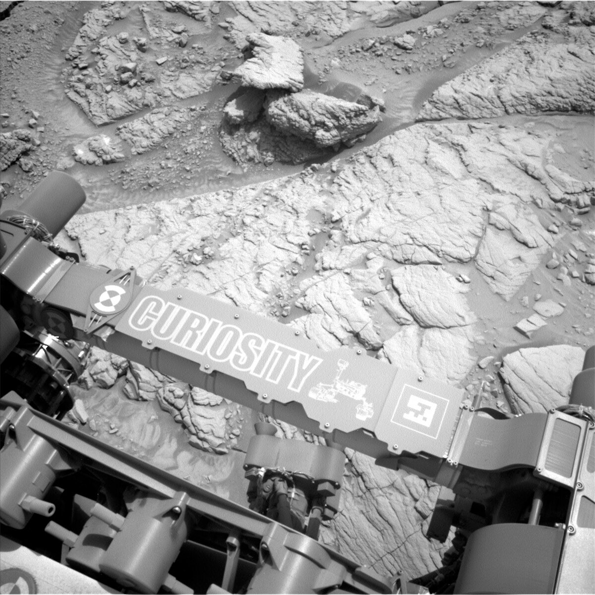
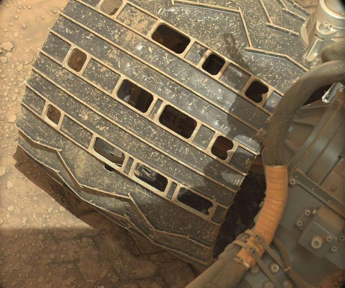
The image above shows one of our wheels and the JPL ‘morse code’ message. I wonder just how many of those we have made on Mars so far. Ten years and over 29 kilometers (over 18 miles) later one could theoretically calculate that knowing the wheels are 50 cm in diameter and thus the circumference is about 1.57 metres…. I think I leave the rest to you and just say: What a journey, and no matter if we celebrate Thanksgiving by calculating the number of morse code imprints we have left on Mars (and that Mars has probably dutifully erased by blowing dust over them!) or not, seeing our hardware on Mars always is a pleasure to be thankful for!

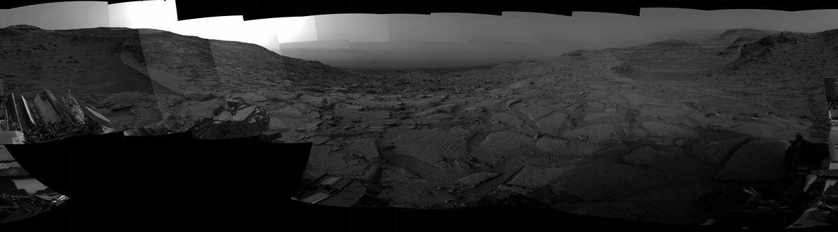
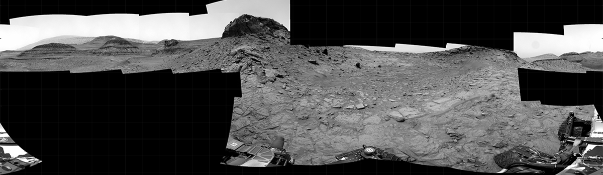
In this part two of our Thanksgiving plan, Curiosity is getting a lot of investigations done at out current location before we turn around and move on to continue our journey up the interesting and informative landscape that is the flank of Mt Sharp. If you want to remember what that area looks like from a distance, a beautiful image was recently posted, including an indication of the rover size as seen from a position back in 2015! We’ve come a long way, see for yourself here.

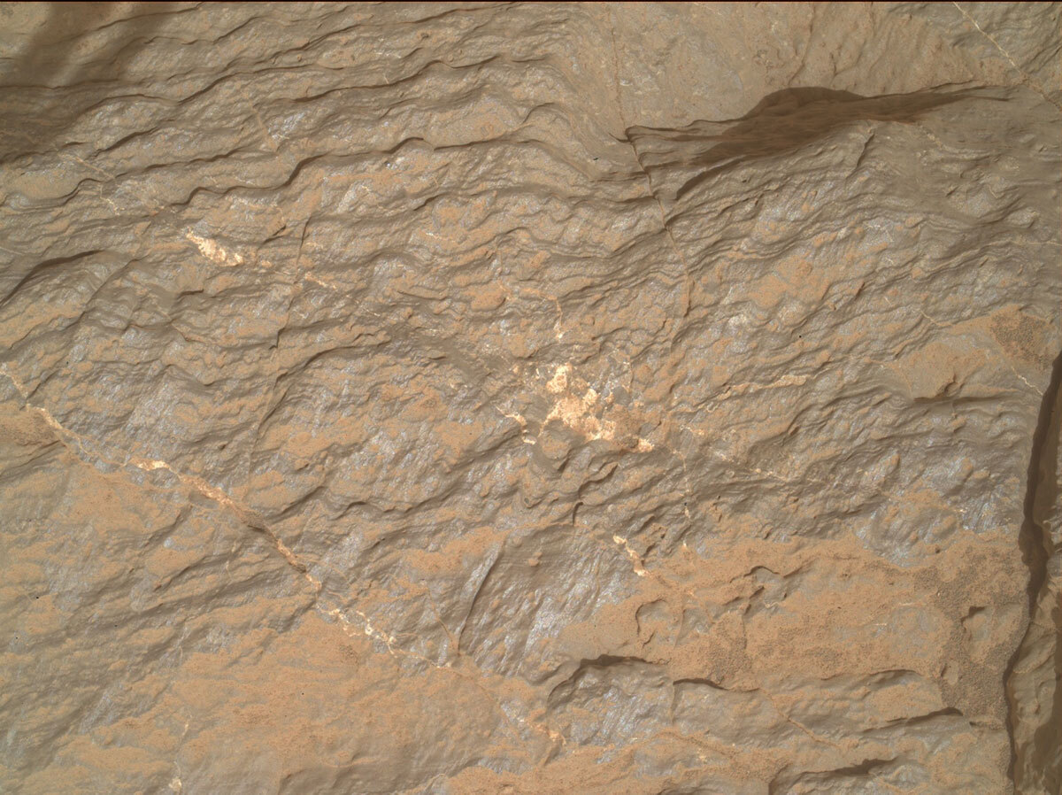
Enough happy thoughts, let me talk about the plan in front of us, well, on the rover: APXS and MAHLI will investigate target “Los Tranques,” which is a bedrock target, after it’s been brushed. That target will then also be investigated by Mastcam using the multispectral mode. Another multispectral observation is on target “Poraque.” ChemCam will look at target “Murabia,” which caught the team’s attention for its colour and knobbly surface texture. Mastcam is documenting this target, too. Mastcam also has three spots to monitor for change detection – taking images that would allow the team back on Earth to allow to trace the movement of sand grains between different sols.

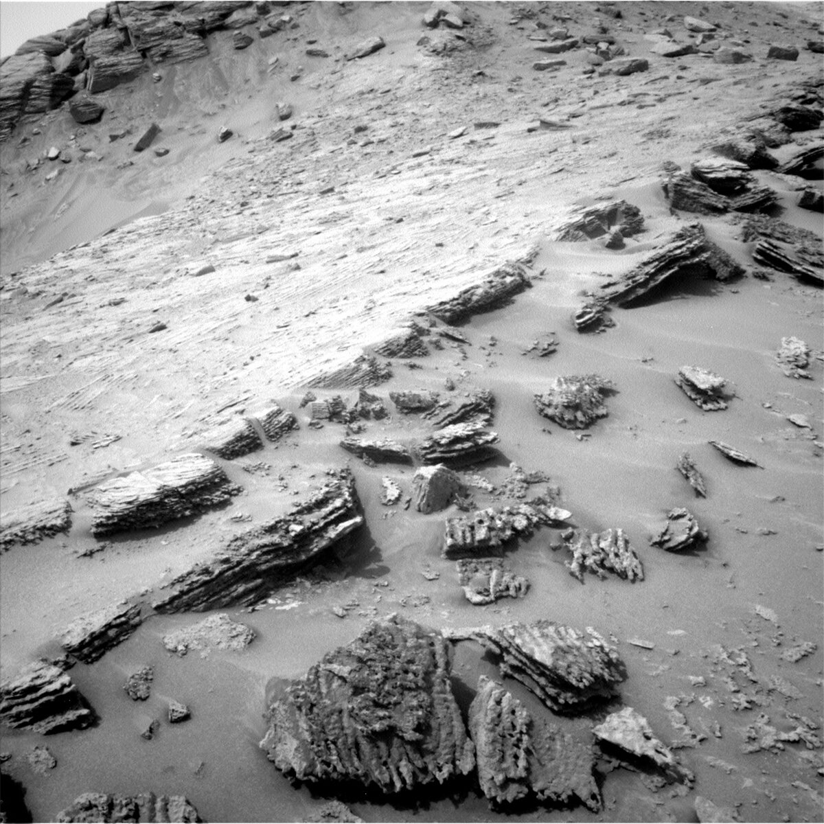
There is a lot of imaging going on, still, because this landscape is so fascinating and displays the layers upon layers of rock, to scientists known as stratigraphy, in excellent ways. Curiosity has already taken images of parts of an outcrop in the distance we called “Bela Vista,” which is extended in this plan to cover the feature in full. Mastcam is also documenting the structures of a block closer to the rover, which is called “Wonotobo.” ChemCam also uses its remote imager in distance mode to take close up images of another interesting stratigraphic feature. Last but not least, there is a drive, post drive imaging and a ChemCam AEGIS as well as a MARDI image after the drive.

November 21, 2022

Sols 3657-3659: Working Through the Weekend

Written by Keri Bean, Rover Planner Deputy Team Lead at NASA's Jet Propulsion Laboratory
This image shows Curiosity's nameplate above the Mars surface and was taken by Left Navigation Camera onboard Curiosity on Sol 3655.

This image was taken by Left Navigation Camera onboard NASA's Mars rover Curiosity on Sol 3655. Credits: NASA/JPL-Caltech. Download image ›

Today was a plan chockful of goodies to cover the weekend! Luckily the rover repositioning mentioned in the previous blog worked and we could safely use the arm in this plan.

We start the rover off right away in the morning on sol 3657 with a very long block of remote sensing, including a Navcam dust devil survey, a ChemCam laser observation of “Cigana,” some long distance ChemCam imaging, a DAN observation, and several Mastcam observations of Cigana, Rafael Navarro, Gediz Vallis Ridge, and some imaging of the rover deck. The rover will take a nice nap until later in the afternoon where the rover will wake up and perform some arm activities. As I’ve blogged before, we’re really having fun challenging our arm Rover Planner trainees and today included two uses of our Dust Removal Tool! We brush and take MAHLI imaging of both the “Lua” and “Rio Jufari” targets, and start the evening with the APXS instrument observing the Lua target. Mid-evening we will replace the APXS on the Rio Jufari target to get an observation of that target. Later that night we will stow the arm to prepare for the next sol’s drive.

Starting out nice and early in the rover’s morning on sol 3658, we take a full 360 panorama around us in the morning light, followed by some imaging of Gediz Vallis Ridge. A bit later in the morning we do some atmospheric monitoring imaging with Mastcam and Navcam, a ChemCam laser observation of the previous sol’s arm target Rio Jufari, some distance imaging with ChemCam, and a slew of Mastcam observations of Saddle Mountain, “Xua,” Lua, and Rio Jufari.

After all that great imaging, the rover will spend the next 4 hours driving! Today I was the mobility Rover Planner, so I was responsible for driving the rover today! In today’s plan we included something we don’t do very often, and that’s what we call the Full MAHLI Wheel Imaging activity, where we use a combination of Mastcam and MAHLI to image our wheels and monitor our wheels for any new damage. We have some requirements to find a spot safe to do this imaging, so a lot of my morning on shift was verifying a good safe spot to perform this activity in. Luckily there was a good spot about 5 meters behind where the rover is, so we back up, run this activity, then start heading back the way we came. We’ll be driving about 45 meters, retracing our steps, and ending near the sand ripple from a few sols ago with hopefully some bedrock in the workspace for the next Rover Planners to play with.

After the drive completes, we’ll take our post-drive imaging block of Hazcams, Navcams, and Mastcams to provide the imaging for the next planning team to use. We’ll take a bit of a nap (after all, 4 hours of driving is a lot!) and later in the evening we’ll take a MARDI image.

The third and final sol of this plan, sol 3659, has an autonomously selected ChemCam target in the morning before sleeping until very early on sol 3660 where we’ll take a slew of atmospheric monitoring images with Navcam and Mastcam. Throughout the plan are our standard environmental monitoring with DAN, RAD, and REMS as well.

November 21, 2022

Sols 3660-3664: An Early Start to a Long Weekend

Written by Natalie Moore, Mission Operations Specialist at Malin Space Science Systems
This image shows the Curiosity rover's tracks on sol 3658 and was taken by the left navigation camera.

This image was taken by Left Navigation Camera onboard NASA's Mars rover Curiosity on Sol 3658. Credits: NASA/JPL-Caltech. Download image ›

On a usual week of Curiosity operations, Friday plans take the longest since they span the whole weekend. This rare Monday morning, however, we’re planning five sols to start covering Tuesday - Monday of operations so the team can spend Thanksgiving on Earth. When we plan a large chunk of sols like this, the first couple sols are lightweight with minimal risk activities from environmental sensors like RAD and REMS. This time those are Sols 3660 and 3661, so Tuesday and Wednesday will be pretty quiet in Gale while we catch up on downlinking old data. Any remote sensing activities from instruments like Mastcam and ChemCam will kick off on the third sol (Thursday), and for safety reasons we're waiting until the last sol (Saturday) to plan any arm activities. For example, any faults that occurred wouldn’t be mitigated until at least Tuesday, and it would not be ideal for MAHLI to be stuck with her dust cover open near the surface for sols at a time! As part of the MAHLI uplink team today I was aware of this constraint and knew we’d have only a single sol available for planning today.

We began planning with news of a successful ~46 meter drive back towards the Mount Sharp Ascent Route (MSAR) from our detour to image the Gediz Vallis Ridge (GVR). Probably the last view of the GVR we’ll have for quite some time, the past few weeks were spent taking lots of Mastcam images and ChemCam Remote Micro-Images (RMIs). Abby Fraeman wrote about the reasoning behind this detour in the Veteran’s Day blog from 10 days ago. Since we’re now traversing on a “paved" road back to the MSAR and Marker Band valley, the weekend drive was easier to plan and even included Full MAHLI Wheel Imaging (FMWI). This is when we get MAHLI out during the drive and image all wheels from five small bumps, something we haven’t done since June. Last plan’s mobility Rover Planner, Keri Bean, described the process behind Full MAHLI Wheel Imaging and why we do them in the last blog. Taking a look at this weekend's downlink, it’s amazing to see what over 29 kilometers and 10 years on Mars can do: MAHLI image of our left middle wheel! The engineers will analyze these images in the coming days, but their last analysis suggested we should be able to drive many more kilometers on these wheels.

The first opportunity for remote sensing is on Sol 3662 and includes ~60 Mastcam stereo frames of our view back to the MSAR and hills beyond Marker Band valley. ChemCam is taking the early opportunity and shooting five laser spots on our workspace block at a target named “Urutai,” as well as an RMI of the GVR while we still have the view. Sol 3663 has more opportunities for remote sensing and kicks off with a second round of ChemCam laser spots on another workspace block target named “Lontra” and another RMI of dry channels in the distance near the GVR. Mastcam will follow with 20 more stereo frames of our nearby rock textures and tones before sunset (reminder that sunsets on Mars are blue!!). Finally, Sol 3664 is where things really get moving with a third nearby ChemCam laser target “Purue,” yet another RMI of distant hills from our past, and the arm activities.

Our arm activities include using our Dust Removal Tool (DRT) on a bright vein target named “Poraque” and letting APXS sniff the dust-cleared spot after MAHLI images it from ~25, 5, and 2 cm away. We’re also prepping a target named “Los Tranques” for DRT in tomorrow’s plan by getting 25 cm and 5 cm MAHLI images before letting APXS sniff it, dust and all. Mastcam is also included in the arm activities today for imaging her cousin camera MAHLI. Every ~120 sols or so MAHLI requests Mastcam high-resolution images of MAHLI's dust cover. These images are some of the highest resolution Mastcam is capable of at ~1.6 meters away for focus. Check out this one from Sol 3541! Since Martian dust is magnetic, these images also show how much dust is accumulating on the cover's magnet over time.

Tomorrow we’ll be planning the last two sols of our holiday weekend, Sunday and Monday, which includes a drive away from our Thanksgiving site and resumption of our normal planning schedule. I’ll be blogging on our first plan back next Monday as well, and on a personal note I’m feeling very thankful for this incredible mission I get to be a part of and my team members who inspire me every sol. I’ll be thinking of our hardy rover all weekend as I watch Mars rise in the east each night, somehow feeling close even at 52 million miles away.

November 16, 2022

Sols 3655-3656: Try, Try Again

Written by Alex Innanen, Atmospheric Scientist at York University
This image was taken by Left Navigation Camera onboard NASA's Mars rover Curiosity on Sol 3653. Credits: NASA/JPL-Caltech.

This image was taken by Left Navigation Camera onboard NASA's Mars rover Curiosity on Sol 3653. Credits: NASA/JPL-Caltech. Download image ›

Yesterday we weren’t able to use the arm and thus weren’t able to do contact science, but a short drive got us into a better position. Unfortunately, the dust removal tool still wasn’t safe to use at our location, so the team decided to make another drive to try again for contact science on the weekend. Even though the plan wasn’t what we expected coming in to today, we were still able to make the most of the fantastic location we’re in, and to manoeuver into a safer location.

Before the drive, we are fitting in two hours of science, packed full of ChemCam and Mastcam observations. ChemCam is doing LIBS on the target 'Caracarana' and a series of long distance mosaics of Gediz Vallis Ridge. Mastcam is joining ChemCam on Caracarana, and is documenting two bedrock targets, 'Cigana' and 'Tacari' and an area of soil scuffed by the wheel, 'Saddle Mountain.' After the drive, ChemCam is using AEGIS to autonomously select a target.

ENV is taking advantage of the great view of the crater rim and dune field, which you can see in the (slightly askew) Navcam image above. We are doing a 360 degree dust devil survey, and focusing at that view for a targeted dust devil movie. We are also taking a tau and crater rim line of sight to measure dust in the atmosphere, and a suprahorizon cloud movie.

November 15, 2022

Sols 3653-3654: A Scenic Stop

Written by Lauren Edgar, Planetary Geologist at USGS Astrogeology Science Center
This image was taken by Right Navigation Camera onboard NASA's Mars rover Curiosity on Sol 3652.

This image was taken by Right Navigation Camera onboard NASA's Mars rover Curiosity on Sol 3652. Credits: NASA/JPL-Caltech. Download image ›

Over the weekend Curiosity made great progress towards a location that the team identified as a good imaging stop. We came in this morning and confirmed that we have arrived at the desired location, with a great vantage point looking towards Gediz Vallis ridge, as seen in the above Navcam image. Friday’s blog described why we wanted to come to this spot, and today we had the chance to start acquiring those observations!

The terrain to climb up to this location was a little challenging, so unfortunately we weren’t able to use the robotic arm for contact science today, but that didn’t stop the team from planning a ton of great remote sensing observations (after all, that’s what made us want to come to this site!). The highest priority is a large Mastcam mosaic of Gediz Vallis ridge, which we hope to use to decide where Curiosity will go next. Then ChemCam will assess the target “Guariba” to characterize the new rocks in our workspace. Another high priority in today’s plan is a large ChemCam Long Distance RMI mosaic, to get an even better view of the distant stratigraphy at Gediz Vallis ridge. We’ll also acquire Mastcam stereo images to document the sedimentary structures near the rover, and a sandy trough in our workspace. Then the rover will bump to a slightly different position to set us up for contact science in Wednesday’s plan. On the second sol, Curiosity turns her eyes to the sky, with an hour of remote sensing activities to characterize atmospheric opacity and search for dust devils. I’m looking forward to seeing the results from these big mosaics and deciding where to go next!

November 11, 2022

Sols 3650-3652: Gediz Vallis Ridge Rising

Written by Abigail Fraeman, Planetary Geologist at NASA's Jet Propulsion Laboratory
NASA's Mars rover Curiosity took 31 images in Gale Crater using its mast-mounted Right Navigation Camera (Navcam) to create this mosaic.

NASA's Mars rover Curiosity took 31 images in Gale Crater using its mast-mounted Right Navigation Camera (Navcam) to create this mosaic. Credits: NASA/JPL-Caltech. Download image ›

Curiosity is continuing to climb towards a Gediz Vallis ridge viewing spot, and we can already get a glimpse of it rising in the distance. In today’s plan we will collect a large stereo Mastcam mosaic of the parts of Gediz Vallis ridge that were visible to us today, and this image combined with the ones we hope to collect from our end of drive location on Monday, will help the team decide if we want to get even closer. We’re trying to understand how Gediz Vallis ridge formed, in particular what kind of watery settings may or may not have been involved. We also want to understand how it relates to the rest of the rocks that make up Mount Sharp and Gediz Vallis channel in order to better constrain when the events that built it happened.

We’ll also spend the weekend investigating the area much closer to Curiosity. We’ll be collecting Mastcam images of some rocks that have interesting textures that we unofficially named “Uruca,” “Tikwah Mine,” and “Prata.” We’re also snapping a photo of a large sand ridge that is right behind the rover, and ChemCam will zap two rock targets, “Cotingo,” and “Boca da Mata,” as well as an automatically selected target using the AEGIS software. APXS and MAHLI will get in on the science action as well, with observations of targets named “Jutai” and “Raposa.” We’ll use the DRT to brush dust away from the Raposa target before the APXS and MAHLI observations, so we’ll also take a Mastcam multispectral image of this less dusty area. Observations to model the environment around Curiosity and a 50 m drive will round out the plan.

November 9, 2022

Sols 3648-3649: Losing the Rhythm?

Written by Lucy Thompson, Planetary Geologist at University of New Brunswick
Image of rocky terrain captured by NASA's Mars rover Curiosity.

~25 cm standoff MAHLI image of “Acara” showing the rhythmic layering and a bright vein/bleb (likely calcium sulfate) in the bedrock exposed just above the apparently rippled marker band. Credits: NASA/JPL-Caltech/MSSS. Download image ›

Curiosity was parked amongst beautiful, rhythmically layered bedrock in our previous workspace. The term rhythmic is used to describe fine scale, repeating layers that exhibit a uniform spacing and thickness. This bedrock was exposed just above the marker band that we had been investigating for several sols prior. The marker band has been mapped from orbit and appears to be a relatively continuous feature around Mount Sharp. We observed possible ripples in the marker band and the relationship between these and the overlying rhythmically layered rocks is important to investigate with the full instrument payload. Unfortunately, Curiosity had one wheel slightly elevated on a rock, and it was not safe to place the turret on the surface, so we were not able to get compositional data with the APXS instrument. We are hoping to drive back this way and will try to place APXS on these fascinating rocks to get bulk chemistry that we can compare with the underlying rippled rocks. We did manage to get MAHLI images from a safe standoff and the “Acara” image is one of these.

We drove away into a slight depression, and found ourselves in a very different looking, dusty and soil covered terrain. Thankfully the rover is parked in a safe and stable spot, and we can unstow the arm, brush the dusty surface and place APXS and MAHLI in close proximity to the rock (“Cana”), as well as get Mastcam imaging and ChemCam LIBS before we drive away. As the APXS strategic planner today, I requested the brushing of the rock prior to analysis with APXS to improve the quality of the data. There was a chance that this may have been too complex or taken too much time, but the team managed to fit it in along with all the other desired observations and activities. The textural and compositional data that we obtain here will be interesting to compare to the previous workspace, the rippled marker band, the bedrock immediately underlying the marker band, as well as the rock we will encounter as we continue to climb. MAHLI will also take close-up imaging of the nearby “Dalbana” target.

As well as looking in the near field, Mastcam and ChemCam RMI will also document features further afield including: fracture networks and their relationship to bedding (“Viruaquim”); light-toned fill in bedrock fissures within the “Canta” butte; stratigraphy of the north face of the “Bela Vista” butte and surrounding float blocks; bedrock exposures within the trough wall and floor (“Coatu” and “Cipo”) that we are currently driving through (“Jatapu”).

To fully document the terrain below us, and any transitions that may occur as we drive, a MARDI sidewalk video was also planned. This is complimented with a MARDI image that we will acquire after the drive. An untargeted ChemCam AEGIS activity after the drive will also give us a preliminary look at the composition of the rocks in our new workspace.

The environmental science team were also busy and planned several observations to continue monitoring changes in atmospheric conditions. These include: a Navcam large dust devil survey, a dust devil movie and line of sight observation; Mastcam crater rim extinction and basic tau observations; and a ChemCam passive sky observation.Standard REMS, DAN and RAD activities round out this plan.

November 8, 2022

Sols 3646-3647: Look But Don't Touch

Written by Elena Amador-French, Science Operations Coordinator at NASA's Jet Propulsion Laboratory
This shows a mosaic image made of 19 images strung together to display Gale Crater; the images were taken with Curiosity's Navcam on sol 3645.

NASA's Mars rover Curiosity took 19 images in Gale Crater using its mast-mounted Right Navigation Camera (Navcam) to create this mosaic. Credits: NASA/JPL-Caltech. Download image ›

I was on shift today as Science Operations Coordinator (SOC) – an exciting role to have, especially on complicated days where communication between teams is key to a smooth operation.

We woke up this morning to a lovely new workspace in front of us after Curiosity drove about 11 meters up and over a small ridge during the weekend, getting us on top of the Marker Band. The notional plan coming in this morning had us unstowing the arm and looking at several targets with MAHLI and APXS which often involves getting pretty close to the surface, sometimes touching with APXS. In order for the science team and the rover planners to feel comfortable that the rover will remain stable as we use our arm, they go through a checklist called the “Slip Risk Assessment Procedure” or SRAP. Based on the tilt of the rover, what rocks are or are not underneath the wheels, and other technical factors, this checklist helps us determine what arm activities are safe for the rover to perform. This analysis is done by both engineers that understand the technical capabilities of the rover and geologists who can consider how the rocks or regolith may behave.

The analysis can take time on complicated days leaving the science team juggling how they might adjust the plan pending the outcome of that assessment. The science team was eager to place APXS on the rocks above the Marker Band – our first “whiff” of the chemical composition but unfortunately, we learned that because our left-front wheel was perched on a rock, our risk of slipping was not negligible and we could not touch the surface with APXS or get closer than 5 cm with our MAHLI instrument. As SOC, my job was then to help the science team understand how we might rearrange today’s plan to respond to this new information and get the most out of the two sols we had for planning before our next uplink on Wednesday.

Given this news, we quickly pivoted to looking at two targets, “Acara” and “Ixi” with MAHLI at higher stand-offs and then driving away on the first sol. By driving on the first sol we gained substantial downlink of all our post-drive imaging – which will set us up well for our next planning day on Wednesday. This is what makes the SOC role so exciting – being prepared to discuss the pros/cons of arranging the plan in certain ways and facilitating discussion between scientist and engineers.

Our two-sol plan starts off with a targeted science block where we are first investigating the chemical composition of the “Ixi” bedrock target with CCAM LIBS – this provides different but complementary chemical information from what APXS would have provided. We also use our ChemCam RMI to take a long-distant mosaic of nearby ridges. We follow up those observations with Mastcam to document our LIBS target, and take stereo imaging around us – as you can see from the above image we are surrounded by lovely buttes – these images will help us understand their context and how the stratigraphy revealed on each of them relates to the other.

In addition to the “Ixi” bedrock target, MAHLI will also image the target “Acara,” a bright white vein infilling that crosscuts the bedrock. Veins like this typically form after the rock has been emplaced and provide a snapshot of the kind of alteration the rocks have experienced since first being deposited.

We will also get a rather long drive in today, about 55 meters, skirting some larger boulders seen in the Navcam image above. This drive will hopefully get us to within a few more drives of our next imaging stop where we hope to get a nice vantage point of Gediz Vallis ridge.

We will wrap up the plan on the second sol with some environmental monitoring activities like a dust devil survey and a Navcam movie that searches for clouds in the sky. We’ll also use ChemCam’s autonomous target selection capability to look at the composition of a target after our drive.

November 4, 2022

Sols 3641-3642: Sausages?! On Mars?!

Written by Catherine O'Connell-Cooper, Planetary Geologist at University of New Brunswick
This image was taken by Left Navigation Camera onboard NASA's Mars rover Curiosity on Sol 3642.

This image was taken by Left Navigation Camera onboard NASA's Mars rover Curiosity on Sol 3642. Credits: NASA/JPL-Caltech. Download image ›

We are perched just below the “Marker Band,” a thin dark band whose origin is unclear. As Michelle noted yesterday, we found some amazing textured float rocks in our workspace but were not in a good position to do contact science here, so we moved back a little in order to get it today.

These float rocks appear to have originated in the Marker Band, which can be seen running from lower left to upper right in the accompanying Navcam image. There are several different textures here – the most noticeable are the ropey elongated ridge features, or “sausages” as one of our colleagues Juergen described them. Underlying the sausages features is smoother bedrock. There are also rougher areas on top of the sausages, which look like they might have been altered (by later fluid movement for example). Finally we have the underlying non-Marker Band bedrock, the smooth rock the floats themselves are sitting on.

It was hard to narrow down our choices with so many interesting targets; we wanted to do a little bit of everything. The rover planners were game to get as much in as possible, so APXS and MAHLI get a rare triple whammy of targets: unbrushed on the sausages at “Iracema,” brushed underlying smooth float rock at “Mel” and then brushed in-place non-Marker Band bedrock at “Mamupi.” Mastcam is getting multispectral imagery on both brushed targets and ChemCam is using LIBS to also analyze the bedrock at Mel.

ChemCam is then turning its focus onto the in-place Marker Band above us, using RMI to image the ropey textures at “Pintada” and LIBS to analyze “Soco,” a bright rock where the Marker Band is in contact with the local bedrock. RMI will also capture images of layering within that in-place Marker Band at “Buena Vista.”

Mastcam continues to document stratigraphy in this area, taking a very large mosaic (83 images) along the Marker Band itself and a slightly smaller (46 images) mosaic on “Canta,” a butte in the distance but above the Marker Band (in the upper left of the Navcam image).

Once all of this has been completed, we drive a short distance, scooching closer to the in-place Marker Band, for the coming weekend plan.

November 4, 2022

Sols 3643-3645: Getting a Dog's Eye View of the Marker Band

Written by Ashley Stroupe, Mission Operations Engineer at NASA's Jet Propulsion Laboratory
This image shows Curiosity's nameplate and surrounding Martian rocks and was taken by the Left Navigation Camera on Sol 3642.

This image was taken by Left Navigation Camera onboard NASA's Mars rover Curiosity on Sol 3642. Credits: NASA/JPL-Caltech. Download image ›

Today we are parked in front of an amazing workspace (seen in image) on the edge of the Marker Band.

On the first sol of the plan, the rover gets a chance to recharge and do some extensive imaging. We have a 21-frame stereo imaging mosaic and a multispectral image of the workspace, centered on a target named “Saracura.” We also take CCAM LIBS observations of the contact science target “Mixiguana,” shown in the upper middle of the image, which is a block with resistant and distinct layers. We also take an RMI 6-frame mosaic of the target “Aniqui,” which is a nearby ripply float rock. The first sol’s science activities also include a large Navcam dust devil survey.

On the second sol we do some additional imaging. We take Mastcam mosaics of the Marker Band and the ”Sauba” target, which is an interesting ground target off in the distance. We also take an image of the target “Malacheta,” which is a possible piece of bedrock just below the Marker Band. We also take CCAM observations, including LIBS on Malacheta and a long-distance RMI of a further spot on the Marker Band. There are also some atmospheric observations, including a dust devil survey and a supra-horizon movie to look at dust in the atmosphere.

After the targeted science, we have a lot of arm activity. I worked with another Rover Planner on the arm activities today. And it was good thing there were two of us: the contact science arm activities were particularly complex to sequence today. The first priority is a low-angle view with MAHLI of MixiguanaIt, which is important to view edge-on due to layering. It has a lot of relief to it and it is significantly tilted, requiring us to get very close to the ground with the turret in order to image it. We are taking a 2x6 mosaic of images with MAHLI about 15cm from the surface of Mixiguana, covering as much of the visible face as we can reach. In addition, we are taking a stereo pair of images at 25cm and also a 5cm image at one location where it was safe to get closer. In addition, we are doing MAHLI (25cm, 5cm-stereo, and 2cm close approach) images and APXS on another target, “Mocra,” which is on the top of block in front of Mixiguara (in the center of the image), as well as a 5cm MAHLI and APXS on an offset target about 1.5cm away from Mocra.

On the third sol, we kick things off with two large mastcam mosaics: a 31-frame of “Bela Vista” Hill and a 360-degree, 136-frame view. We also image the other contact science target, Mocra, with mastcam and CCAM.

The drive, which is also on the third sol, is driving 8-9 meters to get us up onto a ridge. We are eventually heading to a location about 70m away to get a better view of the Gediz Vallis Ridge. Lots of medium sized rocks are on the edge of the ridge, so it was tricky to find a good place to climb up. After exploring a lot of options, we found a good place nearby. The area leading up to that climbing point is fairly sandy; in addition to the higher tilts we may get more slip due to the sand as well. We are taking extra precautions to make sure we have a better chance of succeeding despite the potential for high slip.

Early the next morning, before handing over to the next plan, we have some additional atmospheric observations, including a Mastcam solar tau and Navcam zenith (looking up) and suprahorizon (looking out).