July 24, 2023

Sol 3898: A Stop Along the Road

Written by Alex Innanen, Atmospheric Scientist at York University
This image features part of Curiosity's body on the rocky terrain. It was taken by Left Navigation Camera onboard NASA's Mars rover Curiosity on Sol 3897.

This image was taken by Left Navigation Camera onboard NASA's Mars rover Curiosity on Sol 3897. Download image ›

Earth planning date: Monday July 24, 2023

Today’s single sol plan takes us further into our road trip through the Jau crater cluster. Like any road trip, we’re taking frequent stops to take in the sights, and at this spot Curiosity gets to stretch its arm with a touch and go. It reminds me of being on family road trips with my geologist father – we were always pulling over to look at cool rocks!

The image above shows one of today’s cool rocks. APXS and MAHLI are both investigating the bumpy, ridged surface on the side nearest the rover, a target named ‘Mamore,’ backed up with Mastcam images. ChemCam is also looking at this surface, particularly one of the ridges called ‘Jacunda.’ Slightly further afield, Mastcam is also looking at two of the craters in the cluster and a distant rock ‘Triunfo.’ ChemCam is also taking a long-distance mosaic of the Gediz Vallis ridge.

ENV is also taking the chance to have a look around. We’re looking back over our metaphorical shoulder at a sand sheet for dust devils, and up towards the sun to see how much dust is in the atmosphere. After our brief and productive stop it’s time for us to hit the road again, knowing that there are always more exciting sights ahead.

July 24, 2023

Sols 3895-3897: Navigating Through the Crater Cluster

Written by Lauren Edgar, Planetary Geologist at USGS Astrogeology Science Center
This image was taken by Left Navigation Camera onboard NASA's Mars rover Curiosity on Sol 3894.

This image was taken by Left Navigation Camera onboard NASA's Mars rover Curiosity on Sol 3894 (July 21, 2023). Credits: NASA/JPL-Caltech. Download image ›

Earth planning date: Friday, July 21, 2023

Curiosity is working her way through the “Jau” crater cluster, with the goal of trying to understand how all of these small craters formed and have since been eroded. To do that, the team is hoping to assess the target rocks, any evidence for the impactor, and the morphology of the craters. While the craters are very easy to see in orbital images, the view from the ground is a bit harder to assess, as seen in the above Navcam image. The image shows some broken up blocks of bedrock in the foreground, and small depressions and ridges in the distance. Through a detailed imaging campaign and contact science, the team hopes to gain more insight into the origin of these features, before getting back on the road to continue climbing up Mount Sharp.

Today’s 3-sol plan focused on the crater cluster science with plenty of imaging and contact science. On the first sol, Curiosity will investigate the bedrock target “La Trinite” with DRT, MAHLI, and APXS, and a second target “Rio Javari” with MAHLI and APXS to better understand the target rock properties. The team also planned two large Mastcam stereo mosaics to investigate the depth-to-diameter ratios and erosional state of several craters, and three ChemCam LIBS targets to assess variations in texture and chemistry of the local bedrock. Mastcam will also collect a multispectral observation of the DRT target, along with imaging to assess the movement of fines on the rover deck, and a small mosaic to investigate nearby troughs in the regolith. On the second sol the rover will acquire a long distance ChemCam RMI mosaic looking back towards Peace Vallis – it’s amazing to see how far we’ve come! The plan also includes environmental monitoring activities to look for clouds and dust devils and monitor dust in the atmosphere. Curiosity will drive on the third sol, which will hopefully bring us closer to one of the larger craters in this cluster for even more crater science next week!

July 20, 2023

Sol 3894: Sleeping the Sol Away

Written by Conor Hayes, Graduate Student at York University
This image was taken by Chemistry & Camera (ChemCam) onboard NASA's Mars rover Curiosity on Sol 3892.

This image was taken by Chemistry & Camera (ChemCam) onboard NASA's Mars rover Curiosity on Sol 3892. Credits: NASA/JPL-Caltech/LANL. Download image ›

Earth planning date: Wednesday, July 19, 2023

Curiosity is, first and foremost, a robotic geologist. As an atmospheric scientist who is a member of the environmental science team, this often means that I'm just along for the ride, guided by the needs of the geology team. Besides the fact that geology is our primary mission, observations requested by GEO are often more temporally-constrained than those requested by ENV. This is because if they want to take a close-up look at something, they will usually have only a sol or two to do so before we drive away, never to come back (with a few rare exceptions like our drive back to the marker band over 150 sols ago in our quest to get a drill sample). The atmosphere is always all around us, so it's typically less of a problem for ENV if we have to shuffle observations a few sols earlier or later to accommodate GEO's requests.

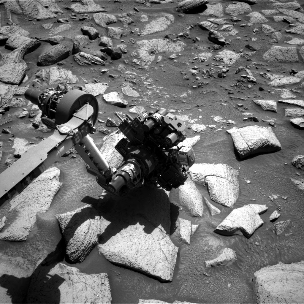
All of this means that dividing our available science time between GEO and ENV is often a careful balancing act. Typically, ENV reserves most of our observations for post-drive "untargeted" science blocks. Because they take place after a drive, we won't know exactly where the rover will be, so we can't plan any "contact science" activities involving the arm. Consequently, untargeted blocks are dedicated to remote sensing, where ENV excels. The pre-drive "targeted" blocks can then be saved for all of GEO's fun with the arm and imaging of more nearby targets.

Planning today was no exception to the balancing act. On Wednesdays, we normally plan two sols, often with targeted science on the first sol, a drive, and then untargeted science on the second sol. However, today we only planned one sol because Thursday is a "soliday," a day off for the rover to allow Earth and Mars time to resynchronize. This means that we only had a single targeted science block for GEO and ENV to fit all of our observations into. Complicating matters even further, we're still letting our batteries recover from some power-hungry observations last weekend, so the total time we had available was less flexible than usual.

Early in planning, it looked likely that ENV would have to push our Mastcam sky survey to study the properties of atmospheric aerosols into the weekend to save some power, but then we received word that the rover had parked itself in a manner where it wasn't safe to unstow the arm. As a result, GEO had to remove their contact science activities, giving ENV just enough time for the sky survey. A loss for one team will often be a gain for the other!

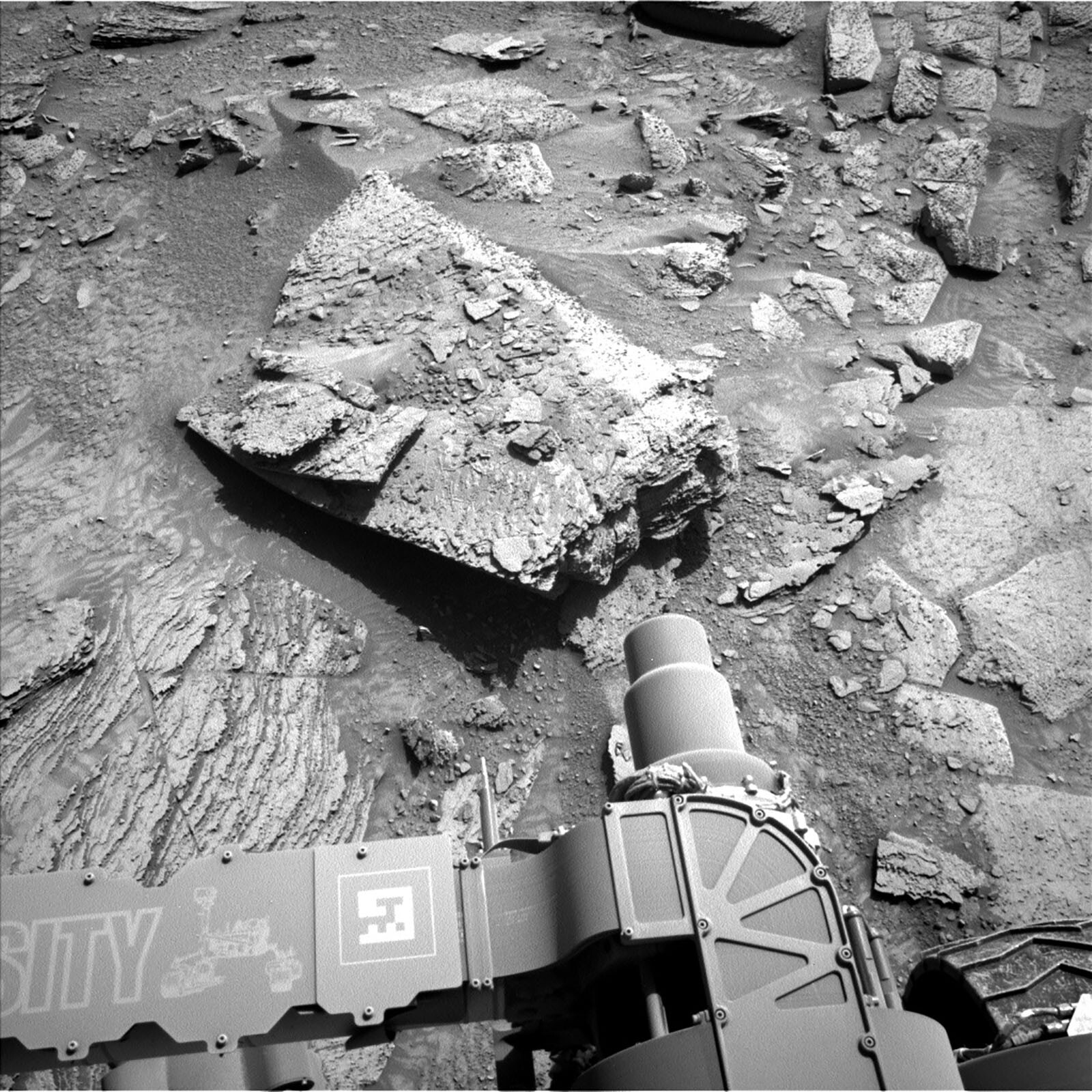
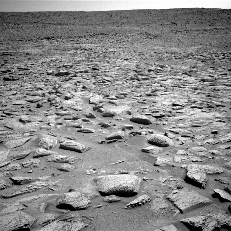
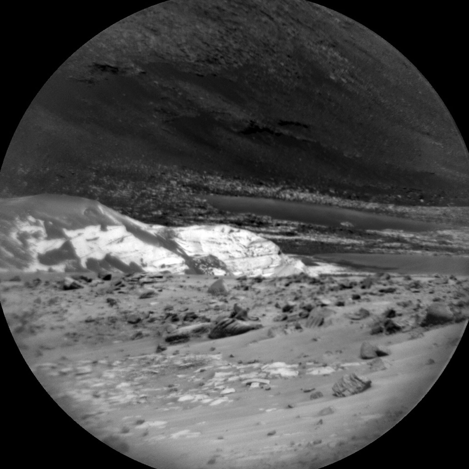
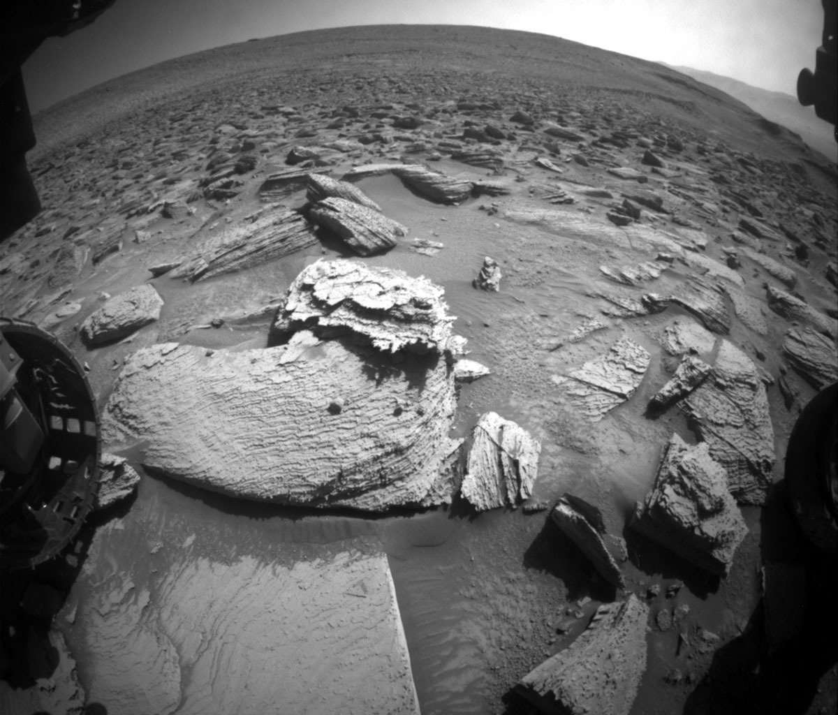
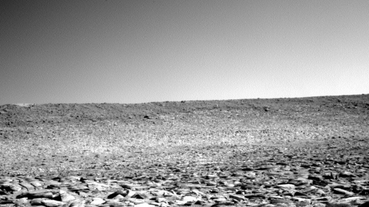
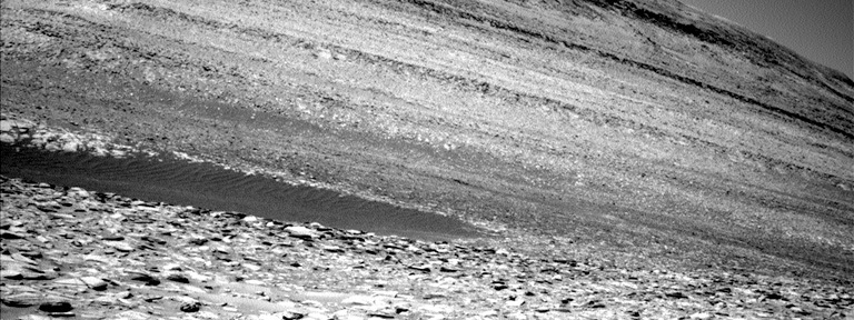
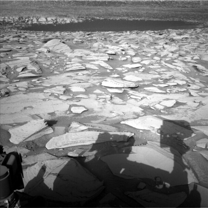
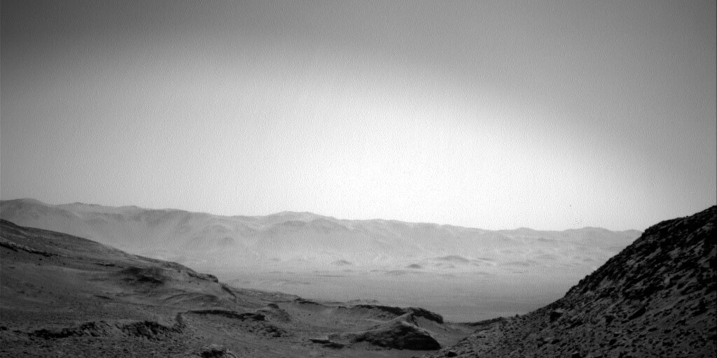
Despite all the challenges, we're still getting good science done in this plan. Our 29 metre drive in Monday's plan brought us to the edge of the crater cluster as expected, so GEO will be spending much of their time today taking Mastcam mosaics of the area to kick off this mini-campaign. For today, this includes mosaics of two craters in the "Jau" cluster, as well as documentation of ripples and lamina at "Jiparana" and a bedrock feature at "Cruzeiro." ChemCam LIBS and Mastcam will also turn their sights to "Akani-Pata," and ChemCam RMI will continue its survey of the upper Gediz Vallis ridge. Note the change in name etymologies, as our drive took us out of the Kalavryta quad that we entered not even 30 short sols ago and back into Roraima.

On the ENV side, in addition to the aforementioned Mastcam sky survey, we also planned a Mastcam solar tau observation to measure the amount of dust in the atmosphere as well as a Navcam dust devil movie looking out over a dark sand patch that we are parked near. As always, the plan is rounded out by a full set of REMS, RAD, and DAN observations to measure the weather and radiation environment, and to look for water-bearing minerals in the subsurface.

July 18, 2023

Sols 3892-3893: The Lion's Mane!

Written by Catherine O'Connell-Cooper, Planetary Geologist at University of New Brunswick
This image was taken by Front Hazard Avoidance Camera onboard NASA's Mars rover Curiosity on Sol 3890.

This image was taken by Front Hazard Avoidance Camera (Front Hazcam) onboard NASA's Mars rover Curiosity on Sol 3890. Credits: NASA/JPL-Caltech. Download image ›

Earth planning date: Monday, July 17, 2023

Today we planned a two sol “Touch and Go” plan. Our weekend drive successfully brought us about 28 metres, bringing us closer to the “crater cluster,” a series of small craters grouped close together. These craters were created by meteoroid impacts, probably from a single meteoroid that broke up before it reached the surface. So this mini campaign will bring us as close as possible to the cluster, for lots and lots of imaging to be analyzed, which will allow us to characterize the craters and potentially get an understanding of their origin. Hopefully we will even get close enough to get contact science on some material up here.

In today’s workspace, we focused all our instruments on one target. Bedrock here (and all our recent workspaces) typically has two variations. In the accompanying image for this blog, the outcrop in the centre of the image reminds me of a lion, lying on its side, and it contains both types. The bulk of the outcrop is made up of blocks which are usually layered and often have lots of nodules – you can see this in the body of the “lion.” Then there are often minor occurrences of a more platy, brittle looking material, like this example (“Planitero”) from sol 3885 – the head of the lion and its shaggy mane is made up of this material, where it has weathered into several distinct layers with ragged edges. Today we focused on this second type of outcrop. APXS will first integrate over the target “Nasia” (located on the top of the “lion’s head”) and then ChemCam will LIBS on the same spot. This will be followed by MAHLI and Mastcam imaging of the same target.

Mastcam will also take two small mosaics (3 images each) in the near field of the workspace – “Zarelia” will look at some nearby laminated float blocks and the “Troughs” mosaic will look at… you guessed it …. some troughs! More specifically, it will look at interactions between rock and regolith and sand in the workspace. Mastcam will also take a larger mosaic (a “15x3” mosaic, i.e., 3 rows of 15 images) focusing on the crater cluster.

The ENV theme group are busy as always. Mastcam will take a pair of tau measurements (measuring dust in the atmosphere), whilst Navcam will take a series of movies, examining martian clouds, their properties and abundances. The cloud “zenith” movie looks directly upwards to look at clouds and their direction, whilst the “suprahorizon” movie is targeted in a more horizontal direction, looking at clouds and variations in optical depth in the atmosphere above the southern rim of the crater. DAN and REMS measurements round out the ENV plan.

Following this, our drive will take us about 30 metres, skirting along the edge of the crater cluster, and setting us for further characterization of the crater cluster on Wednesday.

July 17, 2023

Sols 3889-3891: It's Still Rock and Roll to Us!

Written by Abigail Fraeman, Planetary Geologist at NASA's Jet Propulsion Laboratory
This image was taken by Right Navigation Camera onboard NASA's Mars rover Curiosity on Sol 3887.

This image was taken by Right Navigation Camera onboard NASA's Mars rover Curiosity on Sol 3887 (July 14th, 2023). Credits: NASA/JPL-Caltech. Download image ›

Earth Planning Date: Friday, July 14, 2023

In human spaceflight, it’s a tradition to wake the crew up with a “wake-up song” to let them know “Wake up, it’s time to get to work!” For decades, this tradition has also been adopted by the Mars rover teams, with the tactical team at JPL choosing wake-up songs to play in the downlink room at the start of the planning day for us Earth-based “crew members.” These songs are most helpful right after landing, when the team is living on “Mars time” and operating the rovers on Mars’ 25-hour daily schedule. Scheduling shifts on a 25-hour timeline means we start work about an hour later every day, and this leads to some serious interplanetary jet lag! However, once rovers have been operating for a while and the team settles into a rhythm, most of the team members’ schedules shift back to Earth-time, and we start planning two or even three sols (Martian days) at a time when Mars’ and Earth’s time zones don’t quite match. The switch back to Earth time, and the fact that we’ve been operating for thousands of sols at this point, means we don’t play wake-up songs every tactical shift anymore, although we haven’t let the tradition slip entirely!

We did have a wake-up song today, and it was chosen by tactical downlink lead P.J. Rollins. His song choice? “It’s Still Rock and Roll to Me” by Billy Joel. P.J. explained, “Touch and Go = Rock and Roll… Get it?”

Hahahahaha. Perfect. No notes.

We did indeed do a touch and go in Wednesday's plan, and at downlink we learned that both the touch (contact science on target "Sounion") and go (a ~15 m drive) completed as planned. Hooray! In today’s plan, we’re going to do some more contact science on the rocks in our workspace, along with a ~27 m drive to the west. Before our drive, we’ll collect MAHLI and APXS data from some dark, platy materials on a target named “Thermopylae,” and do a DRT with MAHLI and APXS on a target named “Zachlorou.” We’ll also observe a small dark float rock in the workspace named “Megara” with Mastcam multispectral and ChemCam, and another portion of the bedrock in front of us with ChemCam on a target named “Salamina.” SAM will collect data this weekend too, measuring the Martian atmosphere as part of a campaign to systematically monitor seasonal changes in its composition. Additional Mastcam and Navcam images for both geology and environmental science are also included in the plan, along with REMS, RAD, and DAN measurements. Other observations include a long distance image of Peace Vallis on the crater rim using ChemCam’s RMI and a post-drive ChemCam AEGIS activity.

July 13, 2023

Sols 3887-3888: The Vastness

Written by Scott VanBommel, Planetary Scientist at Washington University
This image shows the vast and rocky martian surface taken by Left Navigation Camera onboard NASA's Mars rover Curiosity on Sol 3885.

This image was taken by Left Navigation Camera onboard NASA's Mars rover Curiosity on Sol 3885. Credits: NASA/JPL-Caltech. Download image ›

Earth Planning Date: Wednesday, July 12, 2023

A blue hue inches over the horizon illuminating a sea of rocks scattered across the landscape like the scales of a fish. Among the sea, alone in the vastness, a rover sleeps. The time is now 9:25, in a "time zone" defined for itself. The waking rover receives instructions from a tiny speck of light, far away and slowly creeping towards the other side of the sun. They read as follows (translated to English from interplanetary robot):

Tosol is sol 3887. Warm the Remote Sensing Mast, arm, Mastcam, Navcam, and Front Hazcam. Unstow the arm and find the surface of the target "Sounion" with APXS. Brush the surface of the rock and place APXS. Wait 20 minutes. Image the brush with Mastcam. Follow with images of Sounion, "Paros," "Kukenan," and "Lefki." Complete a long-distance mosaic with the ChemCam RMI and further conduct a 5-point LIBS analysis of Lefki. Acquire four MAHLI images of Sounion. Stow the arm. Complete a ~15 m drive towards the crater cluster imaging stop. Now late afternoon, nap until the following morning, waking periodically to relay what you've done and learned to your usual pen pals orbiting overhead. It is now sol 3888. Your day will focus on a ChemCam passive sky. After resting much of the day, you will be busy throughout the night, closely monitoring the atmosphere with APXS to acquire complementary data for the earlier passive sky experiment.

Instructions in hand, Curiosity gets to work, forging ahead with another two-sols worth of instructions from its operations team, including a planned drive that should bring the rover's odometer north of 30,300 m. Its contact science target in the plan, Sounion, is named after a region in Greece, home to the Temple of Poseidon. I'm reminded of the visual similarities between the terrain surrounding Curiosity, such as the image of today's blog, and a vast body of water, extending as far as the eye can see - as one may observe from Cape Sounion. Whether pondering the vastness of an ocean around 400 BC, or the geologic and climate history of a neighbouring planet in present day, curiosity drives us to explore and learn. When Curiosity wakes on sol 3889, there'll be three more sols of instructions to complete as it bravely continues to explore the vastness, now on the flanks of Gale crater's Mount Sharp, and teach us more about the history and evolution of the planet it now calls home.

July 11, 2023

Sols 3885-3886: Planning Take Two

Written by Remington Free, Operations Systems Engineer at NASA's Jet Propulsion Laboratory
This image was taken by Left Navigation Camera onboard NASA's Mars rover Curiosity on Sol 3881.

This image was taken by Left Navigation Camera onboard NASA's Mars rover Curiosity on Sol 3881 (July 7th, 2023). Credits: NASA/JPL-Caltech. Download image ›

Earth planning: Monday, July 10, 2023

This weekend, Curiosity went into runout and was unable to execute the Sols 3882-3884 plan that is detailed in last blog post. Nothing is actually wrong; runout refers to when the rover doesn't have anything to do as it hasn't received any new instructions. Runout is normally caused by an error in the uplink process – in this case, the transmitter at our DSN station went 'red' and was unable to send up our plan. DSN refers to the Deep Space Network, which is the ground-based collection of huge antenna dishes which we use to beam information at our rovers. They are hugely important for us to be able to communicate with Curiosity, but occasionally there are faults which prevent transmission. My tactical role is on downlink for the robotic arm, so it was an uneventful downlink assessment day with most teams not having any completed activities.

To check on the state of the rover during runout, we have created what is known as a "runout beep." When it doesn't have any normal planning instructions (in the form of a master sequence), Curiosity is able to recognize it is in runout and send a small "beep" transmission which lets us know that it is otherwise working normally and is healthy. We did successfully receive the runout beep, so we know she is doing just fine up there!

Current planning for sols 3885-3886 involves repeating a lot of the intended activities of the previous plan (sols 3882-3884). Due to runout, Curiosity actually had built up a lot more power than we would have had if the plan had uplinked correctly, so we were able to fit in additional science activities to take advantage of the extra power. An extra ~60 minutes of science time was added to the intended plan, which is exciting! The team discussed how best to use that extra power.

On sol 3885, we will perform APXS analysis of the "Planitero" target, which is a flat, less dusty area of bedrock surface, in order to determine its composition. On this sol, we also have a large science block, which will include Mastcam imaging of the "Kukenan" hill to document its stratigraphy (the layering of the rock), several cracked bedrock fractures, and the "Stokani" target, which is more dark planar bedrock surface. ChemCam will perform additional observation of "Stokani" using the LIBS instrument (see my previous blog post for a description of LIBS) and several ridge mosaics. Later on in the day, Mastcam will also document "Planitero." After the bulk of the science activities, Curiosity will perform a short drive, which is very similar to the previous drive planned.

After the drive, we performed a SPENDI (Shunt Prevention Environmental Navcam Drop-In). It is not preferable to fully charge the batteries, so when we have a lot of charge such as in this case caused by runout, we keep the rover awake longer and fill the extra time with Navcam use for opportunistic science activities. Otherwise, we would have to radiate the extra heat and power into the atmosphere, which would be a waste. Our SPENDI included a number of Navcam movies and a full dust devil survey. Post-SPENDI, Navcam will take a sky observation. Other remote sensing activities in sol 3886 of the plan included, Mastcam mosaics and tau (atmospheric opacity) observations. It's nice to be able to take advantage of unexpected situations like this; we were able to get some awesome pictures that we might not otherwise have time for.

July 10, 2023

Sols 3882-3884: Weekend Routine for a Red Rover

Written by Natalie Moore, Mission Operations Specialist at Malin Space Science Systems
This image captures Curiosity's name on the rover which was taken by Left Navigation Camera onboard NASA's Mars rover Curiosity on Sol 3880.

This image was taken by Left Navigation Camera onboard NASA's Mars rover Curiosity on Sol 3880. Credits: NASA/JPL-Caltech. Download image ›

Earth Planning Date: Friday, July 7, 2023

Happy Friday, Earthlings! Few things are better than planning an action-packed weekend on Mars. It’s even better when the last plan executed like a charm; our drive from Wednesday’s plan made it over 44 meters and put us in veiny, layered bedrock heaven (see cover image for our workspace)! We’re still headed towards a local cluster of craters ~150 meters to the east, and my Mastcam brain is excited for a far-field imaging campaign when we get there. In the meantime, I’m using my MAHLI brain to plan some close (and some extremely close) images of the terrain in front of us. And since the downlink arrived as expected, Curiosity is in great shape for her classic weekend routine.

On the first sol in this weekend’s plan, which will actually kick off around 10:15am Pacific, our rover will wake up and spend some time organizing her data from the previous plan. After a leisurely mid-morning nap she’ll start her first science activities which include: Mastcam stereo mosaic of Kukenan butte in the far distance, ChemCam LIBS 5-spot raster of a nicely-layered block in the workspace named “Akrata,” a Mastcam-Right documenting image of the LIBS laser spots, and a DAN measurement in parallel with all to measure any water-related atoms present in the ground (here's a reminder of DAN’s capabilities). Around 2pm she’ll take another nap to prepare for arm activities in the late afternoon, kicking off around 3:20pm and continuing all evening!

What does a Martian rover do on a Saturday evening? Stick her cupcake-sized APXS on some dust-free rocks and “sniff” the surface chemistry of course! But first, she has to pre-game with some dust-clearing and MAHLI images while the sun is still up. This weekend we picked a layered bedrock target for our DRT to swish the dust away and named it “Desino.” After brushing Desino, it’s time to take our usual Mastcam-Right images of the DRT for documentation and head into some major MAHLI imaging. Starting with a dark, plate-like target named “Planitero,” MAHLI will take images at 25cm and 5cm from the surface. Then we have an exciting 2x3 mosaic planned of some bedrock layers at ChemCam’s Akrata LIBS target, for a total of 6 images at best focus (actually, we take 8 images at difference focus values for each mosaic position to make sure we’re getting the best focus possible in addition to an extra full frame - so that’s really 54 images, plus 6 subframes. It’s a MAHLI party!). Last plan we did a similar type of mosaic along a vertical fin, and the surrounding bedrock shows the type of layers we’re hoping to get with this weekend’s mosaic (single frame from that mosaic for reference). For the MAHLI’s finale she’ll take images of dust-cleared Desino at 25cm, 5cm, and 2cm from the target’s surface. On a side note - this is our first western-like heading in quite some time and for MAHLI that means much better chance at full-sun image lighting, which is almost always preferred. After the MAHLI party, APXS will settle into some surface sniffing - starting with Planitero and ending with Desino at ~9:30pm. It’s an early night for Curiosity, but she’ll be awake in intermittently to send the sol’s data to Earth via orbiters when they pass overhead.

For the second sol, which kicks off ~11am Pacific this Sunday, Curiosity will have another late morning and start her science activities around noon. Mastcam will take a multispectral stereo frame (in 7 wavelength filters for each camera) of Desino and a couple, smaller stereo mosaics of the vertical rock fins and sand cracks around us. ChemCam will shoot another bedrock target named “Skotani” with LIBS and Mastcam follows up with the usual documentation image of the spots. Then it’s time to pack it up and drive away! A ~17 meter Sunday stroll will hopefully get us closer to the local craters in the distance and put some more interesting bedrock in the workspace for Monday’s planning. Another fun weekend for Curiosity, and we hope you enjoy yours as well!

July 6, 2023

Sols 3880-3881: Heading Toward a Cluster of Craters

Written by Sharon Wilson Purdy, Planetary Geologist at Smithsonian National Air and Space Museum
This image shows the shadow of the Curiosity rover on the Martian surface and was taken by Left Navigation Camera onboard Curiosity on Sol 3878.

This image was taken by Left Navigation Camera onboard NASA's Mars rover Curiosity on Sol 3878 (July 4th, 2023). Credits: NASA/JPL-Caltech. Download image ›

Earth Planning Date: Wednesday, July 5, 2023

While many of us were up late watching fireworks here on Earth, Curiosity wrapped up a very busy weekend on Mars. The team was pleased that our four-sol plan over the 4th of July holiday executed as expected, but planning today was unusual because the new images of the terrain in front of the rover could not be loaded into our planning software. Although we were not able to select ChemCam and Mastcam observations, the science team put together an exciting plan and drive for sols 3880 and 3881.

The rover will use DRT plus MAHLI, APXS, and Mastcam multispectral data to characterize the bedrock at “Roghi” (I got the honor of picking the name for this target!) as well as a MAHLI observation of “Xerocambos,” a fin-like, gray vein sticking out of the bedrock. A large Mastcam mosaic of the layered butte named “Chenapau” is also in the plan. The science team planned ChemCam AEGIS activities on both sols; AEGIS is an acronym for Autonomous Exploration for Gathering Increased Science and is a mode where the rover identifies and selects a geological target from navigation camera images based on a set of guidelines set by scientists on the team. A full slate of ENV atmospheric observations round out the plan, including images and movies to monitor clouds, a tau observation to monitor dust, and a dust devil survey.

The 50-meter drive will get us closer to the exciting cluster of impact craters on our route. We look forward to seeing you Friday, Curiosity!

July 5, 2023

Sols 3876-3879: Bumpy Road Ahead

Written by Remington Free, Operations Systems Engineer at NASA's Jet Propulsion Laboratory
This image was taken by Right Navigation Camera onboard NASA's Mars rover Curiosity on Sol 3874.

This image was taken by Right Navigation Camera onboard NASA's Mars rover Curiosity on Sol 3874 (June 30, 2023). Credits: NASA/JPL-Caltech. Download image ›

Earth planning date: Friday, June 30, 2023

Our latest assessment period over sols 3872 and 3873 was a “touch and go” plan: some contact science and other observations, followed by a drive. We performed some imaging and DRT (Dust Removal Tool) brushing on the “Madero” bedrock target, to allow for contact science using APXS. For some of our Mastcam imaging, we also move the arm out of the way as to reduce shadow in our images. Our planned drive was more or less a success – we made it most of the way we had planned, despite driving through a small ditch. The current rocky terrain has been tricky for Curiosity, and we often have little slips in our drives, but it’s all in the name of continuing to ascend Mt. Sharp!

We also imaged the "Vesini” target to get a better look at protruding veins in the bedrock. We performed ChemCam LIBS (Laser-Induced Breakdown Spectrometer) imaging which will give us elemental compositions of the vein target. The LIBS instrument functions by producing powerful laser pulses which ablate ions on the surface of the sample and causing their decay into light-emitting plasma. The rover can make spectroscopic observations of this plasma, which through spectral analysis is what allows us to understand what elements exist within the rock.

My tactical role is on downlink assessment for the robotic arm, so this was a fun assessment day with lots of normal arm motions to enable our imaging, DRT, and contact science. Downlink assessment refers to reviewing data we receive back from the rover to understand how our planned activities actually executed on Mars. We have representatives from every major subsystem on downlink, and a TDL (Tactical Downlink Lead) who brings our findings to the uplink team. Today our decisional pass (the data transmission we use to perform our assessments) was delayed due to the scheduled DSN station not receiving Curiosity’s data, but we had enough information from previous passes to perform our assessments. Shortly after downlink, we received our data via a re-transmit from MRO (Mars Reconnaissance Orbiter). Yay for orbiters!

Stepping into the uplink side of tactical operations, I will give a summary of our planned science activities. On sol 3876, we are planning for remote (non-contact) science activities using the Mastcam which will focus on stereo documentation of nearby surface features and eroded bedrock. On sol 3877, more remote science using Mastcam will occur; these will focus on both continued documentation of various rocks as well as tau (atmospheric optical depth) and aerosol measurements. Curiosity will also perform contact science including DRT surface brushing. On sol 3878, Curiosity will perform additional tau and aerosol measurements as well as Mastcam documentation of the DRT target and the previous ChemCam LIBS target.

On this sol, we also added some MAHLI wheel imaging into our plan – this is an engineering activity we perform at a regular cadence in order to assess the state of our wheels. This is crucial for us given the wear and tear we experience from drives due to the sharp rocks and bumpy terrain. Full MAHLI wheel imaging (FMWI) is accomplished during a drive by rotating the wheels by a fixed amount for each imaging position so we can get a good look at the entire wheel state.

Overall, this was an interesting tactical day – for both the downlink and uplink sides of the house. In my role on the robotic arm, I get to assess arm activities which enable our scientific observations, but it’s great to remember that there is also plenty of science we do with our remote instruments. We’re excited to continue to ascend Mt. Sharp with the eventual goal of drilling once we reach an appropriate elevation.