June 29, 2023

Sols 3873-3875: Up! Up! And Finally... Over!

Written by Catherine O'Connell-Cooper, Planetary Geologist at University of New Brunswick
This image shows part of the Curiosity rover overlooking a canyon of rocks on the Mars surface and was taken by Right Navigation Camera onboard Curiosity on Sol 3872.

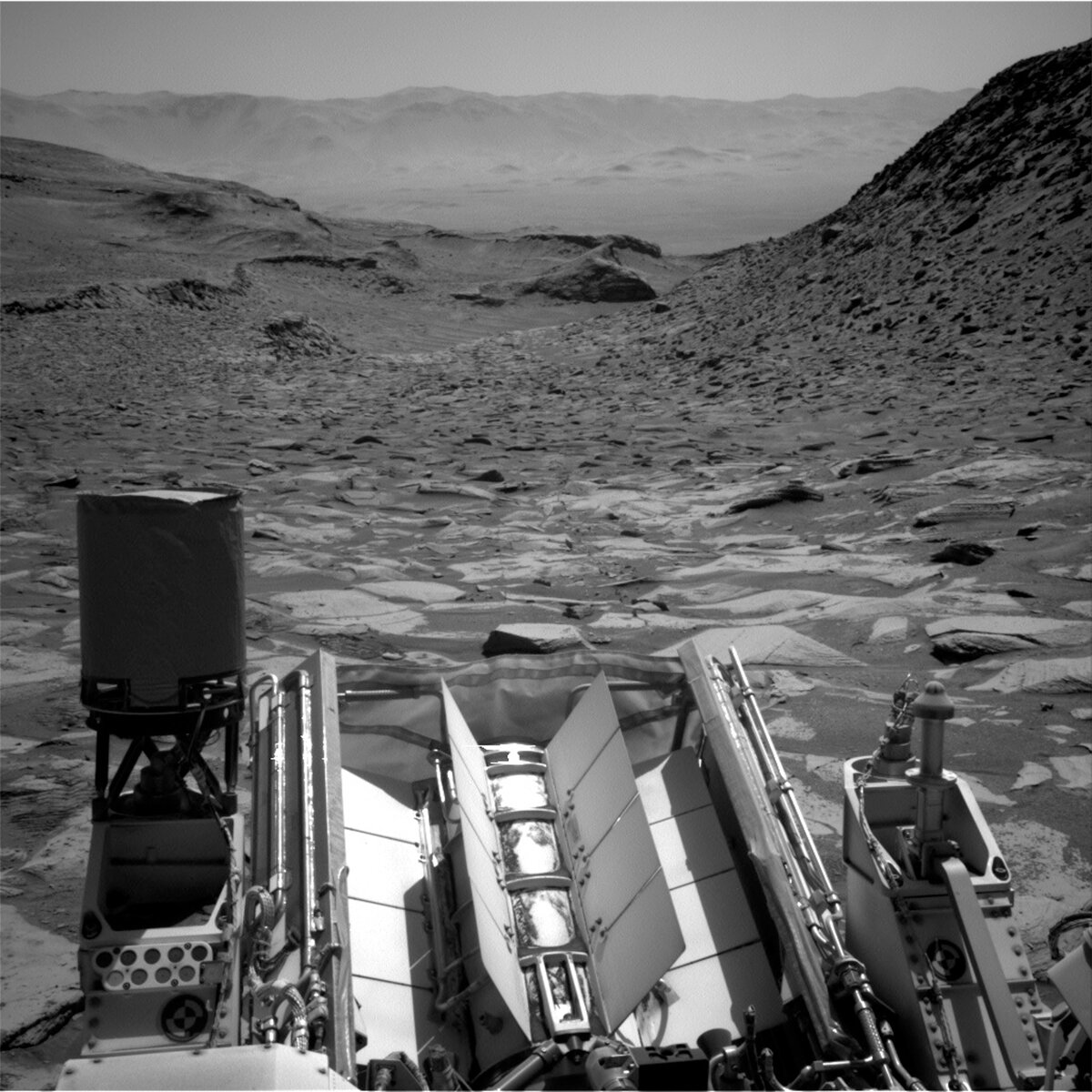
Right navigation camera, looking back down at the canyon. Credits: NASA/JPL-Caltech. Download image ›

Earth planning date: Wednesday, June 28, 2023

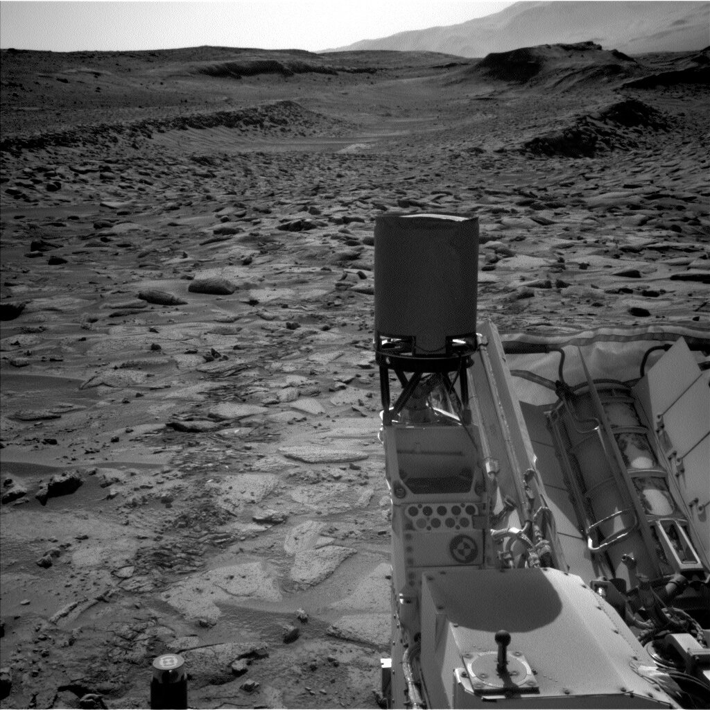
We made it! We are peeking up over the edge of the ridge that we have been trying to climb for a few weeks now. The view ahead is spectacular but it's worth pausing for a minute to look back down into the canyon. You can faintly see rover tracks in the centre of the image, left behind as we slowly made our way up the hill. Lots of slipping and sliding, and drives ending too soon or terminating on precarious footings, but we finally made it!

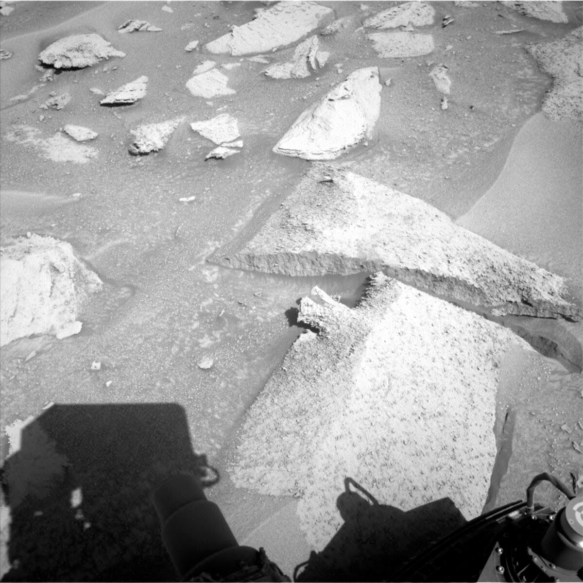
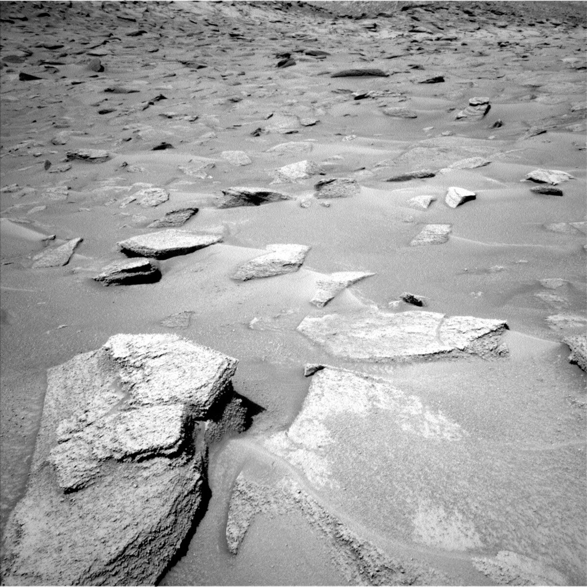
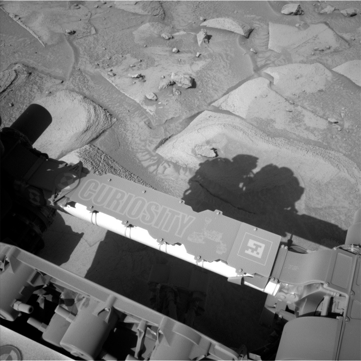
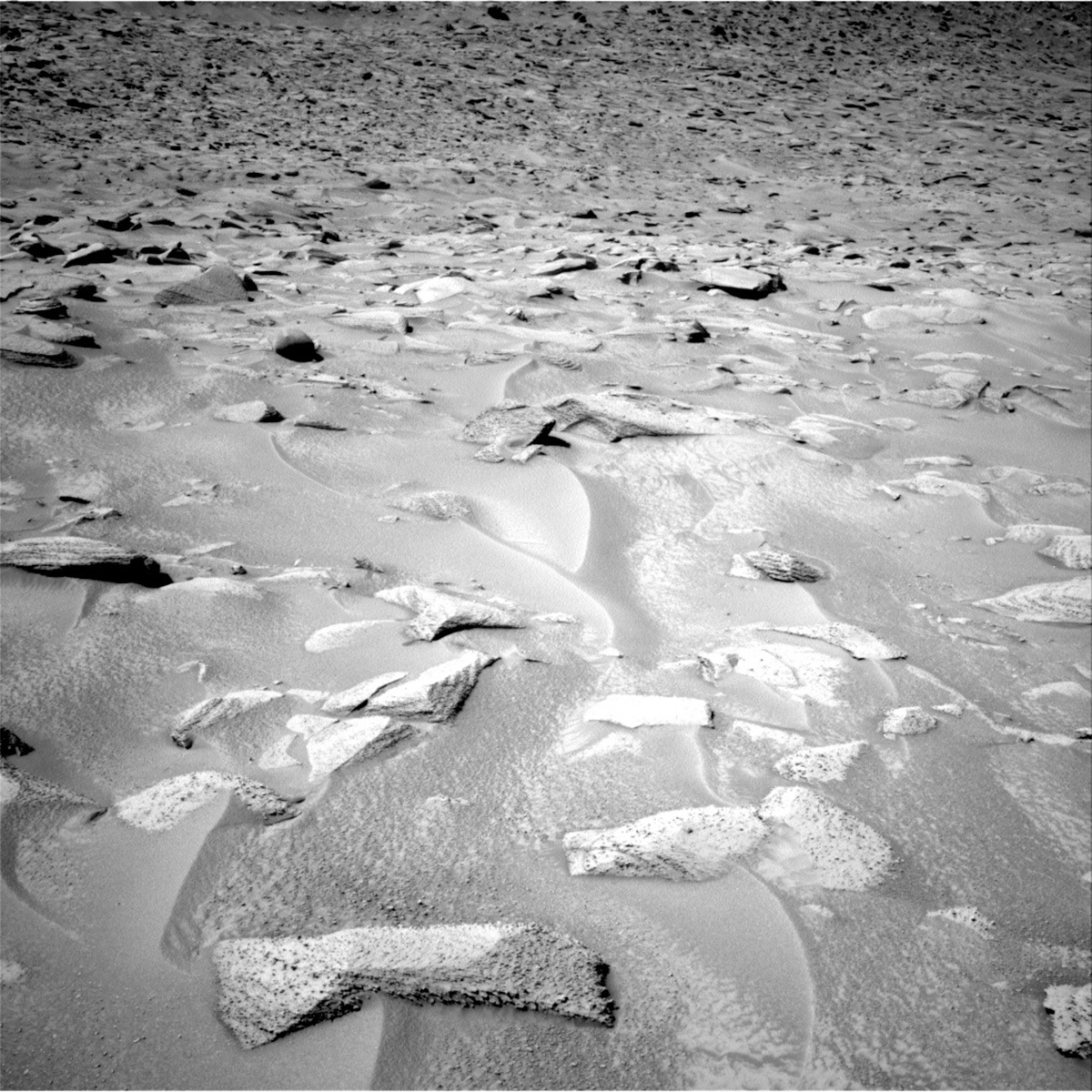
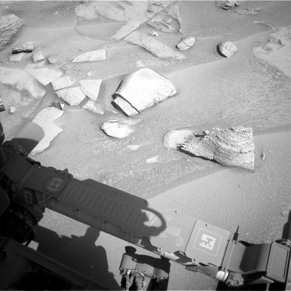
Today we planned a “Touch and Go” plan. Before we push out onto the ridge, we will characterise the local bedrock at “Madero” with APXS and MAHLI on some brushed bedrock. This workspace has mineral veins running perpendicular to the rock layers and fragments of a dark layer that is parallel to the other layers. MAHLI will image a vertical vein at “Vesini” to look at its relationship to the host bedrock and some of the dark layer around the vein, whilst ChemCam LIBS will analyze a vein fragment at “Mega Spilaio.” Mastcam will acquire a multispectral image of the same target.

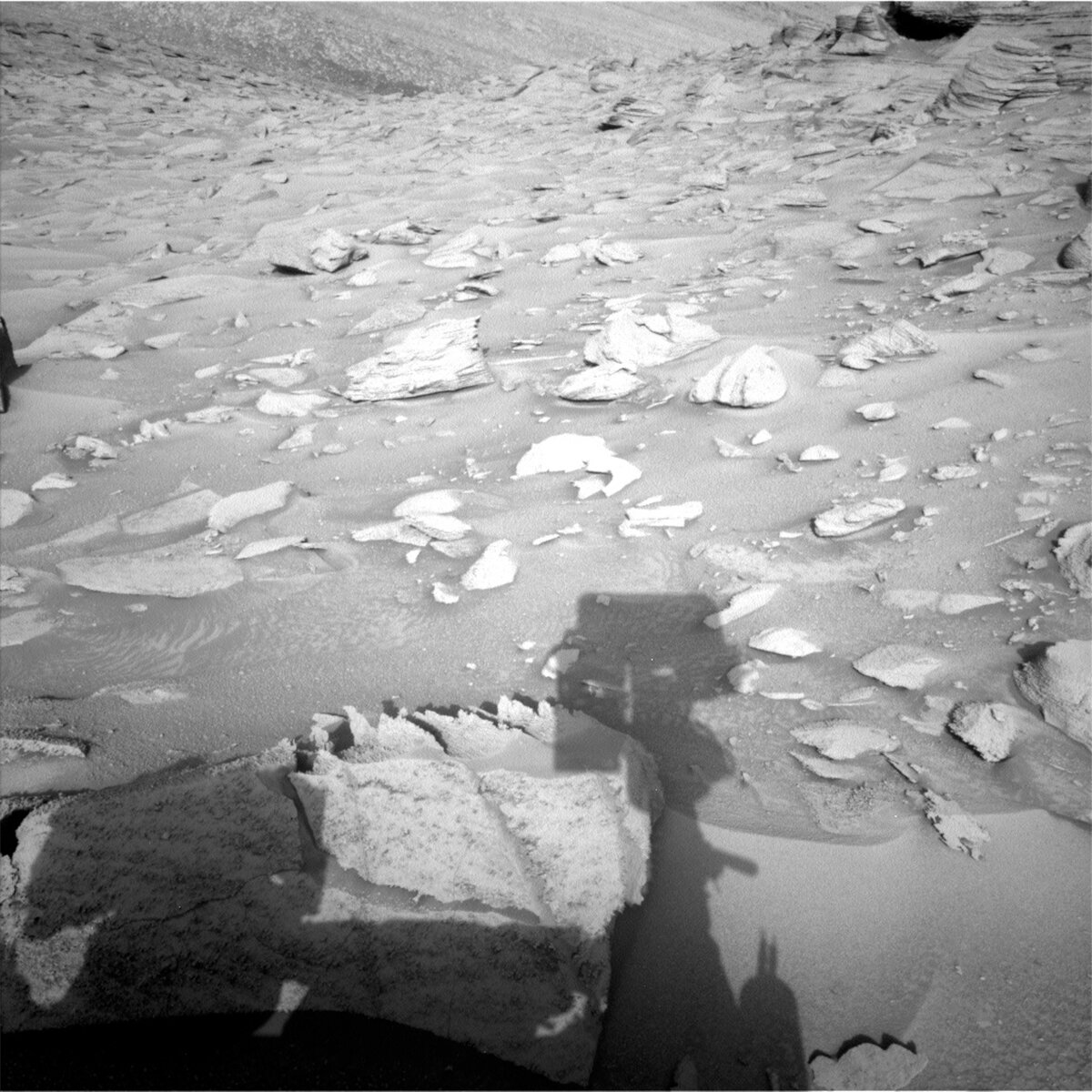
Mastcam will also take four stereo mosaics in this plan. The largest mosaic (28 images) looks at the nearby crater cluster, as well as further ahead to “Gediz Vallis ridge” and the “Texoli” butte. Two smaller mosaics look at laminations and erosionally resistant features in bedrock in this area and an area of more active sand. The smallest mosaic (3 images) uses colour Mastcam imagery to support a black and white ChemCam RMI observation, which focuses on erosionally resistant features in the direction of today’s drive.

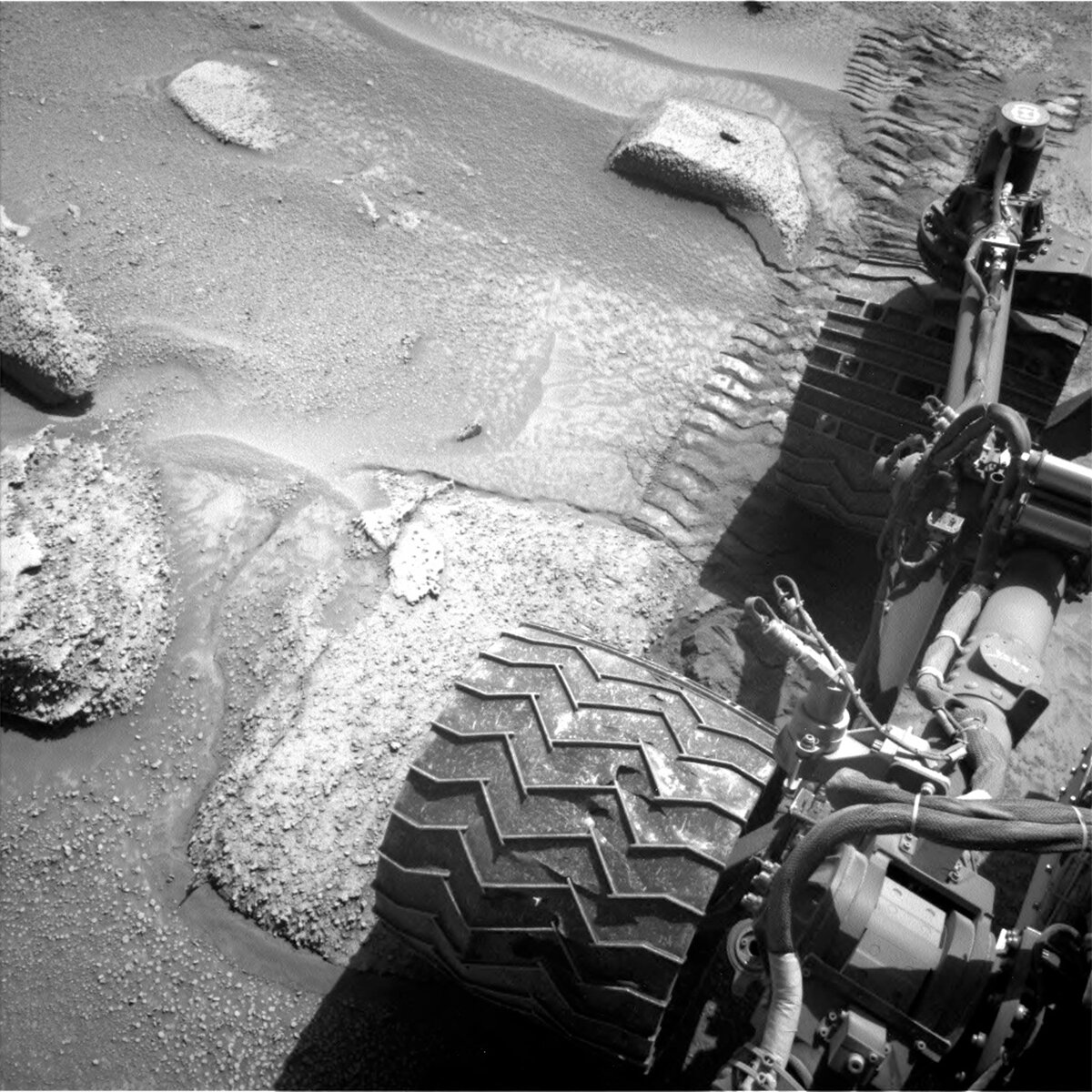
Our drive on the afternoon of the first sol is relatively short, about 15 metres further out onto the ridge, where we hope to catch up on an important housekeeping chore in the upcoming 4th of July long weekend plan. Full MAHLI Wheel Imaging (FMWI) uses a combination of Mastcam and MAHLI to image our wheels and monitor them for wear and tear, and was last done just before Thanksgiving. This activity needs some flat ground to be executed, so it had to be delayed while we were playing slip-and-slide on the hill and we are hoping to get it done as soon as possible now in order to keep to our routine cadence (every 1000 metres).

ENV planned some basic tau measurements for this plan, where Mastcam will help to measure dust in the atmosphere. On the second sol of the plan, ECAM will look for dust devils and survey the clouds overhead in Gale. ENV rounds out the plan with DAN and REMS activity, for a full suite of environmental activities.

June 27, 2023

Sols 3871-3872: Back on Track

Written by Alex Innanen, Atmospheric Scientist at York University
This image was taken by Left Navigation Camera onboard NASA's Mars rover Curiosity on Sol 3870.

This image was taken by Left Navigation Camera onboard NASA's Mars rover Curiosity on Sol 3870. Credits: NASA/JPL-Caltech. Download image ›

Earth planning date: Monday, June 26, 2023

We started planning today with the great news that our drive was successful! This put us in a perfect position for our split touch-and-go plan – lots to see, and no need to worry that we might be on unsteady footing, like we were on Friday.

Our two nearby targets are bedrock blocks: the nodular bedrock ‘Lousoi,’ which we’ll be investigating up close (the ‘touching’ in the touch-and-go) with APXS and MAHLI; and the ChemCam LIBS target, ‘Valvousi,’ which is on the face of another block. Adjacent to Valvousi is a small trench, which Mastcam will take a look at. Masctcam and ChemCam will also be looking further afield. Mastcam is taking a mosaic of the ridge to our south, and ChemCam is looking behind us towards the Gediz Vallis Ridge. After we finish up, we’re taking a late afternoon drive southeast along our alternate route.

After this busy sol, Curiosity will spend most of the second sol of the plan napping, but will wake up for a few observations around noon. ChemCam will use AEGIS to autonomously look for a post-drive target. ENV also has some of our normal atmospheric monitoring activities, including a suprahorizon cloud movie, a tau observation to monitor dust, and a 360 degree dust devil survey.

June 23, 2023

Sols 3868-3870: Not Again, Mars!

Written by Susanne Schwenzer, Planetary Geologist at The Open University
This image was taken by Left Navigation Camera onboard NASA's Mars rover Curiosity on Sol 3867.

This image was taken by Left Navigation Camera onboard NASA's Mars rover Curiosity on Sol 3867. Credits: NASA/JPL-Caltech. Download image ›

Earth planning date: Friday, June 23, 2023

Today we started planning at a location short of our intended drive end position. Mars has, once again, not read our script! Regular readers of this blog will have noticed lately that many reports start with some news about a shortened drive that didn’t quite complete, and that Abigail got really excited on June 20th, when three drives in a row had completed successfully. And that’s not the rover’s fault and of course also not the fault of our excellent engineers who try to navigate this extremely challenging terrain. If we could put on a spacesuit and walk around there, we would have to carefully test every step before we put weight on the foot. This is because large rocks are mixed with loose sand, and Curiosity is also climbing uphill to get to the next location. It is impossible to judge just from looking at these rocks, if they will stay in place when weight is put on them. Anyone of you regularly hiking in the mountains or along beaches with lots of boulders, will know what this means – and maybe even remember the grazes and bruises from an unlucky step. While the engineers cannot test every wheel turn before committing to it, the rover is really good at keeping itself safe and avoiding that unlucky step. When some rocks aren’t well behaved, Curiosity stops to give us here on Earth a chance to assess and make the best decisions. So, while I am a little disappointed that we are not where we wanted to be, I also marvel at all the skills the rover has keeping itself safe out there. And I am a little jealous that I cannot be there myself. If you haven’t seen the postcard from Mars yet, check it out! It’s such a beautiful terrain!

A drive not ending where planned, often also means the arm gets a rest as it is not safe to use close to the rocks when we are not sure all six wheels are firmly on the ground. And today is no exception, for which reason there is no APXS and MAHLI in the plan. That means we have lots of time for ChemCam and Mastcam, which we make good use of. On the positive side, this terrain is complex and interesting from a geological perspective, you can see lamination and nodules, then there is the sand itself, which we have repeatedly investigated, and of course the hills in the distance, which are displaying the bigger picture of what is in front of us.

ChemCam has three LIBS targets in today’s plan, a smooth bedrock target called ‘Solos,’ a target on the side of the same block that has the Solos target on. ‘Doxa’ is intended to investigate the lamination and also catch an alteration feature within the rock, and finally a target on a laminated area of a rock called ‘Balcony of Styx.’ Together, those LIBS targets will give us a good overview of the chemical variation of the rock – and no, the reference to Styx is not a reference to what we think of this terrain! ChemCam also has two long distance imaging activities to document the hills around us, one of them looking at Peace Vallis from the new vantage point.

Mastcam has many interesting observations in this plan, starting with a multispectral observation on target on target ‘Xidia,’ and continuing with a comprehensive investigation of the most recent sediments by imaging sand troughs in three separate observations, it supports one of the long distance imaging of ChemCam to give context to the very high resolution images that ChemCam produces, and has a multispectral observation on target ‘Xidia,’ which may be a rock that does not quite belong to this area.

There are also atmospheric observations in the plan and DAN is looking at water in the subsurface. CheMin is also waking up for some house keeping, dumping the last sample and vibrating the funnel to clean it to get ready for sampling again. The next drive will hopefully get us to where we wanted to be today, or a few meters further up the hill. The terrain remains challenging, yet beautiful and highly interesting. Happy climbing, Curiosity, and stay safe out there!

June 22, 2023

Sols 3866-3867: Welcome to Kalavryta

Written by Scott VanBommel, Planetary Scientist at Washington University
This image of the rover's shadow on Mars was taken by Left Navigation Camera onboard NASA's Mars rover Curiosity on Sol 3865.

This image was taken by Left Navigation Camera onboard NASA's Mars rover Curiosity on Sol 3865. Credits: NASA/JPL-Caltech. Download image ›

Earth planning date: Wednesday, June 21, 2023

Time, it never seems to pass at a constant rate. Today is summer solstice here in the northern hemisphere on Earth; the longest "day" of the year. It was only fitting time was at the forefront of planning today, particularly at the onset. For starters, in order to better synchronize with Curiosity's workday, our shifts started later than usual in order to permit requisite data from the previous plan to arrive in time for today's planning. In said previous plan, Curiosity completed a drive that would take us on, near, or just past the border of a new quad.

A quad, or quadrangle, is an area outlined where the rover may explore. Several quads were outlined within Gale crater before Curiosity landed, each roughly 1.3 km across. Each quad has a theme based on a significant geologic feature on Earth, and the quads themselves are named after small towns near those geologic features. The regions where the geologic features are found dictates the names given to targets and features explored by the rover in that quad. Many quads are never visited by the rover. In the case of today's plan, we were waiting to see if we had driven far enough to find ourselves in the "Kalavryta Quad," named after a town in Greece, due west of Athens and near the Chelmos-Vouraikos UNESCO Global Geopark, a region that consists of 40 unique geological sites including caves, karstic springs, rivers, alpine lakes, and fossil sites. While we waited patiently, eagerly, and excitedly for rover localization to be confirmed, I found myself envisioning the comical scenario of the quad border being within (rover) arm's reach. Then, when the arm was deployed for contact science, the turret-mounted instruments "cross the line" into the new quad first, like a runner leaning forward across the finish line in a race.

It did not come to such a scenario, however, as our previous drive of approximately 16 m successfully took us into the Kalavryta quad. And with that, we had a fresh set of new names to choose from, including target names such as "Kastria Spring," "Feneos," "Niamata," and "Kerpini." In today's two-sol plan, Curiosity started by completing ChemCam and Mastcam activities, including analyses of Feneos. A DAN passive analysis and environmental activities followed with the rover then brushing the Kastria Spring target before imaging with MAHLI and commencing a two-spot APXS analysis. Curiosity also completed a MAHLI mosaic of the Feneos target.

The second sol of the plan focused on additional imaging activities, with Mastcam images of Niamata, Kerpini, and Kastria Spring, the latter of which included images before and after analysis by the ChemCam laser. The rover then completed yet another drive (with a planned distance of ~40 m) and acquired the necessary post-drive imaging before the decisional MRO pass which will relay the data necessary before the next tactical day kicks off.

June 21, 2023

Sol 3865: Touch and Go!

Written by Emma Harris, Graduate Student; Natural History Museum; London, UK
This image was taken by Left Navigation Camera onboard NASA's Mars rover Curiosity on Sol 3864.

This image was taken by Left Navigation Camera onboard NASA's Mars rover Curiosity on Sol 3864. Credits: NASA/JPL-Caltech. Download image ›

Earth planning date: Tuesday, June 20, 2023

Curiosity is currently trekking east along a small detour due to recent challenges on steep, rocky, sandy terrain. Today we planned 1 sol known as a ‘Touch and Go’: Curiosity spends a short time collecting science data including contact science activities, and then drives away on the same sol. These are useful plans when you have places to be, but don’t want to miss out on anything along the way!

Previously, Curiosity drove ~38 m, a little short of where we intended to be, so we weren’t too sure about the stability of the rocks we were perched on. Due to this, the arm could not be used (better to be safe than sorry). But when one door closes, another opens, and we now had ~2.5 hours (!) of science time to fill with remote observations, and the team was not lacking in suggestions including both geological and atmospheric targets.

Our science plan starts with MastCam targeting a small, flat rock near the rover named “Crique Guillaume.” Next, ChemCam will take a LIBS of a bedrock target “Lago Do Boto,” before looking backwards for a long-distance RMI towards the NW rim of Gale crater to a sediment fan known as “Peace Vallis.” Curiosity will continue to analyse the surrounding geology with a MastCam target to complement the ChemCam LIBS target “Lago Do Boto.” The team noticed Curiosity had slightly dislodged a rock with one of its wheels so we are targeting this, aptly named “Disturbed Rock.” MastCam will then spend 30 minutes imaging a massive 30x2 mosaic of the ridge we are driving along known as “Starboard Ridge.” Finally, looking backwards we can see a U-shaped “Canyon Lip.” A MastCam target here will be used to assess aeolian erosion. Within this plan, there are ~40 minutes of atmospheric observations too. This includes a Navcam dust devil survey, and a ~30 minute ‘passive sky’ observation using ChemCam to detect trace gases in the atmosphere. The plan ends with a hopeful 17 m drive, taking us even further east on our reroute.

June 20, 2023

Sols 3861-3864: Continuing Along the Alternate Route

Written by Abigail Fraeman, Planetary Geologist at NASA's Jet Propulsion Laboratory
This image was taken by Left Navigation Camera onboard NASA's Mars rover Curiosity on Sol 3860.

This image was taken by Left Navigation Camera onboard NASA's Mars rover Curiosity on Sol 3860. Credits: NASA/JPL-Caltech. Download image ›

Earth planning date: Friday, June 16, 2023

Hearing today’s drive completed as planned for the third time in a row was a refreshing change from last week when Curiosity was struggling to get up a rocky and sandy slope. Our alternate route takes us laterally along this challenging terrain, rather than straight uphill, and this small change certainly seems to be helping. I really hope we continue to have successful drives because we planned a ~50 meter drive today! This drive will continue to take us east, towards a slightly less steep part of Mt. Sharp as seen in orbital topographic maps and Curiosity’s images.

In addition to the whopping 50 meter drive, we also planned lots of science for Curiosity during the four sol plan (we planned four sols to cover the US Holiday of Juneteenth on Monday). We’ll collect oodles of remote sensing observations, snapping big color mosaics of a ridge to the starboard side of the rover, patterned troughs in the ground near our wheels, and the Chenapau butte with Mastcam, and we’ll also take three ChemCam LIBS observations of rocks and veins named “Anavilhanas,” “Boquierao da Lua,” and “Cuche.” We’ll be doing some unusual contact science this weekend, deliberately collecting APXS on a dusty rock target “Surpresa” before brushing it with our DRT and then taking follow-up APXS as well as MAHLI and Mastcam multispectral data on the cleaned surface. We’re hoping this observation can be used to quantify the amount of dust that’s on the rocks in the area. We’ve seen some dramatic color changes when we’ve brushed rocks recently, so we’re interested in trying to quantify how much dustier these rocks are then rocks lower on Mt. Sharp. To round out the plan, we’ll be taking our usual cadence of environmental science observations, characterizing the weather, radiation, and dust in the atmosphere this weekend in Gale crater.

June 14, 2023

Sols 3859-3860: A Geologist in a Rock Shop

Written by Alivia Eng, Graduate student at Western Washington University
This image was taken by Left Navigation Camera onboard NASA's Mars rover Curiosity on Sol 3858.

This image was taken by Left Navigation Camera onboard NASA's Mars rover Curiosity on Sol 3858. Credits: NASA/JPL-Caltech. Download image ›

Earth planning date: Wednesday, June 14, 2023

It appears that Curiosity’s recent traverse has turned a new leaf as this is the second successful drive after lots of slipping and sliding. The new workspace is full of goodies for us to target and fill our 2-sol plan with, in addition to new perspectives of features off in the distance. The rover passed the “Slip Risk Assessment Process” (SRAP) which means we can unstow the arm and use its instruments. With lots of science time available, I think many of us planning today felt like a kid in a candy shop… or shall I say, “A geologist in a rock shop?”

On the first sol of the plan, Mastcam will document "Pisori," a large fractured rock, to get a closer look at the fresher surfaces. Additionally, Mastcam will capture some laminated rocks in “Petacas.” Given the change in route, we won't be able to drive past the crater cluster as soon as we'd hoped, so the team also prioritized a large mosaic to capture one of the pits in all its glory from our current position. The drive placed Curiosity right in front of “Macapa,” a lumpy float rock that APXS and MAHLI will analyze in attempt to derive its origin and document texture, respectively. ChemCam will assess the composition of a laminated bedrock target called “Chiribiquete” with Laser Induced Breakdown Spectroscopy (LIBS) and capture a long-distance mosaic of the crater rim with its Remote Microscopic Imager (RMI).

Flatter rocks not only give Curiosity an easier time on the road, but also provide scientists with plenty of options for a “Dust-Removal Tool” (DRT) target. However, we wanted to avoid prominent nodules to maximize dust-removal and assess the bedrock composition. The team settled on “Rio Madeira” as our DRT target to assess bedrock composition with APXS on sol 3859 and a Mastcam multispectral observation on sol 3860. MAHLI will also take a closer look at the textures of Rio Madeira.

One of the first things I noticed in the workspace were the intriguing protruding veins along the edges of some of the blocks. Luckily, the team decided on a target that I selected called “Njam.” Curiosity will assess Njam with ChemCam LIBS on sol 3560 to illuminate the processes surrounding the formation of these features. ChemCam will also acquire a long-distance RMI on a possible exposed stratigraphic layer in the distance. Lastly, Mastcam will acquire a small mosaic that covers the DRT and surrounding targets.

`Twas a fun day of planning with few obstacles- let’s hope Curiosity’s next drive of 30 meters has a similar outcome!

June 14, 2023

Sol 3858: Success on a New Path!

Written by Abigail Knight, Graduate Student at Washington University in St. Louis
This image was taken by Right Navigation Camera onboard NASA's Mars rover Curiosity on Sol 3857.

This image was taken by Right Navigation Camera onboard NASA's Mars rover Curiosity on Sol 3857. Credits: NASA/JPL-Caltech. Download image ›

Earth planning date: Tuesday, June 13, 2023

After several attempts to drive through difficult terrain, Curiosity successfully completed a drive of about 11 m on Sol 3857! We have a straightforward plan today primarily focused on driving farther as well as several observations of both nearby and distant targets. After the recent drive, we have a new area to scope out targets of interest and have selected “Terebito,” which is located on a flat block of bedrock within reach of the rover’s arm. Curiosity will first brush away the dust from Terebito with its Dust Removal Tool (DRT) before performing a quick “Touch-and-Go” observation with APXS to assess the elemental composition of the bedrock. In addition to APXS, Curiosity will also investigate Terebito with MAHLI and Mastcam in this plan.

A second nearby target named “Boa Esperanca” is in an area with possible “duricrust,” a hard crust of soil that forms in dry places like Mars. ChemCam and Mastcam will assess the composition of and document Boa Esperanca. The rover will also use Mastcam to document nearby regolith with interesting surface disruption features. Mastcam will document textures of Gediz Vallis ridge off in the distance as well as churned up terrain behind Curiosity from its previous drive attempts. This rear-view imagery will inform and support potential future drives through tricky terrain.

Later on Sol 3858, Curiosity will drive a planned distance of about 17 m and acquire the usual post-drive imagery to document its new location. We’re hopeful for another successful drive and smoother sailing as Curiosity skillfully traverses the Martian terrain!

June 13, 2023

Sol 3857: Up and Over – Curiosity Is Heading East

Written by Sharon Wilson Purdy, Planetary Geologist at Smithsonian National Air and Space Museum
This image was taken by Left Navigation Camera onboard NASA's Mars rover Curiosity on Sol 3856.

This image was taken by Left Navigation Camera onboard NASA's Mars rover Curiosity on Sol 3856. Credits: NASA/JPL-Caltech. Download image ›

Earth planning date: Monday, June 12, 2023

Curiosity has been diligently driving uphill through a canyon but the terrain right near the crest has proven to be challenging due to a combination of steep slopes, bumpy bedrock, and fine-grained sand. Not to be deterred, the rover is taking advantage of a slightly different route to the east that will allow her to ascend out of the canyon onto flatter terrain.

During science operations today I served as the “Keeper Of the Plan,” or KOP, for the geology (GEO) theme group. The GEO KOP uses a science activity planner software program called MSLICE, which was specifically created for the Mars Science Laboratory rover. MSLICE allows us to create and name targets of interest and generate detailed plans of observations and activities for the rover to execute on Mars.

The science team today planned a series of targeted remote science observations followed by a drive. ChemCam and Mastcam will document the chemistry of “Ananas Berg,” a rock in our workspace with an interesting layered and bumpy texture. The rover will use the Mastcam instrument to expand an existing image mosaic that captures the terrain in the direction of our new driving route, and includes an interesting quasi-circular sand-filled depression on the flank of the slope. After completing some calibration activities for the ChemCam instrument, Curiosity will drive about 10 meters to the east.

On sol 3858 we have a classic “split touch and go” plan lined up for Curiosity (where we “split” the arm activities around the remote science activities before driving in the afternoon) and also plan to brush a rock in the workspace using the Dust Removal Tool (DRT).

Drive safely, Curiosity - we will see you tomorrow!

June 9, 2023

Sols 3853-3856: Time To Try a New Route

Written by Lauren Edgar, Planetary Geologist at USGS Astrogeology Science Center
This image was taken by Left Navigation Camera onboard NASA's Mars rover Curiosity on Sol 3853.

This image was taken by Left Navigation Camera onboard NASA's Mars rover Curiosity on Sol 3853. Credits: NASA/JPL-Caltech. Download image ›

Earth planning dates: Wednesday, June 7 and Friday, June 9, 2023

This blog covers two planning shifts this week, for a total of four sols of activities. Curiosity has been trying to work her way to the top of a canyon towards an interesting cluster of craters. Unfortunately the current terrain is extremely challenging, and the drives have been stopping short of their intended distance. After multiple attempts to get uphill but making only incremental progress, the team decided today to try a new route. The new route looks a lot less steep, which will hopefully help the rover make progress among the mixture of fines and bedrock blocks. I’m reminded of the many challenges we encounter on Earth while driving off road for fieldwork… but Curiosity doesn’t have the help of traction mats and tow ropes! Despite these driving challenges, Curiosity has been conducting a lot of great science this week.

On Wednesday the team planned two sols, including contact science and remote sensing. During the recent drives the rover wheels have been creating scuffs in the soil (as seen in the above Navcam image), which provide an interesting opportunity to assess the composition of soil newly exposed by the rover wheels. Curiosity collected APXS and MAHLI data on the soil target “Saul,” along with ChemCam and Mastcam observations of the sand slumps. The team also planned a long distance ChemCam RMI mosaic towards Peace Vallis and the distant crater rim, and a number of environmental monitoring observations including cloud and dust devil movies and observations of atmospheric opacity. Wednesday’s plan included another attempt to drive uphill…

We came in to planning on Friday to discover that although Curiosity drove ~5 m, there was not sufficient progress to encourage us to continue on this route. So we collected our final observations in this vicinity and set our sights on a new route to the east. Today’s plan covers two sols because Saturday is a soliday. ChemCam will assess the chemistry of two bedrock blocks in our workspace, and acquire long distance RMIs towards Peace Vallis. Mastcam will acquire multispectral observations on a couple of rocks and veins, as well as stereo imaging of our workspace and a nearby crater. Some additional environmental monitoring observations are sprinkled throughout the plan. Then Curiosity will drive on the second sol, and we’re hoping to come in next week to some easier terrain ahead!