April 4, 2022
Sol 3435: Maybe We Should Switch Names?
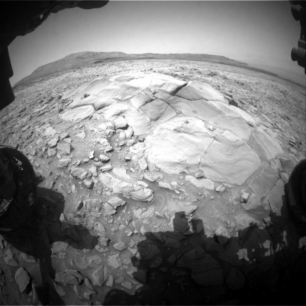
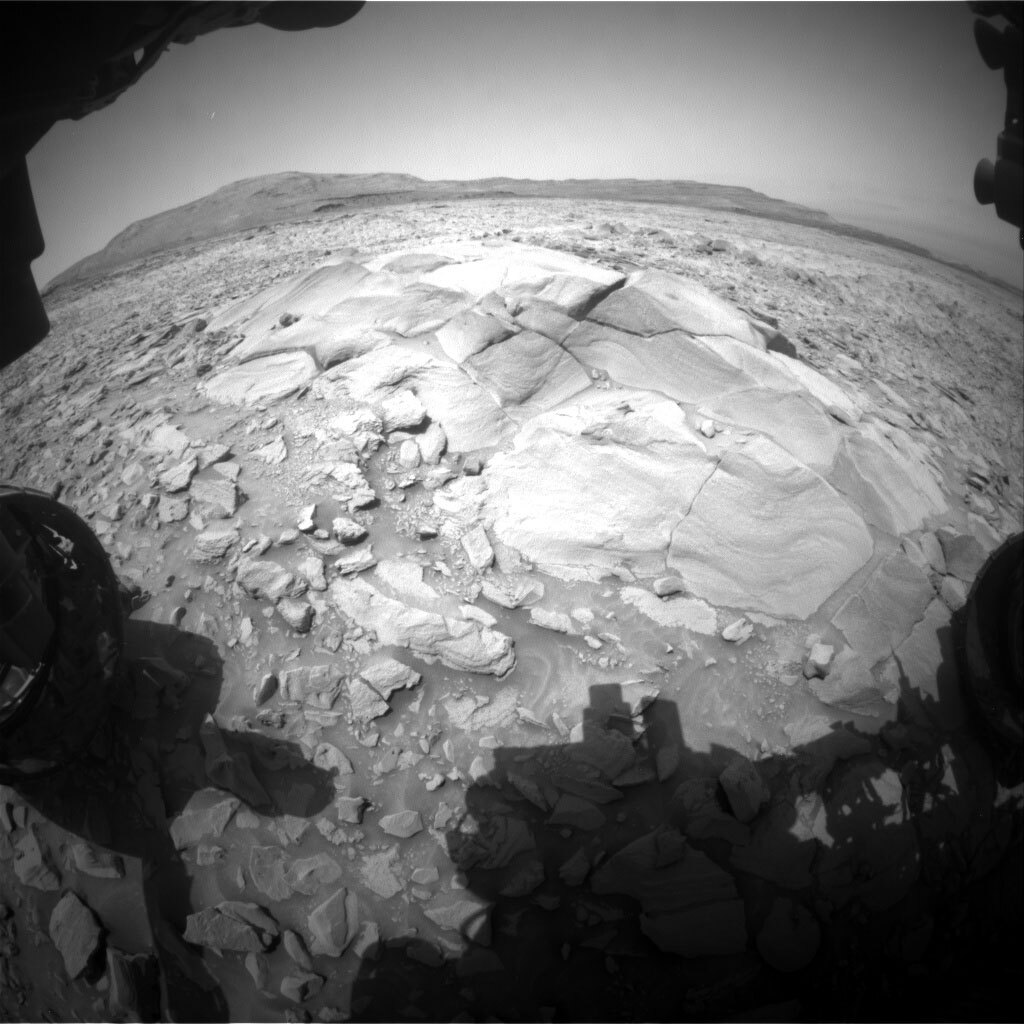
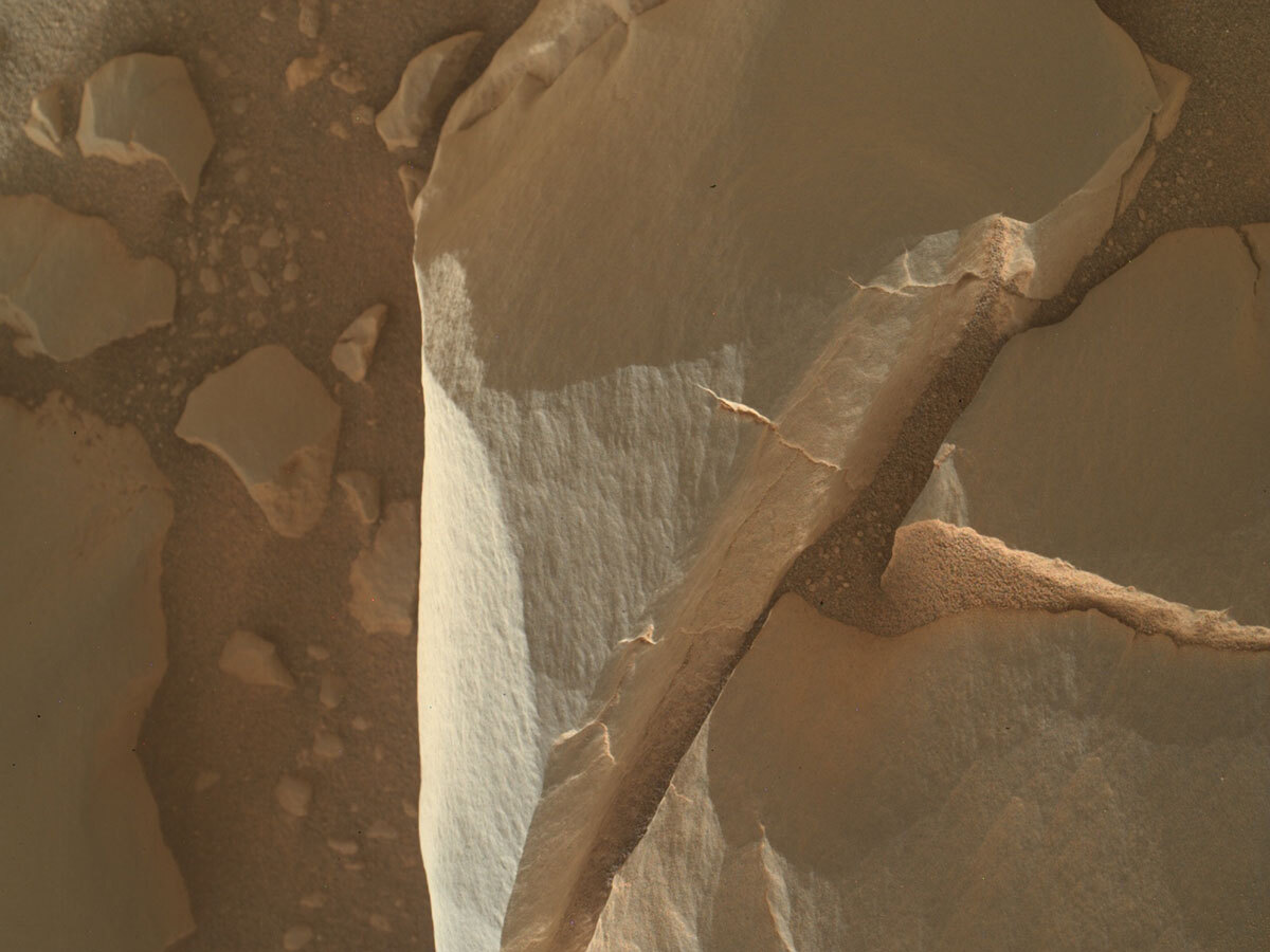
3434 Front Hazcam image of the “Hartle Loup” outcrop. The two darker ovals on the outcrop (just to the right, and up from the centre of the outcrop) are the areas we brushed with the Dust Removal Tool (DRT) prior to analysis with APXS and MAHLI (“Donkey Trail” – top, “Venlaw” – bottom). The Greenheugh pediment surface extends out behind the Hartle Loup outcrop to the Gediz Valles ridge in the background. Credits: NASA/JPL-Caltech. Download image ›
It has been a frustrating week for the Curiosity science and engineering teams. While we have a better understanding of how to recover the minor Remote Sensing Mast (RSM) issue that we encountered at the beginning of last week, we’ll need to try again before we can drive away. We are hopeful and quietly confident that perseverance will pay off and that we gain back full use of the RSM in this plan. Although our weekend remote sensing activities did not execute, Curiosity collected more compositional and close-up imaging data of these interesting, resistant capping rocks with APXS and MAHLI. The APXS also analyzed the atmosphere, looking for seasonal changes in the Ar concentration, as well looking at its calibration target.
Because of the continued RSM problems we focused on recovering as many of the mast activities as possible during this single sol plan before hopefully driving away. ChemCam will analyze the chemistry of the “Cleveland” bedrock target. We will document the previous CCAM/APXS targets; “Braco,” “Burn Mouth,” “Donkey Trail,” and “Venlaw” targets with Mastcam. Mastcam will also image a block that Curiosity appears to have driven over and broken, “Bowder Stone” to look for fresh surfaces and textures. Further afield, we will acquire a ChemCam RMI mosaics of the Gediz Valles ridge and Mastcam mosaics of ridges on the pediment, and the resistant rounded exposure, “Hartle Loup,” that we are currently investigating.
The environmental scientists planned several observations to continue monitoring changes in atmospheric conditions. These included: a Navcam dust devil survey, dust devil movie, a line of sight image and a sky flats observation; and a Mastcam basic tau observation. After our hopefully successful drive, we will image the terrain beneath the rover wheels with MARDI. Standard REMS, DAN and RAD activities round out this plan.