April 25, 2022

Sols 3456-3457: Back Through the Buttes!

Written by Catherine O'Connell-Cooper, Planetary Geologist at University of New Brunswick
This image was taken by Left Navigation Camera onboard NASA's Mars rover Curiosity on Sol 3454.

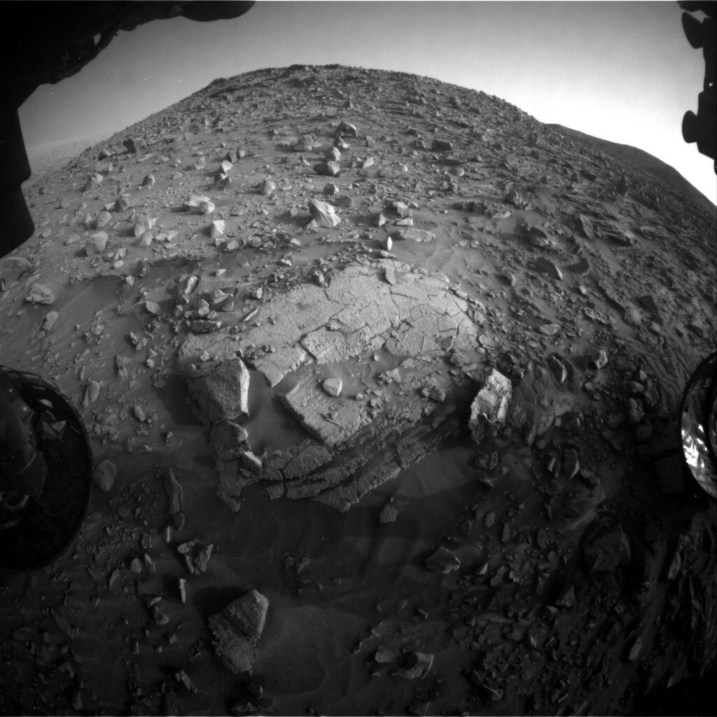
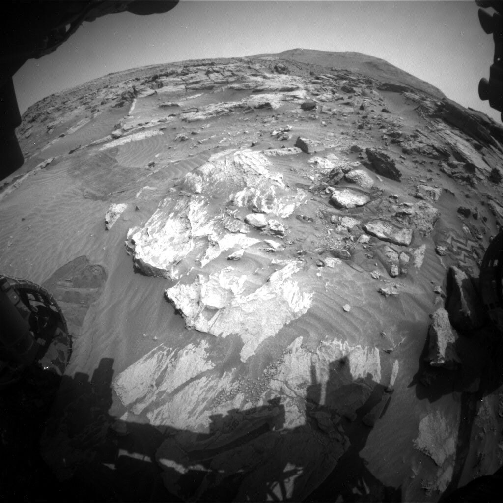
Sol 3454 Left Navigation Camera image of “Deepdale” butte. This image was taken by Left Navigation Camera onboard NASA's Mars rover Curiosity on Sol 3454. Credit: NASA/JPL-Caltech. Download image ›

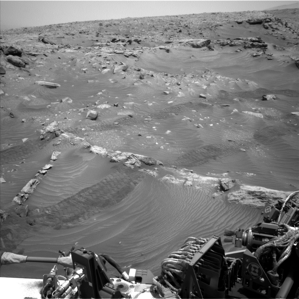
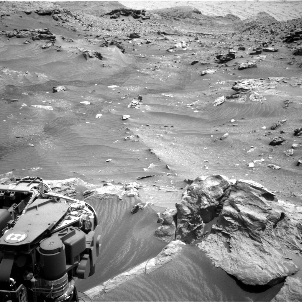
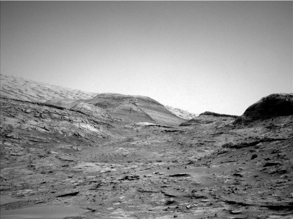
Our weekend drive brought us successfully to our planned stop. The priority in this Touch & Go drive plan is to image the buttes which surround us. Mastcam will image “Blackcraig” and “Maringma” buttes which lie on our left and right respectively as we continue to head down from the pediment, and “Deepdale” butte which is ahead of us in the distance.

Sol 3454: Left Navigation Camera
This image was taken by Left Navigation Camera onboard NASA's Mars rover Curiosity on Sol 3454. Credit: NASA/JPL-Caltech. Download image ›

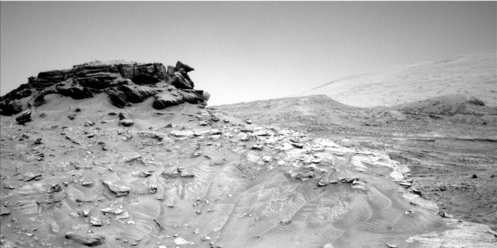
Although we have imaged Blackcraig and Maringma previously, these new images will add to the dataset, allowing investigation of the structures from all angles. We can also focus images on features of interest, zooming in for a closer look. These datasets will be pored over for years to come… and not just because the Mastcam images are so incredibly beautiful!

Sol 3454: Right Navigation Camera
This image was taken by Right Navigation Camera onboard NASA's Mars rover Curiosity on Sol 3454. Credit: NASA/JPL-Caltech. Download image ›

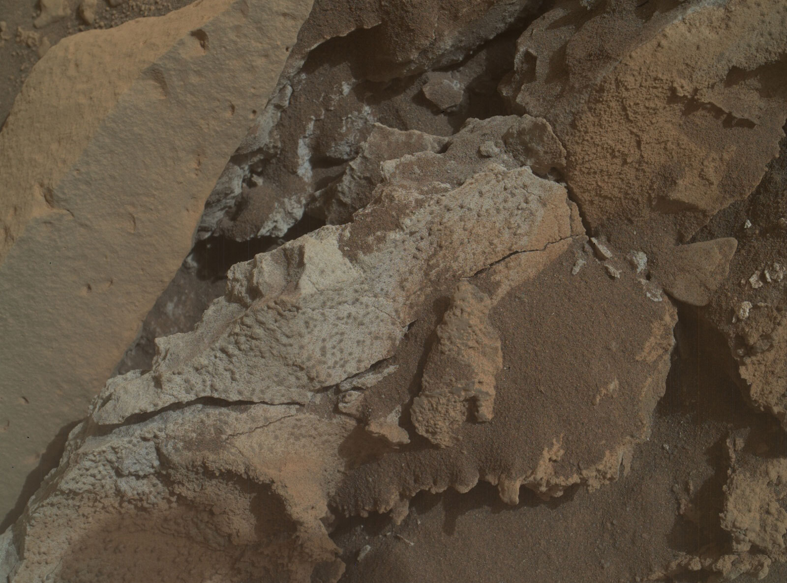
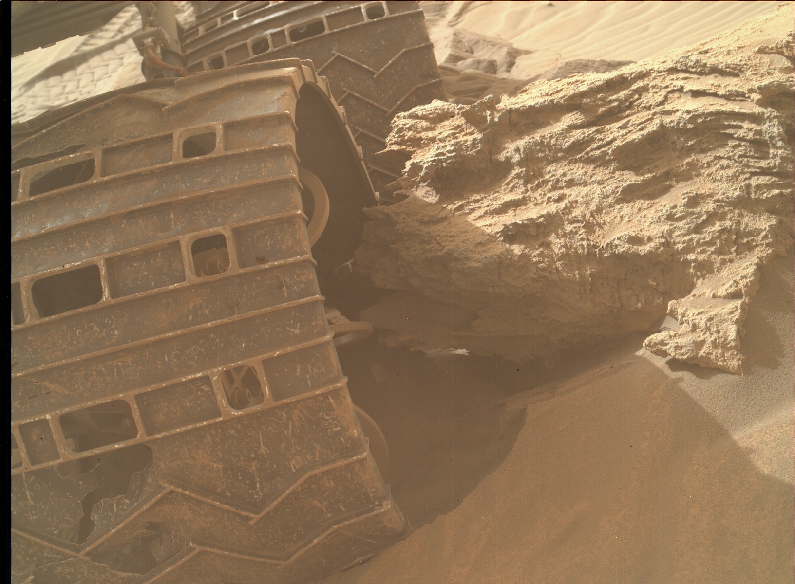
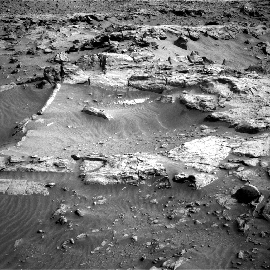
With the priority on imaging, we kept our science requests to a very bare minimum, with no ChemCam in this plan. This allowed some wiggle time for APXS and MAHLI starting times, so they are doing an early morning Touch and Go (i.e., short integration before we drive) on “Colla Firth,” on a small slab of rock in front of us.

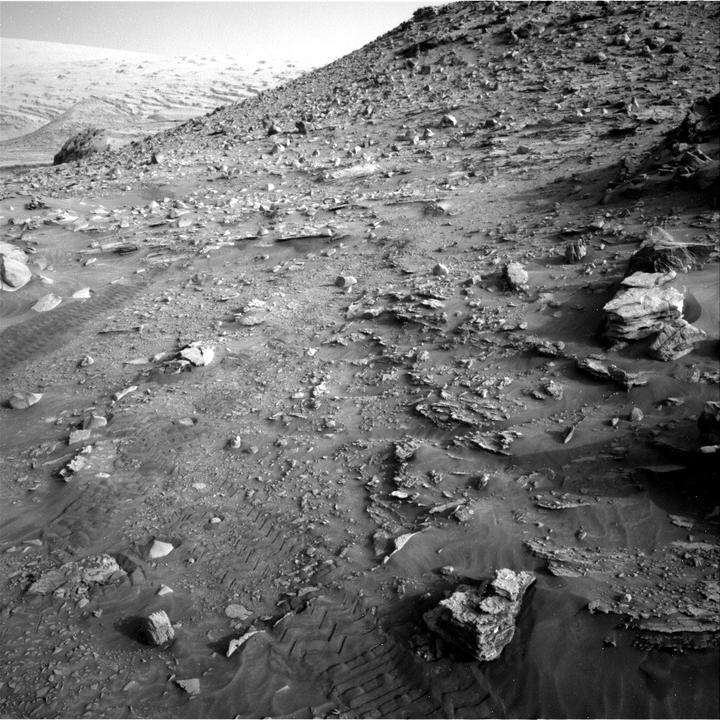
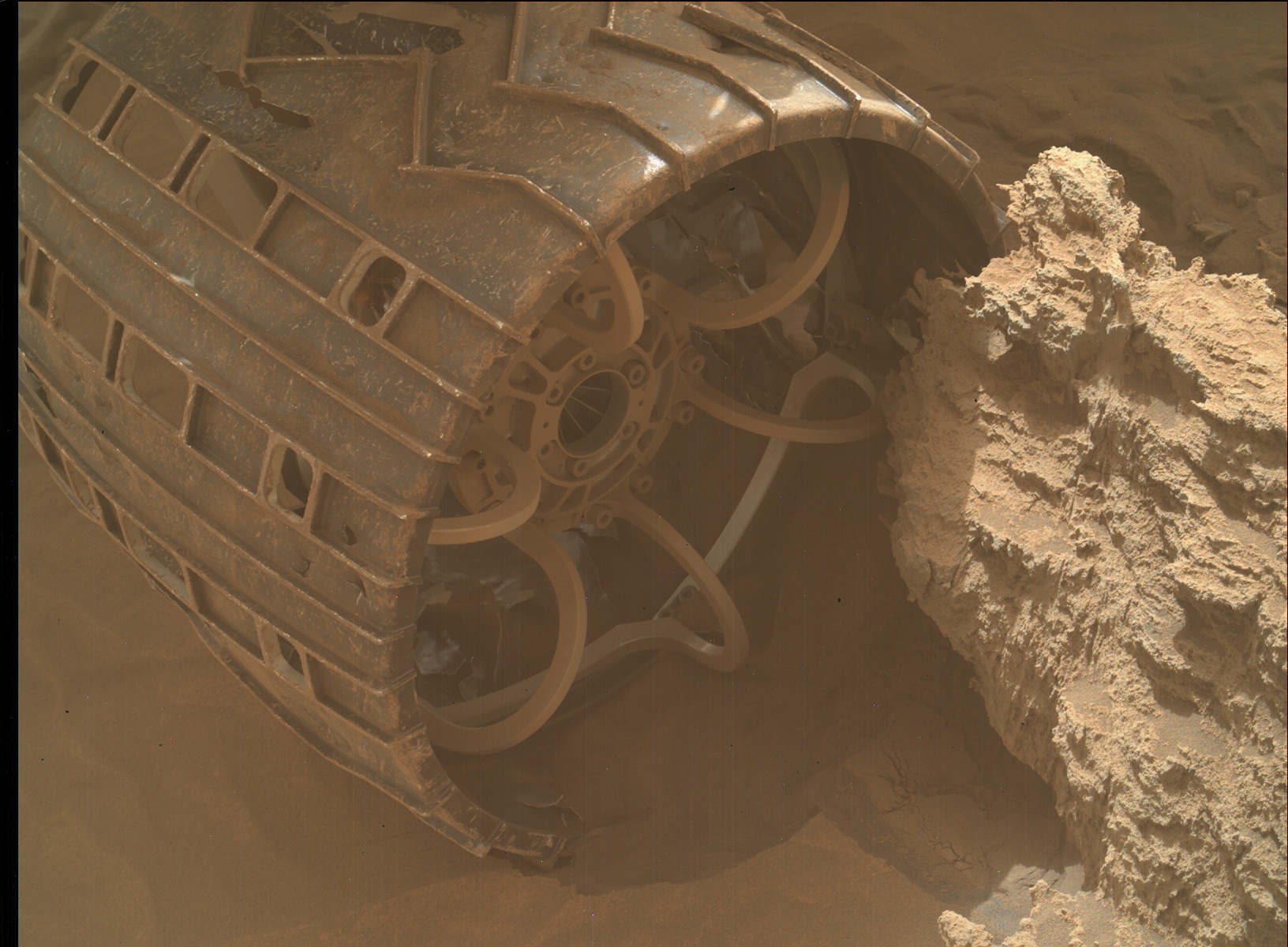
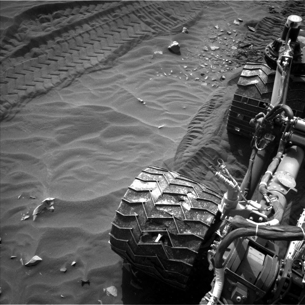
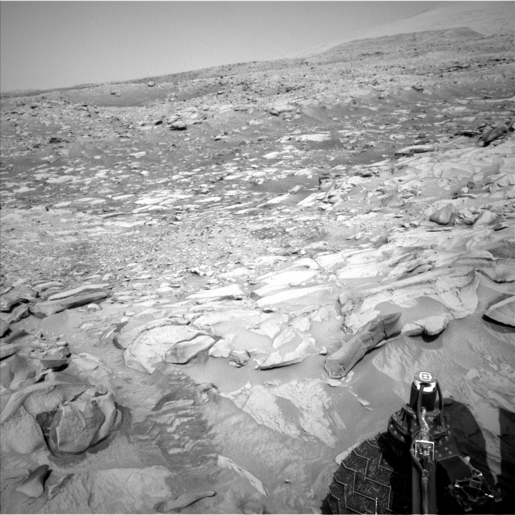
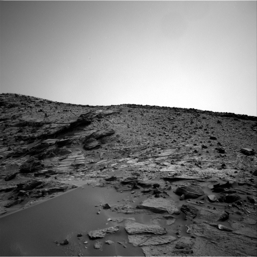
Mastcam will be taking some mid-drive imaging of rover wheel tracks, made as we passed this way on the way up to the pediment, about 70 sols ago. This novel activity will help us assess the rates at which sand is moving at ground level, over a two month period. ENV are also assessing dust movement, through “tau observations” to assess the rates at which dust is moving right now through the atmosphere.

April 22, 2022

Sols 3453-3555: Rad Rock Rumblings

Written by Fred Calef, Planetary Geologist at NASA's Jet Propulsion Laboratory
NASA's Mars rover Curiosity acquired this image using its Mars Hand Lens Imager (MAHLI), located on the turret at the end of the rover's robotic arm, on April 22, 2022, Sol 3451 of the Mars Science Laboratory Mission, at 01:58:18 UTC.

NASA's Mars rover Curiosity acquired this image using its Mars Hand Lens Imager (MAHLI), located on the turret at the end of the rover's robotic arm, on April 22, 2022, Sol 3451 of the Mars Science Laboratory Mission, at 01:58:18 UTC. Credits: NASA/JPL-Caltech/MSSS. Download image ›

Entering the weekend, we have a few more 'rad' rocks we'd like to get some science on before we drive farther away from the Greenheugh pediment and begin our journey again up Mt. Sharp. Starting on sol 3453, we break out our arm instruments for contact science with APXS and MAHLI on "Rumblings," a rock with an interesting knobby texture, followed by a delta over to "Delting," a flat area on some nearby bedrock, first by scrubbing the rock clean(ish) with the dust removal tool (DRT), then repeat a similar set of observations with those previous instruments. ChemCam will also collect science on "TIngaholm," perhaps a filled fracture, and some long distance RMI imaging of the Gediz Vallis ridge to examine its stratigraphy. Speaking of 'rad', or in this case 'radiance', Mastcam coverage of the "Shandon" workspace in front of the rover, also covering "Tingaholm," will be taken, as well as on an AEGIS target (where ChemCam automatically shot a rock with its laser).

The next sol, sol 3454, includes Mastcam multispectral documentation for "Delting" and "Rumblings," with a separate stereo mosaic on "Clo Mor Cliffs." Additional ChemCam includes observations on the "Rumblings" target again (good for cross instrument comparisons) and a second extended RMI mosaic on Gediz Vallis ridge. Finally on sol 3455, the rover will scooch ahead and conduct some post drive NAVCAM imaging. Scattered across all sols are some Mastcam sky flat, tau, and clast survey imaging, Navcam dust devil and line-of-sight surveys, and one MARDI observation on sol 3454. One really 'rad' observation will be a ChemCam passive sky observation that is coordinated with the European Space Agency (ESA) Trace Gas Orbiter (TGO) when it flies over Gale crater to look at water, oxygen, and carbon dioxide abundance in the atmosphere from both the ground and orbit at the same time of day.

April 20, 2022

Sols 3451-3452: Let's Touch and Go… No, No, No!

Written by Susanne Schwenzer, Planetary Geologist at The Open University
Curiosity’s workspace had a big piece of bedrock in plain view! This image was taken by Front Hazard Avoidance Camera (Front Hazcam) onboard NASA's Mars rover Curiosity on Sol 3449. Credits: NASA/JPL-Caltech.

Curiosity’s workspace had a big piece of bedrock in plain view! This image was taken by Front Hazard Avoidance Camera (Front Hazcam) onboard NASA's Mars rover Curiosity on Sol 3449. Credits: NASA/JPL-Caltech. Download image ›

Not that it matters… but exactly 100 sols ago, on January 7th, we were planning sols 3351 and 3352… and it was this blogger’s turn to report on what was happening. Apparently, we were marvelling at the landscape – and dealing with a rock under the foot, well, the wheel. Tosol, we were again dealing with a rock right under the rover, but this time, we were excited about it as the rover was in a stable position parked on a big piece of bedrock, presenting itself flat as a pancake, ready to be brushed and analysed. But there was a problem that required discussion... Tosol’s plan was originally a ‘touch-and-go’ sol, where we put the APXS down for a short integration before we drive away. Those ‘touch-and-go’ measurements return brilliant analysis throughout most of the Martian seasons, but right now we are in a warm season, and that means it’s too warm for really good data at the time those ‘touch-and-go’ measurements are happening. Therefore the science team discussed carefully how important the target is, and if it warrants us to stay in place to get the APXS measurement at a colder time of the day, and therefore get the best possible data quality. Once again, rover progress had to be weighed against the importance of the data. We decided the diversity of the region and the quality of the targets, together with the hypothesis on the different rock types and their formation we can test here, warrants us to stay.

As a result there is a plethora of science activities in the plan, and the team are looking forward to have another data feast over the weekend… and of course to seeing the data. Here are the details:

APXS and MAHLI have two and three activities, respectively. The pancake-shaped rock the rover is parked on will be brushed and investigated with APXS and MAHLI on a target called ‘Shandon.’ APXS and MAHLI are also investigating the edge of the bedrock on a target called ‘Nesting,’ which is at the edge of the big, flat rock and allows side-on view. Finally, MAHLI is looking at ‘Rumblings,’ which is a curiously bright and textured target that the team thinks might be alteration features and would like to know more about. Tosol’s MAHLI will likely also allow for APXS in a future plan, despite the targets being a bit spikey. The MAHLI images will show, if we can get APXS to touch in a safe way, but of course, MAHLI images are always welcome science data, too, especially on textured targets like this one.

ChemCam is investigating two targets, ‘Tonga,’ which is on the bedrock and ‘Kirby Lonsdale,’ a vein target. Mastcam is taking documentation images of the two ChemCam targets and doing a multispectral investigation on the brushed area. More Mastcam images are planned in form of a 16x4 mosaic on the target ‘Onich Dry Gorge,’ which was imaged from a distance and we are now getting much higher resolution images from a closer distance. ChemCam is adding to the images through a long distance RMI and an RMI of rocks broken up by the rover wheels. Lots of data and images, and more to come over the weekend at this interesting location.

April 18, 2022

Sols 3449-3450: Comin' Down the Mountain

Written by Mark Salvatore, Planetary Geologist at University of Michigan
This image was taken by Right Navigation Camera onboard NASA's Mars rover Curiosity on Sol 3447.

This image was taken by Right Navigation Camera onboard NASA's Mars rover Curiosity on Sol 3447. Credits: NASA/JPL-Caltech. Download image ›

After spending the last few weeks exploring the top of the nearby pediment surface, Curiosity is now making her way back down from the pediment and towards an alternate route to Gediz Vallis Ridge.

NASA's Mars rover Curiosity acquired this image using its Mars Hand Lens Imager (MAHLI), located on the turret at the end of the rover's robotic arm, on April 17, 2022, Sol 3447 of the Mars Science Laboratory Mission.
Figure A
Credits: NASA/JPL-Caltech/MSSS
Download image ›
The beginning of the most recent drive sequence successfully extracted Curiosity from the rock that stopped last Wednesday’s drive (see images Figure A and Figure B, but the second half of the drive was cut a bit short because Curiosity’s wheels were observed to be slipping a bit as she was descending through this sandy region. While not a concern for the health or activity of the rover, it has made our descent take a bit longer than expected. That’s okay - plenty more time for additional science observations as we traverse back through the same landscapes that we explored in late February of this year!

NASA's Mars rover Curiosity acquired this image using its Mars Hand Lens Imager (MAHLI), located on the turret at the end of the rover's robotic arm, on April 17, 2022, Sol 3447 of the Mars Science Laboratory Mission.
Figure B
Credits: NASA/JPL-Caltech/MSSS
Download image ›

In our current plan, we will be performing an APXS analysis on a small flat patch of local rock named “Runn” and will also be analyzing some local bedrock to the right of the rover using the ChemCam instrument’s LIBS capabilities. Finally, we will also acquire several high-resolution imaging mosaics of the surrounding landscape captured by both Mastcam and ChemCam. Curiosity will then continue her drive down from the pediment, acquiring post-drive imagery and data for ENV science, in addition to a standard post-drive AEGIS observation using ChemCam. Over the next few days, Curiosity will continue to drive back towards the path that team has identified as the likely best route to continue the Mt. Sharp ascent.

April 15, 2022

Sols 3446-3448: Weekend workload

Written by Mariah Baker, Planetary Geologist at Center for Earth & Planetary Studies, Smithsonian National Air & Space Museum
This image was taken by Left Navigation Camera onboard NASA's Mars rover Curiosity on Sol 3444.

This image was taken by Left Navigation Camera onboard NASA's Mars rover Curiosity on Sol 3444. Credits: NASA/JPL-Caltech. Download image ›

Due to some complex terrain, the rover’s last drive came up about ten meters short of the target destination. The rover’s unexpected parking orientation unfortunately will not allow our usual uplink direct from Earth. We can instead send the weekend’s commands through one of the orbiters at Mars, but a little later than planned. As a result, today’s plan had to be adjusted accordingly. Weekend plans typically include three sols of science, but all the activities for this weekend had to occur with the second and third sols only.

Luckily, the primary targeted science block on the second sol was increased from one hour to two hours, providing ample time to acquire data at this location before driving away. This block was filled with remote science activities to characterize sand and rocks in the rover’s workspace. A ChemCam LIBS activity was planned on bedrock target “Easter Skeld,” and two ChemCam RMI mosaics will be used to target the distant Gediz Vallis Ridge. Three Mastcam stereo mosaics were planned to document the surface around the LIBS target, to characterize some nearby sand ripples, and to extend coverage over interesting sedimentary textures in the target “Lugar Rocking Stone.” Mastcam will also be used to re-image wheel tracks that the rover made during its initial traverse of this area over a month ago (shown in the image above) to search for any wind-driven changes in the tracks. The untargeted science block on the third sol also contains a single ChemCam AEGIS observation. The team decided to forego weekend APXS activities due to the changes in the plan, but three sets of MAHLI images were still scheduled on soil target “Bains Beach,” a small rock named “Spiggie Beach,” and one of the rover’s wheels.

Over the weekend, the rover will also collect a large amount of data on current environmental conditions. The team planned three Mastcam “tau” images, a Mastcam image of the crater rim, and a Navcam “Line of Sight” image, all of which will be used to quantify the amount of dust in the atmosphere. A Navcam dust devil movie will also be acquired, and four Navcam movies will help characterize cloud motion. So, although today’s plan is not necessarily typical for a weekend on Mars, the rover still has a full workload!

April 13, 2022

Sols 3444-3445: The Curious Case of Cross-Cutting Ridges

Written by Sean Czarnecki, Planetary Geologist at Arizona State University
This image was taken by Left Navigation Camera onboard NASA's Mars rover Curiosity on Sol 3440.

This image was taken by Left Navigation Camera onboard NASA's Mars rover Curiosity on Sol 3440. Credits: NASA/JPL-Caltech. Download image ›

Tosol's plan is focusing on examination of the linear ridges that cross-cut the local terrain. These raised ridges look like boxes with their lids cut off and mostly buried in the local bedrock, and all we can see are the vertical box faces sticking up out of the ground. How these structures actually form is an active area of investigation, and we hope the data we gather tosol will help us "think outside the box" and shed some light on their origin.

The plan includes APXS and MAHLI of the target 'Dun,' ChemCam LIBS of 'Ceres' (a target on Mars, not the dwarf planet!), and ChemCam RMI mosaic of the Gediz Vallis ridge. Mastcam will be taking stereo images of targets 'Feorachas' and 'Clavel' as well as a mosaic of some old rover sand tracks to investigate surface granular processes.

Mastcam and Navcam are making several dust devil observations among others, and of course DAN, REMS, and RAD are making their standard observations.

April 11, 2022

Sols 3442-3443: Deoch-an-Doris

Written by Scott Guzewich, Atmospheric Scientist at NASA's Goddard Space Flight Center
This image was taken by Right Navigation Camera onboard NASA's Mars rover Curiosity on Sol 3440.

This image was taken by Right Navigation Camera onboard NASA's Mars rover Curiosity on Sol 3440. Credits: NASA/JPL-Caltech. Download image ›

In Scots Gaelic, “deoch-an-doris” loosely means “one for the road.” Today we planned one more set of investigations on the fascinating Feorachas outcrop before we leave it behind forever. We first visited it over a month ago as we were climbing up the Greenheugh Pediment and now we have given it a more thorough investigation on the way down thanks to some crafty driving by Curiosity’s rover planners in this craggy terrain. You can see our old rover tracks extending off into the distance in this Navcam image. Feorachas is the large block extending out of the sand in the lower right.

Today’s plan includes contact science on three targets, including “Up Helley” (near the circular scoop taken out of the upper left portion of Feorachas), and a variety of remote sensing science with ChemCam LIBS and Mastcam multispectral imaging. ChemCam LIBS and Mastcam multispectral imaging are complementary ways to understand the chemistry of the rocks we encounter on Mars.

As we’re also in the dusty season on Mars, Curiosity will take two dust devil movies and measure the amount of dust in the atmosphere above us and within Gale Crater.

April 8, 2022

Sols 3439-3441: Chance for a Redo in a Geological Wonderland!

Written by Catherine O'Connell-Cooper, Planetary Geologist at University of New Brunswick
This image was taken by Front Hazard Avoidance Camera (Front Hazcam) onboard NASA's Mars rover Curiosity on Sol 3437.

This image was taken by Front Hazard Avoidance Camera (Front Hazcam) onboard NASA's Mars rover Curiosity on Sol 3437. Credit: NASA/JPL-Caltech. Download image ›

We are retracing our steps, picking our way slowly back down from the pediment and the dangerous gator rocks which would have eaten our wheels!

There have been so many times across the almost ten years of our mission in Gale that, in order to keep the forward momentum going, we have needed to move on from sites, leaving our geologists sighing at the wonderful rocks behind us. Our images and compositional analyses usually downlink to Earth after we have left an area, and so we often wish for a “go-back” to zoom in on details that we only noticed in images or to get more compositional data on things that were unexpectedly intriguing.

So, although it is disappointing to be leaving the pediment (for now at least!), this does give us a golden opportunity to revisit outcrops that we passed on our drive up to the pediment, back in early March. We have a long wish list for this area, but Mastcam acquired some incredible imagery on the drive up, which we are using to pinpoint the best outcrops in this area.

We arrived at one of these outcrops on Wednesday, which exhibits a somewhat chaotic appearance and a jumble of veins and raised resistant ridges. Awkward wheel placements meant that we could not do any arm science (APXS and MAHLI) so we had to bump back just a little to be safer. This bump actually gave us a gift – it broke up some rocks in the workspace so we can analyze fresh surfaces. “Lodberrie” will be subjected to the full analytical suite of ChemCam, Mastcam, APXS and MAHLI in the targets, whilst Mastcam will image two other targets “Denny” and “Saltwick Bay."

APXS and MAHLI will analyze “Sneuga” on one of these raised ridges, and MAHLI will get images of the nearby target "Inchbonny." Mastcam will take further images of one of Wednesday’s targets (“Fort Charlotte”) on an area to the right of our workspace with abundant thin laminations but with few raised ridges. ChemCam will use LIBS to investigate the chemistry of the target “Lunna” in that same area. Mastcam will also acquire even more images of the “Feorachas” outcrop, the intended end of drive destination for this plan. You can see the two long linear ridges of this outcrop just beyond our current workspace (about 7 metres away) in the image above and in this Left Navigation camera image. Looking forward to seeing Monday’s workspace!

April 7, 2022

Sols 3437-3438: Got a Hitch in Our Giddyup

Written by Michelle Minitti, Planetary Geologist at Framework
This image was taken by Right Navigation Camera onboard NASA's Mars rover Curiosity on Sol 3436.

This image was taken by Right Navigation Camera onboard NASA's Mars rover Curiosity on Sol 3436. Credits: NASA/JPL-Caltech. Download image ›

We successfully drove further down off of the “Greenheugh pediment” as we head toward smoother driving pathways downhill. However, the chaotic jumble of terrain we encountered in the final few rolls of our wheels left a couple of our wheels perched awkwardly. That meant we could not get out the arm for contact science, lest our large arm swinging around cause the rover to shift unexpectedly. It also meant that our rover drivers wanted to scoot the rover off of the offending terrain to put all six wheels on terra firma (or the Martian equivalent) before attempting another drive. Thus, our drive today aims to reposition the rover for weekend observations.

Before our repositioning, we planned an extensive set of imaging and analyses with ChemCam and Mastcam. ChemCam will acquire chemistry from a beautifully layered bedrock outcrop, “Fort Charlotte,” and will acquire an RMI mosaic from the top section of Gediz Vallis Ridge, which we can still see despite dropping in elevation in our last drive. Mastcam will acquire three mosaics to cover the intricate bedrock structures in this area. Two of these mosaics center on the bedrock ridge in the midfield of the above image, dubbed “Feorachas” on our first pass through this area. The ridge, and the linear features extending away from it, are of great interest for what they might reveal about the history of this part of the pediment. The third mosaic centers on the bedrock in the workspace in front of the rover, which will come in handy as we (hopefully) plan contact science within it over the weekend. We will also look skyward, with a Navcam image to monitor the amount of dust in the atmosphere, and a Navcam cloud movie.

After we settle our wheels, we plan to acquire an automated ChemCam raster from the surrounding bedrock, a ChemCam passive observation of the atmosphere, a Mastcam tau measurement, and a Navcam dust devil survey. We will acquire a DAN active measurement after we move to complement the longer DAN passive measurements that span parts of each sol. REMS and RAD make their systematic measurements throughout both sols.

Here’s hoping the weekend goes off without a hitch!

April 6, 2022

Sol 3436: Motion Accomplished

Written by Ashley Stroupe, Mission Operations Engineer at NASA's Jet Propulsion Laboratory
This image was taken by Left Navigation Camera onboard NASA's Mars rover Curiosity on Sol 3435.

This image was taken by Left Navigation Camera onboard NASA's Mars rover Curiosity on Sol 3435. Credits: NASA/JPL-Caltech. Download image ›

There was good news when we came in for planning today – our remote mast recovery and all our other activities completed successfully, including the drive.

Today I took on the role of “Supratactical Uplink Lead,” and in that role I primarily worked to sketch out what our upcoming plans will look like. I was able to plan for new activities now that we successfully drove away from our prior workspace. Curiosity is now parked at a workspace we partially explored previously on sol 3417, which gave us an opportunity to do some more observations.

We started the day by placing the APXS on a smooth bedrock target, “Broo,” to contrast with the rougher target, Knott, that we looked at before. Fortunately, this was a simpler activity for the Rover Planners than some of our other workspaces recently.

While the APXS integrates on Broo, Curiosity will also be doing some imaging and using the laser. With the arm placed down on the target, we needed to point our cameras at other places. “Blue Mull,” which is another target in the workspace similar to Broo, will be examined by Mastcam and ChemCam (LIBS and RMI). We also will look at some targets outside the workspace, including a previous set of rocks called “Burnfoot,” which we previously imaged from another angle, and a rock named “Da Haaf” that we may have broken under our wheels when driving over it. Also, we are extending the past imaging of a the Tighnabruaich rock cluster and mosaic of the nearby crater. Finally, we image Youkil Quarry target, which shows a nice vertical exposure with layers, from a different angle. Lastly, we are doing some imaging to search for dust devils with Mastcam and Navcam.

After the imaging and APXS complete, we pick up with the arm again, taking MAHLI images of the Broo target and then stowing the arm. Our drive today, which the Rover Planners were able to again refine and improve with this additional attempt, continues to wind around this difficult terrain. We are looking forward to when we have finished returning to these prior locations and can move on to new vistas.

The attached image shows some evidence of driving – both some tracks and another rock that was moved (and maybe also broken) when we drove over it.