May 16, 2022

Sols 3476-3477: A SAM Methane Experiment Between Drives

Written by Scott VanBommel, Planetary Scientist at Washington University
This image was taken by MAHLI onboard NASA's Mars rover Curiosity on Sol 3474.

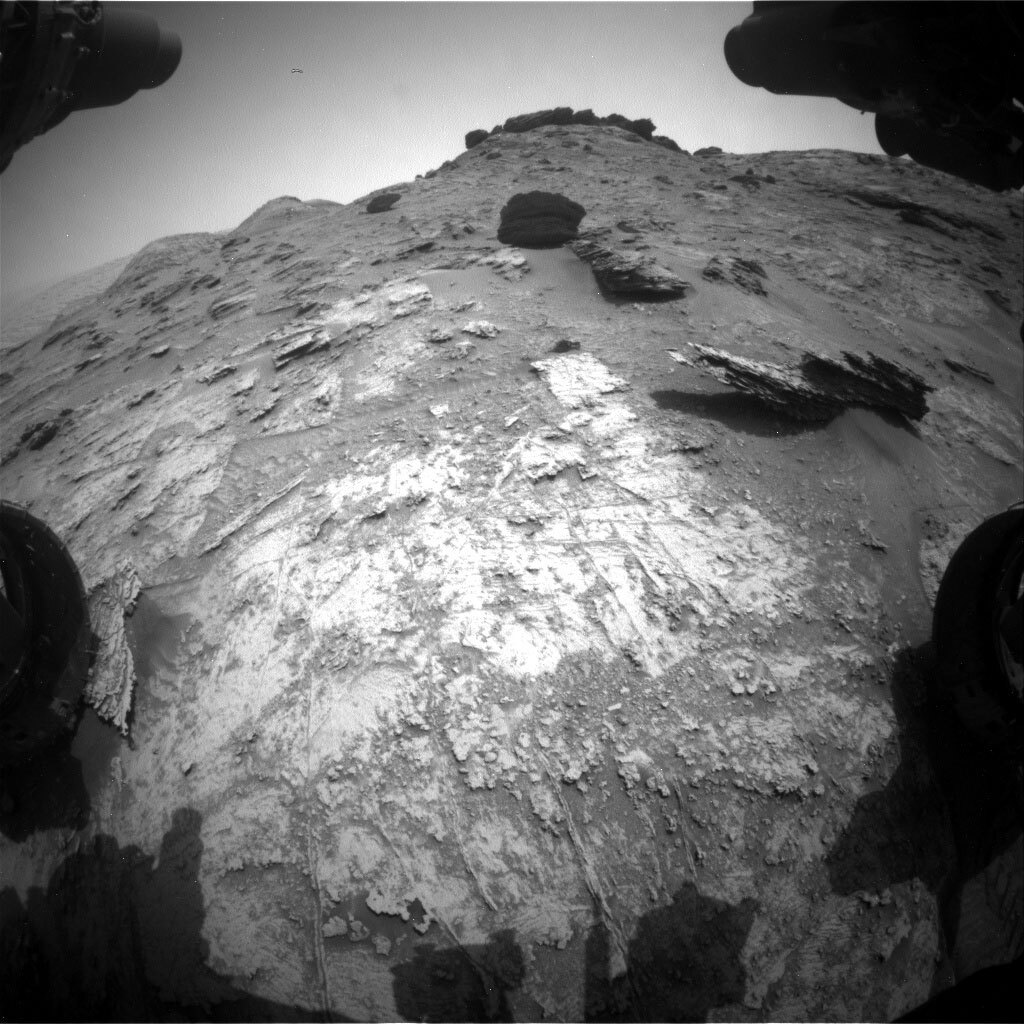
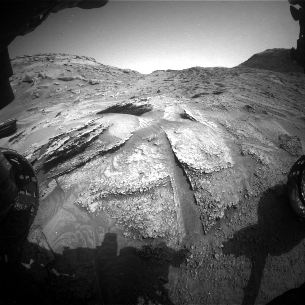
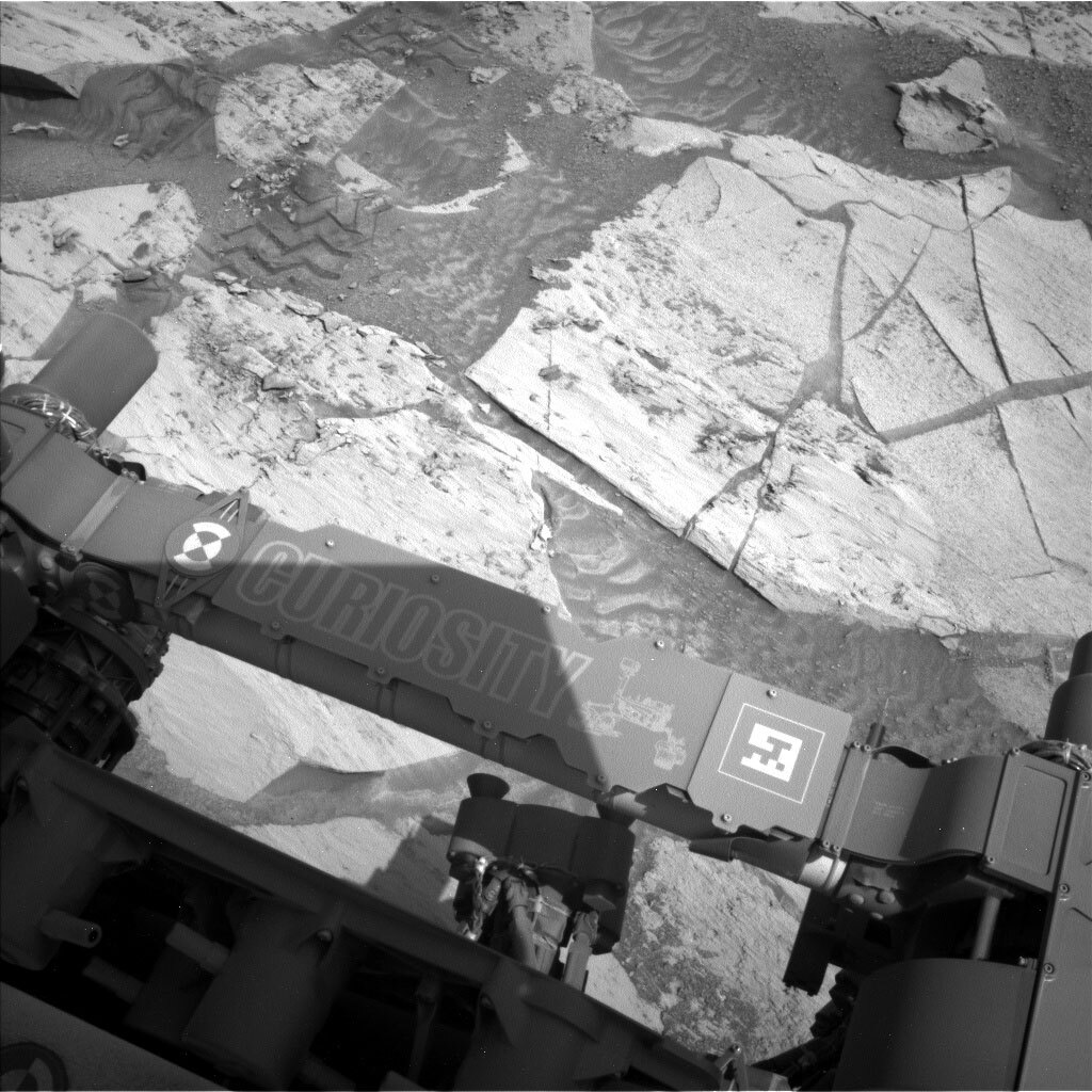
This image was taken by MAHLI onboard NASA's Mars rover Curiosity on Sol 3474. Credits: NASA/JPL-Caltech/MSSS. Download image

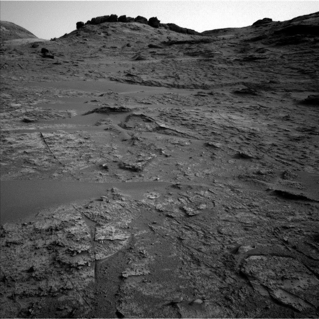
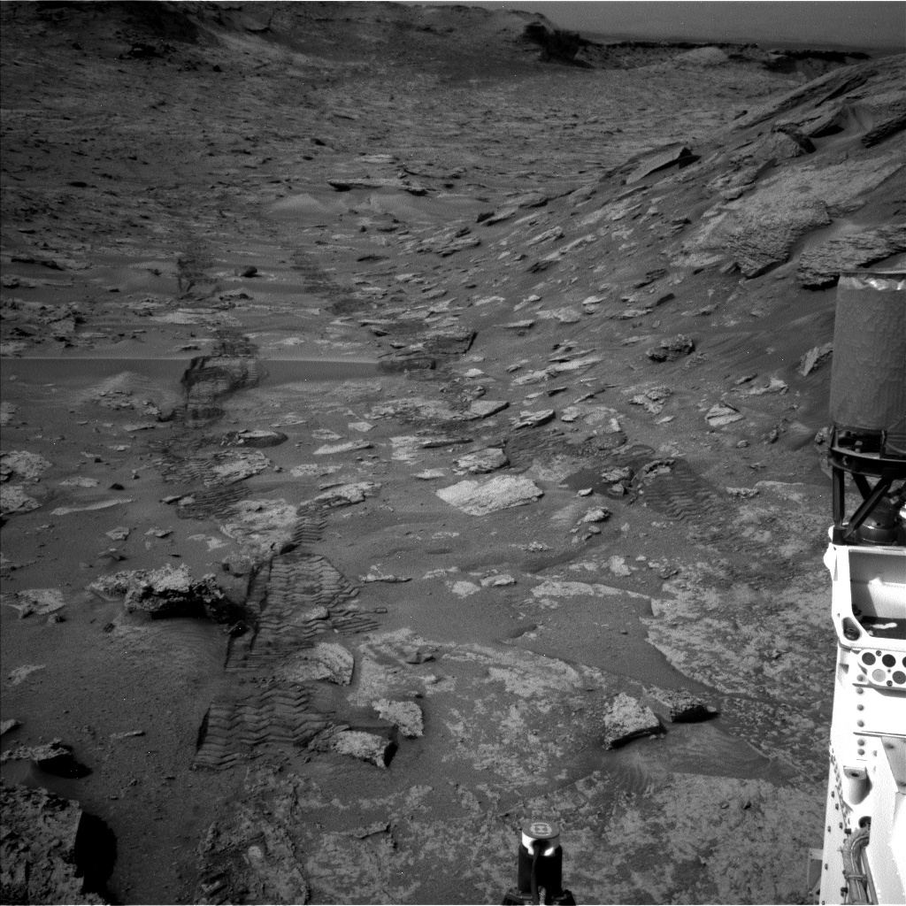
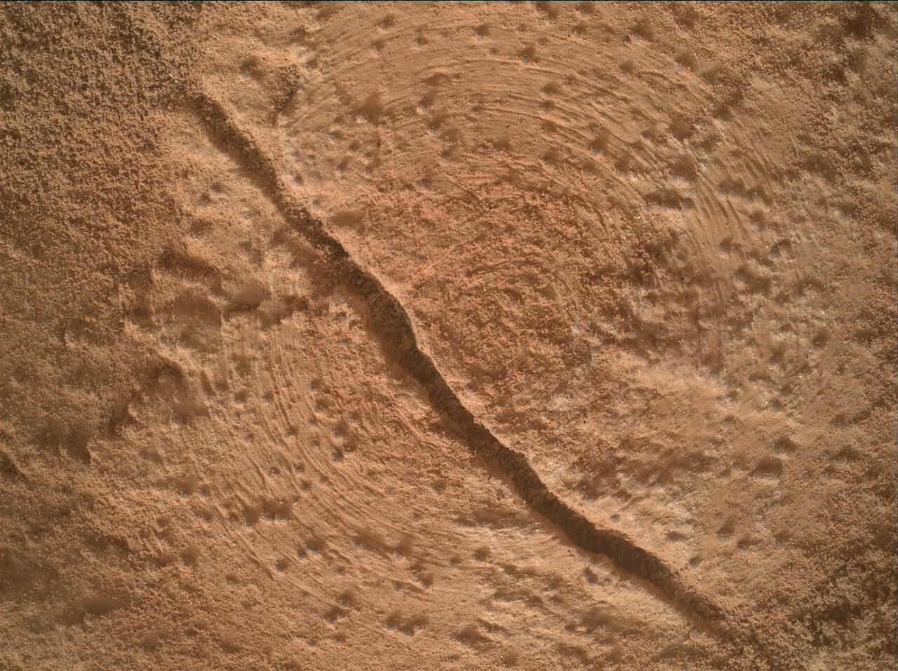
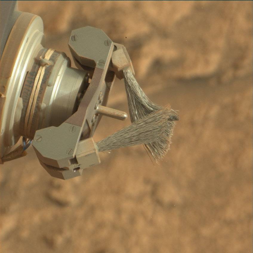
Curiosity continues to navigate challenging terrain. The drive executed over the weekend moved us 8 m from our previous location. Prior to the weekend drive, we completed contact science with APXS and MAHLI on targets "Pedra Pintada" and "San Pedro," the latter of which was brushed with the Dust Removal Tool (DRT) to remove thin airfall dust that was coating the surface of the rock face. Dust is rather ubiquitous on Mars, not only coating rocks and regolith but also spacecraft hardware as seen in numerous selfies taken at Gale, Jezero, and Elysium Planitia. In this past weekend plan's blog, "A Different Perspective on Mirador Butte," Dr. Schwenzer noted how Curiosity continually monitors its environment, including tracking the abundance of atmospheric dust. When that dust settles on rocks, it can partially mask the chemistry and surface texture of these rocks from APXS and MAHLI in particular. Brushing rock surfaces with the DRT is not always possible, but it does improve scientific assessments of these surfaces. To keep tabs on the health of the DRT, we take Mascam images periodically, including in this past weekend's plan.
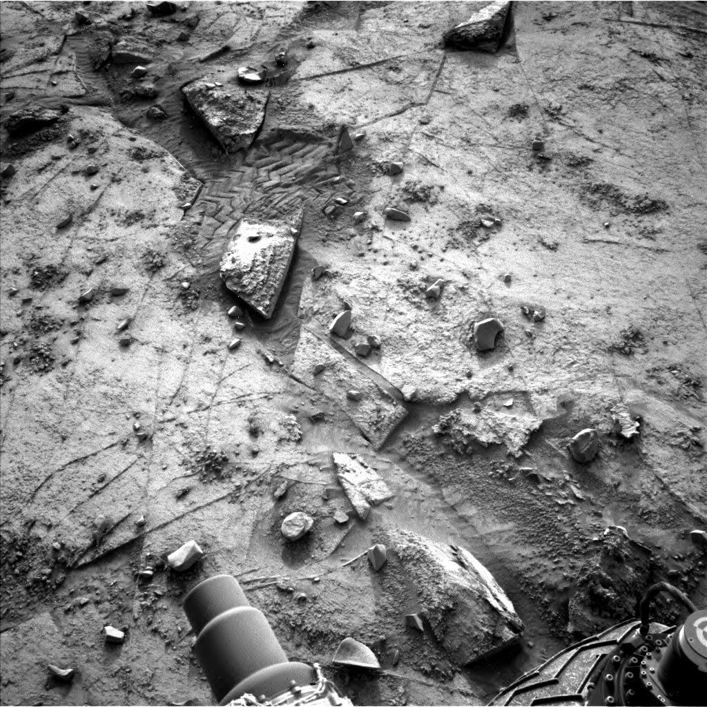
This image was taken by Mast Camera (Mastcam) onboard NASA's Mars rover Curiosity on Sol 3473.
Download image

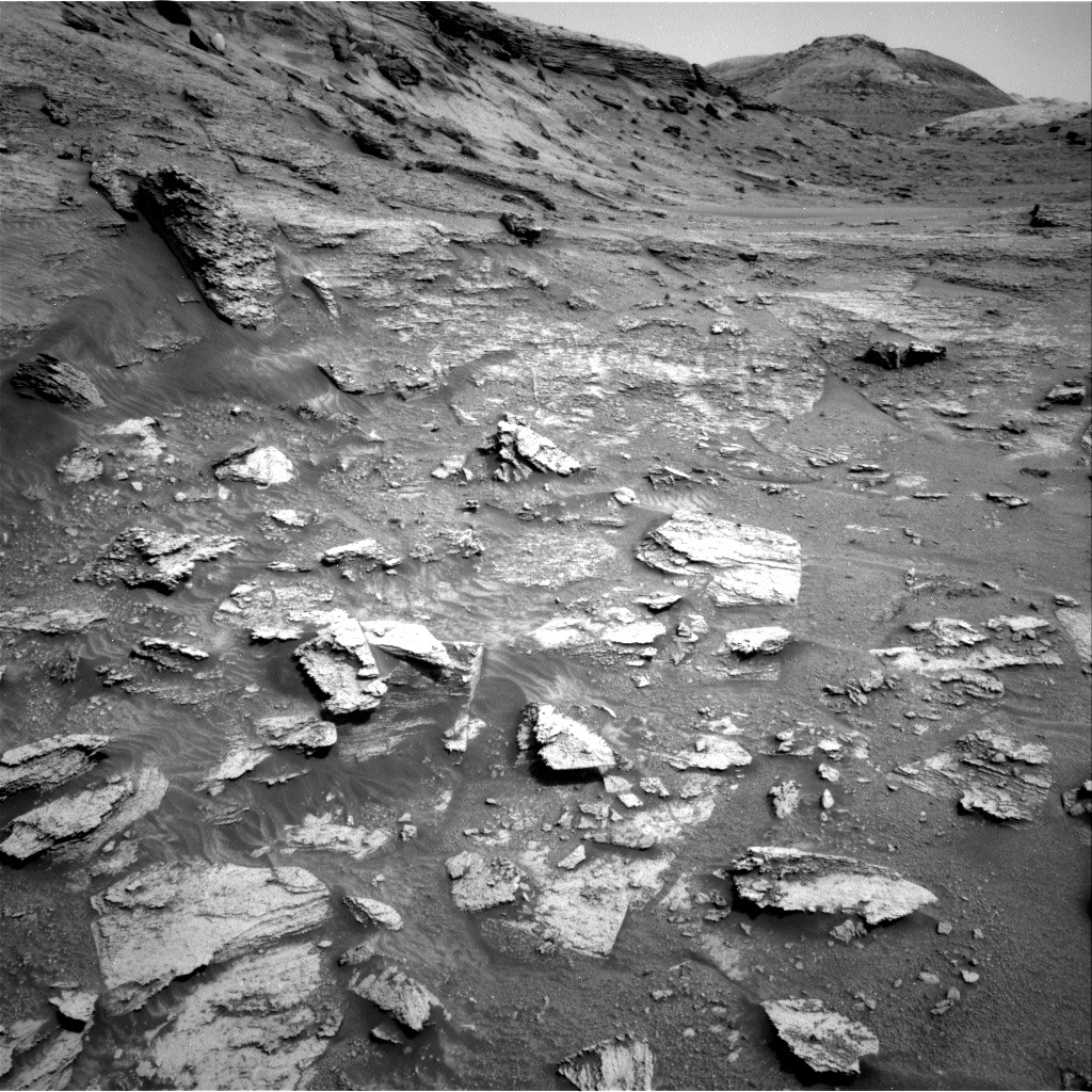
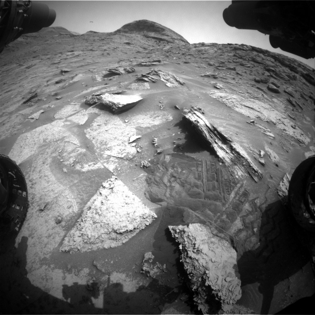
Today's two-sol plan started with a discussion about whether we should include an APXS touch-and-go (T&G) measurement in our new workspace. APXS T&Gs are short measurements, typically 15-20 minutes long, conducted as soon as possible after the rover wakes up but before it drives. The rover "touches" the surface of a rock with the APXS, conducts an APXS analysis (and often acquires MAHLI images), stows the arm, and drives (i.e., "Gos"), all before a data relay in the afternoon that shepherds critical data to Earth in a timely fashion. Currently, however, we are approaching martian summer solstice in the southern hemisphere and temperatures can be rather balmy, with recent daily highs above 0 C (32 F). While APXS prefers cold temperatures (classic Canadian instrument, eh?), and has the ability to cool itself, we have noticed with recent APXS T&Gs that morning temperatures have been less than ideal and have resulted in a reduction in spectral resolution - essentially blurring elemental peaks together and increasing analytical uncertainty. With this in mind, and given the quality of and short distance from our previous bedrock chemical analyses (Pedra Pintada and dust-cleared San Pedro), the decision was made to forego APXS at this site in favour of extending the drive and freeing up resources for additional imaging activities.

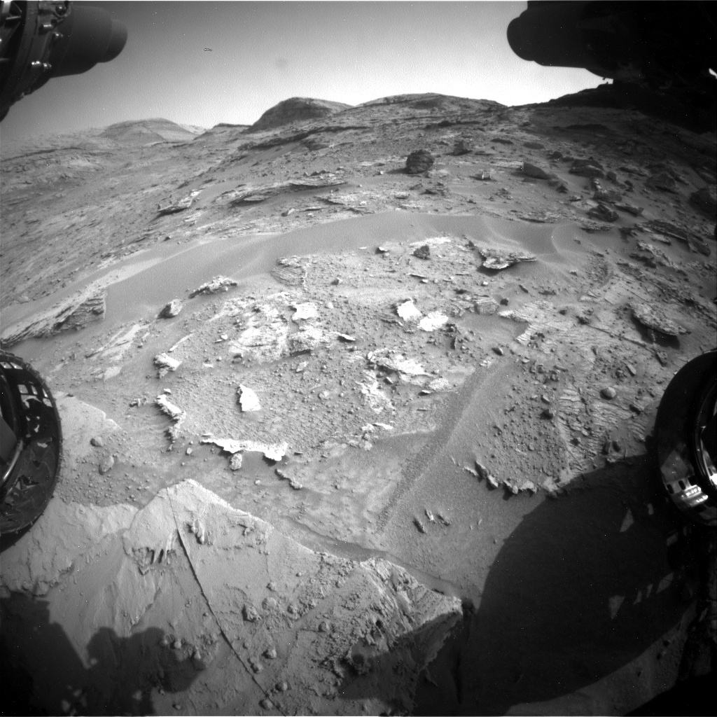
The first sol of the plan kicks off with a DAN passive activity whereby DAN utilizes neutrons produced via interactions between galactic cosmic rays and the martian atmosphere to investigate potential subsurface hydration using hydrogen content as a proxy. ChemCam laser analyses of "Los Caribes" are complemented by ChemCam RMI and Mastcam images. Additional Mastcam images are acquired on targets "Aratana," "Jawalla," "Aranka," and "Rupununi." We also utilize MAHLI to snap three images of Aratana before we stow the arm and commence an early afternoon drive. Post-drive activities on the first sol include a DAN active experiment, with DAN generating its own neutrons to look for subsurface hydrogen.

On the second sol, the plan includes a ChemCam AEGIS activity, where the rover selects its own targets to investigate with the ChemCam laser. This activity is well-suited for post-drive use as it can be conducted autonomously. The star of the sol, however, is an overnight dual enrichment methane experiment by SAM. This experiment has been run before and helps us characterize methane in the martian atmosphere by comparing a methane-enriched sample to one without any enrichment. Throughout both sols, Curiosity will continue with its regular cadence of climate monitoring with REMS.

May 13, 2022

Sols 3473-3475: A Different Perspective on Mirador Butte

Written by Susanne Schwenzer, Planetary Geologist at The Open University
This image shows the today’s workspace, and if you look at the image in yesterday’s blog, you can make out the area in the distance. This image was taken by Left Navigation Camera onboard NASA's Mars rover Curiosity on Sol 3469.

This image shows the today’s workspace, and if you look at the image in yesterday’s blog, you can make out the area in the distance. This image was taken by Left Navigation Camera onboard NASA's Mars rover Curiosity on Sol 3469. Credits: NASA/JPL-Caltech. Download image ›

We drove just over 30 metres in the last plan, reaching today’s location. If you look closely at the last blog’s image you can locate the block in front of us today in the distance of that image. But it’s tricky if you are not used to looking at landscapes in different perspectives. The almost rectangular block in the upper middle of today’s navigation camera image can be seen in the upper left part of yesterday’s blog’s image. There was lots of discussion today, if this is a block that came from the pediment or not, and the team decided that it looked like it did not. Regular readers of this blog will remember how difficult climbing in this terrain is. So, there will be ChemCam observations on this rock on target “Rupununi” doing a LIBS and extended RMI imaging, but Curiosity will not attempt to climb uphill to reach it.

APXS will be investigating two targets “Pedra Pintada” and “San Pedro.” San Pedro will be brushed, also be investigated by ChemCam LIBS. ChemCam will also do a long distance RMI on sedimentary structures in the distance.

Mastcam is very busy in this interesting landscape, whereby the biggest targeted mosaic will get us a new view of Mirador Butte. There will be a mosaic on the hill just off at a distance, now called “Sierra Maigualida,” which will tell us more about the textures of the uppermost unit of the hill. On target “La Paragua,” Mastcam will document more of the interesting structures. Closer to the rover, Mastcam will investigate “San Pedro” with a multispectral observation and have a stereo look at an interesting diagenetic feature just to the side of our workspace called “Tapir.”

On another note, our environment and atmosphere group keeps monitoring the atmosphere with observations of atmosphere opacity each sol of the plan. As one would on Earth, we are watching the weather, that’s a topic that we particularly like over here in Britain. It’s a little dusty at Gale (and rainy here in Britain) and Curiosity is headed uphill after which ChemCam will do a LIBS AEGIS investigation and there will of course be our usual post drive imaging to prepare for the next planning.

May 12, 2022

Sols 3471-3472: Up the Mountain We Go!

Written by Elena Amador-French, Science Operations Coordinator at NASA's Jet Propulsion Laboratory
This is an image of the Martian surface with rocky hills in the background.

This image was taken by Left Navigation Camera onboard NASA's Mars rover Curiosity on Sol 3469. Credits: NASA/JPL-Caltech. Download image ›

After a successful 47m drive with ~5 m of elevation gain by Curiosity yestersol, we arrived at more new and interesting terrain to investigate! I was on shift today as Science Operations Coordinator (SOC), and my role is to keep the pulse on both the science priorities and the rover resources and constraints. It involves a lot of interdisciplinary communication between both the international science team and the JPL-based engineering team.

In today’s 2-sol plan we continued our systematic chemical characterization of the bedrock using APXS and ChemCam as we make our through the clay/sulfate transition. Our two contact science targets, “Pastora” and “Tama Tama,” are nodular bedrock, and we’ll also use the MAHLI imager to take a close look at their fine-texture. Together the imaging and compositional information will provide clues for how these rocks formed and how they have been subsequently altered. We’ll also image some distant buttes and layered stratigraphy using Mastcam and ChemCam RMI to learn about the depositional environments they formed in. Our environmental team continues to monitor the atmosphere as we are approaching our dustiest season by taking tau measurements and line-of-sight observations across the crater, in addition to other weather monitoring observations.

The most fun part of my day as SOC was brokering the discussion between the science team and the Rover Planners for our drive and most importantly our end-of-drive location – which sets us up for the work we’ll do in Friday’s plan. The science team typically provides me with several science targets that they are interested in landing on, and I work with the Rover Planners to understand if those targets work with the resources we have for the drive (for example, power and proper imaging), if accessing those targets is safe (for example, are they on a steep hill where the rover may slip?), and if the targets are generally along our high-level strategic path. After lots of fun back and forth, the team decided to drive 30 m towards some unique dark layered blocks that you can see on the top left-hand corner of the above image. If our drive is successful, we’ll get to do some contact science this weekend before continuing our journey up the mountain!

May 9, 2022

Sols 3469-3470: Multi Part Driving and More!

Written by Keri Bean, Rover Planner Deputy Team Lead at NASA's Jet Propulsion Laboratory
This image was taken by Left Navigation Camera onboard NASA's Mars rover Curiosity on Sol 3467.

This image was taken by Left Navigation Camera onboard NASA's Mars rover Curiosity on Sol 3467. Credit: NASA/JPL-Caltech. Download image ›

Curiosity is getting a good start to the week! The weekend plan completed successfully, leaving some great rover tracks behind us as seen in the attached picture. Today my role was “RP2”, which supports the Rover Planners for the day in planning the arm and drive activities, and doing our final modeling and verification steps before sending the commands to the rover.

Sol 3469 will start out with a lot of camera imaging and laser zapping! We’ll begin with an atmospheric dust observation with the Navcam. Mastcam will image the veins in the bedrock in front of the rover called “Partang” then ChemCam will fire the laser on it. ChemCam will then take a mosaic of the “Mirador” butte. After that, Mastcam will re-image Partang to see how the ChemCam laser affected the target. Once all that imaging is done, we’ll use the robotic arm. APXS opted out of observations today due to the bedrock being sandy and the APXS integration timing would’ve been suboptimal to get good data. We’ll take some MAHLI images of the targets “El Oso” and “Parima.” El Oso is a cluster of clasts on a rock that we aren’t sure are loose or attached. The arm Rover Planner described them as looking like they are crumbling off the block. We’ll see in those MAHLI images! Parima is a vein in the bedrock. Both targets are raised relative to the ground, so the stereo MAHLI images of these targets should be a good reason to grab your stereo glasses. Because of the dusty targets, MAHLI wasn’t interested in imaging closer than 5cm, which made the arm activities relatively easy to command today.

To accommodate all this great science, we are splitting our drive to occur in two segments and allow MRO to communicate with the rover in between those segments. It is a bit unusual for the Rover Planners to break up a drive into multiple segments, so while the arm was relatively easy today, the drive was complex. Luckily the Rover Planners have a great store of documentation to help refresh ourselves on all the things we need to do to safely pass the information on how the first drive segment completed before continuing in the second segment. This approximately 40-meter, two-part drive along our strategic route navigates the rover between some large rock piles as we continue to head generally south. We’ll gain about 5 meters in elevation. Once the second part of the drive completes, we’ll take a bunch of images of our final location to prepare for the next plan’s activities.

On sol 3470 we’ll have some environmental monitoring imaging, along with an autonomously selected ChemCam target.

Let’s keep climbing!

May 6, 2022

Sols 3466-3468: Sliding Into the Weekend Like…

Written by Lauren Edgar, Planetary Geologist at USGS Astrogeology Science Center
This image was taken by Right Navigation Camera onboard NASA's Mars rover Curiosity on Sol 3465.

This image was taken by Right Navigation Camera onboard NASA's Mars rover Curiosity on Sol 3465. Credits: NASA/JPL-Caltech. Download image ›

It’s been a challenging week in Gale crater, but Curiosity and the rover team are ready to put those challenges behind us as we head into a busy weekend plan. I’ve been on shift as LTP and SOWG Chair this week, and we’ve had a handful of issues related to difficult terrain, being in a good orientation for communication, and having small downlink volumes available for planning. Today was a “late slide sol” because the downlinked data that we needed for planning didn’t arrive on Earth until around 9:30am PDT this morning. Despite these challenges and the late start, we put together a very full weekend plan for Curiosity to carryout over the next three days.

The plan starts with a ChemCam observation on the bedrock target “Canaima” and multiple Mastcam mosaics to document the local stratigraphy and fractures. Then we’ll use MAHLI and APXS to investigate a couple of blocks of bedrock in our workspace, including a MAHLI “dogs eye” mosaic to examine the exposed stratification at the target “Kurupukari.” Overnight, APXS will collect data on “Oshi” and “Bonfim.” On the second sol, Curiosity will collect another ChemCam observation on the target “Oshi,” followed by a ~14 m drive to the south. The topography looks a bit challenging, so here’s hoping that Curiosity can channel her sport mode to get up and over the terrain seen in the above Navcam image. After the drive we’ll collect images to help with targeting on Monday. The third sol includes an autonomously selected ChemCam target, and Navcam observations to search for dust devils and monitor dust and clouds in the atmosphere. Early the next morning there’s an additional science block for environmental monitoring.

It’s nice to get back into some new terrain and the views are fantastic. Looking forward to the results from all of these activities, and hoping for easier planning in the week ahead!

May 4, 2022

Sols 3464-3465: All the Science in Half the Time

Written by Michelle Minitti, Planetary Geologist at Framework
This image was taken by Front Hazard Avoidance Camera (Front Hazcam) onboard NASA's Mars rover Curiosity on Sol 3463.

This image was taken by Front Hazard Avoidance Camera (Front Hazcam) onboard NASA's Mars rover Curiosity on Sol 3463. Credit: NASA/JPL-Caltech. Download image ›

We have cleared the “Greenheugh pediment” and the mix of sandy, steep, and rough terrain that challenged our drives up and down it. However, we are finding that as we make our way up Mount Sharp along a new route, some of the same driving gremlins are with us. Yesterday’s drive made it just about all the way to its endpoint, but Curiosity encountered higher than expected tilts as she attempted to turn toward our desired heading to enable clear communications with Earth via our high gain antenna. The turn did not complete, so direct communication with Curiosity via the high gain antenna was blocked. The current relative positions of Earth and Mars plus the pediment and scenic buttes around us give us fewer heading options for direct communication, so we are less robust to a missed turn here or a drive fault there. That meant that we had to wait until the morning of Sol 3465 to communicate with Curiosity another way - through one of the many orbiters circling Mars that we use to send our data to Earth. As such, Curiosity will chill on Sol 3464, but then spring into action on Sol 3465 with the plethora of activities the science team planned today.

The science team was certainly undaunted by having only one sol to plan when we were expecting two. We did our best to cram in just about everything we wanted! APXS was the odd instrument out, as the dusty bedrock and less-ideal integration time available for them led them to take a pass on the workspace. APXS’s usual science partner, MAHLI, had rocks to look at, in particular the nice layered block visible about halfway up the front Hazcam image above. MAHLI will acquire a mosaic across the layers centered on target “Firina,” and will then zoom in to look at the rock texture at target “Bartica.” ChemCam will also shoot the layers of that layered block at the target “Rio Mucajai.” Mastcam will image two large buttes - the one looming to our left ahead of us, and “Mirador” butte - both of which we have imaged from different positions previously. Imaging them from a different perspective can really clarify the orientations of the structures within the buttes, and those orientations are often key to understanding the processes that formed those rocks. Mastcam will also image a set of newly-visible structures in the terrain below Mirador butte, centered on the target “Akopan dal Cin.” REMS, RAD, and DAN run throughout the sol.

With our data in hand, we will drive further up the slope in front of us, alongside the large butte we imaged today. Here’s hoping the terrain is more forgiving!

May 3, 2022

Sol 3463: Tracks in the Sand From About a Hundred Sols Ago

Written by Susanne Schwenzer, Planetary Geologist at The Open University
This image was taken by Left Navigation Camera onboard NASA's Mars rover Curiosity on Sol 3462.

This image was taken by Left Navigation Camera onboard NASA's Mars rover Curiosity on Sol 3462. Credits: NASA/JPL-Caltech. Download image ›

On sol 3415 we encountered what we unofficially dubbed ‘Gator Back’ terrain and decided to not fight the “creature” on the expense of our wheels but rather to turn around and go back. For those of you who like looking back into the events: the first encounter with that terrain that made us turn around was reported here on the blog on sols 3419-3420, blog 3421 showed a beautiful close up of the “beast,” and we decided to turn around on sol 3422. All this was not only reported in the blog, but also in a Curiosity news piece that has a beautiful panorama view of the gator back.

The fact that we turned around, something that very, very rarely happened in the rover’s 3463 sol history, is now very important for a science question: how much does Mars change? You may know that we regularly do change detection imagery when we are stationary for a drill campaign. We repeatedly take images of the exact same sand patch in the rover’s vicinity, which allows us to observe grain movements over a few days or weeks, and using those assess the wind activity at this place. Tracing back our steps from the pediment, we now have the very, very rare opportunity to do a similar experiment but with a much longer duration: imaging our wheel tracks from the ascent, which are by and large 100 sols old by now, we can assess how those tracks have changed over time and therefore the erosional activities acting on those tracks.

Sounds easy? Well, the first question was if the tracks in front of us – you see one in the image above – for sure are old tracks. This question sparked a brilliant example of engineering and science working together (and why this blogger loves working with this team so much!). Our science planning group was not quite sure of the age of the tracks, so we explained to the engineers what it was that we wanted to achieve. The engineers dug though all their data to make sure we indeed have old tracks in our view. Once the engineers confirmed that we had 100 days old tracks in front of us, Mastcam planned three observations on different parts of those tracks. In addition, there is a Mastcam observation on bedrock, which is also a ChemCam LIBS target called ‘Caracarai.’

We also have atmospheric observations in the plan and a long drive to get us into a good location for science tomorrow. If you now wonder why there is no APXS and why MAHLI did not join the image-the-old-tracks feast, then that’s courtesy to Mars, who decided to put a rock right under our front wheel. With Curiosity perched on a rock, we played it safe, as always, and left the arm stowed. Hopefully, APXS and MAHLI get to join the measurements tomorrow again.

May 2, 2022

Sol 3462: Déjà Vu All Over Again

Written by Ashley Stroupe, Mission Operations Engineer at NASA's Jet Propulsion Laboratory
This image was taken by Front Hazard Avoidance Camera (Front Hazcam) onboard NASA's Mars rover Curiosity on Sol 3461.

This image was taken by Front Hazard Avoidance Camera (Front Hazcam) onboard NASA's Mars rover Curiosity on Sol 3461. Credits: NASA/JPL-Caltech. Download image ›

Our previous drive was successful, leaving us at our third and final imaging stop of the pediment. On this drive, we passed back into the Roraima quadrant, so our target names are from that South American region again. in this plan. We were quite limited in our post-drive imaging data volume, so we are making up for that by taking more imaging today before we drive away. In the attached image, you can see the rover’s workspace as well as some rover tracks which feature some clear cleat imprints going in several directions from the rover’s maneuvering. Today, I did the Rover Planner sequencing for the arm activities.

In our first science block, we are taking ChemCam LIBS of our contact science target, “Gran Sabana,” a well as an RMI of “Olea,” which is a dark-toned target on “Maringma Butte,” which is on the pediment about 12 meters to our west. We also take Mastcam of Gran Sebana, followed by a very large mosaic (120 frames!) of Maringma Butte and a smaller mosaic (10 frames) of “Depdale,” which is in our expected drive direction. This will help us plan our route and evaluate our new strategic route better. We also take some standard atmospheric imaging, including a Mastcam solar tau to measure dust in the atmosphere, and Navcam images toward the horizon and a dust devil movie.

After the imaging, we do our contact science. APXS chose not to take data today because we could not get it early enough in the day to have temperatures that are conducive to good quality data. We did, however, still want to take MAHLI images because a block in our workspace shows some very interesting layers. This block is visible just to the right of center in the attached image. It also has a complex shape, which is really evident from the complex curves in the rock’s shadow, and which made it a challenge to get the arm down on it. One target on this block, “Gran Sabana,” is more on the top of the rock, where we could use the APXS to measure where the surface is. RPs can command the arm to place APXS just beyond where we think the surface is, relying on the contact switches to stop the arm exactly on the surface. This is more accurate than what we can determine from the images and allows us to get images as close as 1cm from the surface safely. Today, our close image was at 2cm from the surface. We did have to slightly adjust the position of the target and the angle at which we were approaching it in order to avoid having any part of the turret collide with the ground. The second target, “Berbice,” was even more challenging. This face of the rock was more vertical and very close to other rock features. We had to significantly adjust the position and approach angle not only to avoid colliding with any other part of the rock, but to avoid the arm colliding with the wheel and the rover body, as this target is very far off to the right and close to the rover as well as tiled toward the rover. Ultimately, we had to take images at 20cm instead of 25cm because we just wouldn’t safely move to the standard 25cm hover height.

After we stow the arm, we’re ready to drive. We’re continuing to head back south, approximately following back along our route north. Today we are driving about 45 meters, which will put us close to the spot we parked on sol 3345. This will give us the opportunity to do some additional science. By parking near the same location we visited more than 100 sols ago, we can improve our gravimetry measurements. It is always very exciting to do new kind of science that the rover was never specifically designed to do! The terrain for this drive, and the near-term future drives, continues to be challenging. There are patches of sand and sharp blocks which necessitate winding around rather than driving along a straight path. While our path is 45 meters, we will actually end up only about 35 meters away from where we started.

We finish up our plan with our standard post-drive imaging to look at our workspace and the path ahead. Again, we are only getting a small amount of data down after our drive, so we had to be careful to take only what we needed and to prioritize things.

April 29, 2022

Sols 3459-3461: Farewell to the Torridon Quad!

Written by Catherine O'Connell-Cooper, Planetary Geologist at University of New Brunswick
This image was taken by Front Hazard Avoidance Camera (Front Hazcam) onboard NASA's Mars rover Curiosity on Sol 3458.

Front haz camera image of the workspace, sol 3458. Credits: NASA/JPL-Caltech. Download image ›

We have left the pediment behind and are making our way back to an alternate “MSAR” or “Mount Sharp Ascent Route.” We are at the second (of three) observation stops for this area, chosen as they offer the best chance to acquire high resolution images of the structures in the buttes. We have noticed some dark layers which are reminiscent of the lenses at “The Prow” and may indicate changing grain sizes or depositional environments. In an ideal world, we geologists would just climb up the side of a given butte to thoroughly investigate the layer but sadly, we are not going to be able to walk… or drive the rover… up the side of these buttes, so Mastcam is taking a large (132 frame) mosaic of the “Maringma” butte here at this vantage point.

ChemCam is also acquiring a long distance RMI (remote image) of “Tweedbank,” which is one of these dark layers.

Although we are surrounded by large buttes and rocky hills, our reachable workspace (basically the centre on the above image, in between the two wheels and upwards) was pretty low on rocks this morning! Fortunately, there are small fragments peeking out from under the sand and dust cover, so APXS and MAHLI were able to get two targets close to each other (on the centre right of the image, looking like a book which has fallen open). “Castlecraig” is a tilted fragment, with a brighter appearance than surrounding rocks. These targets are often veins (of calcium sulphate) and we like to analyze these periodically, as veins can reveal hints about conditions at the time of deposition or later. The second target “Cat Firth” is on more regular bedrock. Unfortunately, this target is too small to brush off the sand and dirt. However, it appears to be relatively clean, so hopefully will provide good quality APXS measurements on bedrock, so that we can document changes in base bedrock composition too. Mastcam is also imaging some fine laminations in the target “Moorhowe” which is in the workspace but out of reach of the arm.

As always, ENV is continuing to monitor atmospheric opacity and dust levels. On the first night of the plan, we also have an APXS environmental measurement, to monitor argon levels in the atmosphere which change with the seasons.

Once all the contact science and imaging are done here, we continue with our drive which is planned to take us to the third observation point, which is actually in the next naming quad – so in this drive, we will say “Mar sin leat” (goodbye in Scots Gaelic) to the Torridon quad and “Olá” (hello in Portuguese) to the “Roriama” quad.

April 27, 2022

Sol 3458: Revenge of the Wheels

Written by Ken Herkenhoff, Planetary Geologist at USGS Astrogeology Science Center
This image was taken by Left Navigation Camera onboard NASA's Mars rover Curiosity on Sol 3456.

This image was taken by Left Navigation Camera onboard NASA's Mars rover Curiosity on Sol 3456. Credit: NASA/JPL-Caltech. Download images ›

While angular, pointy rocks have damaged the rover's wheels since early in the MSL mission, sometimes the wheels damage rocks as the rover drives over them. As seen especially at the upper left side of this image, the bedrock was scraped and fractured by the rover during the Sol 3456 drive. Unfortunately, that drive did not complete as planned, but the tactical team took advantage of the situation by targeting observations of the freshly-exposed rock surfaces. First, the APXS will be placed on a scrape mark named "Cow Head" to measure its elemental chemistry, then MAHLI will take a full suite of images of the same target. MAHLI will also take some images of a rock fragment "Orton Scar" that was broken off a bedrock slab. Hopefully textural details will be more visible on these fresh faces than on the nearby undisturbed, dustier rocks.

We will also take advantage of our new location to take Mastcam images of Maringma Butte, as the rover is closer to that outcrop than expected. Mastcam will also acquire multispectral sets of images of the Cow Head and Orton Scar contact science targets. Navcam will search for dust devils and characterize the dustiness of the atmosphere toward the north before the rover drives again. After the drive and the typical post-drive imaging, MARDI will again acquire a twilight image of the ground behind the left front wheel. So overall it was a busy but ultimately satisfying day for me as SOWG Chair.