June 15, 2022

Sols 3505-3506: Summer Science Smorgasbord

Written by Natalie Moore, Mission Operations Specialist at Malin Space Science Systems
This image shows Martian terrain ahead of Curiosity and was taken on sol 3504.

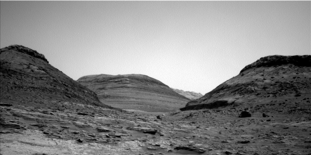
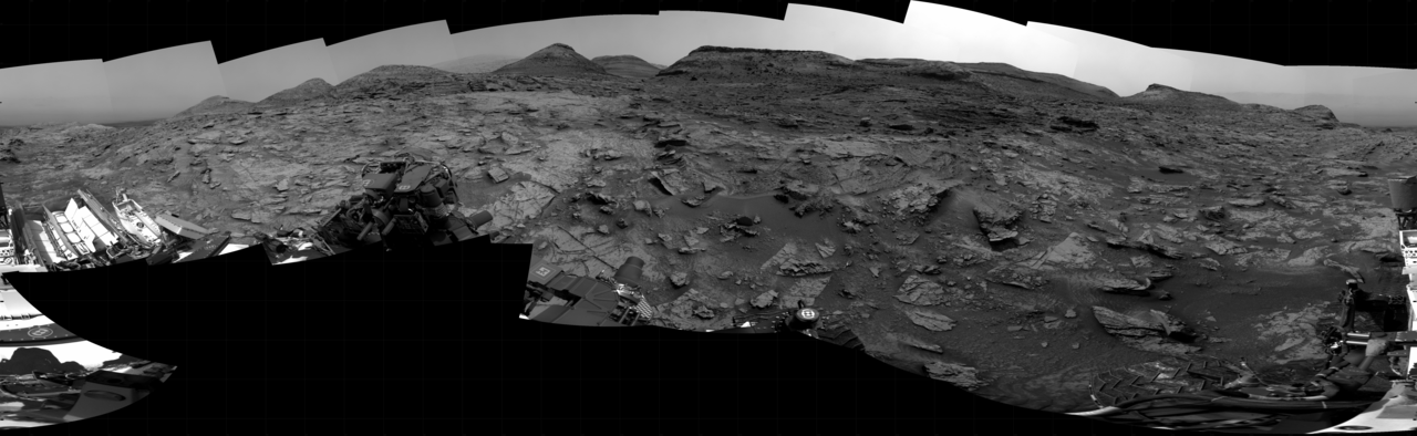
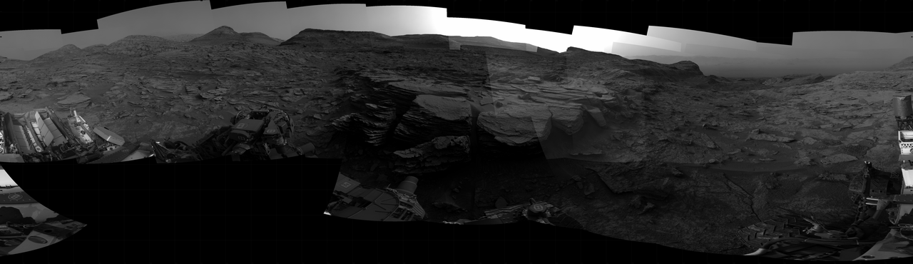
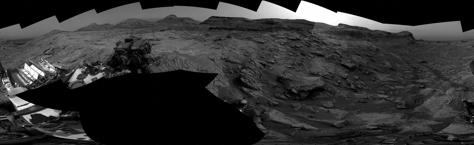
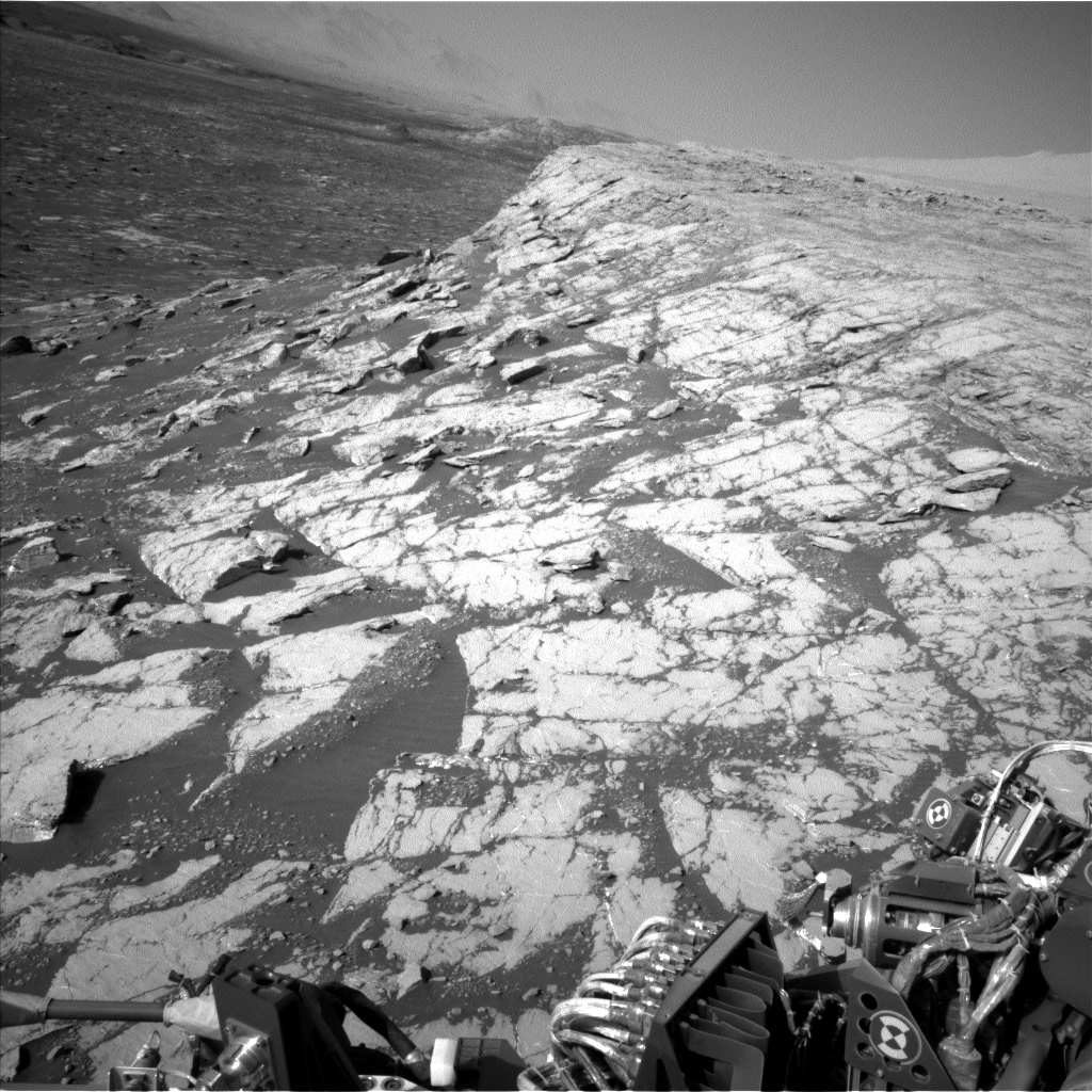
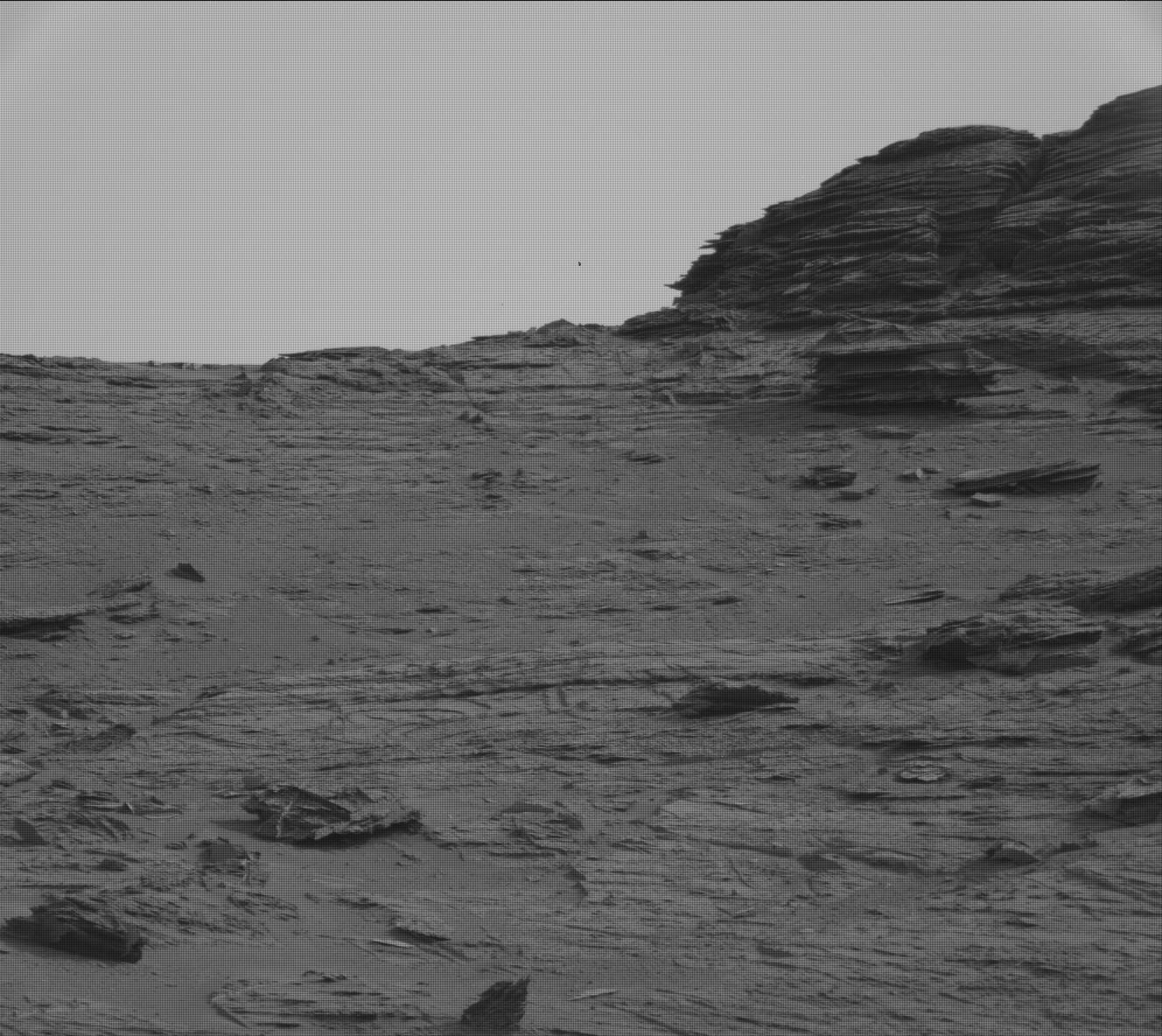
This image was taken by Left Navigation Camera onboard NASA's Mars rover Curiosity on Sol 3504. Credits: NASA/JPL-Caltech. Download image ›

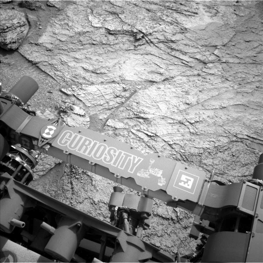
The difficulty of driving on Martian terrain proves itself once again! Our Sol 3504 drive did not complete successfully, leaving us in basically the same spot as our last plan. Thankfully, all the science we planned executed successfully: check out an interesting Dust Removal Tool result on “Omai” showing erosion-resistant veins beneath the surface and a MAHLI closeup of ChemCam’s eye where the laser comes out! My role today was MAHLI and MARDI Payload Uplink Lead, which means I wrote and delivered the MAHLI/MARDI instrument commands and spoke for both instruments’ activities after the plan was approved by the team.

While our resolute Rover Planners worked on planning a drive to get us further down the road, everyone else agreed to fill up today’s plan with even more science and instrument calibration activities. For geology-based science, ChemCam’s Sol 3503 laser target “Mahdia” was so interesting they decided to shoot the same area again but this time have Mastcam take a suite of images in 7 color filters to document the area in various light wavelengths. ChemCam is also planning to shoot their laser on a thin plate of rock sticking out just above the Mahdia target area, named “Iwokrama” after a rain forest in central Guyana. While Mastcam is documenting ChemCam’s efforts in color, it will also be taking a stereo 2x2 mosaic of nearby sand ripples, named “Poci” after the small town in Venezuela, which may help characterize Martian aeolian processes over time.

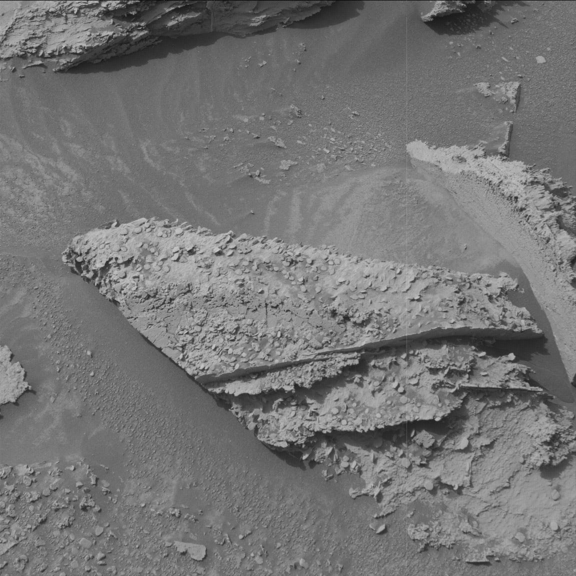
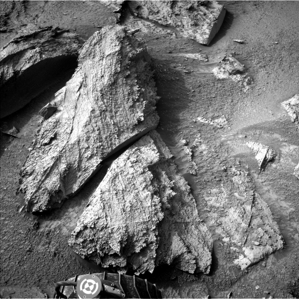
For contact science with the arm, the team decided on a single MAHLI imaging activity on a layered rock we named “Tipuru” after the village in Guyana. Due to the depth of Tipuru's layers, MAHLI will be taking images at 8 focus positions and stacking them into a single image with best focus.

For environmental science, ChemCam is planning to collect data passively while pointed at the sky for atmospheric composition characterization, Mastcam is planning images of the sun with its solar filter for atmospheric opacity measurements, and Navcam is planning an image of crater rim for atmospheric opacity and a movie of the terrain to hopefully capture Martian dust devils. The environmental team is also planning their normal REMS, RAD, and DAN activities for regular measurements of our spot in Gale Crater.

We’re also taking today as an opportunity to get plenty of instrument calibration and documentation activities logged! Mastcam is planning two identical runs of images through the solar filter while not pointing at the sun, which will return black images showing the state of the Mastcam charge-coupled devices (CCDs) to see how they’re holding up after nearly 10 years on Mars. MAHLI is planning an image of the REMS ultraviolet sensor to show how much dust has accumulated and 4 images of the sky to use for processing MAHLI images after they arrive on Earth. SAM has an electrical-baseline test (EBT) and CheMin has an empty cell analysis activity planned for continued instrument calibration.

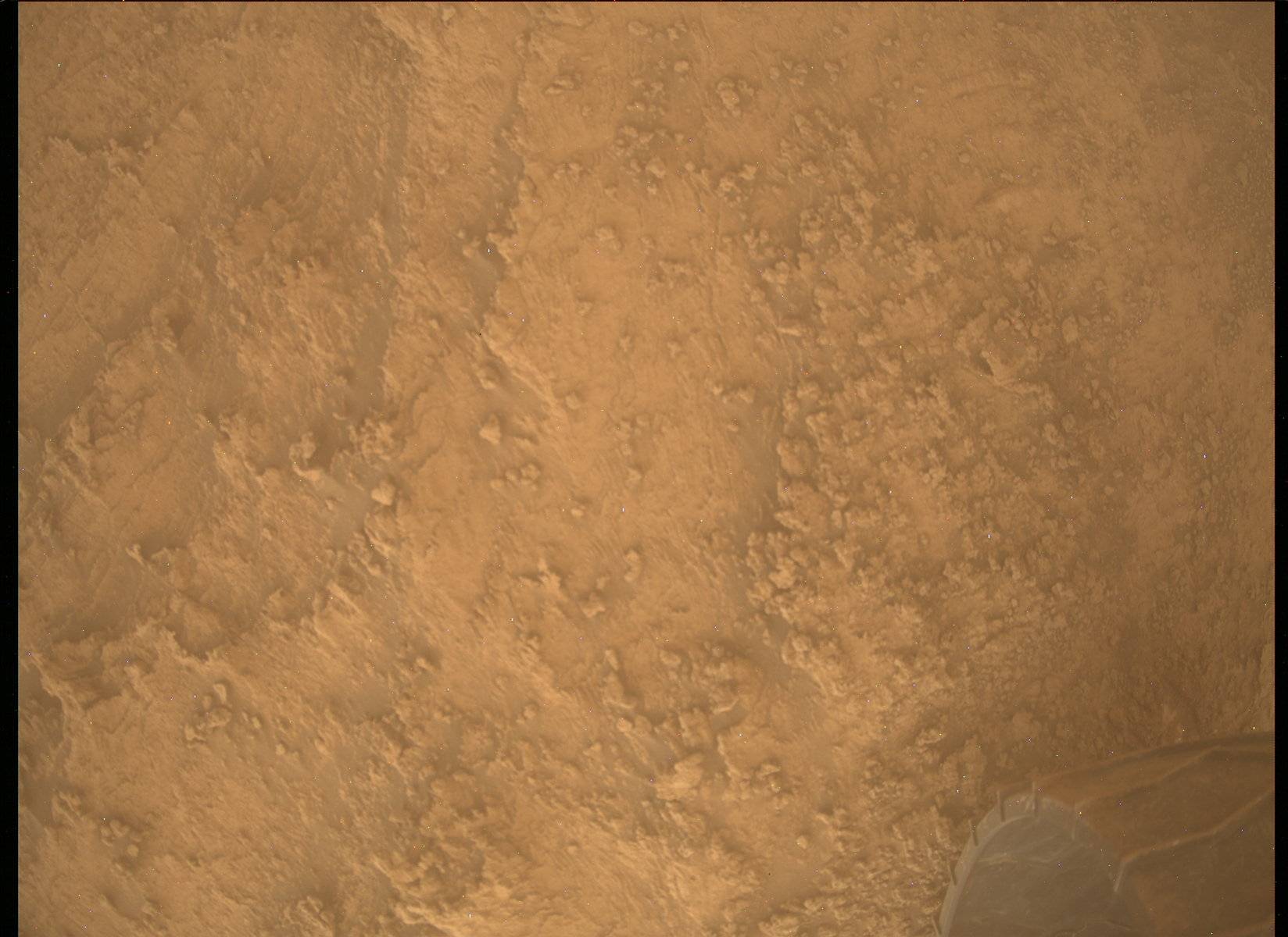
After the planned ~22 meter drive, ECAM and Mastcam are planning their normal images of our new location. Last (but not least, especially from my perspective today) we are planning a single MARDI image of the ground including part of the left-front wheel after sunset to get diffuse illumination of the dusty ground below, like this one from Sol 3495. As of this plan we’ve driven 28 and 1/8th kilometers since landing!

June 13, 2022

Sols 3503-3504: And We're Back

Written by Michelle Minitti, Planetary Geologist at Framework
This image shows the target "Murupu" and was taken by the Curiosity rover on Sol 3495.

This image of target rock "Murupu" was taken by NASA's Mars rover Curiosity on Sol 3495. Credits: NASA/JPL-Caltech/MSSS. Download image ›

The Sol 3496 (last Monday) plan did not execute due to an issue onboard the rover that took a few days to investigate. Today, we were back to normal operations, and we were able to accomplish everything that was in the Sol 3496 plan as reported by my fellow blogger Cat O’Connell-Cooper, and more! More was possible because we had slightly different communication windows between Curiosity and Earth in this plan than in the Sol 3496 plan. This meant we could wait to drive to our next location on the second sol of this two sol plan giving us more time in this workspace.

First and foremost, we added APXS to the plan because it could run in the cool evening temperatures of Sol 3503. We selected a nice smooth patch of bedrock, the target “Omai,” so that we could brush it with the DRT before imaging it with MAHLI and analyzing it with APXS. MAHLI will reattempt a small mosaic across the prominent resistant veins in this area at the target “Wandapa,” and will image ChemCam’s “eye” to monitor the state of that part of the instrument.

Another sol to plan meant we could add another ChemCam raster, as well. In addition to “Mahdia,” the previously-selected bedrock target, we added “Murupu,” the smoother material visible on the upper surface of the rock pictured above. This smoother material might be one of the veins that cut through the rocks here, so getting chemistry on it would be helpful to understand its relationship to the bedrock. ChemCam replanned their long distance RMI mosaic of one of the features along the upper portion of “Gediz Vallis Ridge."

Mastcam had a mix of previously-planned and new observations. The former included three stereo mosaics, two of which covered the dramatic stratigraphy and layering in this area at targets “Serra Mara” and “Eboropu.” The third covered a smaller, but still interesting, area of sand motion near the rover at target “Karto.” New observations included two stereo mosaics that stretched from our workspace to our drive target to help scout the path ahead and provide context for where we are headed. Mastcam will also observe the brushed surface at Omai with its multispectral capabilities.

REMS, RAD, and DAN will be back at it at their usual cadence, and Navcam will acquire a dust devil movie, cloud movie, and an image to monitor the amount of dust in the atmosphere. Hopefully Navcam sees clear sailing up ahead for Curiosity after our break in the action!

June 6, 2022

Sol 3496: Balmy Days on Mars…

Written by Catherine O'Connell-Cooper, Planetary Geologist at University of New Brunswick
This image is a mosaic of 31 images taken by Curiosity in Gale Crater using its mast-mounted Right Navigation Camera (Navcam) on Sol 3495 at site number 95 to create a cylindrical projection.

NASA's Mars rover Curiosity created this mosaic showing a cylindrical projection of the Mars surface from images taken in Gale Crater using its mast-mounted Right Navigation Camera (Navcam) on Sol 3495. Credits: NASA/JPL-Caltech.
Download image ›

Our drive was successful, and we ended with some lovely flat bedrock with some gorgeous veining running through it. As APXS payload uplink lead today, I saw several targets that the APXS team would have loved to analyze.

Sadly, the timing didn’t work in our favour today. APXS prefers temperatures below -20 C – the colder it is, the better the data quality is. But daytime temperatures in Gale are getting balmy and warm (relatively speaking!) and reaching above -20 C earlier and earlier in the day, often hitting that high by 10 am (Mars local time!). Unfortunately, this has an impact on the frequency of APXS data collection. During the week, we typically do “Touch and Go” science, meaning we analyze and then drive (on weekends, we stay for the night and drive on the second or third sol). The earliest we can start the Touch and Go right now are often later than 11 am. This results in “fuzzy” spectra with noisy data for APXS. Whilst we can still discern basic chemistry from the fuzzy spectra, we obviously prefer to get good quality, and so we find that we are currently passing on early morning science. Today’s scheduled start time was 11:10 am, so we decided to skip the APXS contact science today.

However, APXS's loss is MAHLI’s gain! If APXS analyzes a target, MAHLI use their allotted time quota to document the target. Without any APXS in the plan, they gain all of the time allotted to APXS (around 18 minutes), in addition to the time they would have used to document the APXS target (around 8 minutes). Today, MAHLI used the bonus time to take a 3 image mosaic of “Wandapa,” centred on an amazing vein junction feature. There are a number of long linear veins, some thinner cross cutting veins, some nodular features and pebbles, lying on the bedrock. If you zoom in on the image above, the veins are just above the arm (with the little rover graphic). The Wandapa mosaic will capture the interactions between the veins and bedrock.

ChemCam will analyze the composition of the bedrock in this area at “Mahdia” (plus Mastcam) and take some long range imaging of “Gediz Vallis” ridge, up on the pediment. Mastcam is imaging two targets in the immediate workspace: the ChemCam target (Mahdia) and a sandy target “Karto” looking at structures in a small sand deposit in front of the rover. Two long range images “Eboropu” and “Serra Mara” look at stratigraphy and large scale structural features in the distance.

We drive around 40 metres in this plan, aiming to end up on some bedrock for tomorrow’s planning.

June 4, 2022

Sols 3493-3495: Beautiful Weekend Views

Written by Alex Innanen, Atmospheric Scientist at York University
This image is a mosaic of 31 images taken by Curiosity in Gale Crater using its mast-mounted Right Navigation Camera (Navcam) on Sol 3492 at site number 95.

NASA's Mars rover Curiosity took 31 images in Gale Crater using its mast-mounted Right Navigation Camera (Navcam) on Sol 3492 at site number 95 and created this mosaic. Credits: NASA/JPL-Caltech.
Download image ›

We’re heading into a packed weekend, after a successful drive putting us in a great location with some really beautiful views. Everywhere you look in the Navcam mosaic (above) there’s something interesting to see!

We’re up close to a nifty layered outcrop, which is getting lots of imaging including ChemCam LIBS on targets ‘Rukumata’ and ‘Guarico,' a ChemCam mosaic on ‘Kamakusa,’ MAHLI dogs-eye imaging of ‘Tabaco’ and the DRT location ‘Issano,’ which will also have APXS on it. Mastcam will also be imaging Issano pre- and post-DRT for comparison, and taking a mosaic of the outcrop as a whole. Off the outcrop, ChemCam is also doing LIBS on ‘Sisipelin,’ which Mastcam will also image, and ChemCam and Mastcam are both taking mosaics further afield towards the Gediz Vallis Ridge.

I was ENV science theme lead today and was very excited to see the great view we have of the north crater rim, especially since we’ve been spending so much time recently in among lots of terrain blocking this view. Imaging the crater rim can help us to characterise the amount of dust in the atmosphere, which is especially important in the dusty season. Aside from the crater rim observations, we are also trying to catch dust devils with a dust devil survey and movie, keeping an eye on the clouds with a few cloud movies, and taking Mastcam tau observations as an additional way to quantify the amount of dust in the atmosphere.

After this marathon of observations, we’ll drive about 30 m further and finish up the weekend with a morning ENV block with our weekly AM cloud and dust observations.

May 31, 2022

Sols 3491-3492: A Steep (But Short) Climb

Written by Abigail Fraeman, Planetary Geologist at NASA's Jet Propulsion Laboratory
NASA's Mars rover Curiosity took 29 images in Gale Crater using its mast-mounted Right Navigation Camera (Navcam) to create this mosaic.

NASA's Mars rover Curiosity took 29 images in Gale Crater using its mast-mounted Right Navigation Camera (Navcam) to create this mosaic. Credits: NASA/JPL-Caltech. Download image ›

Today in tactical planning I was staffed as Surface Properties Scientist, which means I get to put my geology field experience hat on and work with the rover drivers to assess the terrain we’ll cross in our upcoming drive. We’ll crest onto a plateau in today’s drive, but before we do, we have to finish climbing a small but steep slope. The topography today actually reminds me a little bit of our ascent onto Vera Rubin ridge several years ago, were we similarly crested a steep slope onto a local flat expanse.

This image was taken by Left Navigation Camera onboard NASA's Mars rover Curiosity on Sol 1809.
This image was taken by Left Navigation Camera onboard NASA's Mars rover Curiosity on Sol 1809. Credit: NASA/JPL-Caltech. Download image ›

Curiosity starts the plan parked at an impressive 17˚ pitch (front up) and 17˚ roll (left up) for a total 24˚ tilt. You can get a bit of a sense of the rover’s non-horizontal position by looking at its orientation with respect to the ground in the above Navcam mosaic. Even though this slope is getting close to the limit of what Curiosity can traverse, we don’t think we’ll have any problems unstowing the arm or driving the rest of the way to the top because of the terrain we’re on – nice smooth bedrock with only a thin sand cover is almost the Martian equivalent of a paved road.

Outside of the drive, Curiosity will continue documenting the geology and environment around us. In today’s plan, we will collect ChemCam LIBS observations of a vein target named “Lago Esmeralda” and bedrock target named “Lago de Rei,” as well as some long distance RMI mosaics of a part of the “Bolivar” mound. We’ll also grab some more Mastcam images of Bolivar, as well as several significant outcrops around the rover. MAHLI and APXS will also participate in the science action, with observations of a DRTed bedrock target named “Parepona” and vein target named “Cabadiscana,” and we’ll also be using MAHLI to image our wheels at the start of today’s drive. Finally, several Mastcam and Navcam observations designed to monitor our environment will round out the plan.

May 27, 2022

Sols 3487-3490: Up, Up and Away!

Written by Lucy Thompson, Planetary Geologist at University of New Brunswick
This image was taken by Mast Camera (Mastcam) onboard NASA's Mars rover Curiosity on Sol 3483.

Mastcam image showing the terrain ahead on Mount Sharp. Credits: NASA/JPL-Caltech/MSSS. Download image ›

Our intrepid rover engineers again successfully navigated Curiosity a little higher up Mount Sharp (~5 m) and ~40 m on the ground, away from our previous location. The terrain beneath the rover included striated, dusty bedrock and sand ripples with coarse lag deposits. As a member of the geology/mineralogy planning team and the APXS payload uplink lead today, I chose several interesting areas in the workspace for potential arm, contact science. The rover engineers assessed these targets before we settled on a representative bedrock area. We are planning two APXS observations on the dusty bedrock, and on a brushed area, with accompanying MAHLI images (“Pitinga”). This will help us assess the effect of the ubiquitous dust cover on APXS compositional analyses of the bedrock. The measurement of the brushed bedrock also constitutes part of our systematic monitoring of bedrock composition with APXS every 10 m of elevation gain, as we climb Mount Sharp. This is important as we are in a region identified from orbit as showing a change in mineralogy and potentially environment within Gale crater. The brushed target will be imaged with Mastcam, which will also image the two rock targets being analyzed with ChemCam LIBS: “Rio Pipi” – dusty bedrock in the ground, and “Barama” – layered bedrock face; as well as some crevices within the sand and rock in the workspace.

Looking beyond the immediate workspace, the view ahead is mesmerizing with interesting textures and structures both in the near- and far-field (see the image above). Mastcam and CCAM RMI will image the platy, darker, layered ledge in the middle of the image in more detail, but offset to the right (”Dukwari”). Mastcam will also image a cliff off to the right of the rover to document textures, structures and layering (“Cantarrana”). Once Curiosity has executed all the targeted science observations, the rover engineers are planning a drive towards the lip, off to the middle-left of the Mastcam image. That should afford us a better view to plan upcoming drives as we continue climbing Mount Sharp.

The environmental scientists planned several observations to continue monitoring changes in atmospheric conditions and the current dust storm within Gale crater. These included: Navcam line of sight images, a large dust devil survey, suprahorizon movies, a dust devil movie, and a zenith movie; and Mastcam basic and full tau observations. After our hopefully successful drive, we will image the terrain beneath the rover wheels with MARDI. The SAM instrument will also be running a fake handoff and a blank solid sample evolved gas experiment. Standard REMS, DAN and RAD activities round out this plan.

May 25, 2022

Sols 3485-3486: Blast a Knob!

Written by Ken Herkenhoff, Planetary Geologist at USGS Astrogeology Science Center
NASA's Mars rover Curiosity took 3 images in Gale Crater using its mast-mounted Right Navigation Camera (Navcam) to create this mosaic.

NASA's Mars rover Curiosity took 3 images in Gale Crater using its mast-mounted Right Navigation Camera (Navcam) to create this mosaic. Credits: NASA/JPL-Caltech. Download image ›

The Sol 3483 drive completed as planned, positioning the rover near several outcrops of knobby material and more "normal" looking bedrock. The tactical uplink team discussed various options and decided to focus this plan's observations on the knobby material. Unfortunately, timing constraints precluded an APXS integration today, as the instrument temperature would be too high to provide high-quality data. On the brighter side, removing the APXS activities from the plan freed up time for other activities, including a small MAHLI mosaic of a knobby outcrop. The knobby material is too rough to brush clean using the DRT, so we decided to shoot ChemCam's laser at a knob named "Cabo Sobral," expecting that the expanding plasma cloud generated by the laser will blow dust off the surface of the knob. Laser-induced dust clearing has occurred throughout the mission, and is therefore a viable alternative to DRT brushing.

The Sol 3485 plan starts with a Mastcam measurement of the dust content of the atmosphere above MSL and a large Mastcam mosaic extending coverage of the "Deepdale" hills toward the southeast, followed by the ChemCam 5-point raster on Cabo Sobral and Mastcam stereo observations of nearby trough features and a multispectral Mastcam observation of the (hopefully) cleaned surface of Cabo Sobral. Then Navcam will search for clouds and dust devils before MAHLI acquires a 3-frame mosaic from about 25 cm and a stereo image pair from about 7 cm of Cabo Sobral. The arm will then be stowed before a ~50-m drive toward the southeast. A SAM preconditioning activity is planned later that evening, followed by a DAN passive measurement.

The second sol of the plan starts with another DAN passive measurement and a ChemCam AEGIS activity, which will automatically select a bedrock target for a LIBS observation in the new rover location. Finally, MARDI will take an image of the ground behind the left front wheel during twilight.

May 24, 2022

Sols 3483-3484: Decisions, Decisions

Written by Ashley Stroupe, Mission Operations Engineer at NASA's Jet Propulsion Laboratory
This image was taken by Mast Camera (Mastcam) onboard NASA's Mars rover Curiosity on Sol 3481.

This image was taken by Mast Camera (Mastcam) onboard NASA's Mars rover Curiosity on Sol 3481. Credit: NASA/JPL-Caltech/MSSS. Download image ›

On this Monday 2-sol plan, I was one of three Rover Planners. I took the role of Arm Rover Planner, sequencing the contact science. I also helped to review the drive.

Before any of the Rover Planner activities, however, we planned an extensive suite of targeted science. Using the ChemCam laser, we are looking at the target “Takutu,” which is a bedrock target in our workspace. With the ChemCam RMI camera, we also do a long distance observation of a target named “Bolivar,” which is a distant vertical cliff face in the direction we are driving. Mastcam is also observing the Takutu and Bolivar targets as well as a target named “Cachimbo,” which is target that may represent the contact between the Mirador formation and the upper sulfate unit. We finish up this pre-drive science with a couple of atmospheric observations, including a Navcam image of the horizon to look at dust in the atmosphere and a Mastcam of the deck to look at dust accumulation on the rover.

We expected to be planning standard pre-drive contact science, with APXS and MALHI. However, due to a later plan start time than usual, APXS would have been too warm to collect good data. So instead, we decided to do a DRT brush and take some MAHLIs. The rock is showing some nice layering, but is very dusty; without DRT the data would have been much lower quality. Selecting the contact science target was challenging today because the block we wanted to look at was near some other tall rocks. We had to carefully select a spot that, even with uncertainty, we could be sure that we would not hit the wrist or the other turret instruments on those rock when we got close to the ground. With a few minor adjustments, we were able to find a target that worked well for science and was safe. The target was named “Imataca,” and it is a piece of representative bedrock from the workspace with some fine-grained layering.

Planning the drive was particularly interesting today because we had two possible paths along our strategically planned route; one was a little bit more east and one a little bit more west. After evaluating what we could see in the Navcams and Mastcams, a well as the orbital imagery, we ultimately picked the slightly more eastward path because we felt that it was more likely to be friendly terrain down the road. Friendly terrain in this case is still a little bit steep and has a lot of very large and sharp rocks along the way that we have to be careful to avoid (as shown in the attached image of our drive direction). We have a lot of terrain occluding our view in today’s drive so we are using Autonav (“autonomous navigation”) which allows the rover to take images and assess safety to select its route to the goal. We’re driving to get as far as possible in the time we have (about 1:30) and try to park at a high point that will give us good visibility of the future path. We’re climbing about 2m in our 28m drive. At the end we are taking our standard set of post-drive imaging to see our path ahead and to image our new workspace for contact science.

On the second sol of the plan we are using AEGIS to autonomously take pictures, select an interesting target, and make some science observations on that target. It is always interesting to see what AEGIS picks to look at when we get the results. We also continue our atmospheric observations (after all, we are in the dusty season) with Mastcam and Navcam. Mastcam is looking at the crater rim and an image of the sun to look at how much dust is in the atmosphere. Navcam is taking a dust devil survey and a suprahorizon movie a well. We also take our normal post-drive MARDI image just after sunset; we are doing this on the second sol rather than immediately after the drive because a communication with the Odyssey orbiter was happening at the desired time.

May 23, 2022

Sols 3480-3482: Mastcam-Ing All the Things!

Written by Catherine O'Connell-Cooper, Planetary Geologist at University of New Brunswick
Mastcam image, showing some of our surroundings.

Mastcam image, showing some of our surroundings. Credits: NASA/JPL-Caltech/MSSS. Download image ›

Coming into planning on Friday, we were greeted with a beautiful vista, with well preserved layering and amazing outcrops, and a reminder of just how stunning the planet Mars is. Mastcam takes a 360 degree image on a regular basis, and our last one was fairly recently, on sol 3474, but given the stunning views from here, it was suggested that we take another here if we could fit it in.

As APXS planner today, I had hoped we would find something to DRT and remove some dust in this workspace, but I was not very optimistic, as the bedrock is rough, with larger “gnarly” looking nodules or lumps of material, and smaller exposures of nodular free, laminated bedrock. However, the RPS found us a smooth spot just large enough to brush on the laminated material, so APXS will analyze the brushed surface at “Bamboo Creek” and the unbrushed surface at “Maple Creek.”

Pairing targets like this is very beneficial to APXS, allowing us to compare adjacent compositions and to determine if compositional trends are “real” or if dust buildup is obscuring some of the more subtle trends. ChemCam will also use LIBS to look at the chemistry of Bamboo Creek, and Mastcam will use multispectral imaging to look at the brushed spot.

GEO is also investigating the nodular-rich bedrock. MAHLI is taking a suite of images on one of the largest features “Apoteri,” whilst ChemCam and Mastcam take aim at “El Gato.” ChemCam will use the long distance imaging (RMI) to look at some possible Prow-like material in the distance.

Mastcam has a very full list of activities, looking at more possible Prow-like lens material (at “Sierra Maigualida”) in the distance, and characterizing sedimentary structures near the rover (at “Ampa,”) in addition to imaging of Mirador butte and the cliffs to the east of Mirador. There is also a special Mastcam multispectral sunset image, timed to document the brightness of the sky when the sun is at a low angle. But despite this heavy load, the views were just too good to pass up, so Mastcam will get that 360 image here too – keep your eyes peeled for that image!

May 18, 2022

Sols 3478-3479: Everyone Wants a Piece of This Pie

Written by Natalie Moore, Mission Operations Specialist at Malin Space Science Systems
This image was taken by Left Navigation Camera onboard NASA's Mars rover Curiosity on Sol 3476.

This image was taken by Left Navigation Camera onboard NASA's Mars rover Curiosity on Sol 3476. Credits: NASA/JPL-Caltech. Download image ›

Despite the incredibly rough terrain surrounding Mirador butte, our nearly 10-year-old rover successfully drove a net distance forward ~10 meters and ~2 meters in elevation! To get a sense of what our Rover Planners try to avoid navigating this terrain, check out this Navcam image of our left front wheel at our parking spot.

This image was taken by Left Navigation Camera onboard NASA's Mars rover Curiosity on Sol 3476.
This image was taken by Left Navigation Camera onboard NASA's Mars rover Curiosity on Sol 3476. Credit: NASA/JPL-Caltech. Download image ›

Not only did the Sol 3476 drive succeed, but placed us perfectly in front of the most beautiful laminated outcrop, a true canvas of Martian art painted by nature herself. Evidence of possible cross-bedding and fine-scale laminations here are so interesting there was an initial question of whether we should stay for extra contact science opportunities or keep with our plan to drive away on the first sol of this plan. It was decided to keep our drive planned for Sol 3478, which sparked an energized discussion on which types of science we could fit in the limited time we have before continuing forward in the afternoon. Questions of which activities would provide the most useful science were vehemently discussed: Should we prioritize using our Dust Removal Tool to wipe away the atmospheric dust that blocks our view of grain-size? Or would using our DRT damage the undisturbed bedrock laminations and ruin a close-up view from MAHLI? Although scientists were certainly interested in the grain-size of this unit, getting those measurements from MAHLI images at this heading would most likely need low-level lighting from the afternoon sun: a seemingly impossible task as we’ve kept our plan to drive away in the afternoon.

NASA's Mars rover Curiosity took 2 images in Gale Crater using its mast-mounted Right Navigation Camera (Navcam) to create this mosaic. Credits: NASA/JPL-Caltech. Download image ›

In the end, the heat fell on our dedicated Rover Planners who decided to try for all of it. First, APXS will do a short morning sniff of the laminated bedrock target we chose and named “Las Claritas." Then, MAHLI will do the limbo to take a 6-frame angled mosaic surrounding Las Claritas to hopefully catch cross-bedding, and finally we’ll use our DRT on the target itself and do a MAHLI “full-suite” for grain-size which includes images of Las Claritas from 25 cm, 5 cm, and 2 cm away. Besides this full sol of arm activities, Mastcam is also planning a stereo mosaic surrounding Las Claritas and two large farther-field mosaics covering the many outcrops around us, in addition to a host of other Mastcam images to document the state of our DRT and other instrument activity attempts. ChemCam is planning to shoot their laser for spectrometry on a bedrock target nearby named “Maturin” and a micro image mosaic on a layered outcrop ~5 meters away. Our planned drive is for ~30 meters generally south, putting us near the south-east corner of Mirador butte for more science! While we wait for our drive data to come down to earth, our rover will take environmental observations of the sky to monitor dust activity and ChemCam will autonomously choose a target for a second laser spectrometry observation at our new location. From the entire team’s hard work, everyone is getting a piece of the Martian pie this time!

This image was taken by Mars Descent Imager (MARDI) onboard NASA's Mars rover Curiosity on Sol 3474.
This image was taken by Mars Descent Imager (MARDI) onboard NASA's Mars rover Curiosity on Sol 3474. Credits: NASA/JPL-Caltech/MSSS. Download image ›

My role this plan as MAHLI/MARDI Payload Uplink Lead #2 includes creating and delivering the sequences that hold our imaging commands for the MAHLI and MARDI cameras. If you’re wondering why I’m commanding two cameras, it’s because MARDI activities usually include but a single snapshot of the ground below our left middle wheel, like this one from Sol 3474. She is continuing this streak after our drive and sunset on Sol 3478. My main squeeze today is MAHLI, delivering 7 MAHLI sequences for this plan and commanding MAHLI to take 73 images for best focus (not including subframes). Just for fun: here’s a Navcam look at MAHLI taking her images of the Sol 3476 target “Aratana," and the corresponding MAHLI image taken from ~15 cm away.