July 12, 2022

Sol 3531: Moving Right Along! Again!

Written by Abigail Fraeman, Planetary Geologist at NASA's Jet Propulsion Laboratory
This image was taken by Left Navigation Camera onboard NASA's Mars rover Curiosity on Sol 3530.

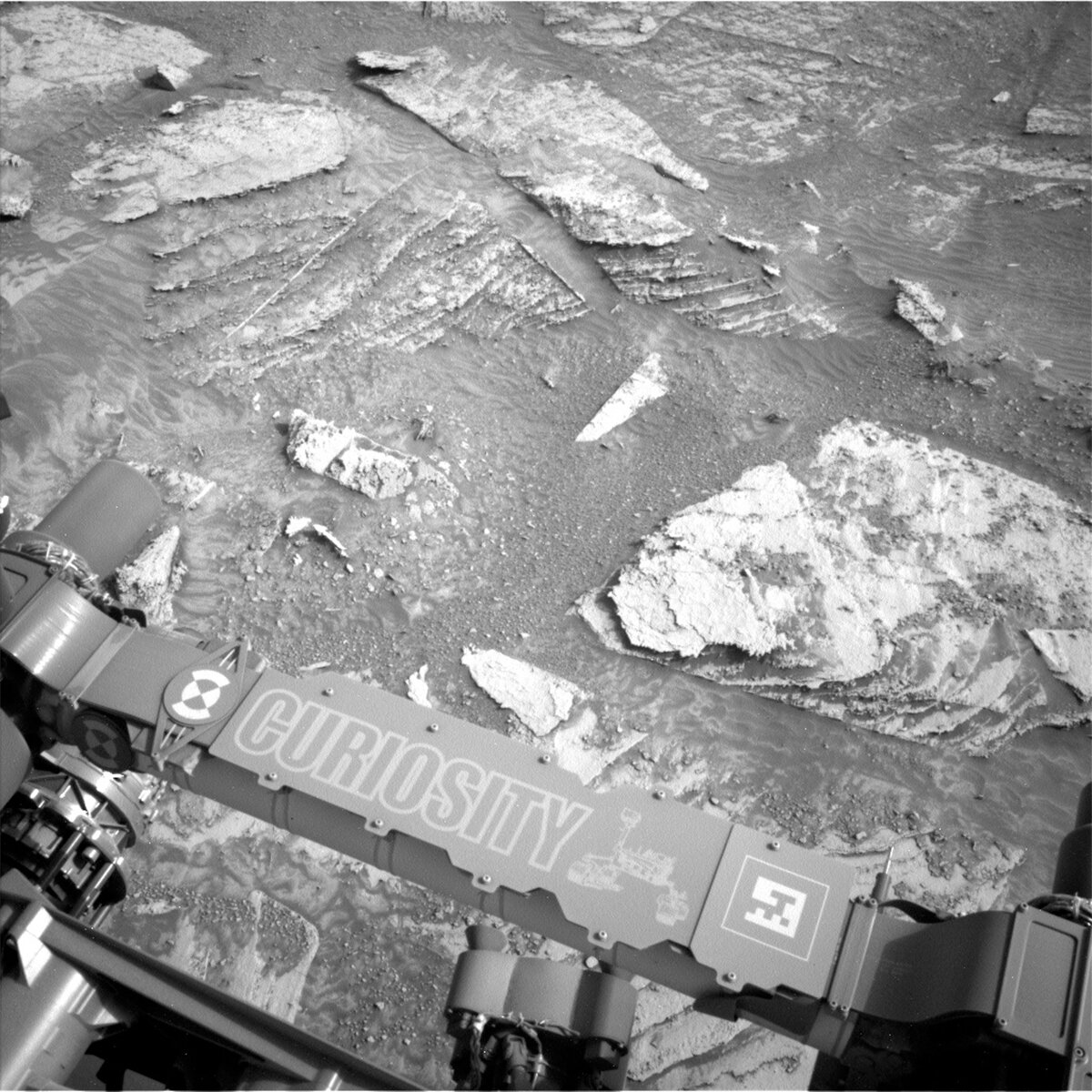
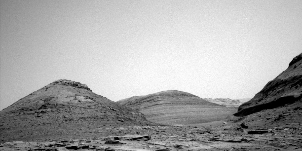
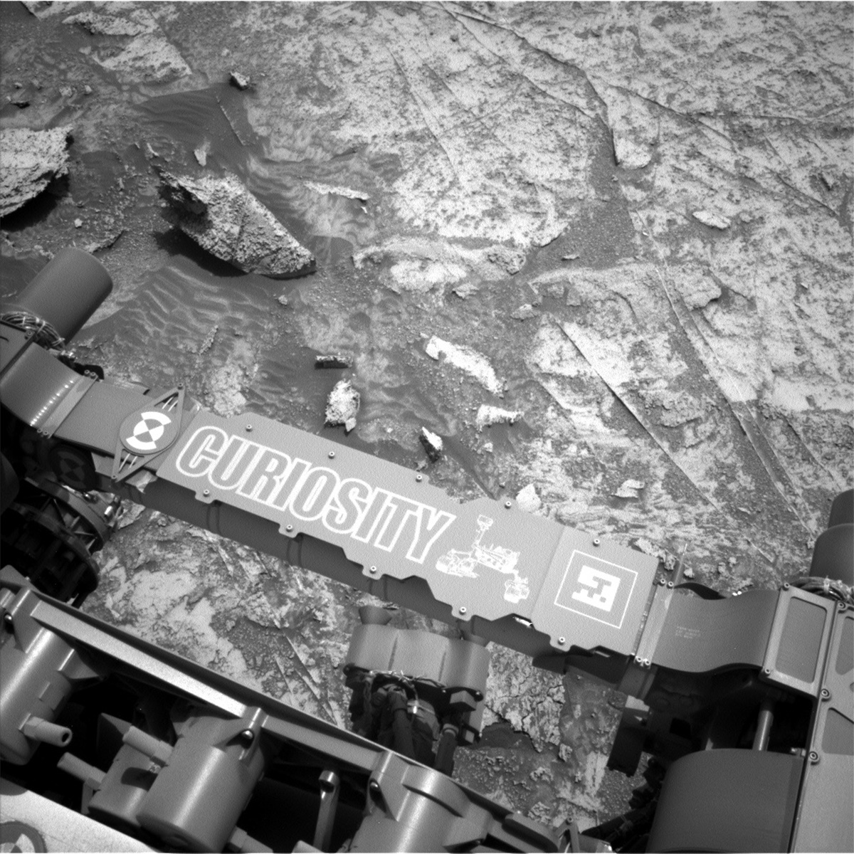
This image was taken by Left Navigation Camera onboard NASA's Mars rover Curiosity on Sol 3530. Credits: NASA/JPL-Caltech. Download image ›

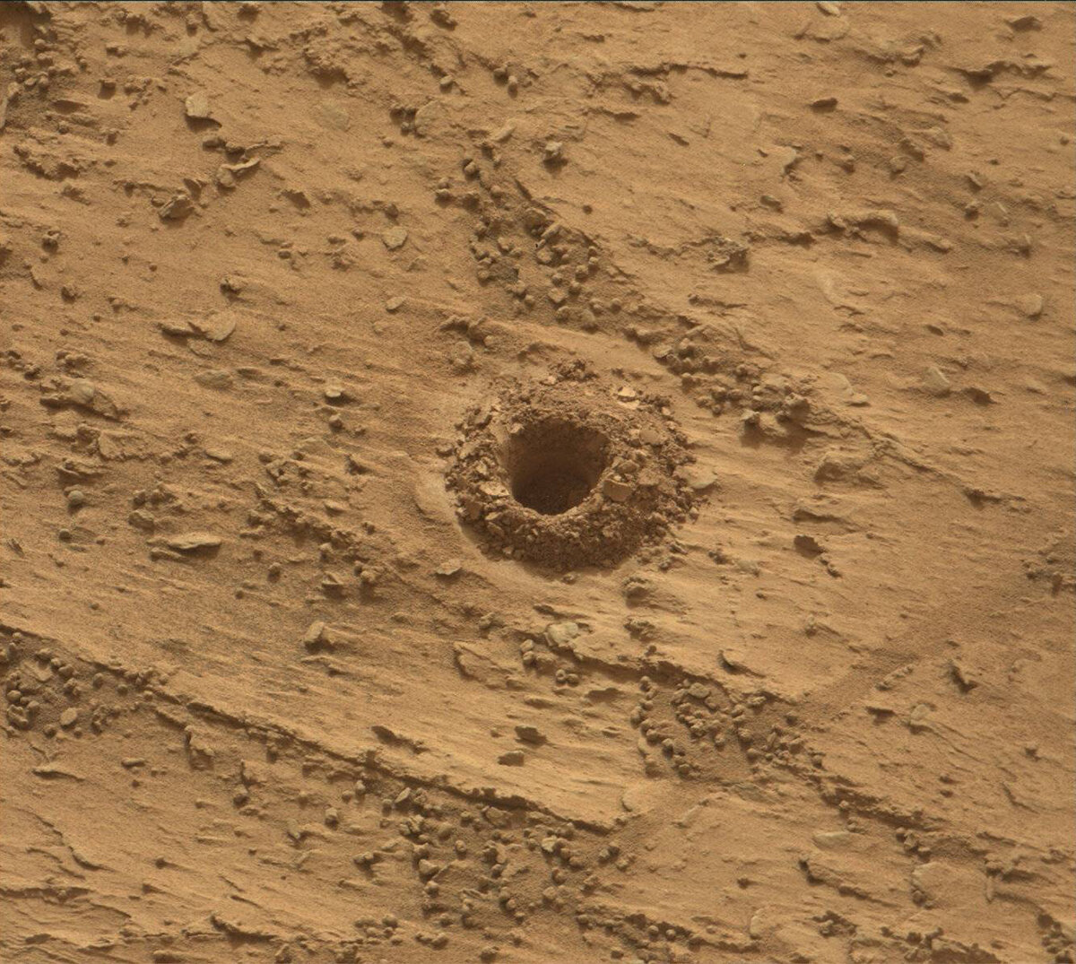
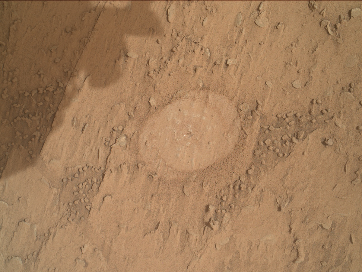
Since we finished up with our “Avanavero” drill activities yesterday, we’re officially back on the Martian road to the layered sulfate-bearing unit! Today we just planned a single sol’s worth of activities, and filled the day with contact science, remote sensing, and a 50m+ drive. The remote sensing and contact science activities include a MAHLI and ChemCam LIBS observation of a bedrock target named “Uai Uai,” as well as Mastcam regular and multispectral images of a vein-rich rock target named “Las Nieves” and a layered rock named “Luepa.” We’ll also use both Mastcam and Navcam to monitor the atmosphere.

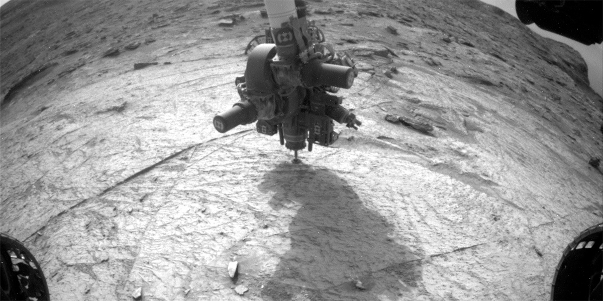
My tactical role today was “Surface Properties Scientist,” also known as the SPS. I helped the rover drivers assess whether Curiosity’s parking spot was stable enough to retract the arm for the MAHLI observations, and any terrain hazards that might affect the drive. Several of Curiosity’s wheels were perched on rocks today which made the stability assessment particularly interesting, but after a lot of discussion with the rover drivers, we all agreed there was minimal risk of the rover shifting when we unstowed the arm. I’m looking forward to tomorrow when we’ll be able to see the MAHLI images we collected today, and to finding ourselves a little closer to the sulfate-bearing unit.

July 11, 2022

Sol 3530: Leaving Avanavero

Written by Ken Herkenhoff, Planetary Geologist at USGS Astrogeology Science Center
NASA's Mars rover Curiosity acquired this image using its Mars Hand Lens Imager (MAHLI), located on the turret at the end of the rover's robotic arm, on July 10, 2022, Sol 3528 of the Mars Science Laboratory Mission.

NASA's Mars rover Curiosity acquired this image using its Mars Hand Lens Imager (MAHLI), located on the turret at the end of the rover's robotic arm, on July 10, 2022, Sol 3528 of the Mars Science Laboratory Mission. Credits: NASA/JPL-Caltech/MSSS. Download image ›

The MAHLI images acquired on Sol 3528 confirm that the APXS was well placed over the Avanavero drill tailings, and the APXS data look good so we are ready to drive away from this location. But first, we are planning a few more MAHLI and remote sensing observations. ChemCam will shoot its laser at a vein target named "Chiung" on the right side of the rover, then will acquire another RMI mosaic to extend the coverage of a bright mound with numerous veins. Mastcam will also extend stereo coverage of the "Amacuro" outcrop, document ChemCam's Chiung target, and monitor changes in the distribution of material on the rover deck. After Navcam searches for dust devils, Mastcam will look for changes in nearby rover tracks at Kamana. The arm will then be deployed to acquire another MAHLI image of the drill tailings to determine whether the APXS touched the tailings during the overnight integration planned on Sol 3528. MAHLI will also take images from 25 and 5 cm of a vein named "La Laja." Then the arm will be stowed for the drive. We are not expecting to receive as much data as usual for future planning, so downlink priorities were carefully reviewed, especially for the post-drive images.

July 8, 2022

Sols 3528-3529: Everyone Gets to Savour the Avanavero Flavours!

Written by Lucy Thompson, Planetary Geologist at University of New Brunswick
RMI of the Avanavero drill hole and fines taken by Curiosity's ChemCam on Sol 3523.

This image was taken by Chemistry & Camera (ChemCam) onboard NASA's Mars rover Curiosity on Sol 3523. Credits: NASA/JPL-Caltech/LANL. Download image ›

Both the CheMin and SAM instruments have dined on the Avanavero drill samples and have decided their appetites are sated. CheMin has completed X-ray diffraction mineralogical analysis of the Avanavero drill sample, and SAM their Evolved Gas Analysis. Both instrument teams are satisfied with their analyses and SAM are not opting to do a Gas Chromatography-Mass Spectrometry run. Now it is the turn of MAHLI, APXS and ChemCam to investigate the flavour of the drill fines around the Avanavero drill hole for texture and chemistry, finishing up observations at this site before we drive away next week. The composition of the drill fines determined by APXS and ChemCam will help the CheMin and SAM teams refine interpretations of their data. The science team are all eagerly awaiting their results as we drive through this interesting transition from clay-bearing to sulfate-bearing strata. As the APXS payload downlink/uplink lead and strategic planner today, I worked with the rover engineers to find the best placement for APXS to ensure that we fill as much of our field of view as possible with the fines. I also realized that our new drilling strategy required a MAHLI image co-located with the APXS placement, so that we can determine that we did indeed target the drill fines before we drive away in the next plan.

As well as finishing up our investigations of the Avanavero drill site, we took advantage of our time here to add to our inventory of imaging and compositional data, which will result in this being a well-studied area. As well as LIBS of the drill fines, ChemCam will analyze a resistant, plate-like feature, “Ekereku” (also documented with Mastcam) and acquire an RMI mosaic of an interesting lighter coloured expanse of bedrock in the distance. The pre-existing Mastcam mosaic of the well-layered strata associated with “Marbura Hill” will also be extended to provide improved context, textural and structural information.

When Curiosity is parked in one spot for more than a few sols, the team often takes advantage of the situation to monitor any changes to the surface over that time. As part of these change detection observations Mastcam will continue to monitor the movement of the drill fines around the hole, and any sand/soil movement in the wheel tracks (“Karouni,” “Kamana” and “Simibi”). In contrast, the environmental science team planned several observations to continue monitoring changes in atmospheric conditions. These included: Navcam line of sight images, a large dust devil survey, suprahorizon movies, and a zenith movie.

Because SAM and CheMin are finished with drill sample, both will execute activities to ready their respective instruments for the next time we drill. The SAM instrument will remove the sample cup from the SAM oven in preparation for driving, and CheMin will perform an empty cell analysis to check for any remaining sample after they dumped the fines in the previous plan. Standard REMS, DAN and RAD activities round out this plan.

July 6, 2022

Sols 3525-3527: A Plan Fit for a Rover

Written by Mariah Baker, Planetary Geologist at Center for Earth & Planetary Studies, Smithsonian National Air & Space Museum
NASA's Mars rover Curiosity took 36 images in Gale Crater using its mast-mounted Right Navigation Camera (Navcam) to create this mosaic on July 4, 2022, Sols 3522-3509.

A Navcam mosaic of the rover’s current location at the Avanavero drill site. Credits: NASA/JPL-Caltech. Download image ›

Tosol’s plan included a little bit of everything, with more than four hours of remote science spread over three sols. However, the rover is still in the midst of the Avanavero drill campaign, so all desired observations had to be strategically fit in around important drill-related SAM and CheMin activities.

Remote science observations also sometimes come with their own timing constraints, so it was the job of the team on shift to schedule all activities in an efficient way, and to ensure coordination between any activities that might influence one another. For example, while there was no contact science in this plan, Mastcam of the drill tailings will be used to assess wind conditions and mitigate risk to the MAHLI camera when it images the drill hole in a future plan. Mastcam images of the rover's wheel tracks (target “Kamana”) and sand ripples (target “Karouni”) will also be used to study wind activity.

Mars is currently in the dusty season, so a significant portion of the plan was dedicated to studying environmental conditions during this dynamic time of year. The team worked together to find time to slot environmental activities around geologic observations, including a 26-minute-long ChemCam passive sky image. Additionally, the team scheduled a Navcam suprahorizon movie, a Navcam dust devil survey and dust devil movie, a Navcam “line of sight” image, and two Mastcam “tau” images to measure atmospheric dust levels.

Remote science activities included three ChemCam LIBS observations on rock targets “Araca,” “Isla Caou,” and “Guarento,” each of which was also accompanied by a Mastcam documentation image. A coordinated Mastcam multispectral observation of Isla Caou will be used for comparison against ChemCam data on the same target. The team also found time to include a large ChemCam RMI observation covering part of Gediz Vallis Ridge, rounding out a very full plan for the ChemCam instrument.

When the team was informed that SAM and CheMin activities were placing tight constraints on the time and power available on the first two sols, some remote science activities had to be moved to the third sol where they fit better. This included observations that needed to be acquired at atypical times of sol for lighting reasons. A set of Mastcam images, including a multispectral of “Bolivar” and a mosaic of the Gediz Valles Ridge required morning illumination to avoid shadowing, and a set of photometry observations needed to be acquired late in the afternoon to provide comparison data with similar images collected at other times of sol.

Tosol’s rover planning was busy, but successful. The team worked together to fit as much high-quality science as possible within the allotted time and to collect data needed to support ongoing and future drill-related activities at this site.

June 30, 2022

Sols 3519-3524: Eyeing Kukenán

Written by Abigail Fraeman, Planetary Geologist at NASA's Jet Propulsion Laboratory
This image was taken by Left Navigation Camera onboard NASA's Mars rover Curiosity on Sol 3515 (2022-06-26 19:35:29 UTC).

This image was taken by Left Navigation Camera onboard NASA's Mars rover Curiosity on Sol 3515. Credit: NASA/JPL-Caltech. Download image ›

Curiosity is continuing to proceed through our pre-planned checklist of activities that we’ve made for drill campaigns. The team is currently waiting for the downlink that contains data from CheMin’s first analysis of the Avanavero drilled sample, and we will use these data to help us decide whether to analyze the sample with SAM as well. While we wait today, we planned a whopping six sols worth of activity that will cover the upcoming July 4th US holiday. The main activities in the plan included a second evening of analysis of Avanavero with CheMin, and an activity to prepare the SAM instrument to accept a sample so that we can be ready to say “Go for sample analysis!” on Tuesday after we see the CheMin results.

We planned lots of remote sensing activities around the tasks of our SAM and CheMin onboard laboratories. We will be collecting several high resolution Mastcam mosaics of the area and environmental sensing data. We’ll also collect ChemCam LIBS observations of rock targets named “Tocobirem” and “Uaiparu,” a soil target named “Simibi,” and the drill hole itself. On top of that, ChemCam will also acquire two long distance RMI mosaics, one over Gediz Vallis ridge, and one over a far distant hill (shown in the center of the above Navcam) we decided to name “Kukenán.” Kukenán’s Earth namesake is a tepui, or distinctive isolated table-top mountain, found in South America. The Martian Kukenán is also somewhat flat topped and an impressive expression in Mt. Sharp’s topography. While it looks like it’s about the same size as the hills that bound it in the above Navcam image (“Deepdale” on the left and the edge of “Bolivar” on the right), this effect is just due to forced perspective. In reality, Kukenán is nearly five times farther away and over three times as tall as Deepdale! Curiosity’s strategic traverse path takes the rover right past Kukenán in about a kilometer or so, so this feature will become a familiar landmark rising in our windshield for months to come.

June 28, 2022

Sols 3517-3518: Digging Into Our New Drill Hole

Written by Mariah Baker, Planetary Geologist at Center for Earth & Planetary Studies, Smithsonian National Air & Space Museum
Mastcam image of Avanavero drill hole acquired on sol 3512.

Mastcam image of Avanavero drill hole acquired on sol 3512. Credit: NASA/JPL-Caltech/MSSS. Download image ›

After a successful drilling of Avanavero, the team is ready to dig even deeper into our investigation of this new drill target. Tosol’s plan includes an important part of this process: our initial analysis of the drilled sample with the CheMin instrument. In addition, the team planned three full hours of remote science activities at this new drill site, including a ChemCam LIBS observation on the wall of the Avanavero drill hole. A second ChemCam LIBS on target “Pipillipai” will be used to assess chemical variability in local bedrock.

Two extensive Mastcam stereo mosaics will be used to characterize interesting textures in the “Manga Brava” target and to extend coverage of rocks adjacent to the prominent “Bolivar Butte.” A portion of the distant “Pediment Edge” will be imaged with both a Mastcam mosaic and a ChemCam RMI observation. Lastly, tosol’s plan will include a large set of observations for monitoring local dust activity, including two Navcam dust devil surveys, a Navcam dust devil movie, a Navcam line of sight image, and a Mastcam “tau” image. A Navcam suprahorizon movie and Navcam zenith movie will be used to track cloud movement.

Tosol’s plan will be the first of many focused on analyzing the Avanavero drill target. Over the coming sols, the rover’s diverse suite of onboard instruments will be used to collect a large amount of information on the drill hole and surrounding rocks. The team is looking forward to digging into these data in order to characterize our newest drill target on Mars!

June 24, 2022

Sols 3514-3516: Drill Success!

Written by Ken Herkenhoff, Planetary Geologist at USGS Astrogeology Science Center
This image was taken by Front Hazard Avoidance Camera (Front Hazcam) onboard NASA's Mars rover Curiosity on Sol 3512.

This image was taken by Front Hazard Avoidance Camera (Front Hazcam) onboard NASA's Mars rover Curiosity on Sol 3512 (2022-06-23 19:00:25 UTC). Credit: NASA/JPL-Caltech. Download image ›

The MSL team is very happy today, because our first drill attempt since last November was successful! This Front Hazcam image shows the drill being extracted from the new drill hole, which is surrounded by drill tailings as expected. This is one of several times in MSL’s mission that drilling had to be re-designed to overcome an anomaly, again requiring lots of careful planning and testing using nearly identical drill hardware at JPL. Kudos to the anomaly resolution team and thanks for all the good work that enabled the capability to drill again! Drilling is required to acquire samples of rock and deliver them to the laboratory instruments SAM and CheMin inside the rover, so this is a day of celebration for the MSL science team.

But before any sample can be delivered to CheMin or SAM, we have to see the results of the drill sample portion characterization that was planned last Wednesday. These results will not be relayed to Earth in time for planning Sols 3514 through 3516, so this weekend's plan includes many remote sensing and environmental observations, including more Mastcam and Navcam images of the terrain east and west of the rover at various times of day to improve the sampling of observational geometries needed to constrain the photometric behavior of the surface materials. Such photometric observations are useful in determining the scattering properties and roughness of the rocks, soil and dust on the surface. ChemCam will also be busy, with LIBS rasters planned on each sol, of targets "Magna Brava" (local bedrock), "Rio Uraricoera" (a vein), and "Wiapri" (a dark rock). Mastcam will document the LIBS spots on each of these targets, and on the morning of Sol 3514 will acquire a 12x2 stereo mosaic extending the coverage of sedimentary structures at Marbura Hill and a multispectral observation of disturbed soil at "Kamana." That afternoon, Navcam and Mastcam will examine the properties of dust in the atmosphere and Mastcam will acquire two more stereo mosaics, of "Amacuro" and "Deepdale."

On Sol 3515, Mastcam and Navcam will measure the amount of dust in the atmosphere and Navcam will search for dust devils and clouds more extensively than usual, as additional time and power are available this weekend. Navcam will search for clouds before dawn and Mastcam will measure the amount of dust above the rover later the next morning. Navcam will search again for clouds and dust devils later that sol. The rover will wake up before dawn again on Sol 3517 to allow Navcam to search for clouds. Later than morning, Mastcam and Navcam will measure atmospheric dust content before Navcam searches for clouds one more time. REMS and DAN will also monitor the environmental conditions through the weekend plan. So MSL will be busy while we wait for news of the sample portion characterization!

June 23, 2022

Sols 3512-3513: Drilling Again!

Written by Keri Bean, Rover Planner Deputy Team Lead at NASA's Jet Propulsion Laboratory
Curiosity acquired this image using its Mars Hand Lens Imager (MAHLI), located on the turret at the end of the rover's robotic arm, on June 22, 2022, Sol 3511 of the Mars Science Laboratory Mission.

NASA's Mars rover Curiosity acquired this image using its Mars Hand Lens Imager (MAHLI), located on the turret at the end of the rover's robotic arm, on June 22, 2022, Sol 3511 of the Mars Science Laboratory Mission. Credits: NASA/JPL-Caltech/MSSS. Download image ›

Today was an exciting day of planning (and not just because of the thunderstorms here in southern California!). We planned a full drill of Avanavero, our first drill in over 6 months! The MAHLI image shows the spot after the DRT brush and our drill preload test. In November 2021 we faced an anomaly with the brake mechanisms in the arm and out of an abundance of caution, the team decided to pause any future drill-based sampling campaigns until the engineers got a more thorough look at the problem and what we can do to mitigate wear on the backup set of brakes we are now using. Dozens of engineers have been tackling the problem and finally gave the ok to drill again with some adjustments to our drill campaign process. The teamwork in tackling hard problems is one of my favorite things about working on the Curiosity team!

The first sol of the plan was mostly dedicated to the drilling. In the science block before the drill, we take some Mastcam documentation of Avanavero and of “Marbura Hill” along with some photometry observations with Mastcam and Navcam. These observations will show us how the surface reflects light under different illumination conditions. Then we’ll drill! We will also take REMS and DAN background measurements as well.

Sol 3513 starts out with a science block that includes more photometry imaging with Mastcam and Navcam. We also take Mastcam and ChemCam observations of the Avanavero drill tailings. We also take a ChemCam observation of “Yanomami” before some atmospheric Navcam imaging. Later in the afternoon we have another science block of photometry observations. Later in the sol we also perform the drill sample portion characterization activity, where we deliver two portions of the drilled sample to the SAM inlet cover to take a look at the samples before we deliver any into the CheMin or SAM instruments. We also have DAN and REMS measurements as well.

Today my role was “RP2” so I was responsible for the final verification and modeling of the drill commanding. Because of how many sequences it takes to drill, our modeling software can take hours! Today’s planning also started at noon Pacific, so the team stayed at work late to make sure we were confident in the plan. I know I won’t be the only one on the team eagerly awaiting the downlink of telemetry about how the drilling went!

June 21, 2022

Sol 3511: On the Cusp of Drilling

Written by Scott VanBommel, Planetary Scientist at Washington University
This image shows Curiosity's name plate and was taken by Left Navigation Camera onboard Curiosity on Sol 3509.

This image was taken by Left Navigation Camera onboard NASA's Mars rover Curiosity on Sol 3509. Credit: NASA/JPL-Caltech. Download image ›

It has been almost 8 months to the day since Curiosity powered up its drill and extracted tailings from a Gale crater rock. Today, we prepared a single-sol plan for sol 3511. Our initial intent was to acquire APXS before the afternoon decisional pass, which would relay data from Mars to Earth in time for tomorrow’s delayed start. Unfortunately, as previously reported, temperatures this time of year in Gale crater are not overly conducive for quick, high-resolution APXS measurements, which prove particularly useful in assessing drill target suitability in short order. In lieu of decisional APXS data, we will utilize recent evening measurements on APXS targets “Omai” (a brushed rock face) and “Opadai” (as-is rock face) to help us make a decision tomorrow if we want to drill here. We have not moved a significant distance and the rock composition in this area is very well constrained.

The sol 3511 plan kicked off with a DAN passive activity followed by images and ChemCam LIBS on the potential drill target, “Avanavero,” located in the polygonal area above the arm and “CURIOSITY” in today’s blog image. We then acquired MAHLI images of Avanavero before and after brushing the rock with the DRT. Our final activity before the MRO decisional pass was a drill pre-load test, where we deploy the arm and place the drill bit in contact with the rock face, applying pressure (as well as our due diligence) to ensure the rock is safe to drill. These data will be needed for tomorrow’s GO/NO-GO decision to drill.

As APXS PUDL (Payload Uplink/Downlink Lead) tosol, my shadow (trainee) and I were primarily responsible for assessing APXS data received over the long weekend (Opadai) and planning/executing tosol’s APXS activities. Specifically, after the decisional pass in today’s plan, Curiosity conducted APXS analyses on the main Avanavero DRT spot as well as on a location slightly offset. Acquiring APXS data on the central DRT location as well as offset slightly provides us with additional means to mitigate dust signatures in APXS spectra. We then lifted APXS from its placement 5 mm above Avanavero and positioned the arm up and to the side but in a drill-ready state. Curiosity completed a series of periodic tests throughout the night before waking up on sol 3512, which could mark an exciting return to drilling operations at Gale crater. We are certainly looking forward to the opportunity to drill in tomorrow’s two-sol plan, something we have not done since sol 3289 (early November 2021).

June 17, 2022

Sols 3507-3510: Getting All Possible Science In!

Written by Catherine O'Connell-Cooper, Planetary Geologist at University of New Brunswick
This image was taken by Curiosity's left Navigation camera on sol 3506, showing the large out of place target “Kukui" and "Curiosity" name plate on the rover.

Left Navigation camera, sol 3506, showing the large out of place target “Kukui." Credits: NASA/JPL-Caltech. Download image ›

This weekend plan is a four sol plan to allow a no planning day on Monday, for the commemoration of “Juneteenth,” and we crammed a lot in. This workspace is relatively similar in appearance to the last workspace (which is not that far away) but still had more potential targets than we could ever hope to capture, even in a big four sol plan. There is a finite amount of time that we can fill with science and every team wants to make the most of their instrument, so planning days like this one involve a lot of work and lots of back and forth between instruments. Plans (like this one) which feature multi-instrument investigation of targets are the best of all worlds, keeping all instruments busy and teams happy, whilst optimizing the science … and hopefully recording everything that this site can show us.

APXS, ChemCam and MAHLI all cooperate to analyze the target “Opadai.” This dusty bedrock target continues our campaign to catalogue bedrock compositions, a primary science goal. We have gathered these bedrock compositions regularly, allowing us to track changes and to help identify trends, over the entire traverse – a distance of 28 kilometres as noted by our last blogger, Natalie Moore. Geochemical results are uploaded to the NASA online database “Planetary Data System” every few months, so that this data can be available to everyone, and the newest images are always available on the NASA “Mars Exploration Program” Raw Images webpage.

Mastcam and MAHLI will look at potential diagenetic features on “Kukui” (a large out of place block, shown in the image above), whilst ChemCam and MAHLI team up to document “Salto Angel” (a dark rough looking material, overlying the bedrock). Salto Angel is crosscut by a long linear white vein, so ChemCam will analyze across the whole target, giving compositional data for both.

Mastcam will image both small scale and large-scale colour and texture changes in this plan. In the immediate workspace, there are some interesting changes in colours and textures in the pebbly, sandy regolith in the target “Amozonas,” and in the distance, much larger scale changes will be documented on the butte “Bolivar.” This target has been imaged several times and this newest set of images will add to that collection, but from a slightly different perspective.

ENV continue their routine monitoring of environmental conditions, with tau and crater rim extinction measurements (to record dust levels in the atmosphere). Finally, we will have a short drive, positioning ourselves on a nearby large patch of bedrock, for contact science next week.