August 1, 2022

Sols 3551-3552: Through the Pass We Go!

Written by Elena Amador-French, Science Operations Coordinator at NASA's Jet Propulsion Laboratory
A 360-degree cylindrical projection panorama of the Martian surface centered at 162 degrees azimuth (measured clockwise from north).

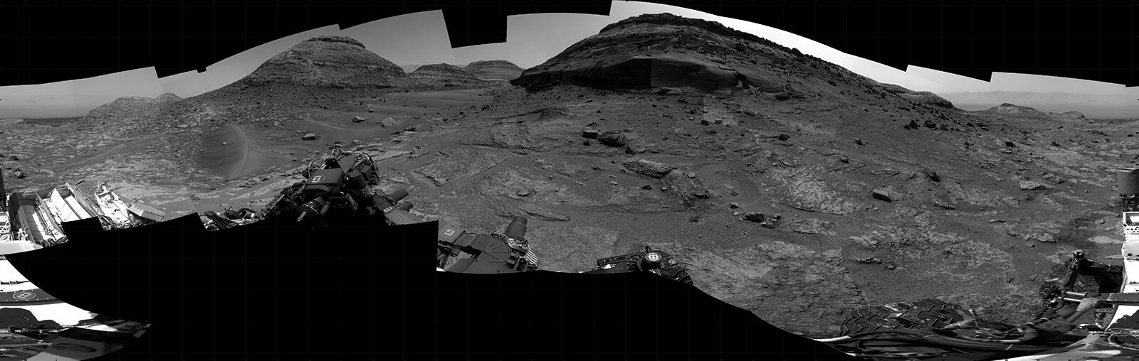
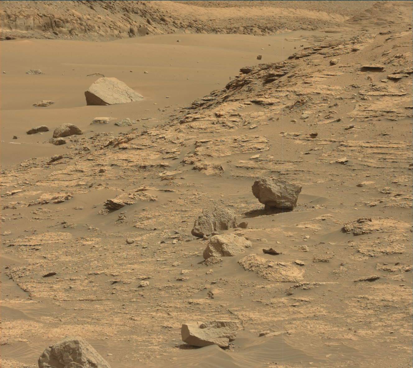
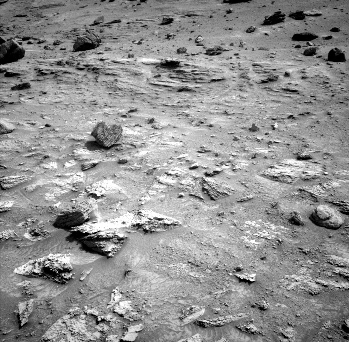
NASA's Mars rover Curiosity took 31 images in Gale Crater using its mast-mounted Right Navigation Camera (Navcam) to create this mosaic. Credits: NASA/JPL-Caltech. Download image ›

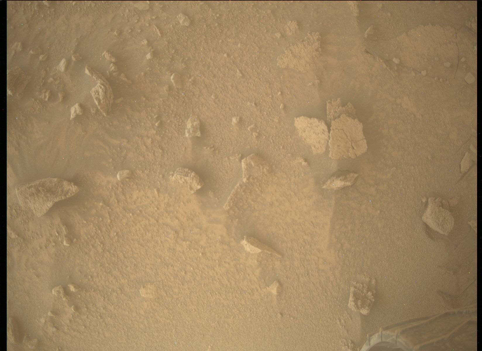
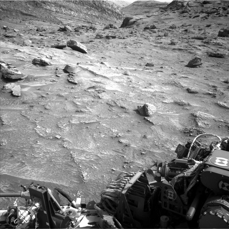
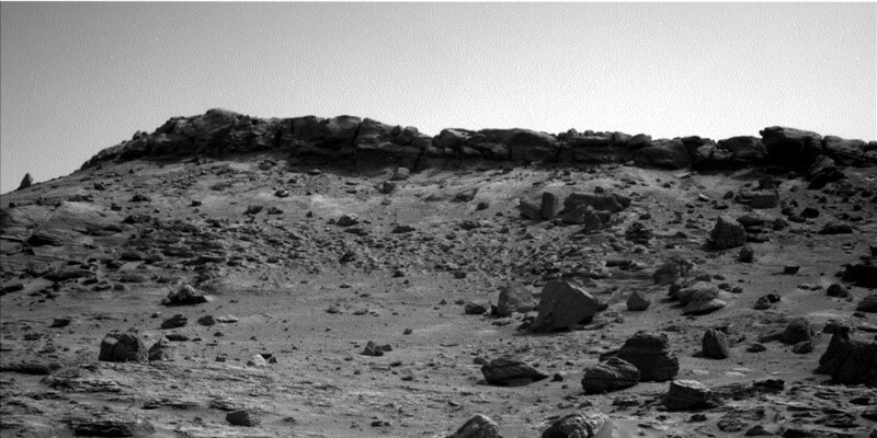
Curiosity is making its way through the stunning “Paraitepuy Pass,” the little canyon that runs between the “Deepdale” and “Bolivar” buttes to our east and west, respectively. The canyon floor is filled with aeolian bedforms, or sand ripples, as wind is likely funneled through the pass, mobilizing sand grains – a lovely modern process, active on Mars today! Today’s two-sol plan contains our normal cadence of remote science, contact science, and driving on the first sol, and untargeted remote science on the second sol.

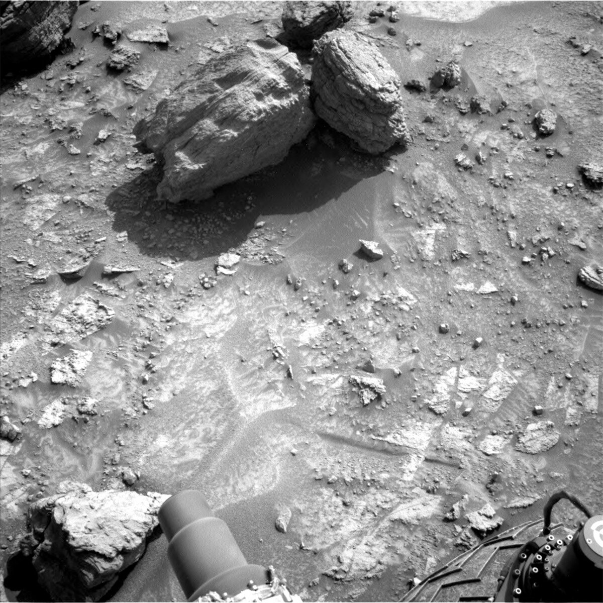
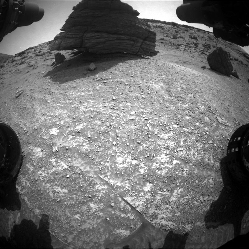
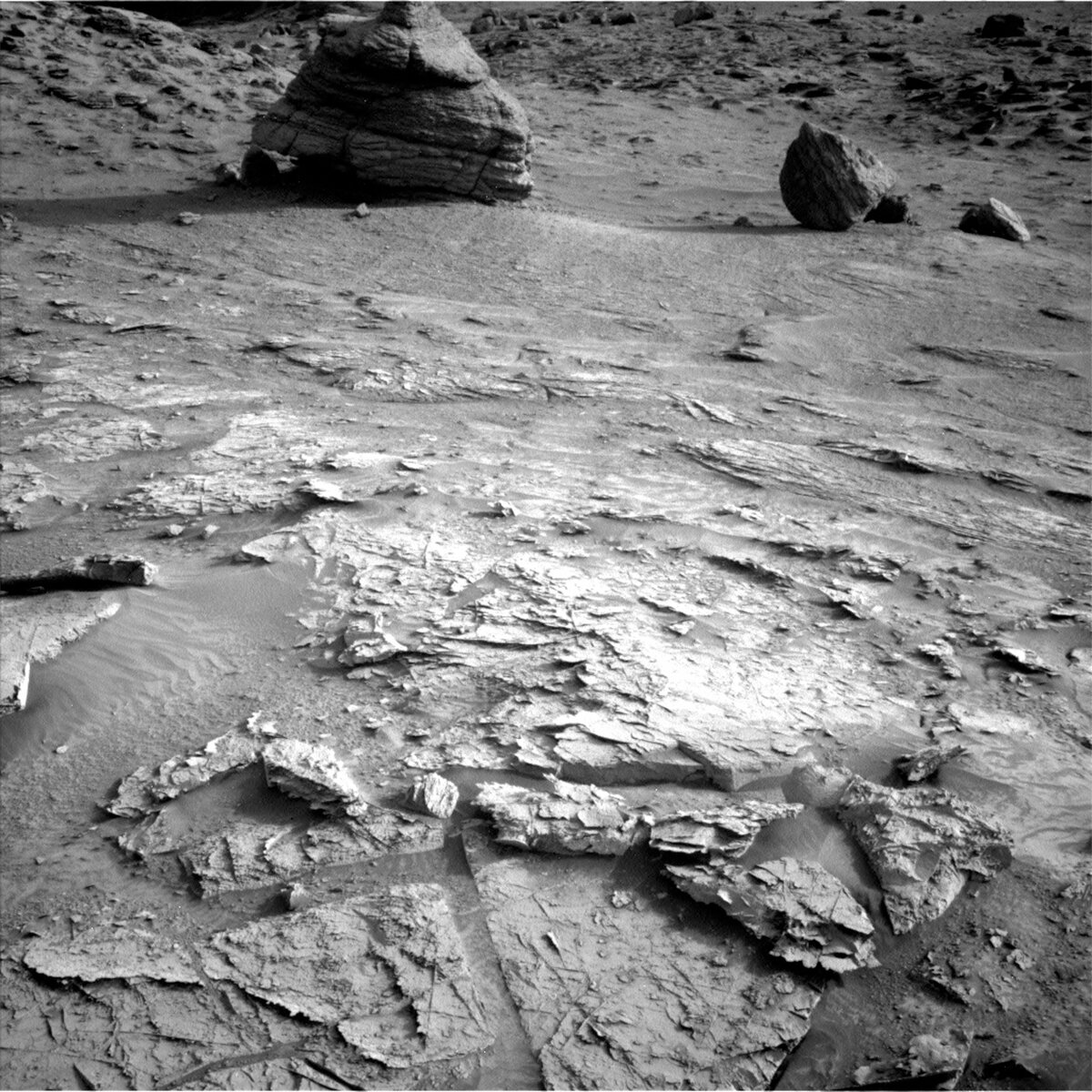
Our contact science includes taking a MAHLI “dog’s eye” mosaic of the bedrock target “Karisparo.” In a dog’s eye mosaic, the rover planners attempt to get the MAHLI camera as parallel to a vertical face of an exposure as possible. This provides a nice view of how any rock layers are oriented relative to each other, as well as getting a fine-scale view of the grain sizes. The science team then uses these observations to interpret how the grains were deposited and may have been subsequently perturbed. The science team was able to bring in plenty of observations today as we expect to have plenty of power and daylight to work with. We’ll use the ChemCam instrument to take a LIBS observation of some local bedrock and a long-distance RMI of the Deepdale butte. The RMIs provide an excellent “spy glass” view of distant layering that otherwise can’t be resolved with the other cameras. Mastcam will take mosaics of both the Bolivar and Deepdale buttes from this new vantage point.

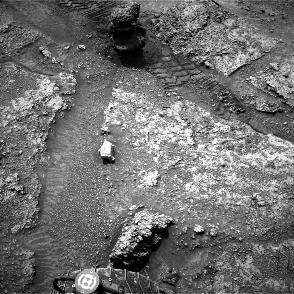
The drive planned by the rover planners will navigate about 30 meters forward through Paraitepuy Pass. They are working through challenging terrain with higher than normal tilts and pointy blocks that have eroded off the surrounding buttes. A fun drive for Curiosity!

The second sol of today’s plan will be in a new location after the drive. We will use ChemCam’s autonomous target selection software to pick an interesting science target for a LIBS observation and document that spot with Mastcam. We also have our continued environmental monitoring observations including a dust devil and sky survey.

July 29, 2022

Sols 3548-3550: Rocky Road Ahead – Still Not the Good Kind

Written by Ashley Stroupe, Mission Operations Engineer at NASA's Jet Propulsion Laboratory
This image was taken by Mast Camera (Mastcam) onboard NASA’s Mars rover Curiosity on Sol 3545.

This image was taken by Mast Camera (Mastcam) onboard NASA’s Mars rover Curiosity on Sol 3545. Credits: NASA/JPL-Caltech/MSSS. Download image ›

For this 3-sol weekend plan, I worked as the Tactical Uplink Lead. This morning we came in to discover that the drive had stopped early due to high slip on the steep terrain, and our parking place was not a safe spot to unstow and use the arm. So we quickly switched gears and loaded up the plan with lots of remote science. This terrain is particularly beautiful, so the opportunity to take more imaging is both scientifically interesting and visually stunning, as shown in the attached Mastcam image which shows the valley into which we are heading, called “Paraitepuy Pass.” We hope to be able to avoid the deep sand ripples which are strewn with boulders and follow a bedrock “sidewalk” along the western edge.

On the first sol of our plan, we looked at “Carrao,” a nearby smooth bedrock target with ChemCam LIBS and documented it with Mastcam. We then took several large Mastcam multispectral mosaics of two sand ripple targets, “Holmia” and “Gluck Island,”, and the Bolivar butte from this new vantage point. We also did ChemCam sky flats, to look for any dust on the camera, and an early morning engineering activity to help calibrate our heating needs in this changing season as we start to reach the end of summer.

On the second sol, we continued our intensive remote imaging campaign, with LIBS and Mastcam on the target “Siparuni,” a laminated bedrock target to contrast against Carrao. In addition we used Mastcam to take multispectral imaging of two areas, “Young Paru” and “Alvorada,” to document the different textures that are present. We also imaged “Wandaik” and “Isla Orquidea,” two diagentic features, in stereo. We also took stereo imaging of “Bom Futuro,” which is a fracture in the rock that has been filled with different material. Lastly, for Mastcam, we took multispectral imaging of “Salto Sakaika,” which is a large fallen block that shows bright flecks, and a set of color calibration images. Also before driving away, we took some atmospheric measurements with Navcam, a frame looking north toward the crater rim and a suprahorizon movie also looking north.

The drive itself was very challenging, given that we had already stopped short due to the difficult terrain. We are attempting to reach a high point, just at the top right edge of the image, so we can look down into the valley to see if there is a way out on the other side and to help plan our path forward. High tilts, sand, and large and small rocks clutter the terrain, requiring the Rover Planners to pick their way around while making sure they stay clear of the hazards.

After the drive, we took a lot of imaging from our new location, including a 360 degree Mastcam mosaic and an upper tier of imaging to catch the tall relief of the valley walls. We also took a very long atmospheric suite of observations to look over time for dust devils as well as another suprahorizon movie. We finish our post-drive imaging with a MARDI image of the ground underneath us just after sunset (as we do after each drive) and a pre-dawn Navcam cloud survey.

On the final sol of the plan, we have some additional atmospheric and instrument engineering activities, including a Mastcam tau image of the sun, Chemcam sky imaging, Chemcam calibration imaging, another Navcam dust devil survey, and a long APXS of the atmosphere with the arm stowed.

July 28, 2022

Sols 3546-3547: Staring at the Ground

Written by Keri Bean and Kristin Bennett
This image was taken by Mars Descent Imager (MARDI) onboard NASA's Mars rover Curiosity on Sol 3543.

This image was taken by Mars Descent Imager (MARDI) onboard NASA's Mars rover Curiosity on Sol 3543. Credits: NASA/JPL-Caltech. Download image ›

Today’s plan is chock full of goodies! We start out sol 3546 with a ChemCam observation of a sand ripple “Deposito” and an RMI observation of the Bolivar outcrop in the distance. Then we’ll do some Mastcam observations of Deposito, “Lilas” which is one of our robotic arm targets later in the sol, Bolivar, and “Deepdale.” Once all that wraps up, we’ll get into our robotic arm activities for the sol!

Today I (Keri) was the Arm Rover Planner, which means I was responsible for writing up the commands for the robotic arm activities in this plan. The original plan only had one set of MAHLI observations, but when I loaded up our most recent images in the morning, I noticed this lovely rock in our workspace. The top of it looked like a nice large flat spot where we could use our DRT to brush off some dust! The scientists also were thinking the same thing and agreed, so we added it to the plan. The scientists are also interested in the rough face pointing at the rover, so we are also taking some MAHLI images of that rough face “Simoni” followed by brushing away the surface dust on the top of the rock with DRT and taking some MAHLI and Mastcam images of Lilas.

Once the arm activities wrap up, we’ll begin driving! Our Mobility Rover Planner responsible for driving today just received their Martian driver’s license a few weeks ago, so today they’re getting to enjoy it by driving about 34 meters in some tricky terrain! We are driving in some terrain that could potentially make it more difficult to talk to Earth, in part because the tall hills we’re driving past block sections of the sky where Earth or the orbiters are visible. To make sure we maintain good lines of sight, they worked closely with some of the rover engineers to assess our communications with Earth and the Mars orbiters along with working with the Surface Properties Scientist that provide guidance on what type of rocks and terrain types are safe to drive over and which to avoid. There can often be a lot to juggle when driving a rover on Mars, so this is why we always work as a team!

During the drive, the science team decided to add in an observation that we don’t often use: a MARDI sidewalk observation. MARDI is a camera that is pointing down at the ground. Its initial purpose was to take pictures while MSL was landing on Mars, but now we use it to take pictures of the ground beneath the rover (the image shows a recent MARDI observation). A MARDI sidewalk observation is when we take several MARDI images while Curiosity is driving so we can get a “video” of the ground that the rover is driving across. It is like when you look down while walking along a sidewalk on Earth. The science team is excited for this observation because we are driving across changing terrain. We can’t stop everywhere along the traverse, so obtaining this MARDI sidewalk video will give us close up images of the rocks we drive over. This will help the science team pinpoint exactly when we drive into an area with different rocks. Maybe staring down at the sidewalk while you walk sounds a little boring on Earth, but on Mars it can help us learn more about the changing terrain!

After all that completes, we will take some post-drive imaging with Hazcams, Navcams, and Mastcams which will help the next planning team determine their activities.

On the second sol, we are doing what we call untargeted science, since the rover will have driven to a new location by the time they occur so we plan science observations that don’t require being in a specific place. First we let the rover autonomously select ChemCam targets then use Navcam look to the crater rim to see the dust in the atmosphere followed by looking for dust devils. Later in the sol, Mastcam will do a sky survey observation. The entire plan also includes our standard background RAD, REMS, and DAN observations.

July 26, 2022

Sol 3545: Small but Mighty!

Written by Elena Amador-French, Science Operations Coordinator at NASA's Jet Propulsion Laboratory
This image was taken by Left Navigation Camera onboard NASA's Mars rover Curiosity on Sol 3544.

This image was taken by Left Navigation Camera onboard NASA's Mars rover Curiosity on Sol 3544. Credits: NASA-JPL/Caltech. Download image ›

Today’s team planned a single-sol plan. Our greatest challenge was fitting in all the fantastic science observations and drive distance required during the ~3.5 hours of Mars time available before we need to communicate back to Earth for tomorrow’s planning. Often during single-sol plans we include contact science where we use our arm instruments to take a close look at the structure and composition of a particular surface target. However, with our limited duration, the science team needed to work together to carefully identify the highest priority activities. For today that meant removing the contact science and making as much progress on our drive towards our next science waypoint as possible. Once the Rover Planners knew how much time they needed to execute the drive today, the science team used the remaining available daylight to make science observations. These include using our ChemCam and Mastcam instruments to image an interesting float rock – a rock that has been displaced from its original setting – named “Surucucus” (see rock in top center of the above image). We also used our ChemCam RMI capability to take long distance images of the planar beds along “Bolivar,” the ridge that we have been following for the last several plans. Our drive will continue to move us to the east as we navigate towards the small valley that we will soon pass through seen here. In the evening after our drive we will take environmental monitoring observations using our engineering and science cameras to monitor for dust mobilization and cloud formation. Even though we had limited time to work with today, we made sure to pack the plan with many science goodies!

July 25, 2022

Sol 3544: Bye-Bye Bolivar!

Written by Catherine O'Connell-Cooper, Planetary Geologist at University of New Brunswick
Left Nav camera image from sol 3543, showing the float blocks “Tumereng” and “Muruwa."

Left Nav camera image from sol 3543, showing the float blocks “Tumereng” (bottom of image) and “Muruwa” (larger block at top of image). Credits: NASA/JPL-Caltech. Download image ›

We have come to the end of our detour to image the "Bolivar" butte and are starting back to the MSAR (Mount Sharp Ascent Route). This plan provides the last chance to image Bolivar from this vantage point, with the aim of characterizing, so Mastcam is taking one final large mosaic of the butte, before we move on and it is blocked from our sight.

We cannot drive up the side of Bolivar (although that would be a wild ride!) to investigate its chemical composition, so we are analyzing float rocks in the workspace. “Float” rocks are loose rocks, lying on top of the local bedrock and are often from the surrounding area. As Bolivar is the highest point around here, we are working with the idea that the floats in our workspace have rolled down from this hill, and will analyze these in lieu of asking our rover to defy physics and climb up Bolivar.

MAHLI is imaging “Tumereng,” a float block directly in front of the rover, and Mastcam will image a larger float block “Muruwa” further away – both sets of images will look at sedimentary structures such as layering, and the MAHLI images may also give an indication of grain sizes. Mastcam will conduct multi-spectral imaging of the float block “Lagoa do Paraiso.” As multi-spectral imaging is routinely taken for brushed targets such as “Motocuruna” this past weekend, we can compare the results between previous bedrock targets and Lagoa do Paraiso, which can help characterize the float rock as either relatively similar to the underlying bedrock or as something more “exotic.”

ChemCam is using LIBS to analyze the bedrock target “Hororabo,” as part of its continuing bedrock monitoring – this target will also be imaged by Mastcam.

Once these science activities are complete, we drive onwards, leaving Bolivar behind for now – perhaps we will get another look as we continue our climb up Mount Sharp.

July 22, 2022

Sols 3541-3543: Teamwork? Sure!

Written by Susanne Schwenzer, Planetary Geologist at The Open University
This image was taken by Left Navigation Camera onboard NASA's Mars rover Curiosity on Sol 3540, showing target 'Merume.'

This image shows target ‘Merume’ and was taken by Navcam left on NASA's Mars rover Curiosity on Sol 3540. Credits: NASA/JPL-Caltech. Download image ›

Some planning days are more complicated than others, not because Mars throws us a curve ball, that happens, too, as regular readers of this blog will know. No, sometimes it’s just plain old computer issues here on Earth that make things complicated. Today was such a day, and some of our personal computers hadn't properly updated one of the tools, but when we found out it was too late to diagnose that this was the case and re-install everything as we had to get on with planning. I was Geo science team lead today, and my computer was also guilty of it. Thus, me and a few random others could not see parts of what was happening, especially the tool where we look at the targets we are planning. That’s like driving with half of the windscreen obscured. It is very frustrating, yes, you are right! But, amazing teamwork, lots of screenshots by people who could see what we needed to see, patience and constantly making sure all descriptions are accurate and in place everywhere got us around it and we delivered a full plan, as you see below. I love this team for what we can do even if we get a curve ball from any one of the two planets involved, just because everyone focuses so much to make it work.

We are particularly excited here today as we have spotted some really nice bedrock just in front of the rover, which we will of course measure with APXS and MAHLI, a target now named ‘Motocuruna.’ But bedrock is not the only interesting feature in the area, there are also veins that we were particularly interested in. APXS and MAHLI look at those, too, on a target named ‘Benhori Bumoko:’ but that’s not all as MAHLI also peeks off to the side of Motocuruna onto target ‘Serra da Mocidade’ for some more context on the bedrock.

ChemCam has a busy day too, investigating three targets with LIBS and one target with a long distance RMI. The long distance RMI is looking at a structure higher up on the mountain which might be traceable for quite some distance, so is of particular interest to observe. LIBS investigations are on the two APXS targets Motocuruna and Benhori Bumoko, and on another bedrock target named ‘Lethem.’

Mastcam has a very busy day, too, with two multispectral investigations, one on the APXS target Motocuruna, and another one on a small float rock with striped textures that are also remarkable rich in contrast, named ‘Merume’ and shown in today’s title image above. ‘Auaris’ is a target that also stands out for its appearance and texture and thus was another Mastcam target. Two more targets are looking at all the sedimentary details around us, ‘Malonquinha’ and ‘Tumatumari.’

As we are just starting the summer at Gale crater, we are also continuing our atmospheric monitoring in some detail. The DAN instrument has an observation and of course MARDI takes its image. Looks like a lot? Well, yes, but Curiosity will also do some housekeeping as it photographs the MAHLI magnets to monitor dust accumulation. It’s a long weekend, so we keep the rover busy.

July 20, 2022

Sols 3539-3540: When Mars Throws You a Curveball…

Written by Elena Amador-French, Science Operations Coordinator at NASA's Jet Propulsion Laboratory
Image taken by Left Navigation Camera onboard NASA's Mars rover Curiosity on Sol 3536.

This image was taken by Left Navigation Camera onboard NASA's Mars rover Curiosity on Sol 3536 (2022-07-18 09:16:22 UTC). Credit: NASA/JPL-Caltech. Download image ›

The rover has been making its way along the “Bolivar” ridge, dodging small boulders and rocks that have apparently eroded off the hillside as seen in the above engineering camera image. Unfortunately, due to the complex terrain our last drive ended about 11 meters short of its anticipated location. Because of the unexpected rover heading, the antenna we usually use to uplink plans directly from Earth was blocked by terrain. This precluded our ability to send our normal 1-sol plan today, so instead we’ll use an orbiter tomorrow to relay our commands for two sols. Today as Science Operations Coordinator my job was to make sure the engineering team at JPL and the international science team were communicating effectively and efficiently as we reworked our plan around the unexpected constraints.

Today’s team did a fantastic job, pivoting to a slightly more complex 2-sol plan but one that allowed for additional science observations to be made. Our plan includes studying the apparent layering of the “Surama” target with our MAHLI instrument to search for fine-scale layering. This rock seen here on the right side of the rover’s workspace, appears to be one that has rolled down from the Bolivar ridge – a “float” rock. We will also place our APXS instrument on the top of the rock to analyze its chemical composition. This information can then be compared to other compositions measured along our traverse. Will it be in family with those we have seen already, or will we find more similar compositions as we continue to ascend, hinting at its source?

Because we ended up planning two sols today, we had plenty of time to plan remote science observations. This included Mastcam and ChemCam imaging of the Bolivar ridge and surrounding rocks. We will also use our engineering cameras to take images that monitor for dust accumulation in the atmosphere and dust devils on the ground. Lastly, we will continue driving-on to the southeast, skirting the Bolivar ridge, and making our way towards the canyon visible in the top left-hand corner of the above image.

July 18, 2022

Sol 3537: Approaching Bolivar

Written by Kenneth Herkenhoff, Planetary Geologist at USGS Astrogeology Science Center
This image was taken by Left Navigation Camera onboard NASA's Mars rover Curiosity on Sol 3536.

This image was taken by Left Navigation Camera onboard NASA's Mars rover Curiosity on Sol 3536. Credit: NASA/JPL-Caltech. Download image ›

The Sol 3536 drive went well, getting MSL closer to the cliffs of interest toward the south of the rover. This one-sol plan includes both arm activities and another drive, squeezed into the time available before the mid-afternoon opportunity to "phone home." Mastcam will be busy at the start of the plan, measuring the amount of dust in the atmosphere above the rover, imaging the back side of the big Ilha Novo Destino boulder that was the subject of several investigations last weekend, and acquiring stereo mosaics of a bright outcrop named "Issineru," the layered bedrock capping the nearby "Bolivar" hill, and a boulder named "Arumim" that appears to have rolled down from Bolivar. Then ChemCam will fire its laser at a nearby bedrock outcrop target dubbed "Cerro Raya" and acquire an RMI mosaic of sedimentary structures in the Bolivar caprock seen along the skyline in this Navcam image. I supported the ChemCam team today by adjusting both target locations to ensure good coverage of interesting features. Mastcam will also acquire a stereo mosaic of the bedding exposed near the rover, which will include the Cerro Raya target, before taking a break while MAHLI takes images of the laser spots on Cerro Raya. There isn't enough time in this plan for DRT brushing of the MAHLI target, so we're hoping that ChemCam's laser will clean some of the dust off of Cerro Raya so that fine grains and micro-textures will be visible to MAHLI. After the arm is stowed, Mastcam and Navcam will image the workspace to look for material that may have spilled out of the drill assembly. Then a short drive toward the southeast is planned, followed by the standard post-drive imaging that will be used to plan Sol 3538 activities, and another MARDI twilight image of the ground behind the left front wheel.

July 15, 2022

Sols 3534-3536: A Chip off the Old Block

Written by Catherine O'Connell-Cooper, Planetary Geologist at University of New Brunswick
This Front Hazard Camera from Sol 3533 shows the boulder “Ilha Nova Destino.”

This Front Hazard Camera from Sol 3533 shows the boulder “Ilha Nova Destino.” Credits: NASA/JPL-Caltech. Download image ›

We have been making our way to a large boulder “Ilha Nova Destino” (which from the distance looks remarkably like the Hogwarts Sorting Hat from Harry Potter!) and landed about 3 metres back from the block. Although we would have loved to get closer, the boulder is as large as the rover (as tall as an SUV) and considerably less stable looking, appearing to be almost perched up on one side. To reduce danger to Curiosity, we planned to keep our distance, just getting close enough for ChemCam LIBS.

ChemCam will combine LIBS compositional measurements (on targets “Serra Dourada,” “Serra Nova Olinda” and “Serra da Lua”) and RMI imaging (on targets “Ilha de Maraca” and “Ilha Sao Lourenco”) to conduct a very thorough survey of the rock. Mastcam will undertake a multispectral analysis of the boulder, and image “St Marys” along the base of the boulder, looking at the contact with the underlying bedrock. Mastcam will also target a second large float rock “Wineperu,” which can be seen to the right of the Ilha Nova Destino boulder in the Front Haz camera image above.

As APXS Strategic Planner this week, I was disappointed that we would not get close enough to use APXS to look at the composition of this large boulder. But, almost magically, when we started planning this morning, we discovered a small float block that may have broken off Ilha Nova Destion - you can see this float "Monte Caburai" in the shadow in front of the boulder in the Front Haz camera image. This float block was close enough to allow both APXS and MAHLI to analyze it. Additionally, MAHLI were able to add a “dogs-eye” (a set of overlapping images which are used to make a larger mosaic) along the base of Ilha Nova Destino, looking at the layering.

In addition to this, ENV will continue to monitor environmental conditions in Gale, tracking dust level changes in the atmosphere and watching for dust devils on the ground. REMS will record temperatures and DAN continues to look for evidence of hydrogen (hydrogen detection may indicate the presence of water in minerals). We will drive onwards on the third sol of the plan, driving to the right past Wineperu, which will allow us to look back at Ilha Nova Destino and get some images of the back of the boulder.

July 13, 2022

Sols 3532-3533: A Rover-Sized Boulder

Written by Lauren Edgar, Planetary Geologist at USGS Astrogeology Science Center
This image was taken by Left Navigation Camera onboard NASA's Mars rover Curiosity on Sol 3531.

This image was taken by Left Navigation Camera onboard NASA's Mars rover Curiosity on Sol 3531. Credits: NASA/JPL-Caltech. Download image ›

Curiosity is back on the road, but some interesting boulders caught our attention and led to a short detour. The team was already planning to divert to the southwest to get some imaging of nearby cliffs, but the large boulders that have tumbled down provide a tantalizing glimpse of what’s to come. Boulders like the large one shown in the above Navcam image (now named “Ilha Novo Destino”) can help inform our understanding of the upcoming stratigraphy, so we thought it was worth a trip to this “new island destination” for the weekend.

But first, there’s plenty of science to be done in our workspace before we get to the boulders. Today’s two-sol plan focused on DRT, MAHLI, and APXS on the bedrock right in front of the rover, including the interesting vein and fracture patterns shown in the foreground of the above Navcam image. Today we planned 3 MAHLI imaging targets and 2 APXS targets to assess the sedimentary textures and composition of bedrock and veins. We also planned ChemCam LIBS and Mastcam multispectral observations to further characterize this outcrop. Mastcam will also be used to document the field of boulders to help plan weekend activities, and ChemCam will acquire a long distance RMI mosaic to characterize the stratigraphy. The ENV theme group planned several environmental monitoring activities to search for dust devils and monitor dust and clouds in the atmosphere. On the second sol, Curiosity will drive to a parking spot right in front of these boulders to prepare for the weekend plan. Can’t wait to see this rover-sized boulder up close!