August 22, 2022

Sol 3571: We'll Take a Little Bit of Everything Please!

Written by Catherine O'Connell-Cooper, Planetary Geologist at University of New Brunswick
This image looking at the TARS was taken by Left Navigation Camera onboard NASA's Mars rover Curiosity on Sol 3570.

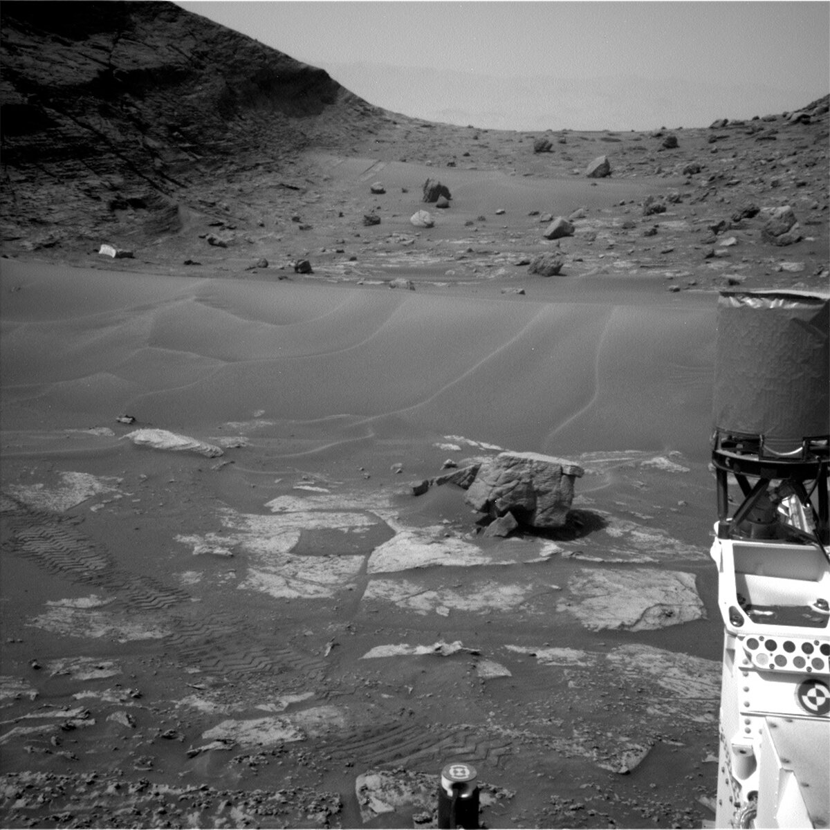
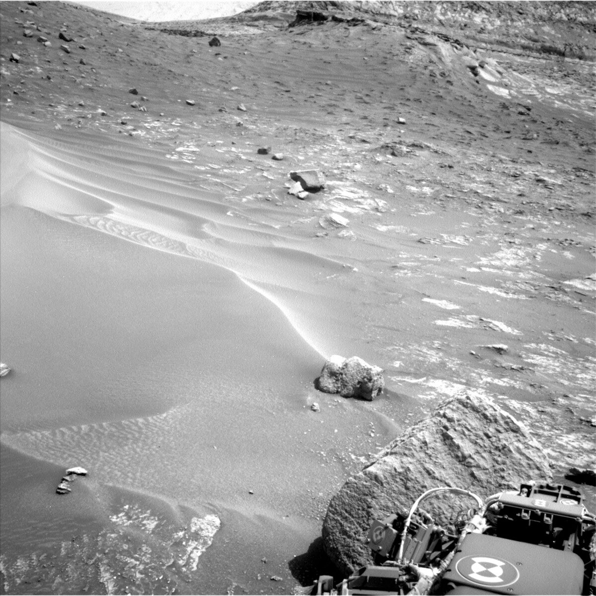
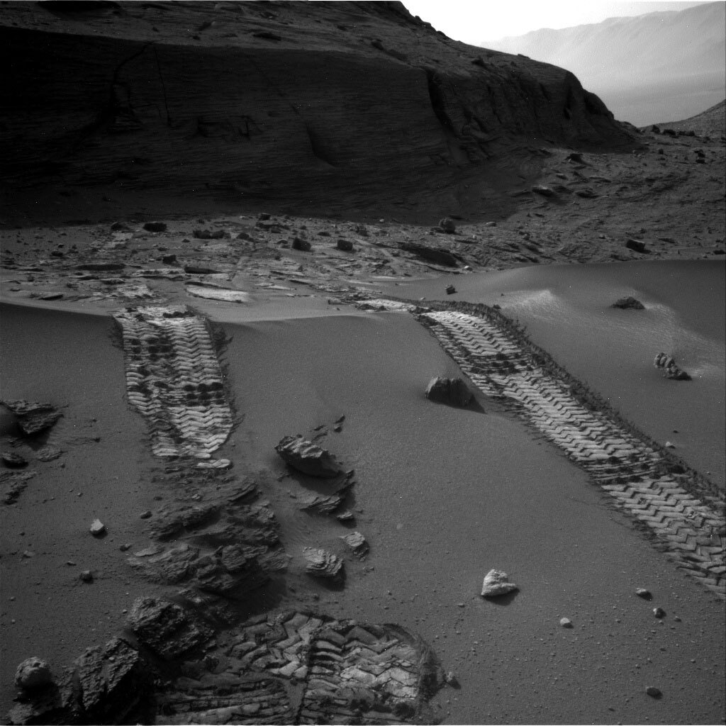
Left Navigation camera image, from sol 3570, looking back at the TARS and tricky traverse. Credits: NASA/JPL-Caltech. Download image ›

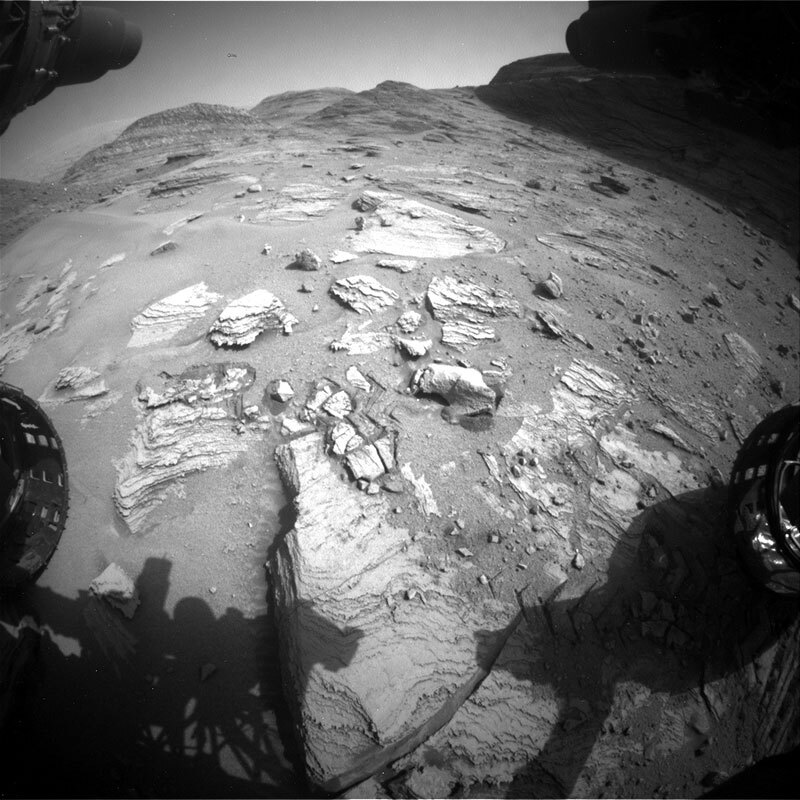
Today we planned a single sol plan cramming lots of science into a small plan, before driving in the afternoon. The workspace here has flat-lying bedrock, sometimes with visible laminations or with raised ridges, with some patches of rougher textured (chaotic looking) material overlying the bedrock and lots of float rocks. So – rather than choose between them – we are doing a bit of everything!

ChemCam will use LIBS to look at the composition of representative bedrock here, at the target “Buck Island,” which will also be imaged by Mastcam. MAHLI will analyze the target “Raimundo,” on a raised patch of knobbly, rough textured material. Mastcam will image both Raimundo and the surrounding bedrock, capturing some of the smaller, laminated float pebbles just in front of the rover. Mastcam will also image some raised ridges, potentially fracture zones, at “Kuyuwini” in the direction of our drive. Unfortunately, we couldn’t add APXS to this plan, as the mornings are too warm to run APXS right now, so the APXS team (myself included) are looking forward to getting some nice cold evening integrations later in the week.

The Mastcam target “Cairiri” is a nice bonus target for us too. On Earth, when geologists go to examine a new area, we bring hammers to break rocks open, to see what the interior looks like. When you stand on a rock surface, the colour may be red or brown or green – but often you are looking at the effect of weathering and not the rock as it would have been when it was “fresh.” Additionally, on Mars, the fine red martian dust can conceal and hide features. Sadly, Curiosity doesn’t have an actual hammer on board, but sometimes, as we drive over bedrock, the rover’s wheels can cause fragments to break off or break open. The target Cariri looks like it is comprised of nodular material that was crushed as we drove over it. Mastcam will image this, in the hopes that we see some of the internal structure of the nodules.

The environmental theme group (ENV) will undertake some environmental measurements, such as tau measurements (to quantify the amount of dust in the atmosphere), before we drive onwards to our next location.

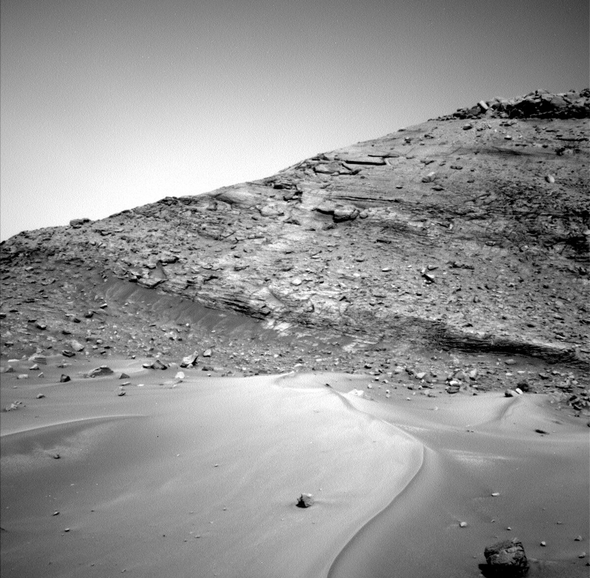
We are past the worst of the transverse aeolian ridges or sand ripples (“TARS”), just outside the thinnest part of Paraitepuy pass. It is satisfying to look back and see where we have just come from, through sand and rocks, through challenging terrain (in the accompanying Navcam image). The drive path forward is still slow going, but our current end goal is in sight now. We have been eyeing a patch of paler appearing rocks for some time, so our plan is to get to those and start figuring out why they appear and how they relate to the surrounding buttes: “Bolivar” (behind us on our right hand side), “Deepdale”(behind us on our left side) and “Orinoco,” “Kukenán” and “Chenapau” (left to right, ahead of us).

August 19, 2022

Sols 3568-3570: That Was Close

Written by Ashley Stroupe, Mission Operations Engineer at NASA's Jet Propulsion Laboratory
This image was taken by Left Navigation Camera onboard NASA's Mars rover Curiosity on Sol 3567.

This image was taken by Left Navigation Camera onboard NASA's Mars rover Curiosity on Sol 3567. Credits: NASA/JPL-Caltech. Download image ›

Coming in to work on the three-sol plan for the weekend, we were met with another set of stunning Images of the landscape around us. But for the Rover Planners the thing that really stood out is just how close we are to the very large rock (which you can see in the above image). Fortunately, Curiosity is safe and sound and ready for another set of exciting activities on Mars.

The first sol of the plan begins with a lot of imaging. Before things get warm, ChemCam is taking a measurement with the laser of the “Arimu Mine” target, a significant overhang on a rock in the workspace that appears to be resistant to erosion. This is followed up by a long-distance ChemCam of the Kukenan butte which still lie in the distance. Mastcam is also looking at Arimu Mine as well as “Konawaruk,” which is a target on the Bolivar buttes. We also do some atmospheric observations with Navcam including a dust devil survey.

Curiosity then takes an afternoon nap before waking up to do contact science on the knobby rocks in the workspace. It took two Rover Planners to find and validate two targets that were accessible for contact science. “Massara” is the fattest rock we could find, but is still a rough rock. After studying the images and a lot of refinement, we were able to select a spot for Massara suitable for brushing; we also plan to take MAHLI images and APXS measurements on this target. Our other target took an equal amount of work, as it is on a lower tier of a rock and close to several other rocks. After significant refinement, we were able to select the target “Fortaleza,” which keeps the rover’s turret safe from colliding with the ground while hovering with the APXS and MAHLI. We also did some housekeeping observations, taking MAHLI images of the MAHLI and APXS calibration targets.

Early in the morning, before handing over to the next sol of the plan, we do an engineering heating test as well as some morning imaging of Bolivar; at this time of day sun is lower in the sky and provides the perfect lighting to look at textures.

On the second sol of the plan, Curiosity hangs out to take more imaging. ChemCam points the laser at “Taiano,” which is a nearby bedrock target, before looking further away with the RMI at what looks like an “inverted channel;” inverted channels form when the sediments are more resistant to weathering than the surrounding bedrock, so all that's left is the raised channel material. Mastcam also looks at Taiano, as well as taking multispectral images of the DRT target, Massara, and “Stampa Island,” a nearby rock that may be an iron meteorite. The science observations wrap up with a dust devil movie and an engineering maintenance activity for SAM.

In the evening, we do the first of a series of observations designed to look for cosmic rays by taking Navcam images at night. When cosmic rays hit the camera, streaks will appear in otherwise dark images which can indicate the direction and type of particle. We have accidentally caught cosmic rays with cameras on Mars before, but these are the first images intending to capture them. In the following early morning (before dawn), we take a Navcam cloud survey; at this time of day the low-angle of the lighting hits the clouds, illuminating them.

On the last sol of the plan, we finish up our target science with ChemCam LIBS observation of “Velami,” which is another rock target in the workspace. ChemCam also does RMI observations of Stampa Island and “Quattata,” which is a light-toned layer near the base of a distant butte. Mastcam also looks at Velami, and then takes stereo of the rover’s tracks, and the inverted channel. The images of the tracks will be used to search for any changes caused by wind after the tracks were made during the drive on 3565. The pre-drive science is rounded out with atmospheric observations, including a Mastcam solar tau to monitor dust in the astmosphere and change detection.

In the afternoon, Curiosity begins picking a way around the tricky terrain. In addition to the very large rock right next to us, we have steep tilts and lots of larger sand ripples, as visible in the above image. We begin by driving around to the right (west) of the boulder, which actually requires us to straddle a large 30cm rock. We also skirt the sand that we had trouble crossing (or rather, not crossing) in the 3565 plan. Once past the boulder, we turn back to the left (east) and park near a small ridge about so that we can see over it before driving further. This parking spot also had to be carefully selected between several other very large rock to ensure that we don’t run into any of them or park on top of them, preventing us from safely unstowing the arm.

The last thing in the plan, just prior to handing over to the sol 3571 plan, is a short set of atmospheric observations, including Navcam zenith and suprahorizon movies, and another Mastcam solar tau.

August 18, 2022

Sols 3566-3567: Curiosity Versus the Sand… Again

Written by Abigail Fraeman, Planetary Geologist at NASA's Jet Propulsion Laboratory
This image was taken by Front Hazard Avoidance Camera (Front Hazcam) onboard NASA's Mars rover Curiosity on Sol 3565.

This image was taken by Front Hazard Avoidance Camera (Front Hazcam) onboard NASA's Mars rover Curiosity on Sol 3565. Credits: NASA/JPL-Caltech. Download image ›

The “road” through Paraitepuy pass continues to challenge our intrepid Curiosity rover. We attempted to cross another large sand ripple (formally called a transverse aeolian ridge, or TAR) in Tuesday’s plan. However, we found out this morning that Curiosity had automatically stopped the drive when the rover’s wheels slipped more than expected right before they reached the crest of the TAR. While unintended stops like this are frustrating, it’s comforting to know the rover is so capable of keeping itself safe – stopping the drive early is definitely better than trying to plow through and potentially embedding the wheels deep into the sand!

In today’s plan, we’ll back out and try again. Rather than crossing the TAR in the same place, we’re going to try crossing a few feet to the side, where the sand is shallower and therefore should be easier to cross. Unfortunately, there’s another obstacle we’ll encounter right after we cross at this new location, a large rock that’s visible in the above Navcam. In order to navigate this tricky terrain, we’re planning to stop the drive after we cross the TAR but right before we reach the rock, just to make sure the rover is positioned exactly where we want and so that we’ll be in the best position to plan a safe path around. Paraitepuy pass is certainly testing our rover drivers, but I have complete confidence we’ll make it through soon!

Since we stopped while trying to cross the TAR, we were greeted this morning with another sand-filled workspace. We planned contact science with MAHLI and APXS on a single target, “Yupukari,” that’s along the crest of the bedform. We’ll also be taking lots of remote sensing data, with a ChemCam LIBS observation of targets “Makarapan,” a rock near the rover’s back wheel, and “Uaipan,” a different area along the crest of the TAR. We’ll collect another long distance RMI mosaic of the mysterious marker band unit (see more), and Mastcam observations of some bedrock behind the rover named “Maturuca,” a float rock in the sand named “Los Viejitos,” another distant rock named “Salgado,” and the rock we’ll need to drive around on Friday, named “Rera.” We’ll also capture additional imaging of the “Bolivar” butte that we have been driving around for the last few sols. Environmental science observations will round out the plan.

August 16, 2022

Sol 3565: Over, Around, and Through

Written by Michelle Minitti, Planetary Geologist at Framework
Image of obstacles, large ripples and several boulders, that guard the Paraitepuy Pass.

This image was taken by Left Navigation Camera onboard NASA's Mars rover Curiosity on Sol 3564. Credits: NASA-JPL/Caltech. Download image ›

We filled much of today’s plan imaging the wonders around and ahead of us as we pick our way through “Paraitepuy Pass” - the towering buttes, geologic relationships, and layers that have drawn our attention for a literal decade. But it is also fun to look back on how we got to where we are. The image above traces a small segment of our path traversing the obstacles that guard the pass - over one of the large ripples, around several large boulders - leading us to a point where we are nearly through the pass. I particularly enjoy seeing the choice of diverting the drive oh-so-close to the towering “Bolivar” butte to our starboard side so our wheels could cross the (presumably!) shallowest part of the large ripple. It is great to see yet another successful ripple crossing, hearkening back to the first big one way back on Sol 535 at “Dingo Gap.”

Before we cross yet one more ripple, we planned imaging from the scale of vistas to small bedrock blocks. ChemCam will image the spectacular “Kukenan” butte, and will team up with Mastcam to image an intriguing rubbly ridge extending from the north side of Bolivar. Mastcam will add to our coverage of the “Orinoco” butte, and Bolivar butte with mosaics along its base including the “Karia Island” and “Ayanganna” targets. The interesting texture and color of the former target also made it a target for Mastcam multispectral analysis. We will acquire one Mastcam image of “Antonio,” the lone rock poking out of the ripple in front of the rover which has a lumpy texture. DAN passive runs in parallel with all these geologic observations and our drive, punctuated by a DAN active post-drive. RAD and REMS will keep their regular tabs on our environment throughout the sol.

August 15, 2022

Sol 3564: Slow and Steady Does It!

Written by Catherine O'Connell-Cooper, Planetary Geologist at University of New Brunswick
Left navigation camera image, showing Orninoco and Kukenán buttes.

Left navigation camera image, showing Orninoco and Kukenán buttes. Credits: NASA/JPL-Caltech. Download image ›

We are making slow but steady progress through the “Paraitepuy pass,” having passed the approximate halfway point over the weekend. Today’s one sol plan found us staring around the corner at the neck of the pass and considering our drive path forward. Sometimes, our drive forward is smooth and flat ….. neither word can be used here! Our drive forward has abundant sand and sharp rocks, so finding a safe path is providing our intrepid rover planners with some interesting times! Today’s planned drive is roughly 29 metres.

The view from here is quite extraordinary –we are looking at several large buttes, which lie along the side of the pass and in front of us – and it is hard to resist the urge to photograph everything in sight, just like any tourist or traveler! Mastcam is hard at work again as a result, imaging the butte Orinoco (the large butte on the left of the image – “Kukenán” is the butte at the centre-back of the image), along with two mosaics on the Bolivar butte. ChemCam is using its long distance imager (RMI) to look at the butte “Chenapua” (the edge is just visible on the right hand side of the image).

We parked next to some sand in this plan, so we are spending time to look at grain sizes within the sand patch. Mastcam will image the nicely developed ripple crest (“Blackwater Creek”). The MAHLI target “Sand Creek” and the Mastcam target “Karowrieng” look at the flanks, away from the ripple crest.

This sandy patch has a few float (i.e., loose on the surface) rocks in it. MAHLI will analyze “Nascente,” which is a small rock in the middle of the sand patch, right in front of the rover. Mastcam is imaging a large float rock “Plantain Island,” off to the left of the rover, and the float “Pairuwa Islands” within the sand patch, which has some intriguing sand flow patterns. We can compare these float targets to the bedrock ChemCam LIBS target “Corocito” – this may help us determine the origin of the float rocks.

Once our imaging and contact science is complete here today, we will move forward, picking our way along the pass.

August 12, 2022

Sols 3562-3563: Adventures Over Sand

Written by Kristen Bennett, Planetary Geologist at USGS Astrogeology Science Center
Image of Curiosity’s tire tracks over a sand ripple.

This image was taken by Right Navigation Camera onboard NASA's Mars rover Curiosity on Sol 3560. Credits: NASA/JPL-Caltech. Download image ›

Curiosity is continuing the journey through Paraitepuy Pass. The image above shows why it is going to take some time to traverse through this area. Here the navigation cameras snapped a photo of Curiosity’s wheel tracks over a sand ripple. The rover was designed to overcome terrain like this, but the rover planners still want to develop the drive paths very carefully as we drive through these rocks and sand features.

We decided to take advantage of these sandy adventures, so today we focused our contact science on a beautiful ripple that ended up in our workspace. “El Silencio” is an APXS and MAHLI target near the crest of the ripple, while “Orinduik” is a MAHLI-only target on the flank of the ripple. Scientists hope that by comparing the sand grains on the top and side of the ripple they will be able to tell whether this ripple has recently been active.

We were also very excited to turn a corner and get new views of the buttes that we are heading towards. A new butte, called “Chenapau,” came into view today. The weekend plan includes Mastcam stereo images of Chenapau as well as the “Orinoco” and “Kukenan” buttes. ChemCam will also target Kukenan with two separate long distance RMI mosaics. To finish off the butte observations in this plan, there is a Mastcam mosaic being taken early in the morning to catch part of the “Bolivar” butte with good lighting. Other observations in the plan include a Mastcam 360, Mastcam stereo of three float rocks called “Parapouco 1,” “Parapouco 2,” and “Parapouco 3,” and ChemCam LIBS targets of rocks called “Los Botellas” and “Aricheng.”

Finally, this plan includes a ChemCam long distance RMI of the rapidly approaching marker bed. The marker bed was described in this previous update: Mission Updates: Sols 2897-2898: Marker Bed in Focus - NASA Mars. We have been observing this interesting feature in long distance images for years now, so it is great to finally be getting closer to it!

August 10, 2022

Sols 3560-3561: Progressing Through the Pass

Written by Alex Innanen, Atmospheric Scientist at York University
Image of sand and rocks taken by Front Hazard Avoidance Camera (Front Hazcam) onboard NASA's Mars rover Curiosity on Sol 3558.

This image was taken by Front Hazard Avoidance Camera (Front Hazcam) onboard NASA's Mars rover Curiosity on Sol 3558. Credits: NASA/JPL-Caltech. Download image ›

Curiosity is continuing to press on through Paraitepuy Pass with the successful completion of last plan’s drive and another coming up on the first sol of today’s two-sol plan. The terrain continues to be tricky, with lots of sand and rocks, as you can see in the Hazcam image, and the rover planners are working hard to determine the best and safest way forward. In between carefully creeping along, we’re pausing to take in the views – by which I mean do a lot of science!

Before we leave our current location, we’ve packed in a whole host of observations. These start with ChemCam on the nearby DRT target ‘Annai,’ and two RMI mosaics looking further afield at the lower part of ‘Kukenan’ (the most distant hill in the Hazcam image) and the marker band near the top of ‘Deepdale.’ Mastcam is also documenting Annai, as well as looking at the side of Deepdale in order to study the processes of its formation. To round out the morning of imaging, MAHLI is getting up close with two targets, Annai and ‘Mirizal.’ We finish up this sol with a drive and post-drive imaging to help find the best path onwards.

Our second sol seems relatively calm in comparison, with a ChemCam aegis and some ENV observations. As always, ENV is keeping tabs on the environment of Gale Crater not only with the REMS and DAN instruments, which maintain their standard monitoring, but also with some observations of dust and clouds. We have a suprahorizon movie, looking just above the horizon for clouds, followed by a line of sight and basic tau to measure atmospheric dust. We are also casting a wide net in hopes of spotting dust devils, with a 360 degree survey and extra-long targeted movie.

August 8, 2022

Sols 3558-3559: New Year, New Challenges

Written by Lauren Edgar, Planetary Geologist at USGS Astrogeology Science Center
This image was taken by Left Navigation Camera onboard NASA's Mars rover Curiosity on Sol 3556.

This image was taken by Left Navigation Camera onboard NASA's Mars rover Curiosity on Sol 3556. Credits: NASA/JPL-Caltech. Download image ›

Curiosity continues to conquer obstacles as we enter our 11th year of operations on Mars. Curiosity is working her way through Paraitepuy Pass, with stunning views and challenging terrain, as seen in the above Navcam image. The weekend drive stopped a little short, but the team is ready to push forward through this valley and make some great observations along the way.

Today’s two-sol plan starts with a ChemCam observation of the appropriately named “Perseveranca” target, as a nod to dedication and hard work that has gotten the rover this far. After studying the chemistry of the nearby cliff face, ChemCam will turn its sight to the distant hills to get a long distance RMI mosaic of “Deepdale,” and an RMI mosaic of the aeolian bedform named “Baia,” which is visible in the above image. Then Mastcam will acquire some complementary images of these features, along with a multispectral observation of a float block with interesting layering. Mastcam will also document the nearby cliff face of Bolivar, with a large mosaic intended to capture the exposed stratification. The team also planned Mastcam imaging of several MAHLI targets, and a coordinated observation with MARDI to look for changes in the windblown sand. Then the attention turns to MAHLI, with three separate targets planned to assess the stratification and diagenetic features in the blocks in our workspace, at targets named “Sao Marcos,” “Essequibo,” and “Kumu Falls.” After the arm work, Curiosity will continue driving to the southeast, to get to a position to better image the road ahead.

The second sol is devoted to untargeted observations, with a number of environmental monitoring observations. Navcam will acquire images and movies to assess the dust content in the atmosphere and search for dust devils, as well as looking for changes in the fines on the rover deck. ChemCam will also assess an autonomously selected target. Several other images at different times of day will be used to monitor high altitude clouds, to assess their height and velocity. I was on shift as Long Term Planner today, and it was fun to think about just how far we’ve come to get to this point, while also making plans for all of the discoveries that lie ahead!

August 5, 2022

Sols 3555-3557: 10 (Earth) Years Later – and Counting

Written by Susanne Schwenzer, Planetary Geologist at The Open University
This image was taken by the Rear Hazard Avoidance Camera (Rear Hazcam) onboard NASA's Mars rover Curiosity on Sol 0 (2012-08-06 05:18:38 UTC) with the dust cover still on the camera, and the right image was taken by the Rear Hazard Avoidance Camera (Rear Hazcam) onboard NASA's Mars rover Curiosity on Sol 3553 (2022-08-04 21:34:03 UTC) and thus the newest one available today.

The image was taken by the Rear Hazard Avoidance Camera (Rear Hazcam) onboard NASA's Mars rover Curiosity on Sol 0 (2012-08-06 05:18:38 UTC) with the dust cover still on the camera. Credits: NASA/JPL-Caltech. Download image ›

Sol 3553: Rear Hazard Avoidance Camera (Rear Hazcam)
This image was taken by the Rear Hazard Avoidance Camera (Rear Hazcam) onboard NASA's Mars rover Curiosity on Sol 3553 (2022-08-04 21:34:03 UTC) and thus the newest one available today. Credits: NASA/JPL-Caltech. Download image ›

“We’ve got thumbnails!!” shouted, emotionally, over excited celebrations, is my most intense memory from 10 years ago. I had sat, with a lot of colleagues from my home university, The Open University here in the UK, in a seminar room, NASA TV on the big screen, anxiously watching the proceedings since 6.30 am on the 6th of August. The UK is 8 time zones ahead of Pasadena in California, where it was late at night of the 5th of August as the main events were followed closely on the consoles of the engineers and scientists at JPL. When the message came that “we are safe on Mars!”, we all joined the celebrations. Check out yesterday’s blog written by my colleague Scott vanBommel for the events at JPL. Here in the UK coffee was spilt and tears shed, hugs exchanged. While most of my colleagues had come along out of interest, I realised at that very moment that I would be part of a mission team, my very first experience of being part of any mission team. While I was contemplating that thought, I heard about the thumbnail, saw the cheers getting even more excited in mission control, and I saw the image that you see on the top left of this blog. To this day, I cannot hear the word thumbnail without thinking that this was the very moment that got me on the mission team and changed my career – and me – forever, making me an explorer of a distant yet so familiar looking world. Little did I know that my first task would be to count pebbles on images of the very first big discovery, a conglomerate on Mars, to get the data to help quantify the nature of the water flow that left this streambed behind.

The past ten years have been amazing. We learned so many things, and I personally grew up as a scientist, and so did so many early career scientists on this mission team. If you want to see some of the reflections, you could start with the poster about the past ten years, which you can find here, and hear from Deputy Project Scientist Abigail Fraeman here. There are many reports everywhere in the media and on social media (say hello on twitter, if you want!), but if you want to know what my personal favourite is, well here it is, especially the fact that Curiosity has measured the age of rocks and their alteration phases on Mars!

At the top, I have also given an image from the very same camera, 3553 sols later, now of course without the dust cover. The terrain is not as flat anymore as we are climbing the mountain, and that is very exciting in terms of beautiful images, which are most importantly also telling us a lot about the geology of the region. But before I try to summarize the story of the traverse from Bradbury Landing via Vera Rubin Ridge through the clay unit towards Gediz Vallis Ridge, I should really get to today’s plan, which is action packed on Curiosity’s anniversary.

Gale crater gave us an anniversary present in the form of a nice, interesting looking and mysterious float rock (here visible in the Navigation Camera image), which Curiosity will investigate intensely to figure out the reason for the mysterious look. Investigations on this block are an APXS and MAHLI investigation on the target “Sloth Island” and ChemCam’s LIBS target name on this block is “Uito.” APXS and MAHLI as well as ChemCam are also investigating the local bedrock on target “Apunguao.” ChemCam has an imaging feast with two long distance RMIs on a target called descriptively “Large Hill” and gets a passive spectral measurement on target “La Fe.” Mastcam joins the celebrations with several mosaics of the very interesting sedimentary features visible in the walls around us. Two of those mosaics are on the area called “Deepdale” and Mastcam joins ChemCam imaging “La Fe.” Finally, there are stereo images of the float rocks – the one right in front of us and some more in a distance, and a multispectral observation on target “Linden.” We have a set of atmospheric observations in the plan, too.

That’s an action-packed anniversary weekend plan, which also has a drive, post drive imaging, and an automated ChemCam LIBS observation after the drive. While Curiosity is being very busy, the humans here on Earth will celebrate – here is to climbing higher and higher, more exploration – more discoveries and surprises, and the many colleagues who work every day to help the rover achieve all this on Mars! I can only join Scott in saying I look forward to the next ten years!

August 4, 2022

Sols 3553-3554: 10 (Earth) Years Later

Written by Scott VanBommel, Planetary Scientist at Washington University
This image shows members of the Curiosity science team jump out of their seats and cheer when they hear that the Curiosity rover has successfully landed on the Martian surface.

Members of the Curiosity science team jump out of their seats and cheer when they hear that the Curiosity rover has successfully landed on the Martian surface. Credits: NASA/JPL-Caltech. Download image ›

Tosol we uplinked a two-sol plan as Curiosity continues to navigate "Paraitepuy Pass." The terrain surrounding the rover, while visually stunning, has impacted our communication bandwidth and timing. In addition, these days Earth rises relatively late on Mars, pushing the handover (i.e., start of the plan) to the late morning when the thermal environment is suboptimal for APXS touch-and-gos. Curiosity did unstow the arm prior to driving, acquiring MAHLI images of targets "Arorouta" and "Yakontipu," the former of which was acquired after a ChemCam 5x1 LIBS raster.

In the science block before the arm backbone, ChemCam also acquired a RMI mosaic on "Ponto_Triplice" which was followed by an array of Mastcam images on Arorouta, "Paruima," "Karrau," "Kavanayen," "Bolivar_Base," "Karasabai," "Meyuni_Island," and Ponto_Triplice. A 24 m drive followed which will present us with a new workspace for Friday's three-sol plan; our intent is to do full contact science, including APXS on a brushed target.

On the second sol, Curiosity completes a post-drive AEGIS ChemCam activity and acquires various Navcam images targeting dust devils, in addition to suprahorizon and cloud movies. Alongside its usual REMS monitoring cadence, Curiosity then acquires a MARDI image of what's under the rover to round out the science activities in the plan.

Today's plan includes the moment our beloved rover will celebrate 10 (Earth) years after landing. I have been fortunate enough to have been a part of this mission since before launch, just a wide-eyed physics graduate student soaking it all in. I can vividly remember landing night and the unbelievable outpouring of raw elation by everyone in the room. Looking back on the ten years since, I remember the first experiment I proposed on sol 35. I remember the first APXS raster, sol 165 on a Ca-sulfate vein "Sayunei," the analysis of which ultimately led to the development of a new APXS analytical method that was the cornerstone of my PhD dissertation. I remember the scare of the sol 200 anomaly and surviving the 2018 Mars global dust storm that unfortunately left Curiosity the lone rover on the surface of Mars until joined by Perseverance 18 months ago. Everyone who has worked on this amazing mission has their own personal connection to its journey.

As we the science and engineering teams have aged this last decade, so has Curiosity. The toll of ten years and nearly 28.5 km of Mars driving shows with every MAHLI wheel imaging activity, with less energy available for a plan, and with aging mechanisms. This is the life of a Mars rover. Spirit and Opportunity were no different, yet they persisted and paved the way scientifically and technologically for the rovers of today. Curiosity has made numerous scientific discoveries during these ten years, emphasized by the over 500 science team publications, with many more ahead as we continue our ascent and exploration of Gale crater and Mount Sharp.

I look forward to the next ten years.