March 14, 2022

Sols 3414-3416: Progress!

Written by Michelle Minitti, Planetary Geologist at Framework
This image was taken by Left Navigation Camera onboard NASA's Mars rover Curiosity on Sol 3413.

This image was taken by Left Navigation Camera onboard NASA's Mars rover Curiosity on Sol 3413. Credits: NASA/JPL-Caltech. Download image ›

Over the weekend, we completed the planned drive with a relatively easy (by “Greenheugh Pediment" standards) traverse in the pediment. With lots of bedrock in the workspace, we quickly identified a contact science target for APXS and MAHLI, “Oosta,” that was slightly less dusty than the surrounding bedrock and nicely layered. We decided not to co-target ChemCam LIBS with the contact science target, to take advantage of targeting some of the exposed vertical faces on the bedrock slabs around the workspace. Many of them had lovely fine layers exposed and interesting texture apparent even in the Navcam images of the workspace. The selected vertical face got a grandiose name, “Hadrians Wall," relative to its relatively small height.

ChemCam and Mastcam imaged other, larger features to explore the three dimensional structure of the pediment cap and Gediz Vallis Ridge. We had a great view of the edge of the trough and the bedding structure and varying textures therein, so Mastcam covered the topography with a large stereo mosaic “Youkil Quarry” (partially captured in the Navcam image above). The top of Gediz Vallis Ridge and a prominent horizon lower down its flank were the targets for two ChemCam long distance RMI mosaics.

After the drive, which gets us closer to a part of the capping unit that has a “washboard” texture from orbit, Mastcam will cover the terrain with mosaics to help with future drive planning, MARDI will capture the bedrock action under our left front wheel, and ChemCam will shoot an autonomously-targeted raster to increase our chemistry measurements on the pediment. The bulk of our environmental observations will take place either after the drive or on the second sol of the plan. We will acquire Navcam cloud movies, dust devil imaging, and dust devil movies at multiple times of day, in addition to multiple Navcam and Mastcam images to measure the amount of dust in the atmosphere. DAN passive measurements will run for a leisurely 8 hours on the first sol and 3 hours on the second sol, with an active measurement added right after the drive. RAD and REMS also run regularly, ever the Energizer bunnies of our plans.

March 11, 2022

Sols 3412-3414: Trying Again...

Written by Ken Herkenhoff, Planetary Geologist at USGS Astrogeology Science Center
Using an onboard focusing process, the Mars Hand Lens Imager (MAHLI) aboard NASA's Mars rover Curiosity created this product by merging two to eight images previously taken by the MAHLI, located on the turret at the end of the rover's robotic arm.

Using an onboard focusing process, the Mars Hand Lens Imager (MAHLI) aboard NASA's Mars rover Curiosity created this product by merging two to eight images previously taken by the MAHLI, located on the turret at the end of the rover's robotic arm. Credits: NASA/JPL-Caltech/MSSS. Download image ›

Due to an issue with the Sol 3410 and 3411 plans, parts of the Sol 3410 plan didn’t execute and the planned drive did not occur. But the Sol 3409 contact science activities completed successfully, returning nice MAHLI images of bedrock.

Because the rover did not move, the high-gain antenna view of Earth is still occluded, preventing direct communication from Earth and daily uplink. So we will have to send commands to one of the Mars orbiters for relay to the rover from orbit. We can't use this technique every day, so we will not be able to send commands to the rover for Sol 3412 and focused today on planning Sols 3413 and 3414. This situation made for an exciting and sometimes stressful day for me as SOWG Chair, but happily we were able to plan lots of good activities. Sol 3413 will be a "touch and go" sol, starting with an APXS integration on a bedrock slab named "Appleby" and ChemCam observations of "Geary Ravine" and the Gediz Vallis ridge in parallel. Then MAHLI will acquire a full suite of images of Appleby and observe another bedrock slab called "Achvarasdal" from 25 and 5 cm above the target. Mastcam will take a multispectral set of images of the "Skaw Granite" brushed spot and document ChemCam LIBS targets. Mastcam will also acquire a 6x6 stereo mosaic of "Lamington Sandstone" before the rover drives toward the northwest and takes a bunch of post-drive images from its new location. Another MARDI twilight image is planned, followed by an overnight APXS measurement of atmospheric chemistry.

Early on the morning of Sol 3414, Mastcam and Navcam will measure the amount of dust in the atmosphere and search for clouds overhead and above the horizon. Later that sol, ChemCam will autonomously select a LIBS target and shoot its laser at 5 spots on it. Mastcam and Navcam will then measure dust in the atmosphere again, and Navcam will search for clouds and dust devils. We are looking forward to getting the vehicle into an attitude that will allow direct from Earth communication!

March 9, 2022

Sol 3411: Bonanza

Written by Scott Guzewich, Atmospheric Scientist at NASA's Goddard Space Flight Center
This image was taken by Left Navigation Camera onboard NASA's Mars rover Curiosity on Sol 3406.

This image was taken by Left Navigation Camera onboard NASA's Mars rover Curiosity on Sol 3406. Credits: NASA/JPL-Caltech. Download image ›

After significant churn in Monday’s planning, today turned out to be a single sol’s worth of untargeted science. That left GEO with only a ChemCam AEGIS activity, where ChemCam automatically identifies and targets an interesting rock near the rover by itself. ENV than planned a bonanza of atmospheric monitoring activities, as we had power to spare. This included 7 dust devil movies with 4 different cameras: Mastcam, Navcam, and the front and rear Hazcams. This image shows the broad viewshed we have to the north from our current location on the Greenheugh Pediment, which provides good opportunities for dust devil searches. Let’s hope Mars accommodates tomorrow!

ENV also planned a ChemCam passive sky to study the abundances of atmospheric gases, a Mastcam sky survey to study the properties of airborne dust particles, and early morning Navcam cloud movies. Needless to say, such a bumper crop of atmospheric image sequences in a single plan is unusual and maybe unprecedented!

March 8, 2022

Sols 3409-3410 (Was 3408-3409): Moving Right Along - Slowly but Surely

Written by Ashley Stroupe, Mission Operations Engineer at NASA's Jet Propulsion Laboratory
This image was taken by Left Navigation Camera onboard NASA's Mars rover Curiosity on Sol 3406.

This image was taken by Left Navigation Camera onboard NASA's Mars rover Curiosity on Sol 3406. Credits: NASA/JPL-Caltech. Download image ›

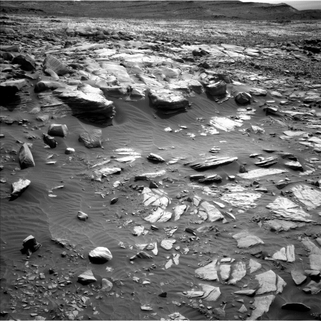
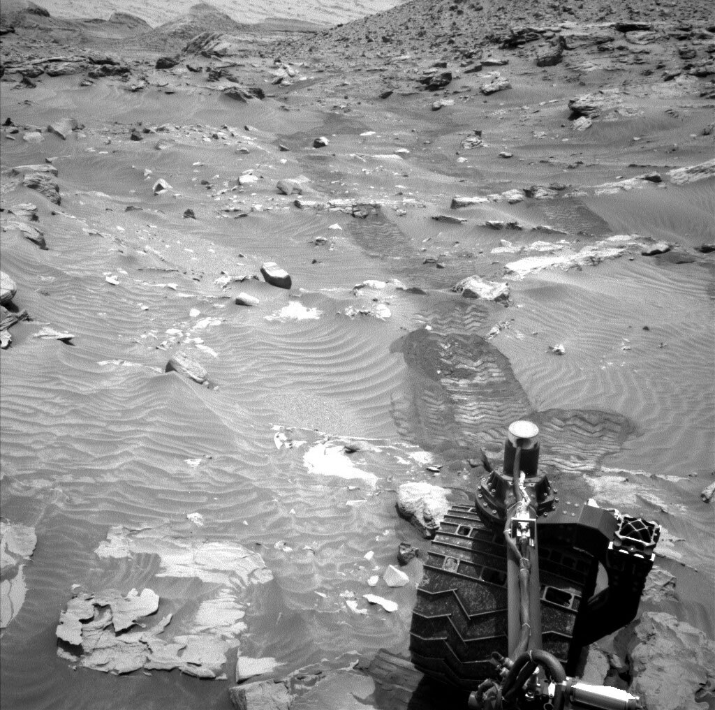
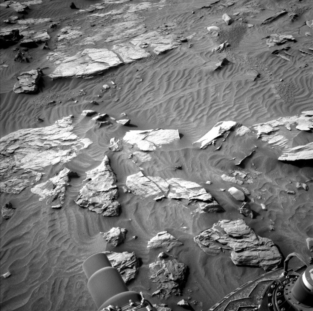
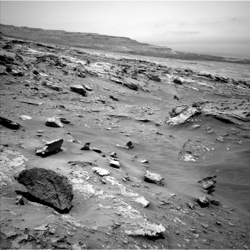
We are continuing to slowly move through this very challenging terrain – over the weekend we made it about 4 meters before the drive stopped when the rover sensed more difficulty. The attached image shows the deeper rover tracks over the undulating and rocky terrain, which has given us so much trouble driving and making it frequently unsafe to unstow the arm.

Despite all the challenges, this was a very exciting day for the MSL team. In honor of international Women’s day (3/8/22) we fielded a team consisting almost entirely of women. We had more than 35 women participating in planning today, between uplink and downlink. Most of the names and roles are included below.

Our first challenge today was dealing with the drive stopping early, in a place that we didn’t expect. Given the difficulties of driving in this area, this was not a huge surprise. With the rover not being in the expected orientation, Curiosity would not have been able to see Earth to receive this plan (the line of site was again occluded by the terrain). Instead, we ended up relaying the plan via the TGO orbiter. Due the timing of the relay, we shifted our plan to cover sols 3409-3410 instead of 3408-3409. Once we knew we could get the plan to the rover, we were able to move forward with the day. We won’t see the results of this plan until Friday morning, but that gives us more time in our plan for targeted observations on the first sol and allows us to drive on the second sol.

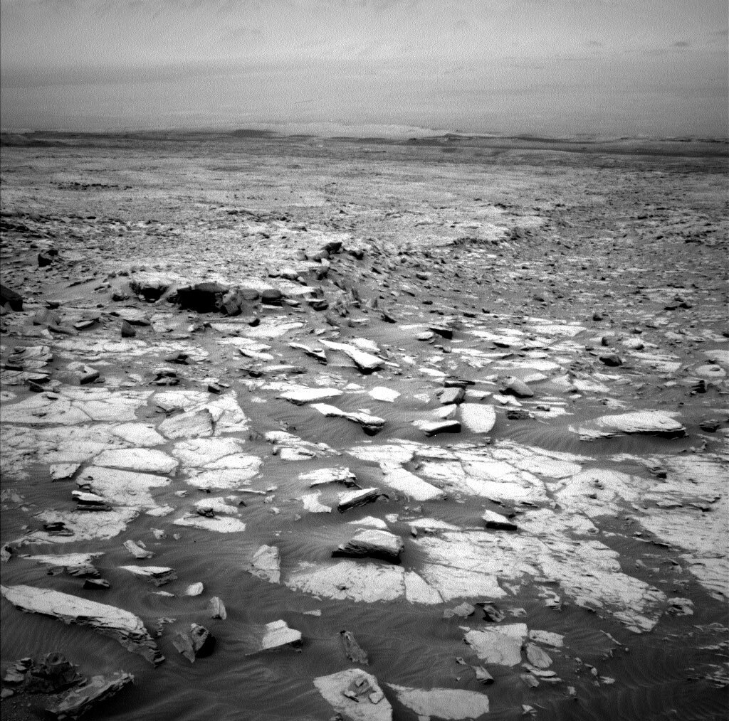
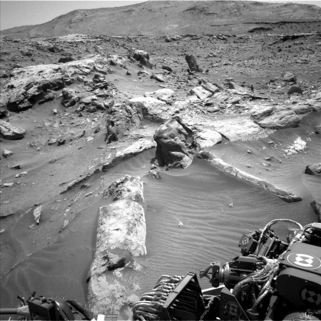
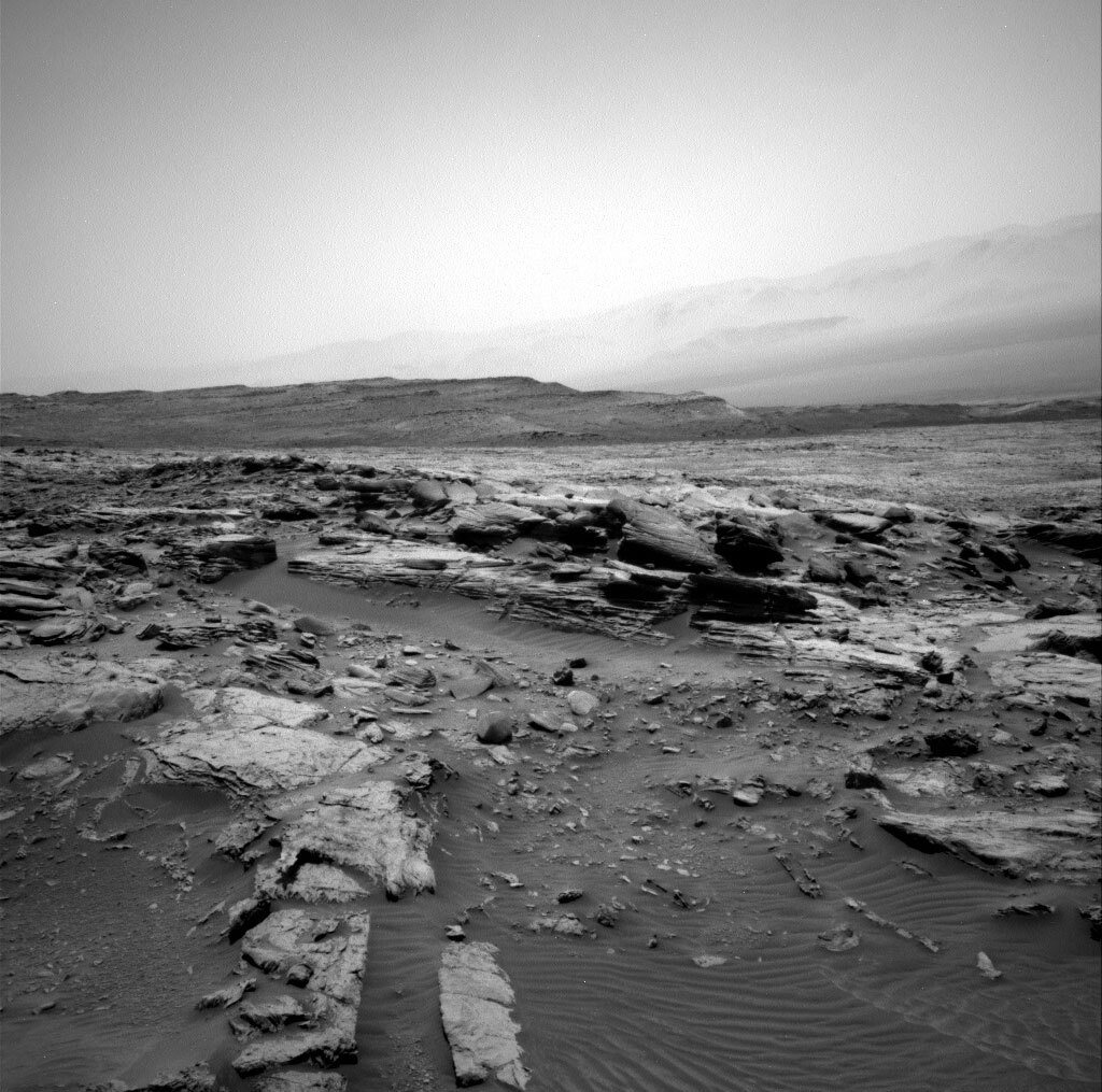
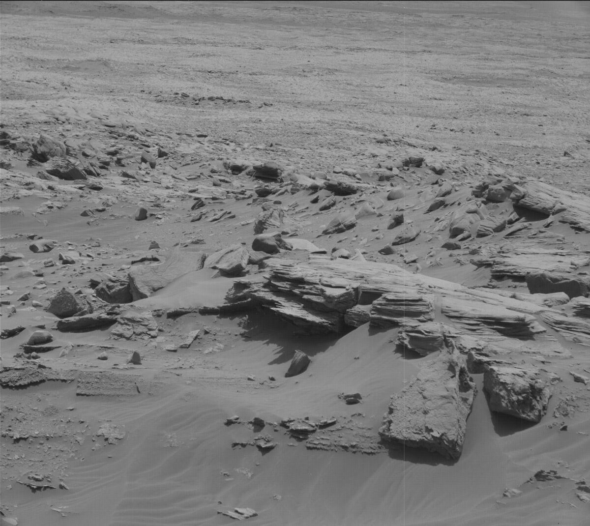
In the morning of the first sol, ChemCam did a LIBS observation of “Achvarasdal,” a dark toned target in our workspace, and a 10-frame long-distance RMI mosaic of the Gediz Vallis Ridge. We also took several Mastcam mosaics, including the ChemCam targets as well as a large 16-frame mosaic to look at pebble sorting and an extension of our prior drive direction imaging. All of these Mastcam images will hopefully provide a 3-D reconstruction of the formations in this area, which can tell us something about how the materials were deposited.

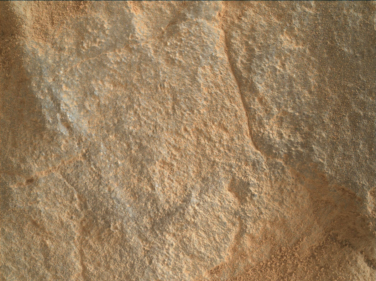
Unlike our previous drive faults, we ended in a place that we could safely unstow the arm for contact science. The target named “Skaw Granite” is one of the larger pieces of bedrock within reach. With the extra time, the arm Rover Planners were able to incorporate a brush of the contact science target (for which we did not have time in the original plan). We also could move the arm backbone later, which allowed for better lighting of the MAHLI images and better temperatures for APXS.

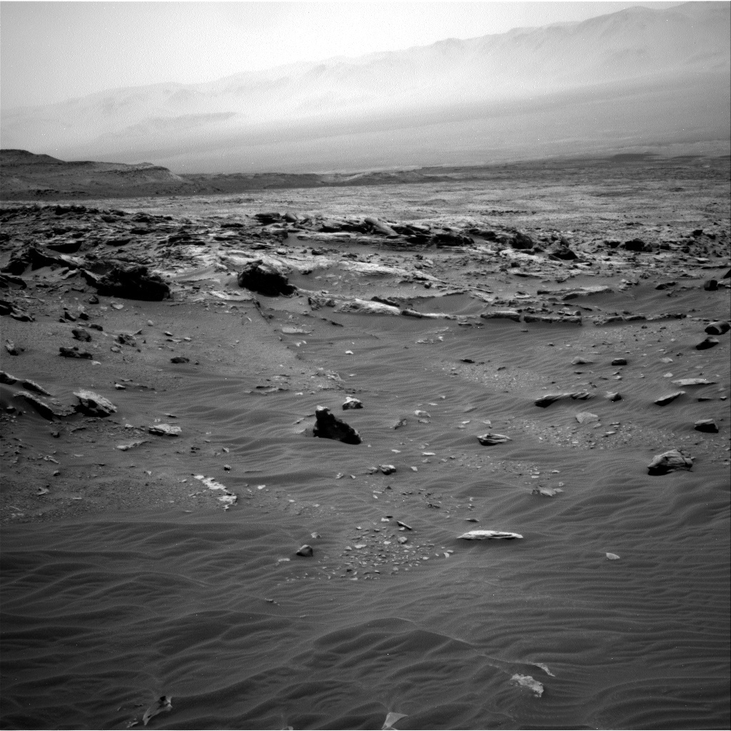
The mobility Rover Planners had a big task – to figure out how to continue to make progress in this very challenging spot. They ended up putting in a lot of extra safety checks and some conditional sequencing in order to try to account for many different possibilities. We’re trying to follow the same route we have planned before, which should take us along this valley to where we might be able to view the pediment and better assess the safety of driving there, as well as to find a good place to climb up. Hopefully, when we get the results of the drive, this tricky area will be in our rear view mirror. After the drive, we also did a lot of environmental observations with Navcam, including a lot of movies/surveys for dust devils.

Trying to help coordinate and hande all of these different complications, while completing planning on time, definitely kept my hands full today as the Tactical Uplink Lead. We really took our time to sort things out and get things right, which did make for a slow start to the planning day, but we got everything in the plan and did complete our process without going too late.

Women Planning Team

Elena Amador-French (JPL, Science Operations Coordinator)

Aseel Anabtawi (JPL, Strategic Comm)

Taryn Aranador (JPL, Enginering Cameras Uplink)

Keri Bean (JPL, Rover Planner)

Diana Blaney (JPL, Science Operations Working Group Chair)

Anna Boettcher (JPL, Sample Acquisition and Sample Processing and Handling)

Nataly Brandt (JPL, Thermal)

Lea Chandler (JPL, Tactical Downlink Lead)

Monika Danos (JPL, Telecom)

Charlene Doucet (Centre National D’etudes Spatiales, France, ChemCam)

Deirdra Fey (Malin Space Science Systems, MAHLI/MARDI)

Amy Hale (JPL, Rover Planner)

Jennifer Herman (JPL, Power Lead)

Alexandra Holloway (JPL, Data Management)

Madison Hughes (Washington University, St. Louis, Surface Properties Scientist)

Heather Lethcoe (JPL, Operations Products Generation Subsystem Tactical Analyst)

Morgan Lewis (University of Tennessee Knoxville, MAHLI/MARDI)

Megan Lin (JPL, Mission Lead)

Sophia Mitchell (JPL, Rover Planner)

Natalie Moore (Malin Space Science Systems, Mastcam)

Valerie Mousset ((Centre National D’etudes Spatiales, France, ChemCam)

Emily Newman (JPL, Strategic Rover Planner)

Catherine O'Connell-Cooper (University of New Brunswick, Canada, APXS)

Lara Panossian (JPL, Science Planner)

Deborah Padgett (JPL, Engineering Cameras Downlink)

Betina Pavri (JPL, Payload Downlink Coordinator)

Kristin Rammelkamp – (L'Institut de Recherche en Astrophysique et Planétologie, France, ChemCam)

Jackie Rapinchuk (JPL, Power)

Nicky Relatores (JPL, Sequence Integration Engineer)

Kimberly Rink (JPL, Mobility/Mechanisms)

Carolina Rodriguez Sanchez-Vahamonde (Malin Space Science Systems, Data Management and MARDI)

Ashley Stroupe (JPL, Tactical Uplink Lead)

Lucy Thompson (University of New Brunswick, Canada, APXS)

Kathryn Tzekof (JPL, Supratactical Uplink Lead)

Nancy Vandermey (JPL, Sequence Integration Engineer)

Trinh Vo (JPL, Operations Products Generation Subsystem Pipeline)

Emme Wiederhold (JPL, Engineering Uplink Lead)

Katherine Winchell (Malin Space Science Systems, MAHLI/MARDI)

March 4, 2022

Sols 3405-3407: Not Quite on the Greenheugh Pediment Yet

Written by Susanne Schwenzer, Planetary Geologist at The Open University
The terrain is currently challenging with sand and float rocks and a hill to climb. This image was taken by Left Navigation Camera onboard NASA's Mars rover Curiosity on Sol 3403.

The terrain is currently challenging with sand and float rocks and a hill to climb. This image was taken by Left Navigation Camera onboard NASA's Mars rover Curiosity on Sol 3403. Credits: NASA/JPL-Caltech. Download image ›

Curiosity is currently attempting a climb onto the pediment, carefully navigating rocks and sand. Our drivers are doing a great job planning but the terrain sometimes has other ideas. Thus, today’s drive came short, and we also stood on sand with some wheels and on rock with others, meaning we could not use the arm today to keep the rover safe. That said, lots of rocks and lots of vertical, dust-free surfaces make our sedimentologists really happy. Every such surface allows for more insights into the complex area and into the detailed structures of the Greenheugh pediment. So, making lemonade out of lemons, we planned many, many images and also some spectral observations.

In detail, ChemCam will be taking two LIBS measurements on the targets ‘An Fhraing’ and ‘Crichope Burn,’ to find out more about the bedrock and alteration features, respectively. ChemCam is also doing a passive observation on ‘East Suisnish,’ which has banded texture, and looking into the distance retrieving even more fascinating details from the Geddiz Vallis Ridge area.

Mastcam is equally busy joining the East Suisnish investigation with a multispectral observation to find out more about the banded texture of this rock. There are two further small mosaics to investigate alteration textures and three large mosaics on points of interest in the landscape. Mostly, what we are looking for is the textures of the rock, as seeing them in great detail will allow us to tease out how exactly those rocks formed. One additional Mastcam image stands out from those, because it is looking at more modern sediments where sorted pebbles have been found in the workspace. As you see, our plan investigates Mars from billions of years ago to very recent times!

APXS, despite the no-go for arm movements, isn’t idle either as there will be an atmospheric measurement over night to measure the argon. That’s something close to this blogger’s heart as argon is a noble gas, and the noble gases tell the story about the evolution of the Martian atmosphere. In addition, we are looking at atmospheric conditions by looking out for dust devils and at the opacity of the atmosphere by taking an image of the crater rim. It’s a very busy plan, which of course also has another drive in this challenging terrain. Let’s see in which geologist-sweet-shop we will end up on Monday!

March 2, 2022

Sols 3403-3404: Tiptoe to the Pediment

Written by Fred Calef, Planetary Geologist at NASA's Jet Propulsion Laboratory
Navcam looking west towards the rocky "Feorachas" area.

Navcam looking west towards the rocky "Feorachas" area. Credits: NASA/JPL-Caltech. Download image ›

The terrain continues to challenge us as we make our way up onto the Greenheugh pediment. Monday’s drive ended sooner than expected when the rover sensed the road was rockier than anticipated, so it paused to wait for further instructions from Earth. In the mean time, we took advantage of this brief pause to 'sniff' the rock field all around us. First, we took ChemCam and Mastcam of "Tobar Mhoire" and "Ardalanish," both points on a gray-toned rock with laminations. Farther afield, the rover will capture large ChemCam RMI (10 images) and Mastcam (18 images) mosaics of "Helmsdale Fault" capturing the pediment edge. In addition, there will be a massive (58 images!) Mastcam mosaic centered about "Feorachas," a remnant monolith in a field of various sedimentary structures. Finally, the rover will look to the north and capture "Torflundie Mire," one of several scoured areas across the pediment, in a 11 image Mastcam stereo mosaic. Other standard imaging includes a Mastcam 360 for documenting the surrounding area, clast survey, and solar tau to measure the amount of dust in the atmosphere, as well as Navcam sky flats, line-of-sight to again look at the atmosphere in a different way, and a dust devil movie.

February 28, 2022

Sols 3401-3402: Sand, Boulders and Ridges, Oh My!

Written by Lucy Thompson, Planetary Geologist at University of New Brunswick
The rocks in the immediate foreground are the lowermost capping unit, with the pediment surface extending beyond. The large-scale layered ridge in the distance is the Gediz Vallis ridge, with Gale crater rim in the background.

3400 Right Navcam image of the drive direction. The rocks in the immediate foreground are the lowermost capping unit, with the pediment surface extending beyond. The large-scale layered ridge in the distance is the Gediz Vallis ridge, with Gale crater rim in the background. Credits: NASA/JPL-Caltech. Download image ›

Curiosity has been picking her way through sand, sharp boulders and ridges to find a way up onto the Greenheugh pediment. We briefly explored the pediment more than 600 sols ago, before resuming our traverse over the Mount Sharp group sedimentary rocks that we have been driving over since ~sol 750. The science team is excited to drive up onto and investigate the very different looking rock that comprises the more resistant pediment again. As we have been driving along the side of the pediment cliffs, interesting textures have been observed, which we are hoping to examine in situ. However, we are not quite there yet. Because of the tricky terrain, Curiosity’s weekend drive stopped a little short of its intended location and she ended up perched on a rock, such that we were not able to safely deploy the arm and use either MAHLI or APXS. However, the rover engineers are confident that we can continue our drive in this plan to get us ever closer to the pediment surface.

Without the use of the arm in this plan, the science team set about planning how to utilize the remaining instruments to continue characterizing this important transitional area. ChemCam will analyze a small resistant ridge and associated bedrock (“Vert Knap of Howar”) with its laser, acquire passive spectra on the bedrock target “River Oykell,” and RMIs of the convoluted layering in the “Drumeizer” bedrock as well as of the blocky, Gediz Vallis ridge in the distance. Mastcam will also image the Vert Knap of Howar target, as well as the “Lamington Sandstone” and “Broch of Gurness” targets to document textures and stratigraphy within the cap rock.

The environmental scientists planned several observations to continue monitoring changes in atmospheric conditions. These included: Mastcam basic and full tau observations and a dust devil movie, and a Navcam dust devil movie and images as well as a supra horizon movie.

After our hopefully successful drive, we will execute a ChemCam AEGIS analysis to autonomously measure the chemistry of a rock target in the new workspace. The terrain beneath the rover wheels will be imaged with MARDI. Standard REMS, DAN and RAD activities round out this plan.

February 26, 2022

Sols 3398-3400: The Road Ahead

Written by Lauren Edgar, Planetary Geologist at USGS Astrogeology Science Center
This image was taken by Right Navigation Camera onboard NASA's Mars rover Curiosity on Sol 3397.

This image was taken by Right Navigation Camera onboard NASA's Mars rover Curiosity on Sol 3397. Credits: NASA/JPL-Caltech. Download image ›

The drive on Sol 3397 went well and gave us some good perspective on the road ahead, as seen in the above Navcam image. Curiosity is perched at the edge of the pediment, carefully planning our route to climb fully on top of the pediment capping unit, and the team is eager to investigate these rocks!

Today’s 3-sol plan was a typical weekend plan, with opportunities for contact science, remote sensing, and a drive. Although our workspace mostly consisted of loose sand, the team was able to plan MAHLI and APXS on some of the broken blocks right in front of the rover to investigate the grain size and composition of the local bedrock. We also planned a lot of remote sensing observations to assess sedimentary structures and chemistry. In addition, the plan includes environmental monitoring observations to assess atmospheric opacity search for dust devils and clouds, as well as an overnight APXS atmospheric observation. Then we’ll drive to a good location to get an even better view, and hopefully have some bedrock in our workspace to study next week.

I was on duty as LTP today, and the team held a science discussion to think about observation strategies as we traverse across the pediment. It’s exciting to think about everything that we might learn on the road ahead of us!

February 24, 2022

Sols 3396-3397: Sediment Before the Pediment

Written by Mariah Baker, Planetary Geologist at Center for Earth & Planetary Studies, Smithsonian National Air & Space Museum
This image was taken by Mast Camera (Mastcam) onboard NASA's Mars rover Curiosity on Sol 3393.

This image was taken by Mast Camera (Mastcam) onboard NASA's Mars rover Curiosity on Sol 3393. Credits: NASA/JPL-Caltech/MSSS. Download image ›

If all goes according to plan, the rover’s drive on sol 3397 will position us at the edge of the rocks that cap Greenheugh Pediment. This drive was pushed back from sol 3395 in order to collect even more data on the sedimentary rocks in our current workspace before we leave this rock formation and enter into a new one. This transition is documented in the Mastcam drive direction image above, in which the rocks capping the pediment can be seen in the background.

Three full hours of contact and remote science activities were planned prior to the drive. Bedrock target “Scousburgh” will be analyzed with APXS, MAHLI, ChemCam LIBS, and Mastcam multispectral after being brushed with the Dust Removal Tool (DRT). APXS, MAHLI, and ChemCam LIBS data will also be acquired on a concretion feature called “Blackthorn Salt.” ChemCam passive observations will be collected on a float rock called “Carn Chuinneag,” as well as on the bedrock target “Galdenoch” that was DRT’ed on sol 3395. The latter target will also be imaged with a Mastcam multispectral to collect additional data on this patch of cleaned bedrock.

Four image mosaics will provide a closer look at far-field rock targets: A Mastcam mosaic will be acquired covering rock outcrop “Auchinleck Tip,” and another will extend coverage over the Stimson formation contact. The distant Gediz-Vallis Ridge will also be imaged with Mastcam and ChemCam RMI. Two additional Mastcam images of a sand deposit in front of the rover called “The Souter” will be used to search for wind-driven sand motion during our stop at this location.

Lastly, a set of environmental monitoring observations were scheduled before the rover’s drive, including a Navcam line of site image, Navcam dust devil movie, Navcam suprahorizon movie, and Mastcam crater rim observation. A Mastcam image to assess dust in the atmosphere will also be acquired on sol 3397 after the rover’s drive towards the pediment. This plan will likely be our last opportunity to study the sedimentary rocks that built Mt. Sharp before we transition into a new geologic formation that caps the pediment, so the team made the most out of it!

February 23, 2022

Sol 3395: Last Chance for Contact

Written by Fred Calef, Planetary Geologist at NASA's Jet Propulsion Laboratory
Looking across to the contact between lower rocks and the undulating Greenheugh Pediment.

Looking across to the contact between lower rocks and the undulating Greenheugh Pediment. This image was taken by Left Navigation Camera onboard NASA's Mars rover Curiosity on Sol 3393. Credits: NASA/JPL-Caltech​. Download image ›

Before the science team says "OK TO GO!," today's plan involves getting one of the last looks at the rocks right below the Greenheugh Pediment, some observations at the contact between them, and some higher up on Gediz-Vallis Ridge. The rover will collect two APXS measurements on "Galdenoch," one a brushed location and another offset from it, including some MAHLI images to document the textures there. Right next to it is target "Glendouran" which we'll collect Mastcam and ChemCam to further document the outcrop. Another target, "Gala Group," uses Mastcam and ChemCam RMI to peer at the geologic contact between the two main units. The last bedrock target is on Gediz Vallis Ridge with a Mastcam mosaic to help document its stratigraphy. Finally, some Mastcam imaging on "The Souter" for change detection in some local ripples. There's also a series of atmospheric observations: Navcam superhorizon, line-of-site, and dust devil survey.