October 10, 2022

Sols 3616-3620: It's SAM Time!

Written by Keri Bean, Rover Planner Deputy Team Lead at NASA's Jet Propulsion Laboratory
This image was taken by Right Navigation Camera onboard NASA's Mars rover Curiosity on Sol 3618.

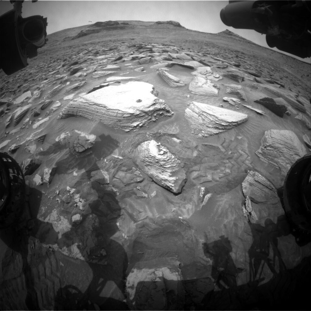
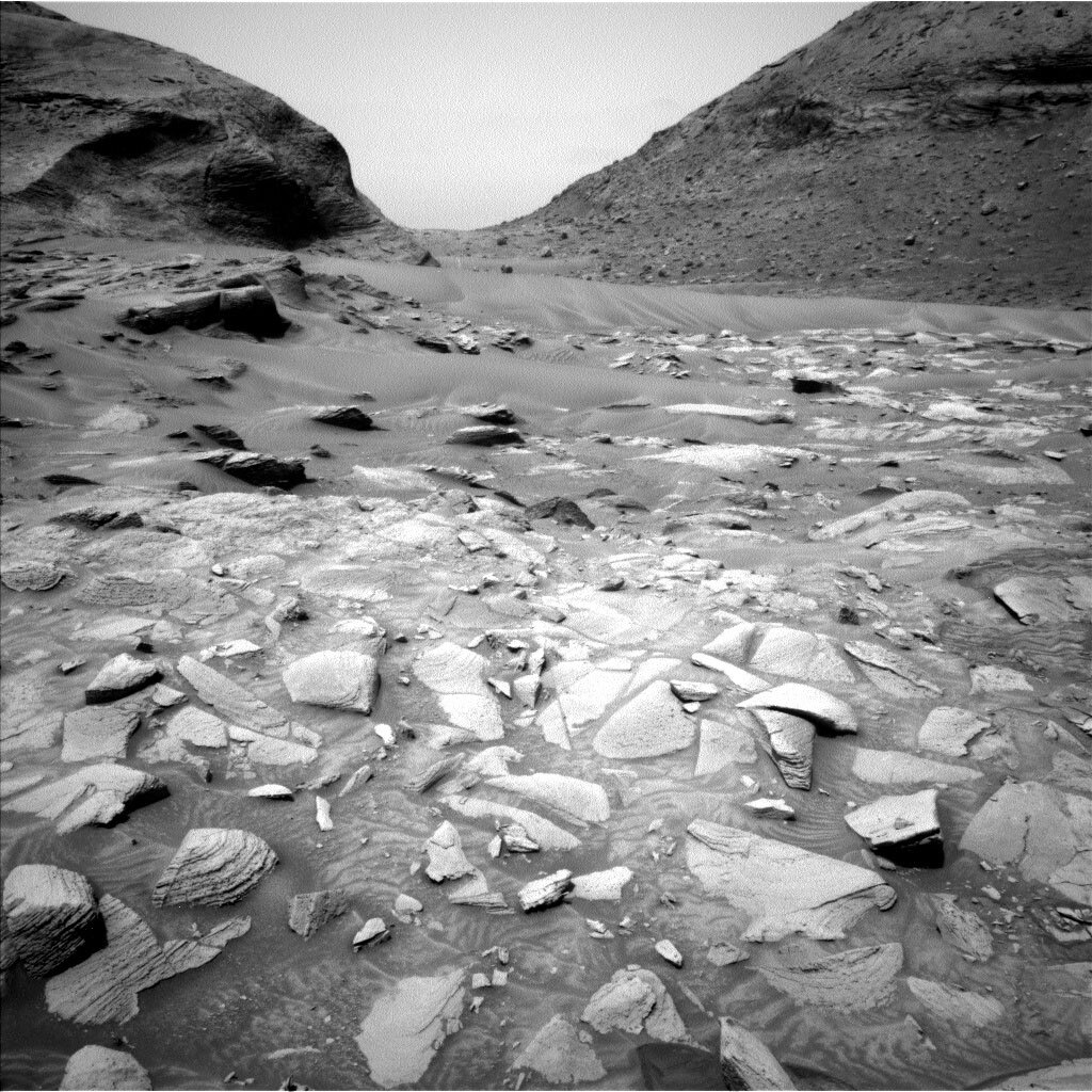
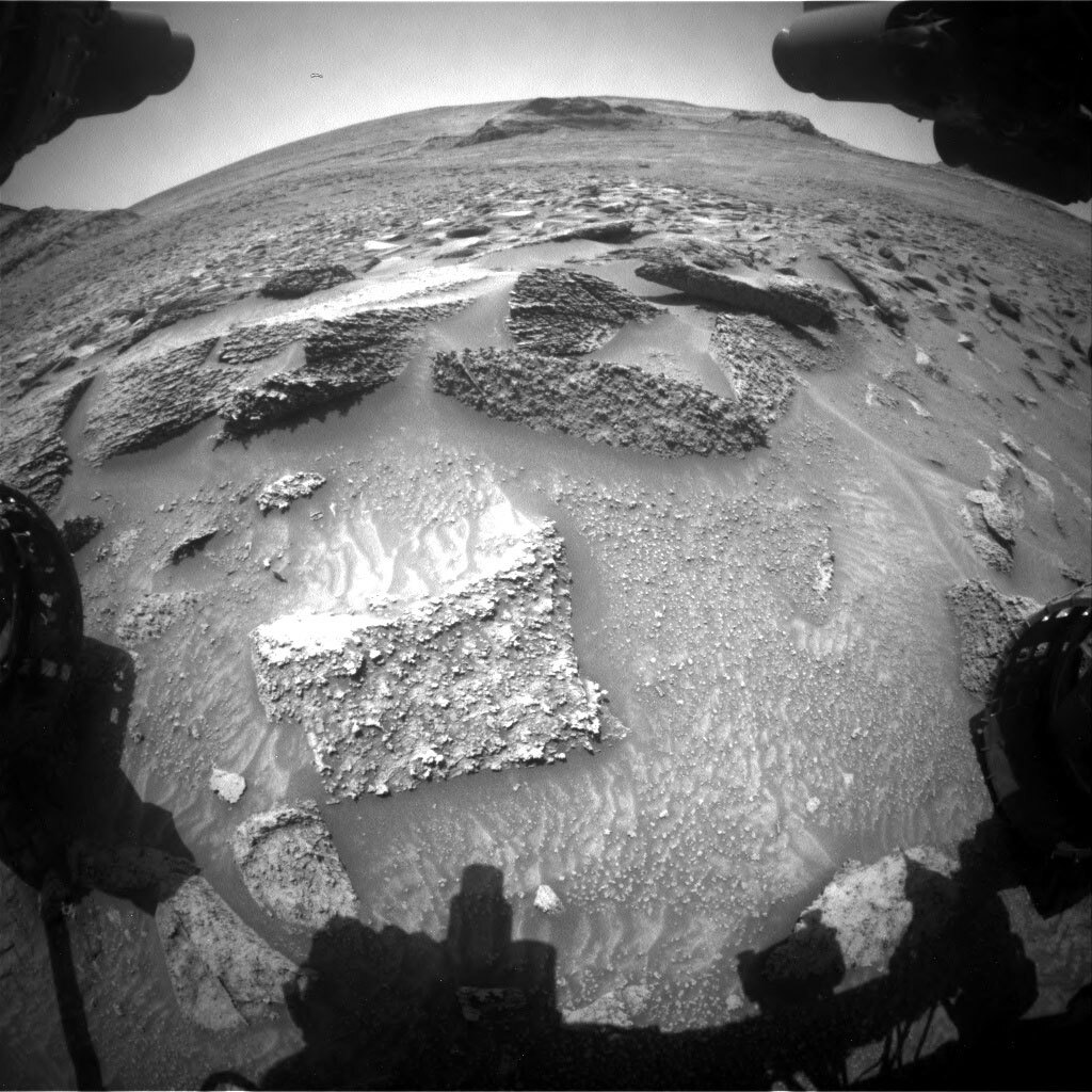
This image was taken by Right Navigation Camera onboard NASA's Mars rover Curiosity on Sol 3618. Credits: NASA/JPL-Caltech. Download image ›

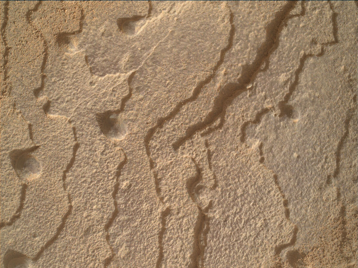
Curiosity spent the weekend (sols 3616-3618) running a second night of CheMin analysis on the Canaima drilled sample and preparing SAM to accept a sample for analysis. The rover also continued to collect remote sensing and environmental science observations, including ChemCam and Mastcam observations of “Baracara Falls” and “Gabro Caracarai,”as well as a ChemCam RMI mosaic pointed towards Bolivar.

Today we planned sols 3619 and 3620. The main star of the show was a sample delivery to SAM! A SAM analysis activity takes a lot of power to run, so it took a lot of negotiating and moving around activities to fit in as much science as we possibly can. Curiosity will also enjoy a few good naps in the plan to recharge the batteries.

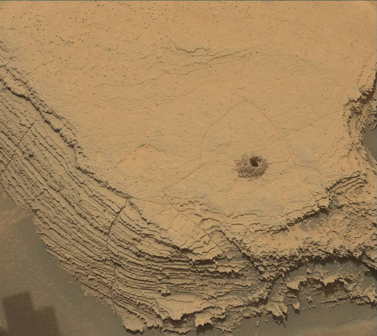
We start sol 3619 off with a block of science imaging activities and a CheMin data retrieval. The imaging block starts off with some Mastcam and Navcam atmospheric observations to monitor the ongoing dust storm. After that, we use ChemCam’s laser to analyze “Alcalina Apiau” and take a Mastcam image to document the ChemCam observation, followed by a Mastcam image of our drill target Canaima to monitor how the winds may have affected the drill tailings. Once all those science observations wrap up, the rover naps most of the afternoon to recharge the battery and to await calmer winds to drop off some of the Canaima drilled sample using our robotic arm. Today I was RP2 which is the role responsible for the final verification and validation of the arm commands before sending them to the rover. I had a trainee today that handled all of the work like a pro! Overnight we perform a SAM analysis on the delivered sample.

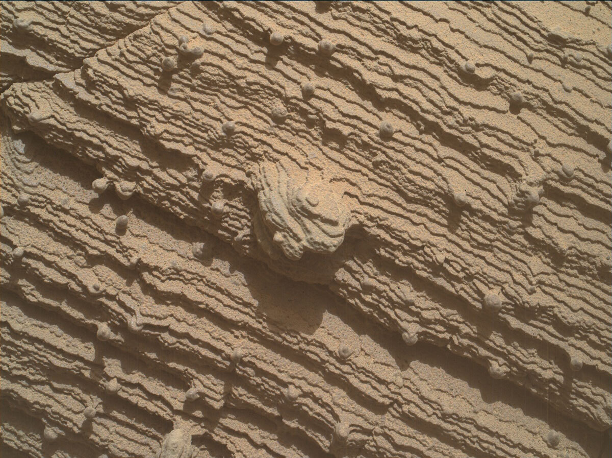
In the very early morning of sol 3620, as the SAM analysis wraps up, we have some communication passes scheduled. During that time, we’ll also take some DAN data and retrieve the SAM data from the instrument to send back to Earth for the very eager scientists to take a look at! Once those passes end, the rover will sleep until much later in the morning. Once the rover wakes back up again, we’ll take another round of DAN data along with a set of atmospheric observations with Mastcam and Navcam, then use the ChemCam laser to analyze “Huruwassaru Creek” and then use ChemCam’s camera to image the marker band in the distance. Once ChemCam is done, Mastcam will take a picture of the Huruwassaru Creek just freshly zapped by ChemCam. The rover will then sleep the rest of the sol to recharge the battery for the next plan. Throughout the plan we also include our RAD and REMS observations to monitor the local environment.

October 5, 2022

Sol 3613: Happy Drill Hole #36!

Written by Susanne Schwenzer, Planetary Geologist at The Open University
This image, showing the new drill hole #36, was taken by Front Hazard Avoidance Camera (Front Hazcam) onboard NASA's Mars rover Curiosity on Sol 3612.

This image, showing the new drill hole #36, was taken by Front Hazard Avoidance Camera (Front Hazcam) onboard NASA's Mars rover Curiosity on Sol 3612. Credits: NASA/JPL-Caltech. Download image ›

This week a lot of us have travelled to the team meeting to talk about the most recent science and the path ahead. Those meetings are important to have focused time away from the daily planning routines to take stock and to strategize. But the rover doesn’t get to take a holiday while the team is meeting. So, several of us were online today doing the planning. We were rewarded with a beautiful drill hole number 36 at Canaima! You can just about spot it as the little ‘mole hill’ on the large block in front of the rover. It is a beautiful drill hole that was drilled to full depth. All the worries we had about the rock and its hardness were lifted. Why am I saying this? Well, regular followers of this blog might remember our drill attempt exactly 1500 sols ago (Earth time 16th July 2018) on the target 'Voyageurs' where we found the rock too hard to get enough drill depth for sampling. Here is the blog by my colleague Lauren Edgar, sol 2113 on Mars: Hard as Rock.

With a beautiful drill hole in front of us, and the heap of drill fines pristinely stacked up, in today's planning we are starting with the investigation of the drill hole and the drill fines before preparing for and eventually handing over sample to the instruments in the rover belly, CheMin and SAM. Today, the focus was on the drill fines as they are mobile, should the wind pick up. In today's plan we have the ChemCam RMI imaging of the drill hole, whereby ChemCam takes 13 images sequentially to get the depth of the drill hole in focus along its length. ChemCam also has a LIBS observation on target "Dress Island."

Mastcam is focusing on all the potentially mobile elements in the scenery: change detection imagery on an area where we have left wheel track marks and investigating the drill fines with a multispectral observation. There is another change detection observation right next to the block that Curiosity drilled to see if that drilling had caused any changes in the fines around this block. In addition, Mastcam is looking at target "Normandia" to investigate the sedimentary structures in this area.

Since this is a one-sol plan, tomorrow's team will pick up the next set of observations, working the way from the mobile materials to the rocks, and also to the preparations for sample handover to and the observations with CheMin and SAM, while tosol’s team will get to listen and contribute to the science team meeting. Meanwhile, this blogger will toast to drill hole #36 tonight!

October 5, 2022

Sols 3614-3615: Chemin's Moment To Shine!

Written by Elena Amador-French, Science Operations Coordinator at NASA's Jet Propulsion Laboratory
This image was taken by Mast Camera (Mastcam) onboard NASA's Mars rover Curiosity on Sol 3612.

This image was taken by Mast Camera (Mastcam) onboard NASA's Mars rover Curiosity on Sol 3612. Credits: NASA/JPL-Caltech/MSSS. Download image ›

The Curiosity team continues with our "Canaima" drill campaign.

Today’s 2-sol plan will provide our first look at the minerals present within this sample. This is complementary but different than the chemical compositions provided by ChemCam and APXS before we drilled. CheMin uses X-ray diffraction to confirm crystalline mineralogy, they direct a beam of X-rays, as fine as a human hair, through the drilled sample. The X-rays interact with the material and then diffract at specific angles. This creates a diffraction pattern that can be used to uniquely identify the crystalline minerals present. Understanding the crystal structure provides a clearer picture of the environment in which they formed and how they’ve been altered subsequently.

After delivering sample to CheMin with the our robotic arm, CheMin will work through the night integrating and building a robust diffraction pattern to be sent back to Earth in the morning. Our SAM instrument will also prepare its sample cup to receive sample in Friday's plan, pending the results from CheMin.

In addition to these activities, we also used ChemCam to look inside the drill hole and the drill tailings left behind before they could be potentially mobilized by wind. As is a common theme, we continue with our regular cadence of environmental monitoring.

October 3, 2022

Sol 3612: Ready for Number 36!

Written by Elena Amador-French, Science Operations Coordinator at NASA's Jet Propulsion Laboratory
Using an onboard focusing process, the Mars Hand Lens Imager (MAHLI) aboard NASA's Mars rover Curiosity created this product by merging two to eight images previously taken by the MAHLI, located on the turret at the end of the rover's robotic arm.

Using an onboard focusing process, the Mars Hand Lens Imager (MAHLI) aboard NASA's Mars rover Curiosity created this product by merging two to eight images previously taken by the MAHLI, located on the turret at the end of the rover's robotic arm. Credits: NASA/JPL-Caltech/MSSS. Download image ›

Over the weekend, Curiosity took compositional measurements of the “Canaima” bedrock target in order to determine if the target merits collecting drilled sample. Concurrently, the engineering team took preload measurements to determine the stability of the rock for drilling. This morning the science and engineering teams reviewed the information downlinked and were excited to approve moving forward with drilling Canaima.

For today’s plan, the rover planners carefully sequenced the motions the rover’s arm and turret will make to drill to approximately 35 mm depth, creating a ~1.6 cm diameter hole (a little less than the diameter of a US dime). This seemingly small volume of drilled sample will be enough to ingest in our internal analytical laboratories to identify mineralogy with CheMin and search for organics with SAM later this week, should the team choose to!

These future measurements with CheMin and SAM are very power intensive. Even though we are not certain we will perform them, today’s team was careful to conserve power in the event that we will. We therefore limited today’s plan to drilling activities and our regular environmental monitoring measurements and extra imaging to monitor for changes in dust levels in our atmosphere.

Looking forward to waking up tomorrow morning to our 36th drill hole!

September 30, 2022

Sols 3609-3611: Preparing to Make Our Mark!

Written by Elena Amador-French, Science Operations Coordinator at NASA's Jet Propulsion Laboratory
Using an onboard focusing process, the Mars Hand Lens Imager (MAHLI) aboard NASA's Mars rover Curiosity created this product by merging two to eight images previously taken by the MAHLI, located on the turret at the end of the rover's robotic arm.

Using an onboard focusing process, the Mars Hand Lens Imager (MAHLI) aboard NASA's Mars rover Curiosity created this product by merging two to eight images previously taken by the MAHLI, located on the turret at the end of the rover's robotic arm. Credits: NASA/JPL-Caltech/MSSS. Download image ›

​The science team has been carefully considering where it will collect its next drilled sample. Like taste-testing ice cream flavors before committing to just the right scoop, the science team first uses ChemCam and APXS to assess the composition of the bedrock. We have been analyzing several areas in the “marker band valley,” and this current rock in front of us shows promise as a potential drill target. We’ve imaged this block now with Mastcam and MAHLI (see image above), and used ChemCam to get an initial look at the composition with LIBS. However, because of the tricky terrain and how it affects the rover’s stability, we’ve been unable to brush the surface with our dust removal tool or use APXS to analyze for more compositional data. Finally, after several sols of repositioning ourselves, Curiosity is now ready to unstow its arm, brush aside the pesky dust, and measure the composition with APXS. We’ve chosen the target “Canaima,” named for Canaima National Park in Venezuela which contains spectacular million-year-old, table-top mountains and is a UNESCO World Heritage Site. Though the science team has not yet committed to drilling Canaima, we have decided to be as efficient as possible and today’s plan will include all the scientific and engineering measurements needed so that we’ll be ready to forge ahead with a drill next week, if desired. This will involve a preload test, which will provide a sense of the stability of the rock, as well as the science observations.

The observations thus far of this rock, like the above MAHLI image, are quite lovely. I particularly like how the layering is expressed on this rock. They are so delicately thin with more resistant nodules poking out – in what setting were they deposited and what kind of alteration have they been through since??

In addition to our contact science today, we continue to image landmarks around marker band valley and in our workspace using Mastcam and ChemCam. We also continue with our regular cadence of environmental monitoring measurements, including those that look for changes in dust abundance in our atmosphere.

Looking forward to Curiosity having a productive weekend!

September 28, 2022

Sols 3607-3608: Making a Pivot

Written by Alex Innanen, Atmospheric Scientist at York University
This image was taken by Left Navigation Camera onboard NASA's Mars rover Curiosity on Sol 3606.

This image was taken by Left Navigation Camera onboard NASA's Mars rover Curiosity on Sol 3606. Credits: NASA/JPL-Caltech. Download image ›

Whenever working on Mars throws up a complication, Curiosity’s team has to make a pivot. As the past couple bloggers have mentioned, we’ve been in a bit of a precarious spot, and can’t do any direct contact science or drill. The small drive in the last plan didn’t quite get us where we wanted to go, so we’re still not able to drill.

The team quickly pivoted into other science looking at some nearby and more distant targets. On the first sol of the plan, ChemCam is going to do LIBS on a nearby block, ‘Sophia Point,’ along with Mastcam. Mastcam and ChemCam are also continuing to document the distant marker band. Later in the sol MAHLI is getting up close with two bedrock targets – ‘Esperito Santo’ and the dusty ‘El Pao de la Fortuna.’

The next sol has a ChemCam LIBS on ‘Juventina’, which we possible scuffed while driving, followed up by Mastcam. ChemCam and Mastcam are also imaging the slightly more distant ‘Kabrito Island,’ a dark, nodular block. After all this we’re going to do a small bump to try to get into a location where we can hopefully drill and do contact science, and finishing up the sol with a MARDI twilight image.

Even through changes to the plan, the environment is always there around us to check up on. We’re still well in the dusty season in Gale, and ENV is keeping an eye on the changing atmosphere. One of these observations is called a tau, which is a measurement of optical depth, or how “thick” the atmosphere is with aerosols such as dust. Another way we look at the amount of “stuff” in the atmosphere is with the line of sight, which shows us how far we see towards the crater rim. Unfortunately, our view of it can get obscured by the big hills we’ve been driving through. Luckily for us, there’s a small gap between two hills where we can see a sliver of crater rim!

We also have two dust devil observations: a survey and a movie. The survey looks all the way around the rover to see where we might spot dust devils, which can help us decide where to point for the movie. Rounding out the environmental observations is a suprahorizon cloud movie. Even though it’s not the cloudy season, we still like to keep an eye on the sky for occasional clouds drifting past. An APXS atmospheric is also planned, to look at seasonal argon changes.

September 26, 2022

Sols 3605-3606: To Drill or Not To Drill

Written by Ashley Stroupe, Mission Operations Engineer at NASA's Jet Propulsion Laboratory
This image was taken by MAHLI onboard NASA's Mars rover Curiosity on Sol 3603.

This image was taken by MAHLI onboard NASA's Mars rover Curiosity on Sol 3603. Credits: NASA/JPL-Caltech/MSSS. Download image ›

The previous attempt to reposition the rover to be safe for additional contact science (possibly including drilling) at this location didn’t quite get us where we wanted to go. The decision was made early to make one more attempt to park the rover where we can safely contact the ground, including collecting data to help decide if we want to drill this rock. I planned this short drive today as the Mobility Rover Planner.

Prior to repositioning, science is taking advantage of still having interesting targets in our workspace. We begin with some targeted science. Targets “Lago Do Lameiros” is a rock with layers perpendicular to those in the adjacent rock. We are taking Mastcam and ChemCam LIBS observations in order to help document the geochemical variability. “Sientro Catrimani” is an interesting region with rocks of different textures. We are taking ChemCam LIBS and multiple Mastcam stereo observations of rocks in Sientro Catrimani to document the changes in color and texture. We are also taking ChemCam RMI and Mastcam stereo of different spots on the Marker Band (a distinctive layer in the distance) to document the variation in thickness. We also do an hour-long atmospheric observation with dust devil surveys and suprahorizon images to look for dust in the atmosphere.

After the targeted science, the arm is put to work. We are extending the observations on the weekend target Tapirapeco (shown in the image) to get greater coverage of the layers along the vertical face. This target is tricky because to approach the nearly-vertical face we need to come in low to the ground. Additionally, because the rover is slightly perched on some rocks today, and we are concerned about slipping off, we don’t want to get too close to the ground where any motion could cause the arm to hit a rock. We ultimately are taking 6 images from about 16cm away from the rock. Since we can’t touch the rock to get a more precise location, we will have some uncertainty in our distance, but the MAHLI camera can account for this with its focus mechanism.

The second sol of the plan includes more targeted science. Early In the morning, we do a pre-dawn Navcam cloud movie. Then later in the morning we begin targeted science. The “Lake Amuku” target is a smooth area of the block (without nodules) on which we did MAHLI imaging today and over the weekend. We are taking ChemCam LIBS and a Mastcam to document the ChemCam on Lake Amuku. We also are taking a Mastcam mosaic of some sand troughs and ridges near the right wheels to examine their geometry and distribution. Lastly we are taking a multispectral Mastcam of a target “Jerry Spring,” which is another layered rock with significant color and texture variability. We also take Navcam images of the rover deck (to monitor the dust accumulation) and some additional dust devil movie images and horizon image.

After the imaging, we are ready to drive. Finding the exact parking spot that would allow us to DRT this rock was very tricky because of the many rocks (some of which are loose). Additionally, since we may want to drill this block, there are even more constraints on our parking attitude to ensure that drilling is safe and that we can move the arm into position to successfully drop-off sample to the CheMin and SAM instruments. Ideally, we would want the rover to just move straight to its left. However, since only the front and rear wheels can steer, driving sideways isn’t something we can do. Instead we are backing up, turning and then driving to get that distance to the left, and then turning back before driving forward again to put the original block back in our workspace. This complicated maneuver is actually driving the wheels about 5.3m with the end result being a move to the rover’s left by about 50cm. It took several iterations and 5 of us working together to ensure the path we chose would achieve the desired result.

After the drive, we take our standard suite of post-drive imaging of the local terrain and the workspace as well as some additional atmospheric observations looking for dust devils and atmospheric dust.

Meanwhile, we will have to wait until the end of the week to collect all the data we need to determine if we are going to drill at this location – which will depend on our parking spot safety as well as how interesting the science observations indicate this rock to be.

September 23, 2022

Sols 3602-3604: Mars Rocks – The Good, the Bad, and the Nodular

Written by Abigail Fraeman, Planetary Geologist at NASA's Jet Propulsion Laboratory
This image was taken by Front Hazard Avoidance Camera (Front Hazcam) onboard NASA's Mars rover Curiosity on Sol 3601.

This image was taken by Front Hazard Avoidance Camera onboard NASA's Mars rover Curiosity on Sol 3601. Credits: NASA/JPL-Caltech. Download image ›

This morning, I was delighted to see that the complex drive we had planned on Wednesday through some very rocky terrain successfully completed! Curiosity is currently parked in front of a finely layered rock that is dotted throughout with tiny nodules. The team was eager to investigate the fine scale textures and composition of this rock using all of Curiosity’s instruments, but unfortunately we discovered early in the planning day that we could not safely place the arm in direct contact with the rock; the rover’s wheels are precariously perched on other rocks, and we really don’t want our ~2,000 pound rover to accidentally shift its center of gravity when the arm is in contact with the ground. Our position was stable enough that we felt safe unstowing the arm and hovering above the ground, so we can collect images of the rock with our MAHLI hand lens from 5 cm distance. The science team felt this rock was interesting enough that we don’t want to drive away today, so we’ll instead reposition the rover to a more stable configuration in the hope that we can brush the rock and collect APXS data on Monday.

The specifics of today’s plan include ChemCam observations of two targets on the rock right in front of us named “Lagoa do Velame” and “Lagoa do Macaco,” as well as a third ChemCam autonomously chosen observation after we drive. MAHLI will also observe Lago do Velame and Lagoa do Macaco, plus a third target on the edge of this rock named “Tapirapeco.” Mastcam will document the nearby area with several mosaics, including a large mosaics and multispectral observation on a broken up nearby rock named “Waiokiepalul.” Navcam, DAN, RAD, REMS, and Mastcam observations of the environment around the rover will round out the plan.

September 21, 2022

Sol 3601: Do You Get a Day off on Mars? Turns Out, Yes You Do!

Written by Susanne Schwenzer, Planetary Geologist at The Open University
This image was taken by Right Navigation Camera onboard NASA's Mars rover Curiosity on Sol 3597. Credits: NASA/JPL-Caltech. Download image ›

This image was taken by Right Navigation Camera onboard NASA's Mars rover Curiosity on Sol 3597. Credits: NASA/JPL-Caltech. Download image ›

Imagine you are a rover on Mars, your team back home on Earth is working around the clock to send you tasks to do, well, would your team get days off? The answer is yes, and that’s what happens in this plan. Although it’s a two-sol plan, only one sol is being planned. This is to allow the timelines on Mars and Earth to get back into a good alignment again. That’s because a Mars day is approximately 37 minutes longer than an Earth day. But before Curiosity’s team has its day off, the rover is going to do a full day of science. And it happens pretty regularly, too, and it’s also being mentioned before, see here by my colleague Abigail.

After staying in place in the last plan, the drive takes precedence in this plan. Therefore, science had to be very strict on the timings to preserve the energy needed for the drive. We had quite a lot of discussion, as lots of interesting rocks are in the area, but in the end we agreed on the following: APXS gets a pause, but target "Cauarane" will be DRT-ed and then investigated by MAHLI to get a close look at the grain size of the target, and it will then be investigated by ChemCam. ChemCam also images an extension of already existing imagery on the Bolivar area, which has some very interesting changes in the sedimentary structure. The same area will also be imaged by Mastcam, which in addition gets documentation images of "Cauarane" and the ChemCam Aegis target from the last plan, as well as investigate target "Malica Macu."

The drive will be an important part of the plan. We are all holding our breath here, because this terrain is anything but easy. Have a look at the image above, which will give you an idea about the difficulty to plan a safe drive in a landscape littered with rocks, some of them sharp. The drive will have to avoid many obstacles, and while our amazing rover planners are planning this meticulously, it’s still an off-road drive, and we will be looking forward to seeing if we will have reached our final parking position. If not, then that’s ok, too, because Curiosity will keep itself safe, and if the drive does not complete, we’ll just try again from wherever it stopped. So, stay tuned, if we’ll get to our destination.

September 19, 2022

Sols 3599-3600: A Stay and Play Kind of Day

Written by Catherine O'Connell-Cooper, Planetary Geologist at University of New Brunswick
This image was taken by Front Hazard Avoidance Camera (Front Hazcam) onboard NASA's Mars rover Curiosity on Sol 3597.

This image was taken by Front Hazard Avoidance Camera (Front Hazcam) onboard NASA's Mars rover Curiosity on Sol 3597. Credits: NASA/JPL-Caltech. Download image ›

Coming into planning, we were ready for a standard “Touch and Go” plan, where we do some early morning science and then drive onto our next location. However, our workspace had some really great bedrock within arm reach, so we decided to convert the plan into a “Stay and Play” type of plan instead and spend more time characterizing the rocks here.

On the first sol of the plan, APXS and MAHLI will analyze the large nodules in the bedrock at the target “Nova Cintra” and a raised ridge feature at “Pirara” on the block closest to the rover. ChemCam will shoot at the block behind this, using LIBS to analyse at “El Triunfo.” MAHLI will image the same target after the LIBS measurement, as the active laser used by ChemCam has the handy side effect of clearing away dust and sand. On the second sol of the plan, ChemCam will use LIBS to look at a second nodular target “El Manteco” and Mastcam will image both El Manteco and El Triunfo.

ENV planned a Dust devil movie and a Mastcam tau observation, which measures dust in the atmosphere, in addition to REMS and DAN active and passive measurements.

As our Science Operations Coordinator Elena described a few weeks ago, we have been longing to get here to the “Marker Band Valley” (an area which has an orbital signature suggesting the presence of Mg-sulfates) for the past 10 years, and so we are investigating this area very thoroughly. Our recent long-range planning for this part of the campaign identified two areas of prime interest (“Area 1” and yes, you guessed it, “Area 2”) which have intriguing textures and potentially tonal differences. Right now, we are moving from Area 1 into Area 2 (dead ahead in the accompanying Front Haz image) so it is important to get as much information and context, looking in particular for any transitions or changes.

Mastcam and the ChemCam RMI (long distance imager) are both key instruments for this sort of campaign. The Mastcam mosaic “Progresso” looks at a stretch of vertical faces in the left of the Front Haz image. The larger mosaic “Lago Ano Bom” looks further ahead into Area 2, where we hope to end up later in the week. The ChemCam RMI target “Uiramuta” also looks at bedrock further into Area 2. Mastcam will also look at a layer called the “Marker Band” in the Orinoco butte (you can just see the edge of the butte on the left-hand side of the Front Haz image) – the valley is named after this layer, which is identifiable through out this area.

We will not drive in this plan, so Wednesday will find us in the same place, but armed with more information about our path forward.